
Fayetteville Arkansas Map
Navigate Fayetteville, Arkansas Map, map of Fayetteville, Fayetteville Arkansas regions map, Fayetteville satellite image, towns map, road map of Fayetteville.
Arkansas Unveiled: The Hidden Wonders of The Natural State
Please subscribe on "World Guide" channnel on Youtube at youtube.com/c/WorldGuide
The Earth, North America and Countries View from Space - Day Time and in the Night
Arkansas Map
States Map of USA
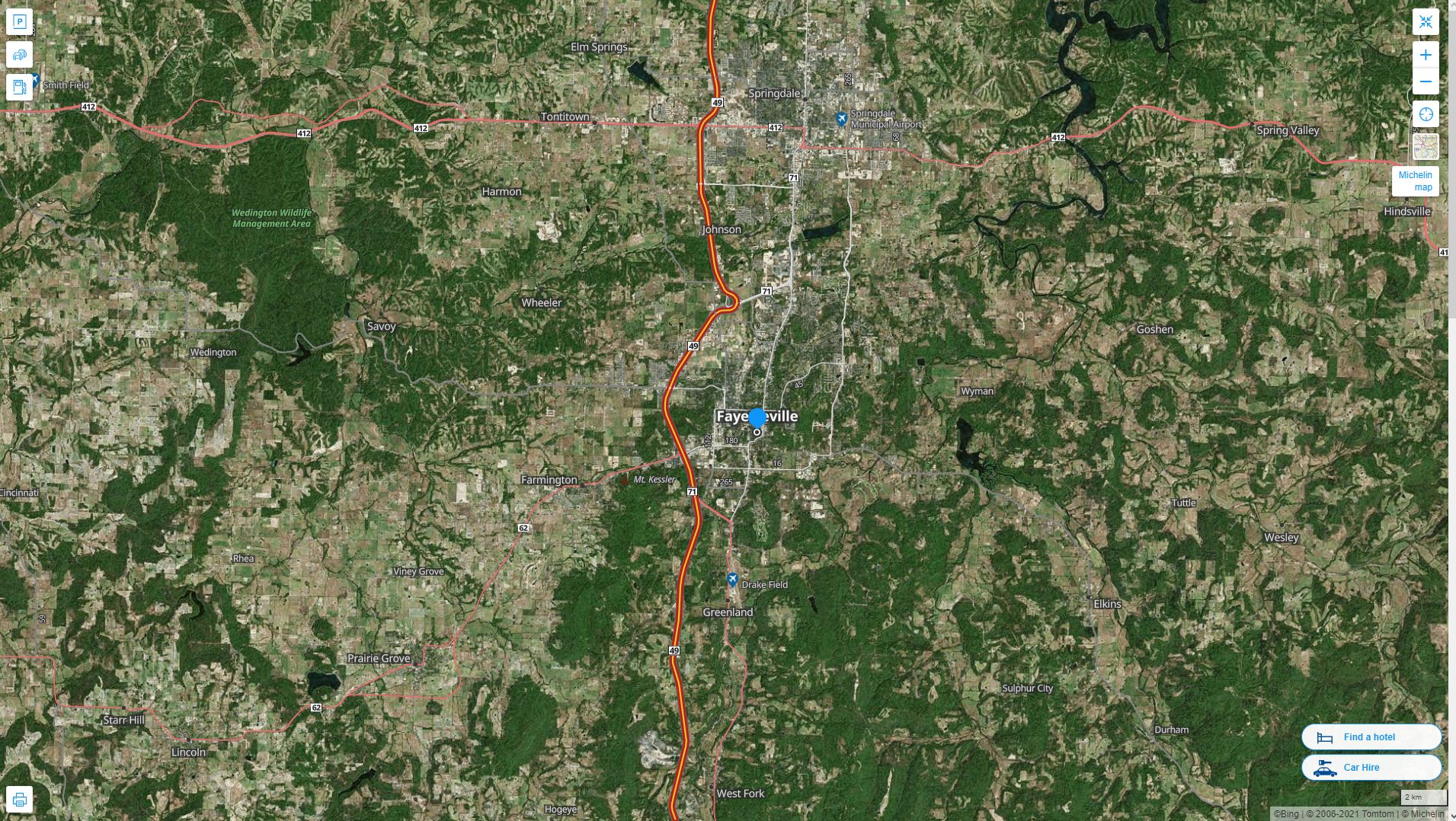
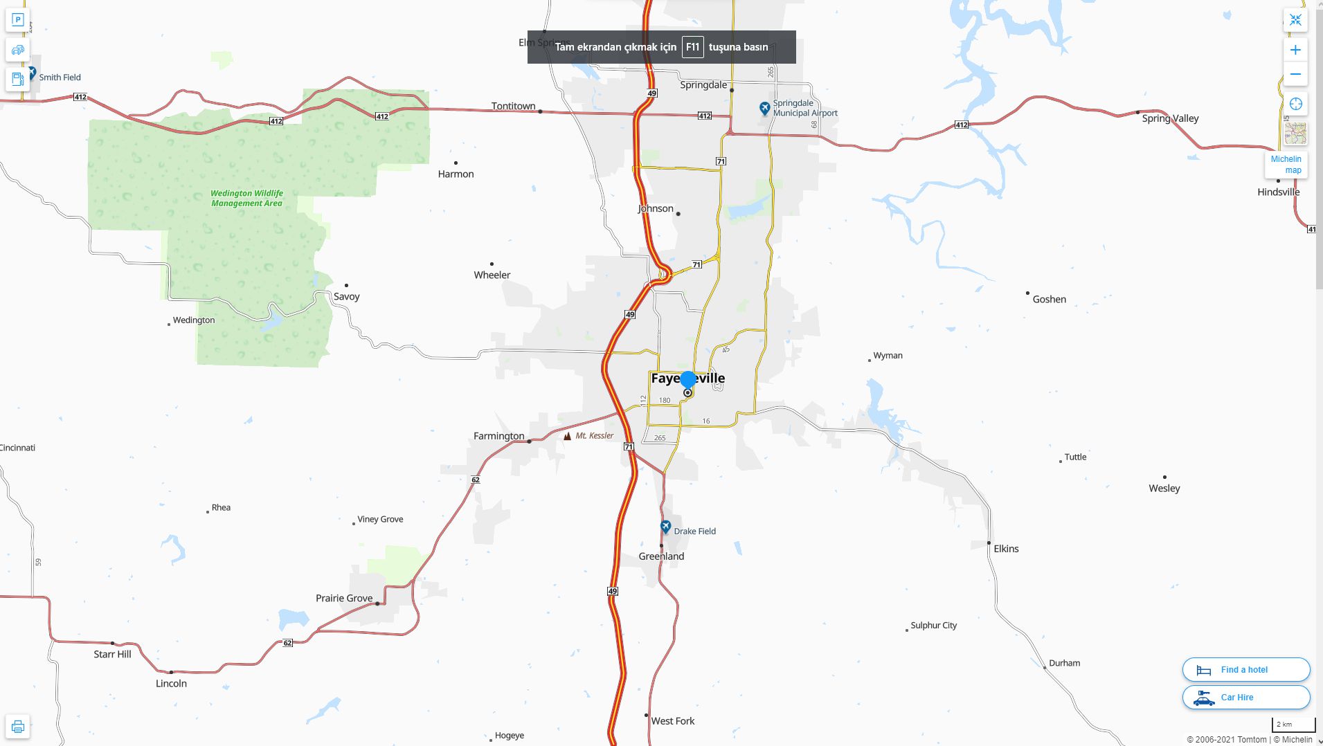
Map of Fayetteville Arkansas, Arkansas
Fayetteville map
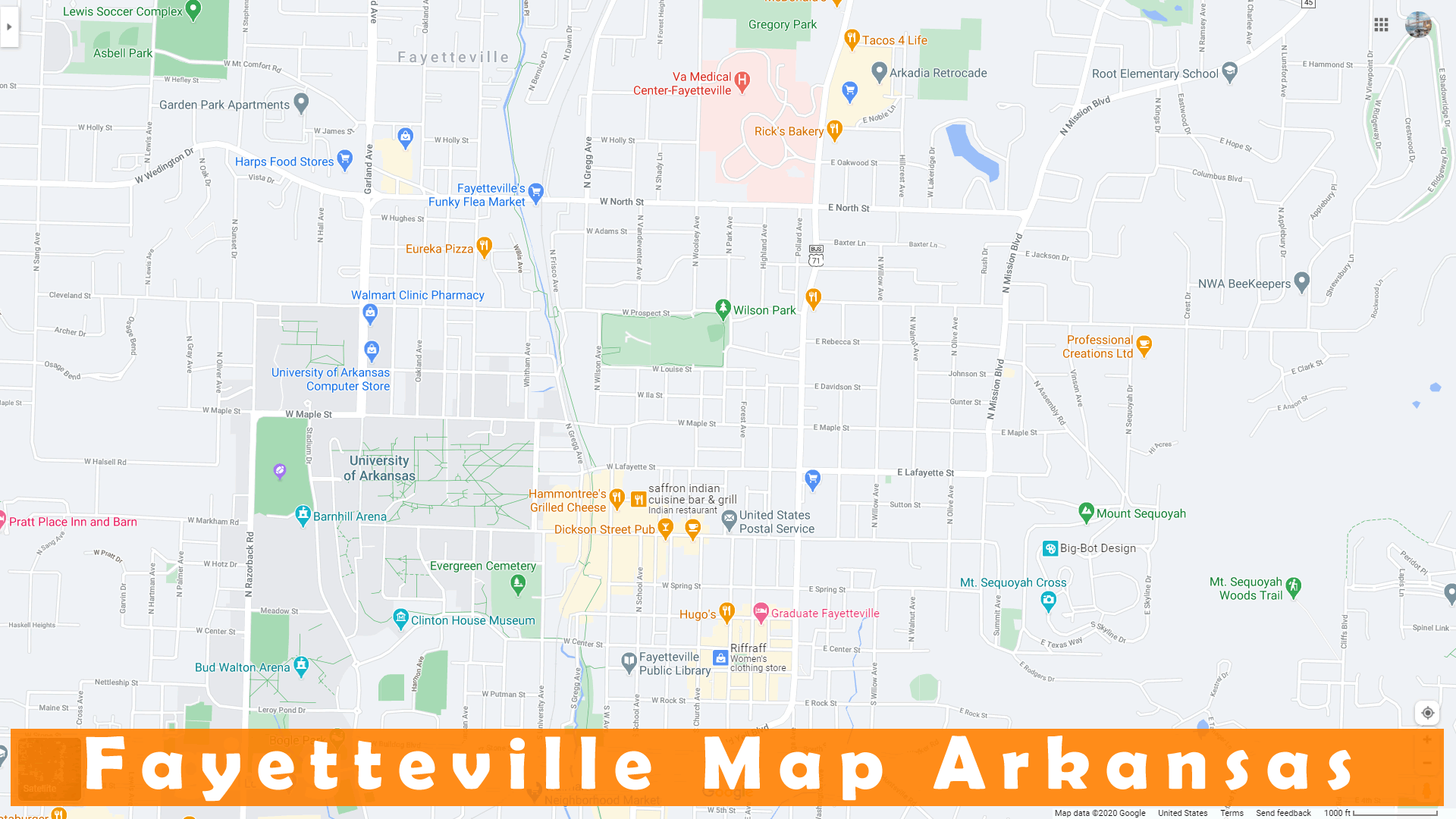
Map of Fayetteville
FAYETTEVILLE MAP
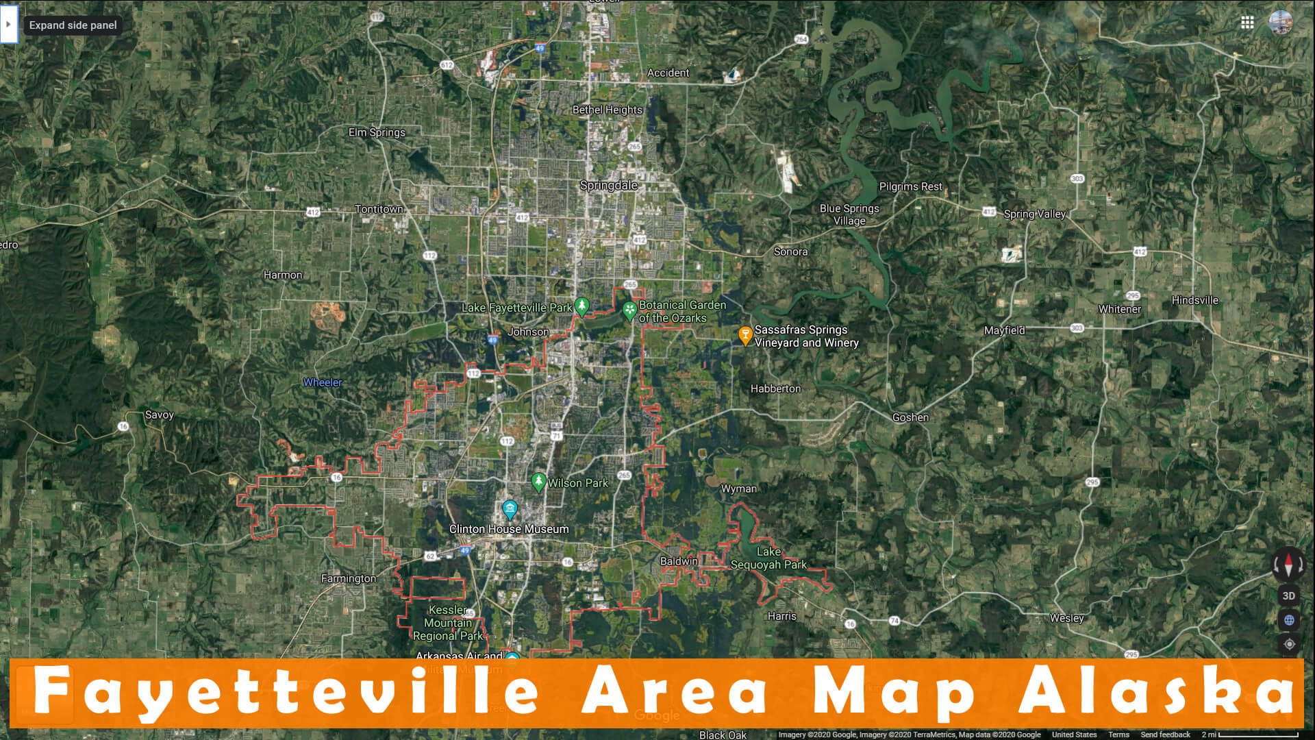
FAYETTEVILLE AREA MAP ALASKA
FAYETTEVILLE ARKANSAS USA

FAYETTEVILLE ARKANSAS

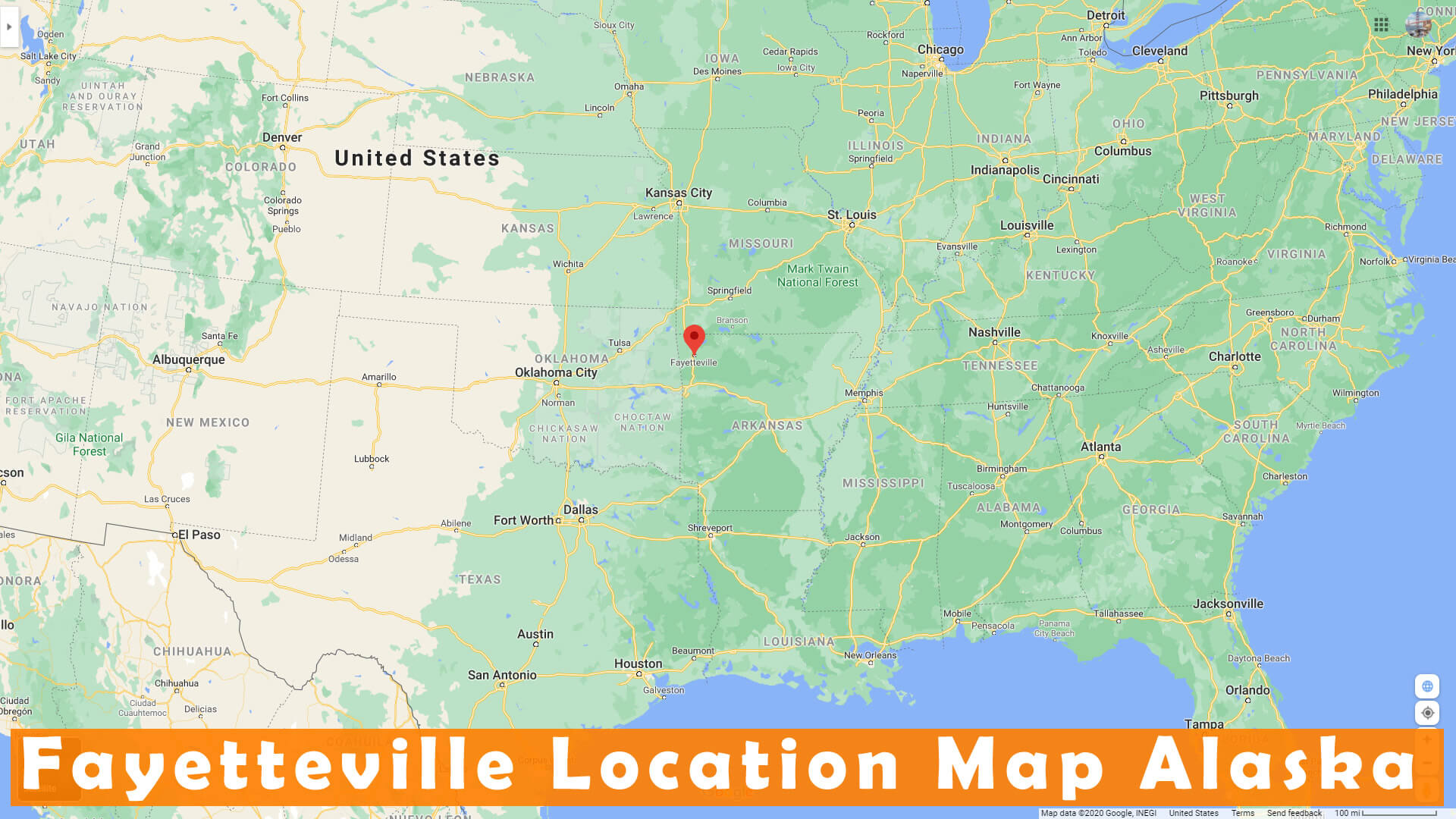
FAYETTEVILLE LOCATION MAP ALASKA
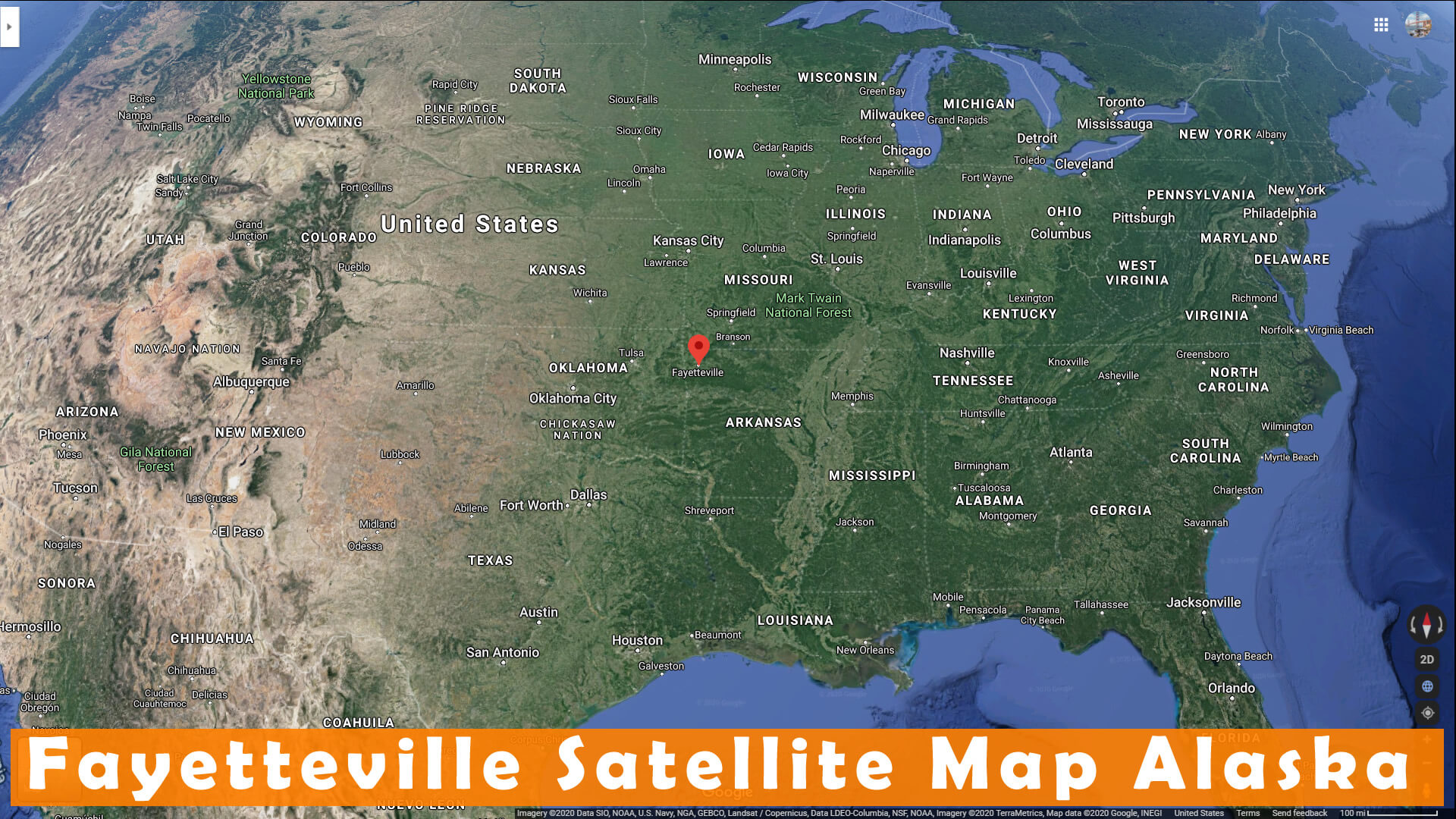
FAYETTEVILLE SATELLITE MAP ALASKA
FAYETTEVILLE ARKANSAS HIGHWAY AND ROAD MAP WITH SATELLITE VIEW
FAYETTEVILLE ARKANSAS HIGHWAY AND ROAD MAP
Largest Arkansas Cities by Population
Little Rock Map Fort Smith Map Fayetteville Map Springdale Map Jonesboro Map North Little Rock Map Conway Map Rogers Map Pine Bluff Map Bentonville Map Hot Springs Map Benton Map Texarkana Map Sherwood Map Jacksonville Map Monette Map- Head of Performance Marketing
- Head of SEO
- Linkedin Profile: linkedin.com/in/arifcagrici
For all Arkansas Cities Map
Fayetteville Arkansas Google Map, Street Views, Maps Directions, Satellite Images
guideoftheworld.net offers a collection of Fayetteville Arkansas map, google map, Fayetteville Arkansas atlas, political, physical, satellite view, country infos, cities map and more map of Fayetteville Arkansas.
US States by Population
California Map Texas Map New York Map Florida Map Illinois Map Pennsylvania Map Ohio Map Michigan Map Georgia Map New Jersey Map North Carolina Map Virginia Map Massachusetts Map District of Columbia Map Indiana Map Tennessee Map Arizona Map Missouri Map Maryland Map Washington Map Minnesota Map Colorado Map Alabama Map Louisiana Map South Carolina Map Kentucky Map Oregon Map Oklahoma Map Connecticut Map Iowa Map Mississippi Map Arkansas Map Kansas Map Utah Map Nevada Map New Mexico Map West Virginia Map Nebraska Map Idaho Map Maine Map New Hampshire Map Hawaii Map Rhode Island Map Montana Map Delaware Map South Dakota Map Alaska Map North Dakota Map Vermont Map Wisconsin Map Wyoming MapCopyright GuideofTheWorld.Net 2006 - 2026. All rights reserved. Privacy Policy | Disclaimer