
New Mexico Map
Discover the Land of Enchantment with our detailed map of New Mexico. Our interactive map of New Mexico allows you to explore its diverse geography, from the high desert and mountains to the Rio Grande Valley. Find your way to major cities and towns, national parks, and historic sites with ease using our comprehensive New Mexico map. Whether you're planning a road trip or a vacation, our map is an invaluable resource for exploring the unique culture and natural beauty of the state.
For all New Mexico Cities Map
Whispers of the Southwest: An Albuquerque Adventure
Please subscribe on "World Guide" channnel on Youtube at youtube.com/c/WorldGuide
The Earth, North America and Countries View from Space - Day Time and in the Night
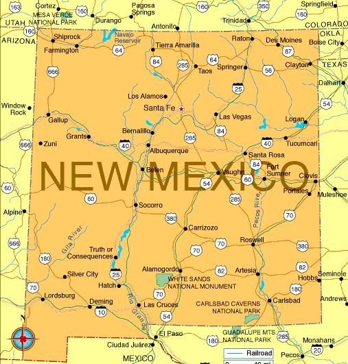
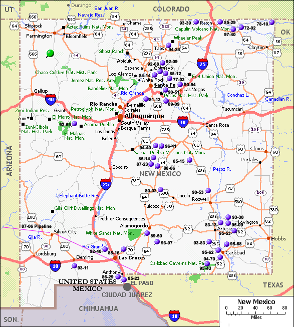
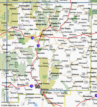
MAP OF NEW MEXICO
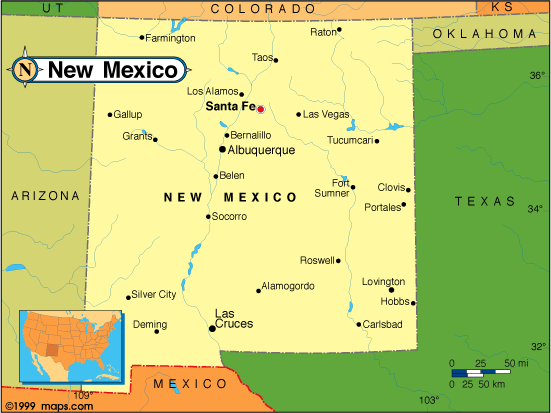
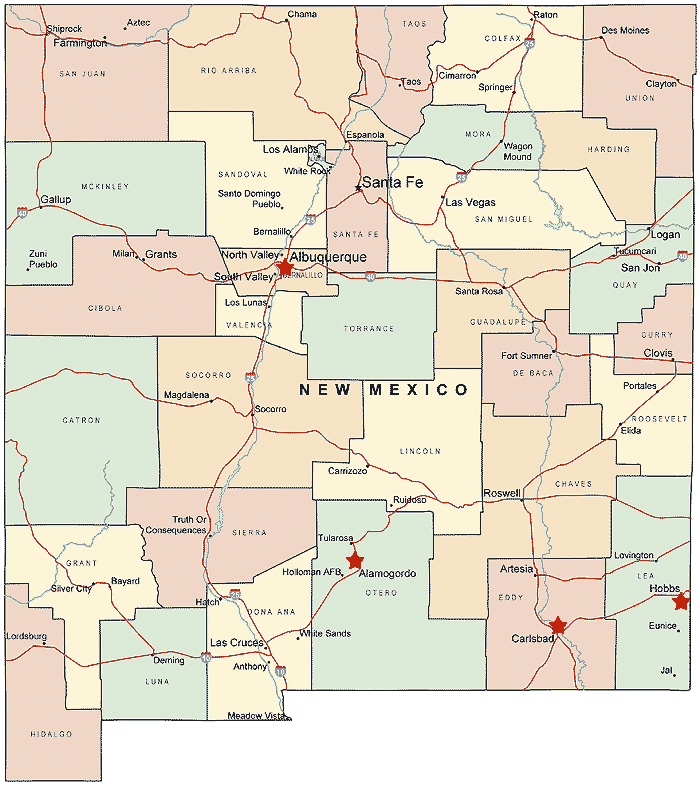
NEW MEXICO CITY MAP
Brief information about New Mexico, US
New Mexico is a state located in the southwestern region of the United States. It is the fifth-largest state by land area and has a diverse landscape that ranges from high desert to mountains to forests. The state is home to over 2 million people and has a rich cultural history, with influences from Native American, Spanish, and Mexican cultures. New Mexico is also known for its art scene, including the famous artist colony of Taos, as well as its cuisine, which includes dishes such as green chile stew and enchiladas. The state capital is Santa Fe, which is the oldest state capital in the country and has a rich history and vibrant arts community. Other major cities in New Mexico include Albuquerque, Las Cruces, and Roswell.A Collection of New Mexico Maps and New Mexico Satellite Images
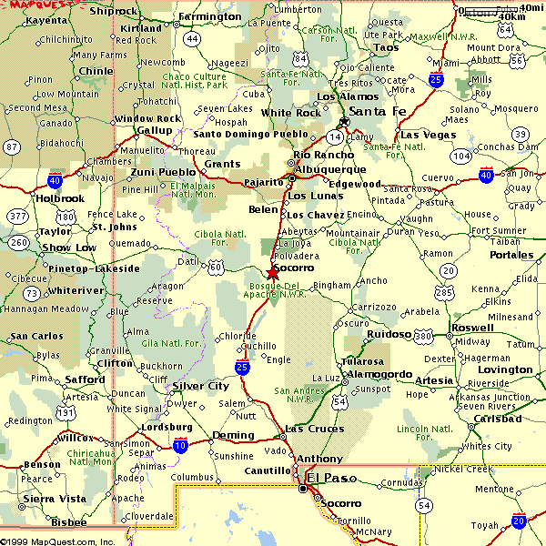
MAP OF NEW MEXICO
NEW MEXICO MAP
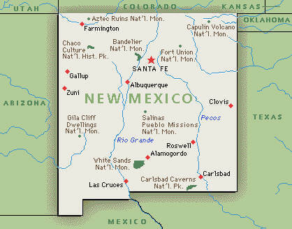
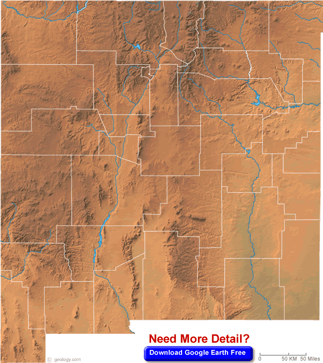
NEW MEXICO BLANK PHYSICAL MAP
NEW MEXICO CITY MAP
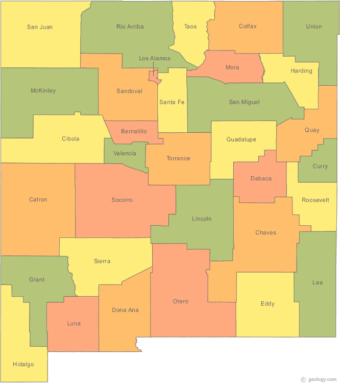
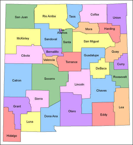
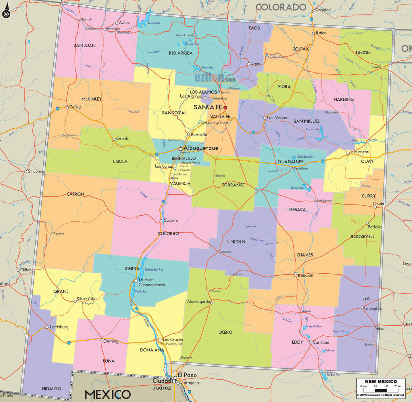
NEW MEXICO COUNTIES MAP
NEW MEXICO COUNTY MAP
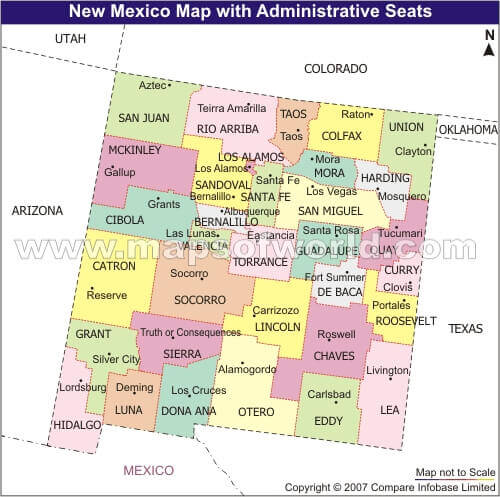
NEW MEXICO COUNTY SEAT MAP
NEW MEXICO LAND MAP
NEW MEXICO MAP
NEW MEXICO MAP SANTA FE
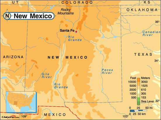
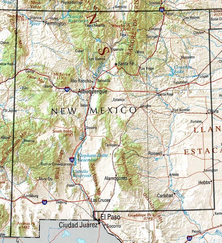
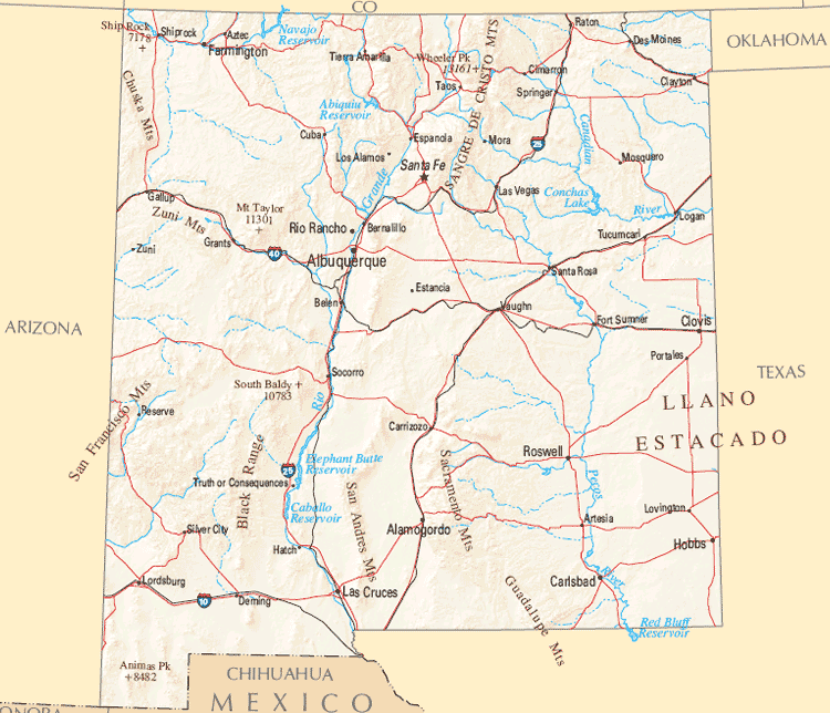
NEW MEXICO PHYSICAL MAP
NEW MEXICO REFERENCE MAP
NEW MEXICO ROAD MAP
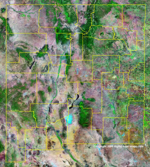
NEW MEXICO SATELLITE IMAGE
ROUTE MAP OF NEW MEXICO
A collection of New Mexico Maps
- Head of Performance Marketing
- Head of SEO
- Linkedin Profile: linkedin.com/in/arifcagrici
Largest Cities Map of New Mexico and Population
Albuquerque Map - 545,852 Las Cruces Map - 97,618 Rio Rancho Map - 87,521 Santa Fe Map - 67,947 Roswell Map - 48,366 Farmington Map - 45,877 South Valley Map - 40,976 Clovis Map - 37,775 Hobbs Map - 34,122 Alamogordo Map - 30,403 Carlsbad Map - 26,138 Gallup Map - 21,678 Deming Map - 14,855 Los Lunas Map - 14,835 Chaparral Map - 14,631Copyright GuideofTheWorld.Net 2006 - 2026. All rights reserved. Privacy Policy | Disclaimer