
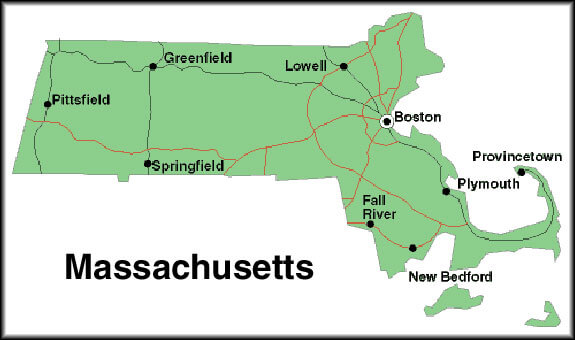
Massachusetts Map
Explore the state of Massachusetts with our map. Discover its charming cities, picturesque landscapes, and rich history, including the birthplace of the American Revolution. Plan your visit to this northeastern state today!
Map of Massachusetts
For all Massachusetts Cities Map
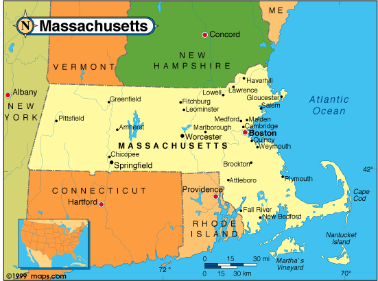
MAP OF MASSACHUSETTS
Exploring Boston's Top 10 Must-Visit Attractions
Please subscribe on "World Guide" channnel on Youtube at youtube.com/c/WorldGuide
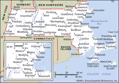
MAP OF MASSACHUSETTS

Brief information about Massachusetts, US
Here's some brief information about Massachusetts:- Area: 10,555 square miles (27,336 square kilometers)
- Population (2020): 7.1 million
- Largest cities: Boston, Worcester, Springfield, Lowell, Cambridge
- Median age: 39.9 years
- Median household income: $86,019
- Major industries: Education, healthcare, finance, technology, biotechnology, tourism
- State symbols: State bird - black-capped chickadee, State flower - mayflower, State tree - American elm
- Massachusetts was first settled by Native American tribes such as the Wampanoag and Massachusett.
- The first European settlement was established by the Pilgrims at Plymouth in 1620.
- Massachusetts played a key role in the American Revolution, with famous events such as the Boston Tea Party and the Battles of Lexington and Concord taking place in the state.
- The state has been a center of education and culture since the founding of Harvard University in 1636.
- White: 75.3%
- Black or African American: 8.3%
- Hispanic or Latino: 12.1%
- Asian: 6.9%
- Other: 6.3%
- Massachusetts's GDP was $627 billion in 2020
- Major industries include education, healthcare, finance, technology (including biotechnology and software development), and tourism.
- Top employers in the state include Harvard University, Massachusetts General Hospital, and the Massachusetts Institute of Technology (MIT).
- Logan International Airport in Boston is one of the busiest airports in the US and a major center for transportation and logistics.
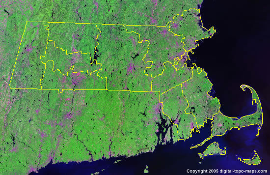
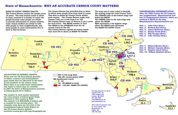
A Collection of Massachusetts Maps and Massachusetts Satellite Images
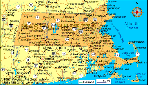
MAP OF MASSACHUSETTS
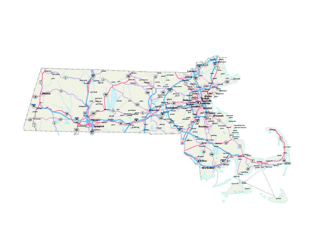
CITIES MAP OF MASSACHUSETTS
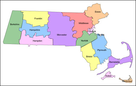
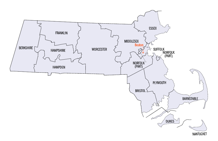
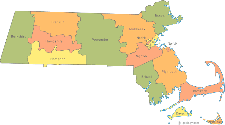
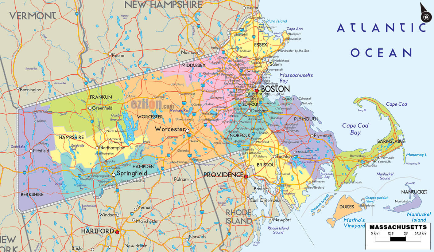
COUNTIES MAP OF MASSACHUSETTS
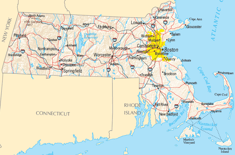
MAP OF MASSACHUSETTS
MAPS OF MASSACHUSETTS
MAP OF MASSACHUSETTS
MASSACHUSETTS CITIES MAP
MASSACHUSETTS COUNTY MAP
MASSACHUSETTS MAP

MASSACHUSETTS MAP
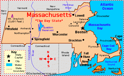
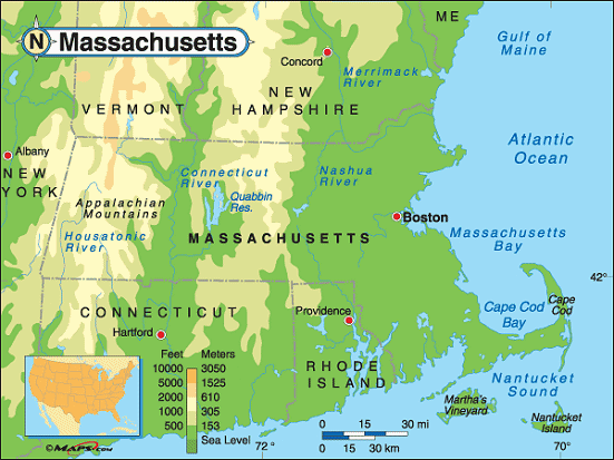
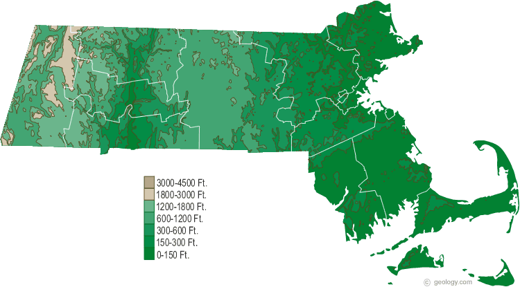
MASSACHUSETTS PHYSICAL MAP
MASSACHUSETTS STATE MAP
MASSACHUSETTS COUNTY MAP
MASSACHUSETTS MAP
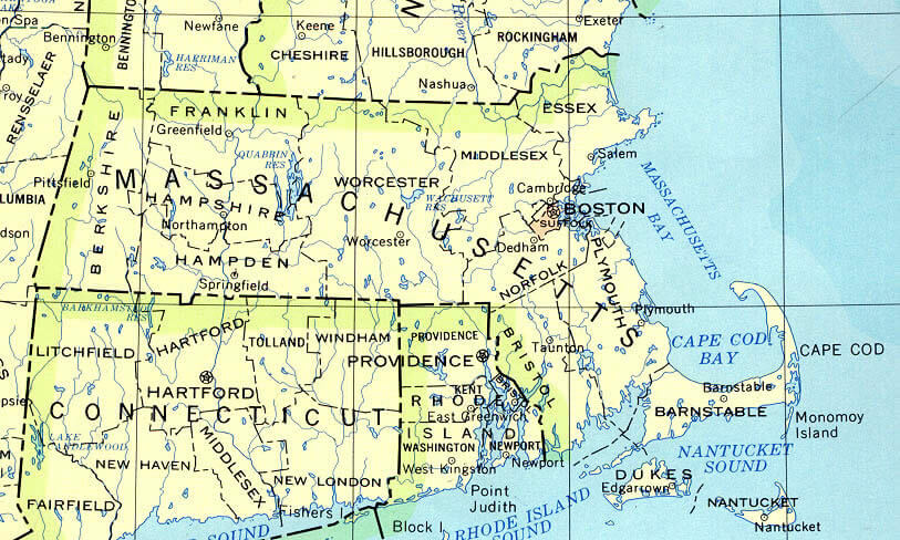
MASSACHUSETTS PHYSICAL MAP
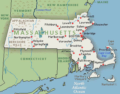
MASSACHUSETTS POLITICAL MAP
MASSACHUSETTS POLITICAL MAP
MASSACHUSETTS STATE MAP

MASSACHUSETTSMAP
MASSACHUSETTS MAP
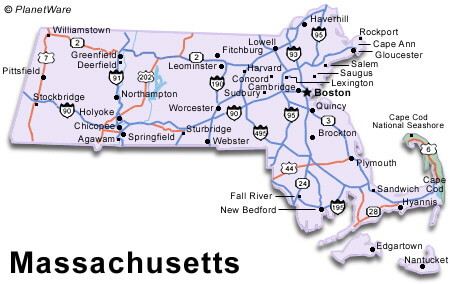
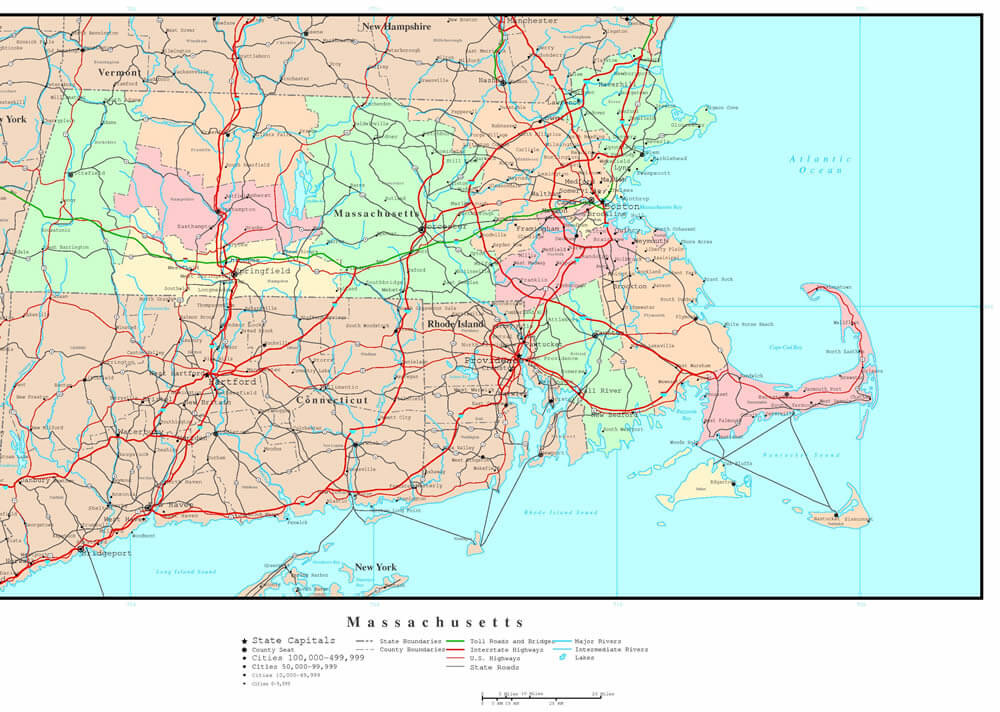
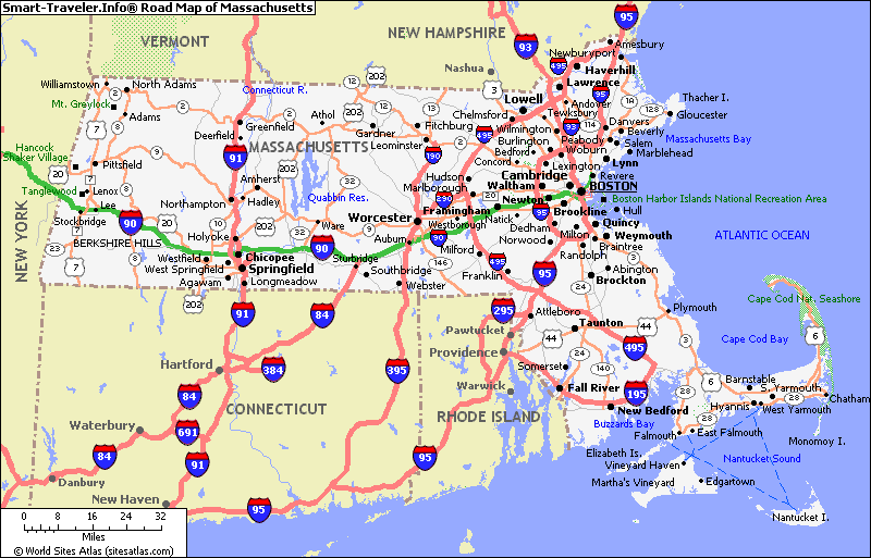
ROAD MAP OF MASSACHUSETTS
ROAD MAP OF MASSACHUSETTS
A collection of Massachusetts Maps
- Head of Performance Marketing
- Head of SEO
- Linkedin Profile: linkedin.com/in/arifcagrici
Largest Cities Map of Massachusetts and Population
Boston Map - 617,594 Worcester Map - 181,045 Springfield Map - 153,060 Lowell Map - 106,519 Cambridge Map - 105,162 New Bedford Map - 95,072 Brockton Map - 93,810 Quincy Map - 92,271 Lynn Map - 90,329 Fall River Map - 88,857 Newton Map - 85,146 Lawrence Map - 76,377 Somerville Map - 75,754 Framingham Map - 68,318 Haverhill Map - 60,879 Waltham Map - 60,632 Malden Map - 59,450 Brookline Map - 58,732 Medford Map - 56,173 Taunton Map - 55,874 Chicopee Map - 55,298 Weymouth Town Map - 53,743 Revere Map - 51,755 Peabody Map - 51,251Copyright GuideofTheWorld.Net 2006 - 2026. All rights reserved. Privacy Policy | Disclaimer