
Iowa Map: Discover the Beauty and Diversity of the Hawkeye State
Explore the state of Iowa with WorldMap1's interactive map. Discover its cities, highways, and topography, and learn more about this Midwestern state's rich history and culture. Whether you're planning a trip or simply want to satisfy your curiosity, our Iowa map has everything you need.
For all Iowa Cities Map
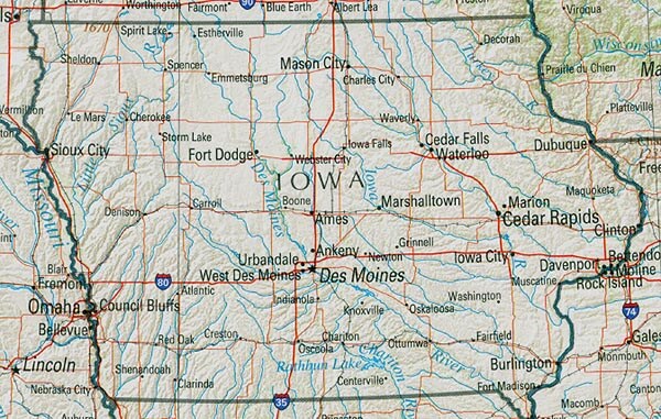
MAP OF IOWA
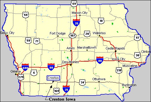
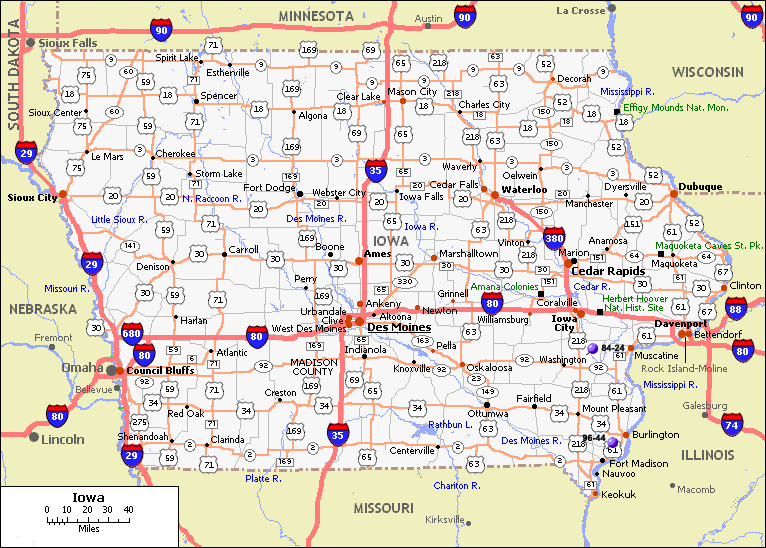
IOWA HIGHWAYS MAP
Brief information about Iowa, US
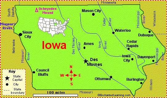
The capital and largest city of Iowa is Des Moines, which is also the economic and cultural center of the state. Iowa is known for its fertile farmland, which produces a variety of agricultural products including corn, soybeans, and pork.A Collection of Iowa Maps and Iowa Satellite Images
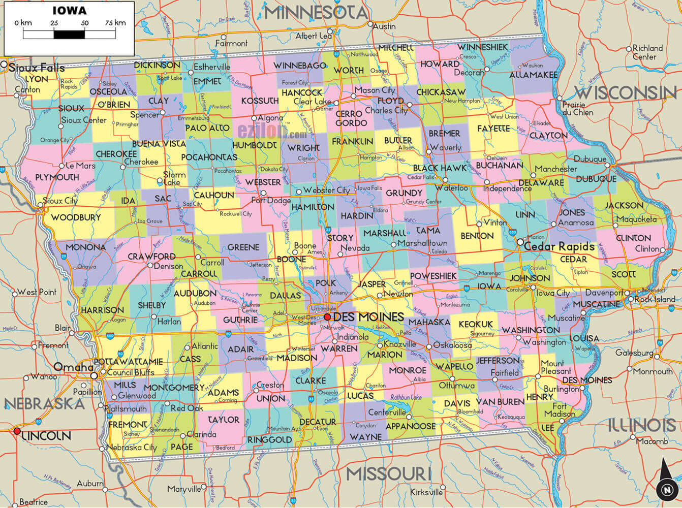
MAP OF IOWA
IOWA CITIES MAP
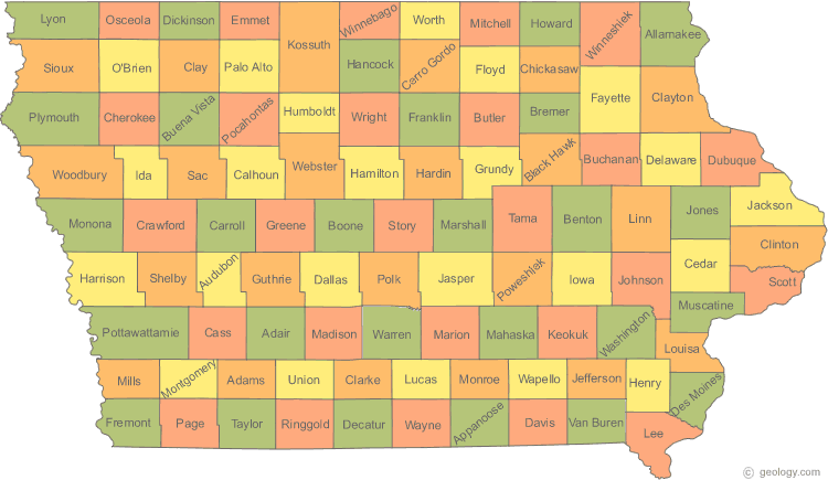
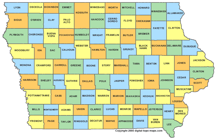
IOWA COUNTY MAP
IOWA HIGHWAYS MAP
IOWA PHYSICAL MAP
IOWA RIVER MAP

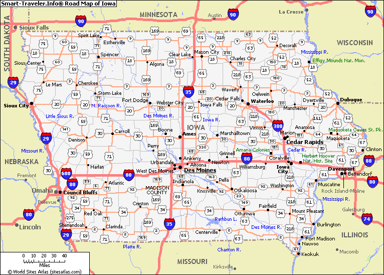
IOWA ROAD MAP
IOWA ROUTE MAP
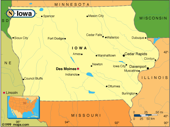
IOWA STATE MAP

STATE MAP OF IOWA
A collection of Iowa Maps
- Head of Performance Marketing
- Head of SEO
- Linkedin Profile: linkedin.com/in/arifcagrici
Largest Cities Map of Iowa and Population
Des Moines Map - 203,433 Cedar Rapids Map - 126,326 Davenport Map - 99,685 Sioux City Map - 82,684 Waterloo Map - 68,406 Iowa City Map - 67,862 Council Bluffs Map - 62,230 Ames Map - 58,965 Dubuque Map - 57,637 West Des Moines Map - 56,609 Ankeny Map - 45,582 Urbandale Map - 39,463 Cedar Falls Map - 39,260 Marion Map - 34,768 Bettendorf Map - 33,217Copyright GuideofTheWorld.Net 2006 - 2026. All rights reserved. Privacy Policy | Disclaimer