
Explore the Charm of Maryland: Detailed Map and Information Available Now!
Explore Maryland like never before with our detailed Maryland map. Discover the state's diverse cities, scenic highways, and historical landmarks. Our Maryland map provides an interactive and user-friendly experience for planning your next trip or studying the geography of the state. Browse through our collection of maps, including political, physical, and road maps of Maryland, and get the information you need to make the most of your Maryland experience.
For all Maryland Cities Map
Navigating Baltimore's Best Kept Secrets
Please subscribe on "World Guide" channnel on Youtube at youtube.com/c/WorldGuide
The Earth, North America and Countries View from Space - Day Time and in the Night
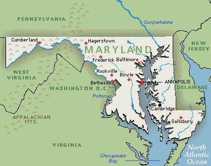
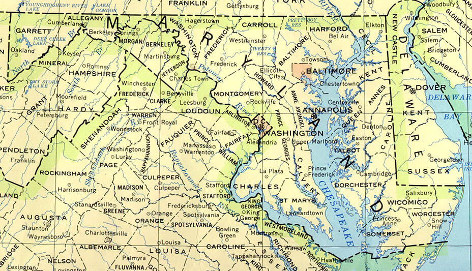
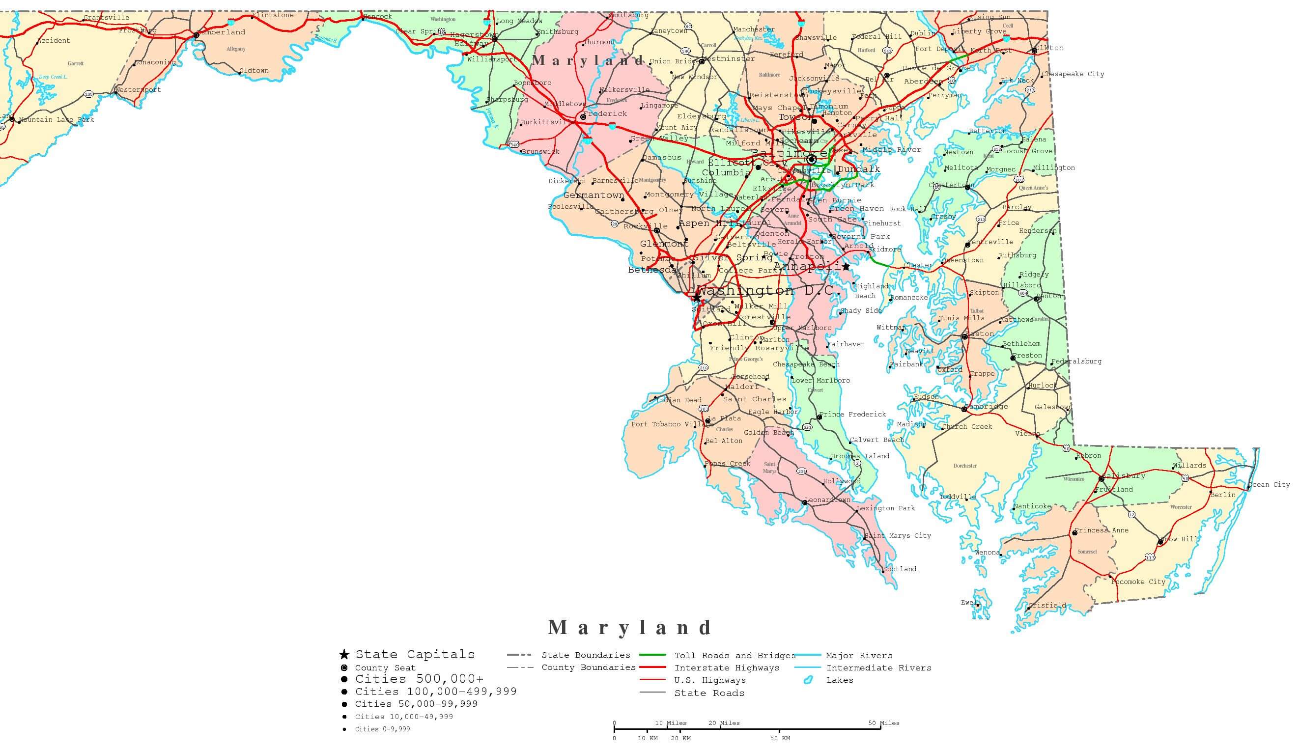
MAP OF MARYLAND
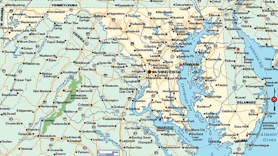
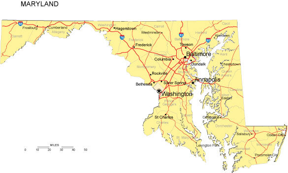
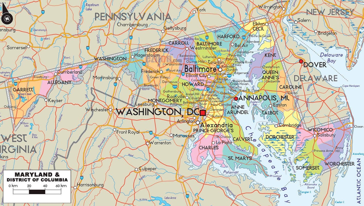
MARYLAND CITY MAP
Brief information about Maryland, US
Maryland is a state located in the Mid-Atlantic region of the United States. It is the 19th most populous state in the US and covers an area of approximately 12,406 square miles. The state is bordered by Virginia to the south, West Virginia to the west, Pennsylvania to the north, and Delaware and the Atlantic Ocean to the east.A Collection of Maryland Maps and Maryland Satellite Images
MAP OF MARYLAND
MARYLAND BLANK PHYSICAL MAP
MARYLAND CITIES MAP

MARYLAND CITY MAP
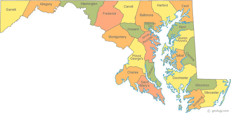
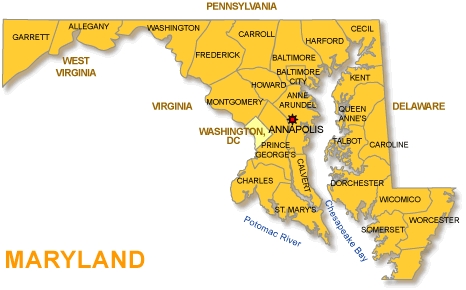
MARYLAND COUNTY MAP

MARYLAND COUNTIES MAP
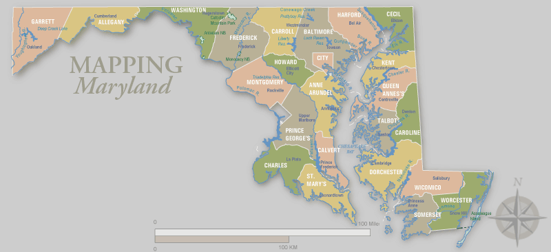
MARYLAND COUNTY MAP
MARYLAND HISTORICAL MAP
MARYLAND MAP BALTIMORE
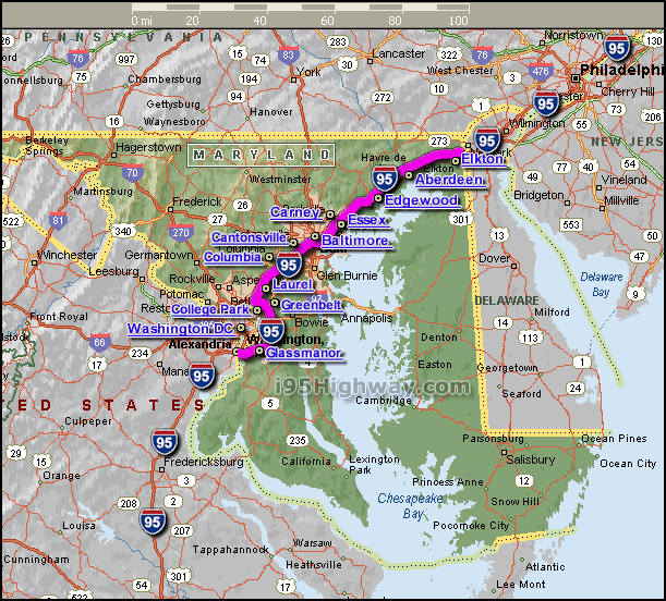
MARYLAND MAP INTERSTATE 95
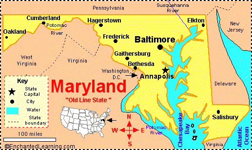
MARYLAND MAP USA

MARYLAND PRINTABLE MAP
MARYLAND ROAD MAP

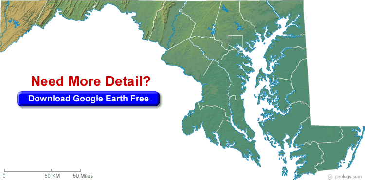
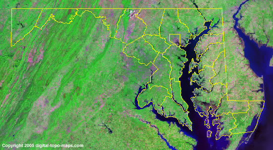
MARYLAND SATELLITE IMAGE MAP
MARYLAND STATE MAP
A collection of Maryland Maps
- Head of Performance Marketing
- Head of SEO
- Linkedin Profile: linkedin.com/in/arifcagrici
Largest Cities Map of Maryland and Population
Baltimore Map - 620,961 Columbia Map - 99,615 Germantown Map - 86,395 Silver Spring Map - 71,452 Waldorf Map - 67,752 Glen Burnie Map - 67,639 Ellicott City Map - 65,834 Frederick Map - 65,239 Dundalk Map - 63,597 Rockville Map - 61,209 Bethesda Map - 60,858 Gaithersburg Map - 59,933 Towson Map - 55,197 Bowie Map - 54,727 Aspen Hill Map - 48,759Copyright GuideofTheWorld.Net 2006 - 2026. All rights reserved. Privacy Policy | Disclaimer