
Nebraska Map: Explore the Cornhusker State: Discover Nebraska's Beauty and History
Discover the wonders of Nebraska with WorldMap1's interactive map. Explore the state's cities, highways, and topography, and learn about its rich history and culture. From the rolling hills of the Sandhills to the vibrant city of Omaha, Nebraska has something for everyone. Whether you're planning a trip or simply want to learn more about the state, our Nebraska map has everything you need.
For all Nebraska Cities Map
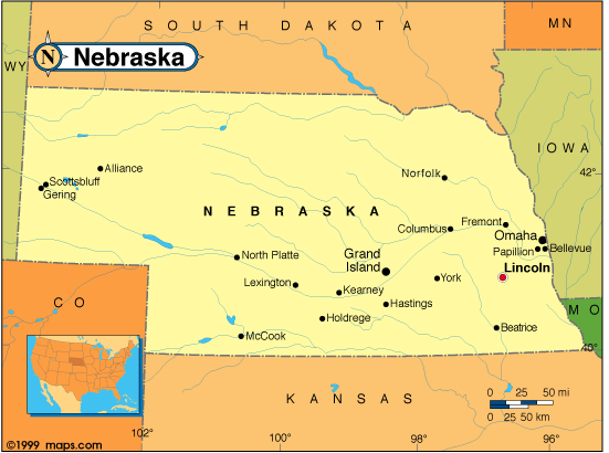
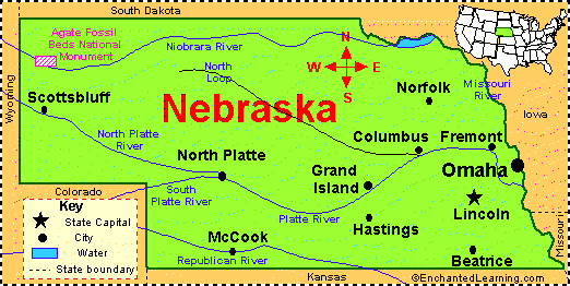
MAP OF NEBRASKA
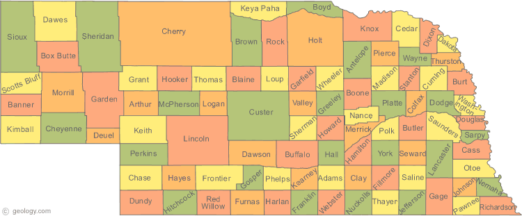
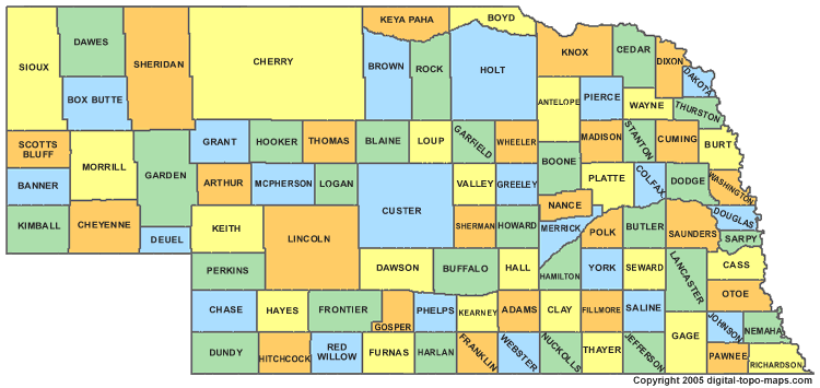
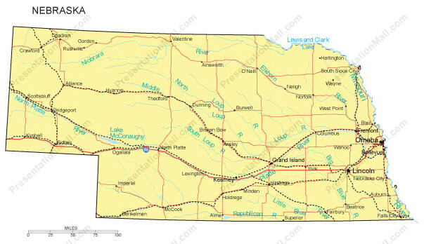
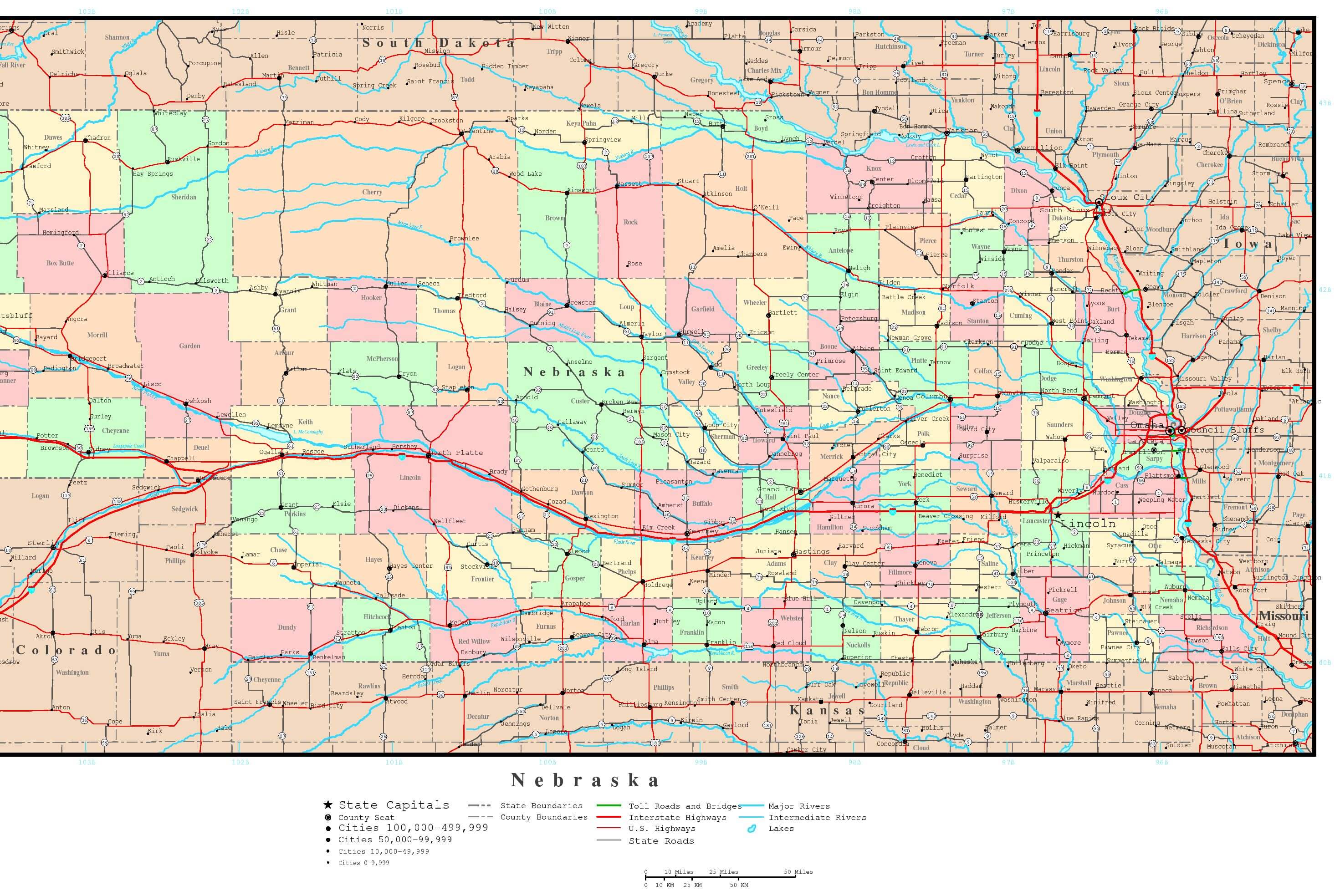
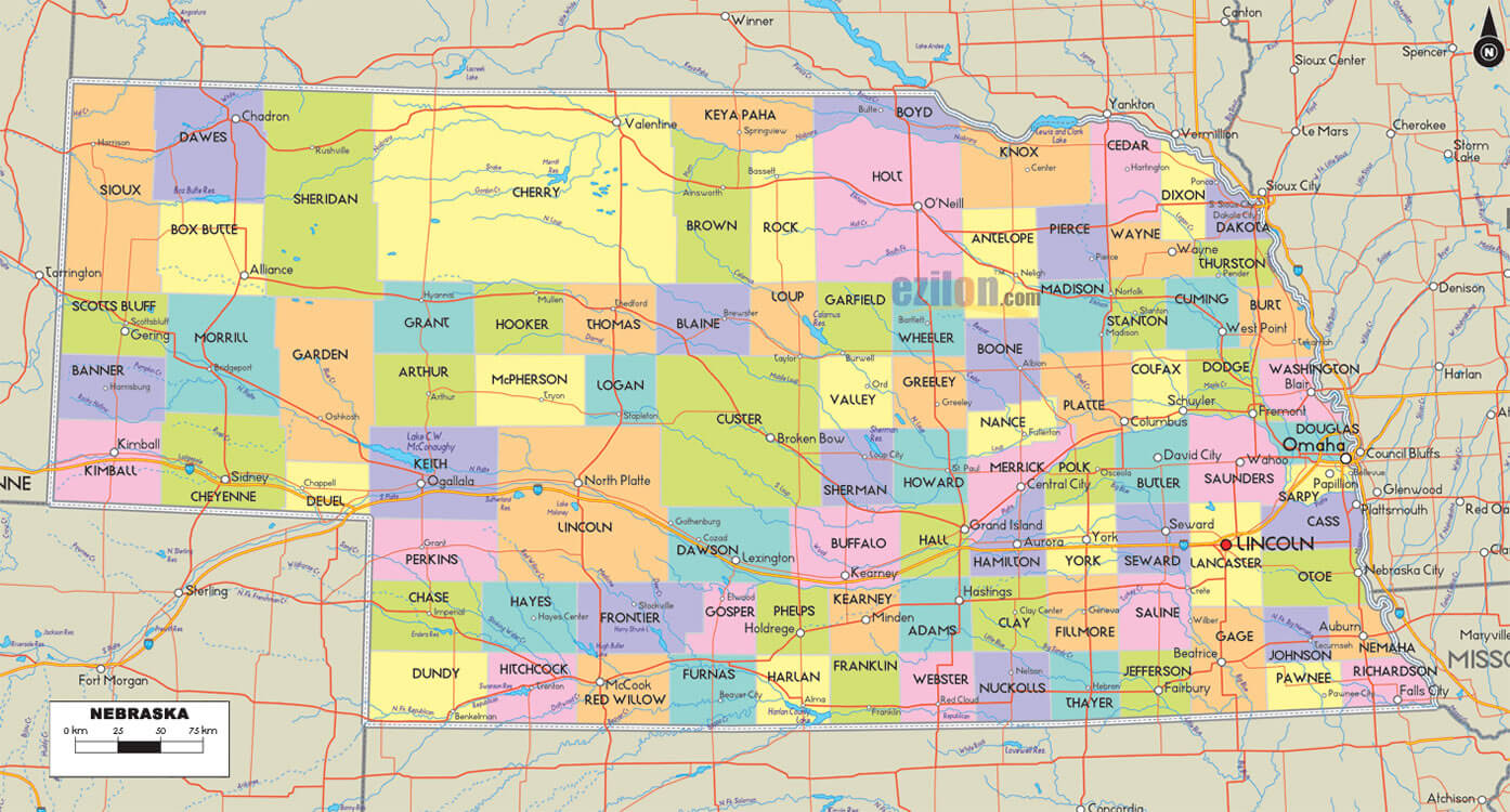
NEBRASKA COUNTIES MAP
Brief information about nebraska, US
The capital of Nebraska is Lincoln, while its largest city is Omaha. The state is known for its vast prairies, rolling hills, and vibrant urban areas.A Collection of Nebraska Maps and Nebraska Satellite Images
MAP OF NEBRASKA
NEBRASKA MAP

NEBRASKA POLITICAL MAP

NEBRASKA COUNTIES MAP
NEBRASKA COUNTY MAP
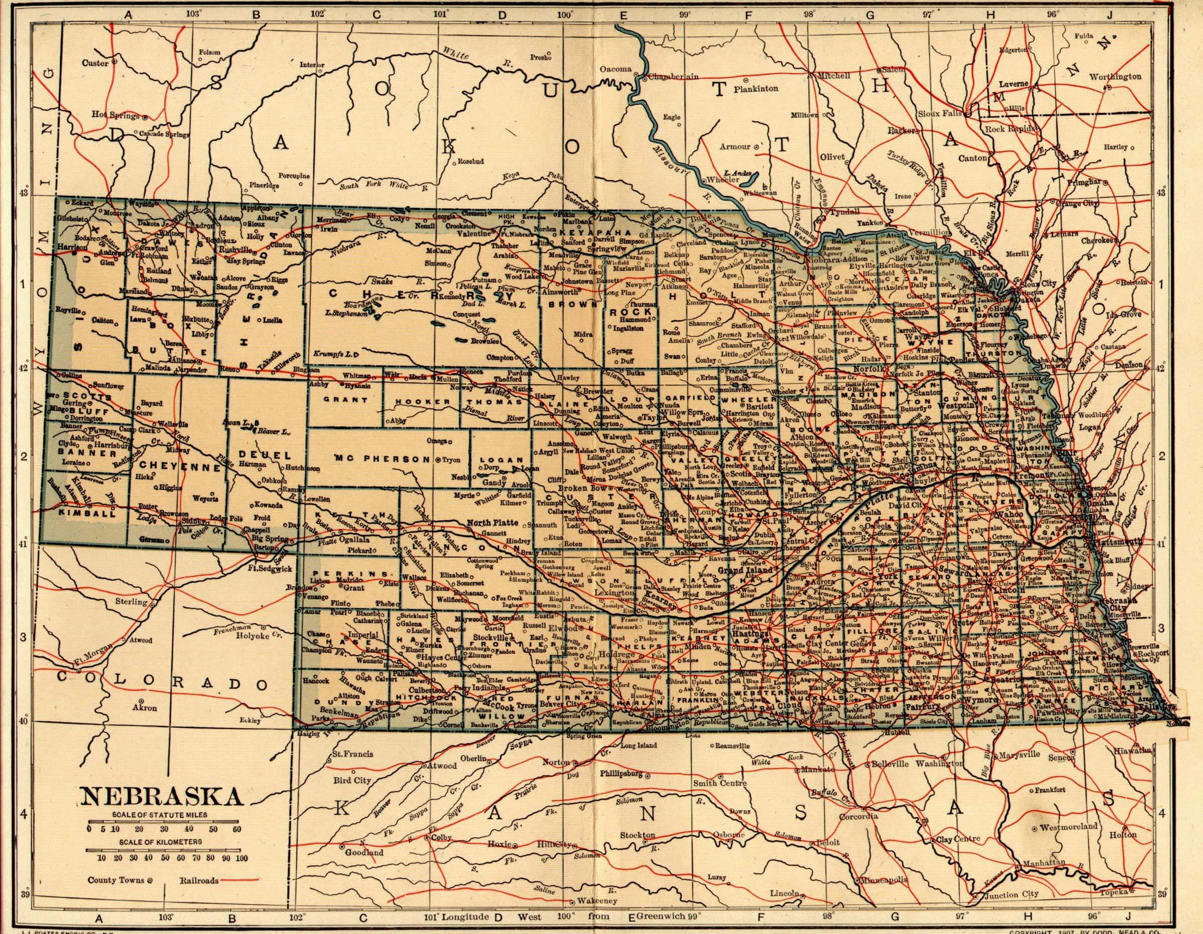
NEBRASKA HISTORICAL MAP
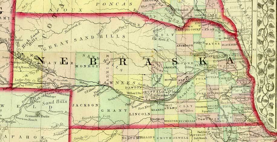
NEBRASKA HISTORICAL MAP 1899
NEBRASKA MAP OMAHA
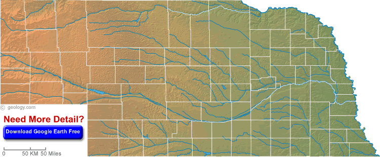
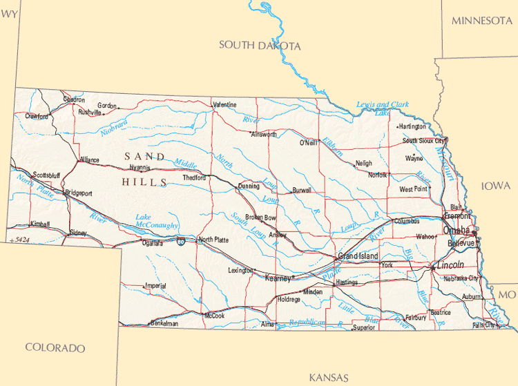
NEBRASKA PHYSICAL MAP
NEBRASKA POLITICAL MAP

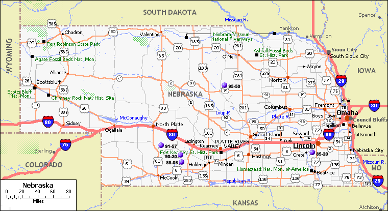
NEBRASKA REFERENCE MAP
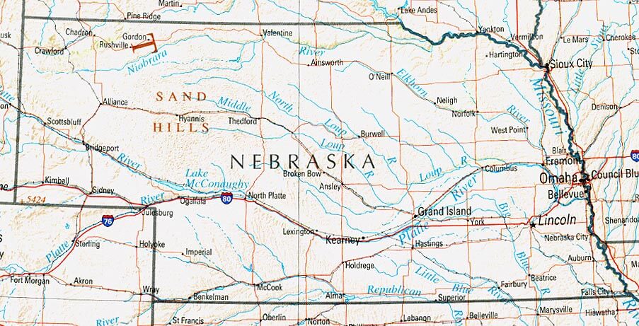
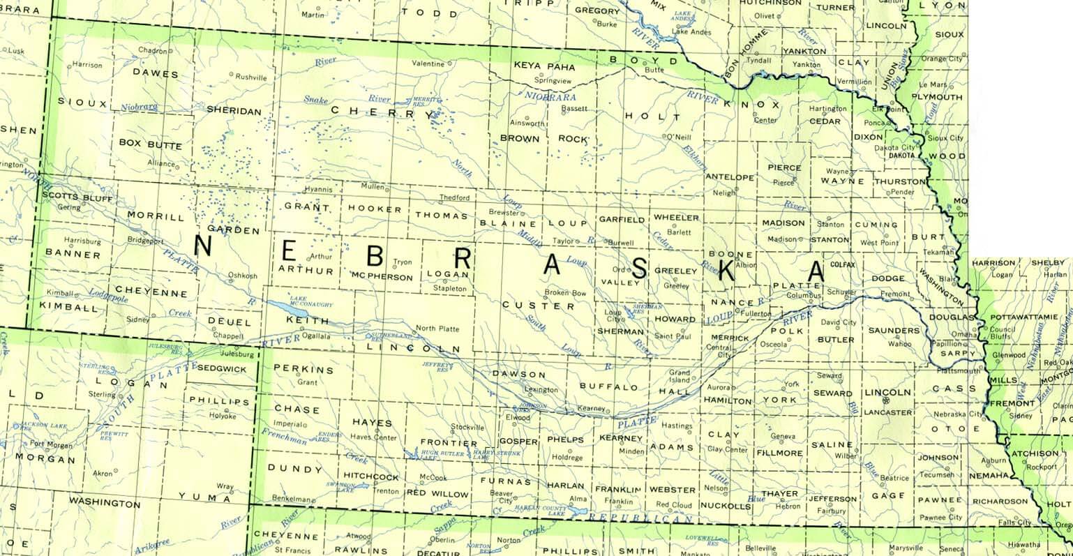
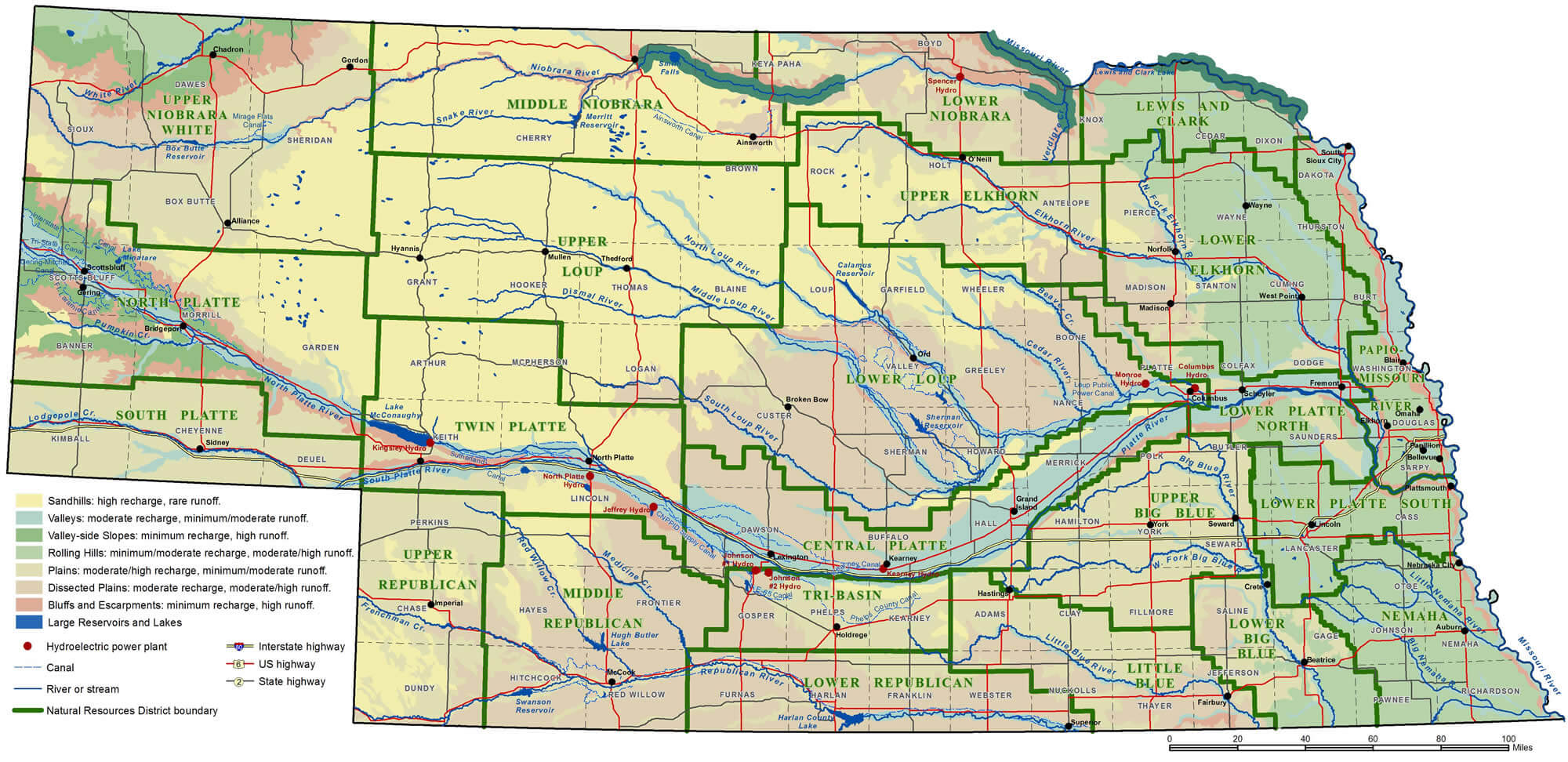
NEBRASKA RIVER MAP
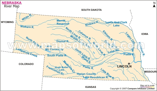
NEBRASKA RIVERS MAP
NEBRASKA ROAD MAP
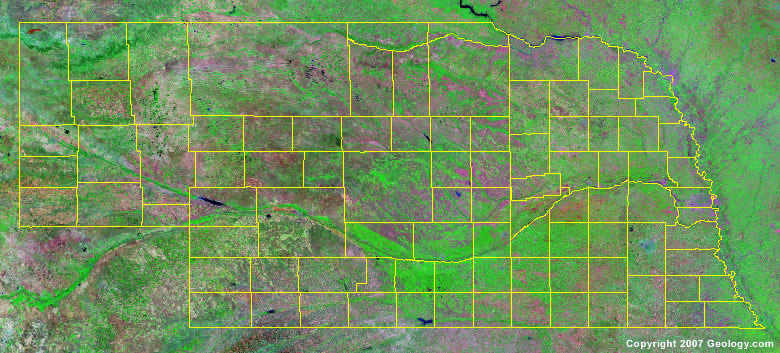
NEBRASKA SATELLITE IMAGE
NEBRASKA STATE MAP

A collection of Nebraska Maps


- Head of Performance Marketing
- Head of SEO
- Linkedin Profile: linkedin.com/in/arifcagrici
Largest Cities Map of Nebraska and Population
Omaha Map - 408,958 Lincoln Map - 258,379 Bellevue Map - 50,137 Grand Island Map - 48,520 Kearney Map - 30,787 Fremont Map - 26,397 Hastings Map - 24,907 North Platte Map - 24,733 Norfolk Map - 24,210 Columbus Map - 22,111 Papillion Map - 18,894 La Vista Map - 15,758 Scottsbluff Map - 15,039 South Sioux City Map - 13,353 Beatrice Map - 12,459 Alliance Map - 8,491Copyright GuideofTheWorld.Net 2006 - 2026. All rights reserved. Privacy Policy | Disclaimer