
Discover the Beauty of the Grand Canyon State 🌵 Explore Arizona with our Interactive Map!
Get ready to explore the stunning state of Arizona with WorldMap1's interactive map! Discover the best attractions, landmarks, and hidden gems the Grand Canyon State has to offer. From the iconic Grand Canyon to the vibrant city of Phoenix, our detailed map allows you to easily navigate and plan your next adventure in Arizona. So, start exploring today and experience the beauty of the Southwest!
Map of Arizona
For all Arizona Cities Map
Unearthing Arizona's Magic: From Desert Sands to Mountain Peaks
Please subscribe on "World Guide" channnel on Youtube at youtube.com/c/WorldGuide
The Earth, North America and Countries View from Space - Day Time and in the Night
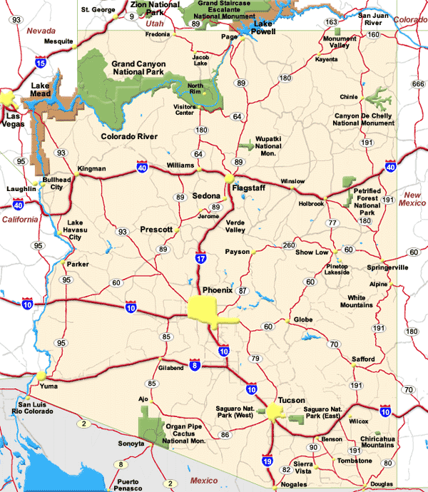
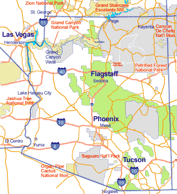
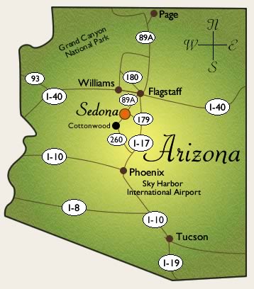
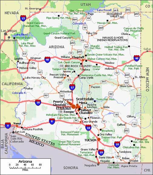
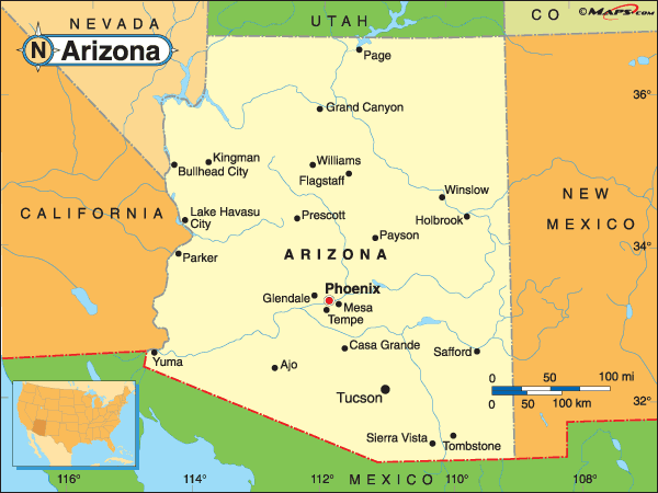
MAP OF ARIZONA
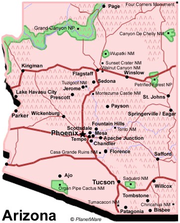
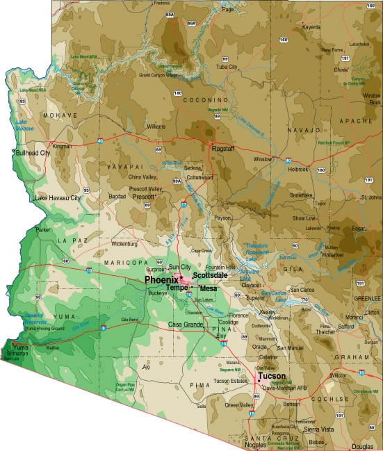
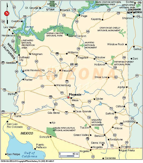
ARIZONA MAP
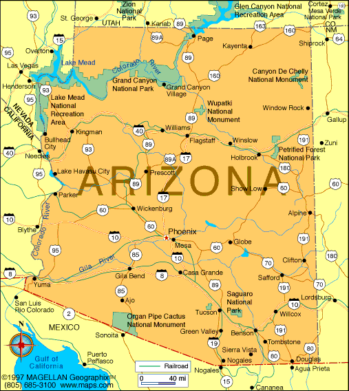
Brief information about Arizona, US
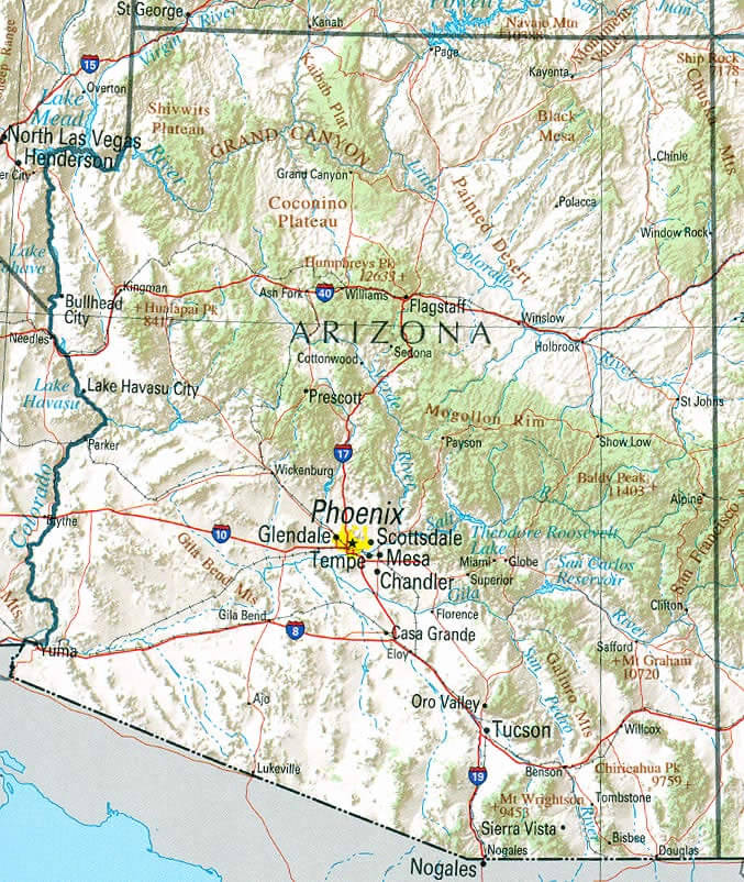
Arizona is a state located in the southwestern region of the United States. It is the sixth largest state in terms of area, covering over 113,990 square miles (295,234 square kilometers), and has a population of approximately 7.5 million people. The state is known for its diverse geography, including the Grand Canyon, the Sonoran Desert, and the Colorado River. It is also home to a rich Native American history, with 22 federally recognized tribes residing within the state's borders.A Collection of Arizona Maps and Arizona Satellite Images
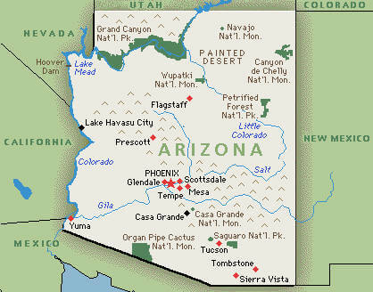
MAP OF ARIZONA
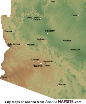
ARIZONA MAP CITIES
ARIZONA MAP
ARIZONA MAP
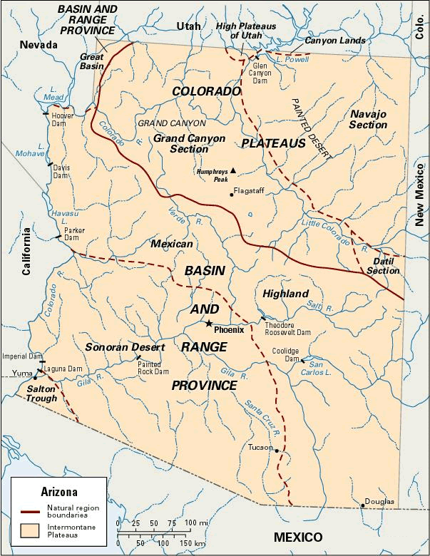
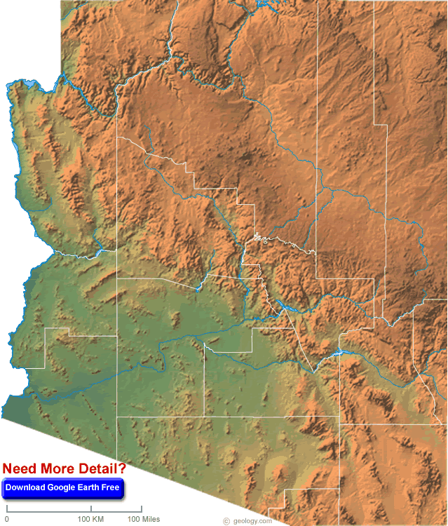
ARIZONA PHYSICAL MAP
ARIZONA POLITICAL MAP
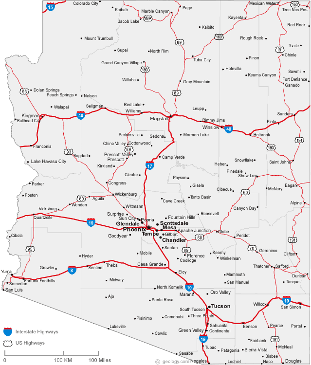
ARIZONA ROAD MAP

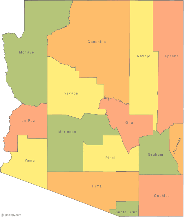
ARIZONA COUNTY MAP
ARIZONA MAP
ARIZONA MAP
ARIZONA MAPS
ARIZONA POLITICAL MAP
ARIZONA RECREATIONAL MAP
ARIZONA ROAD MAP
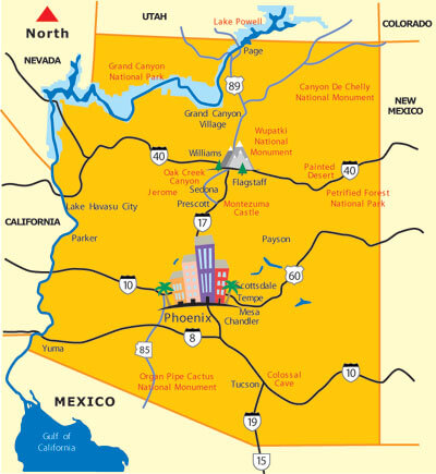
ARIZONA TOURISTIC MAP
MAP OF ARIZONA CITIES
MAP OF ARIZONA
MAP OF ARIZONA CITIES
TOURISTIC MAP OF ARIZONA
A collection of Arizona Maps

- Head of Performance Marketing
- Head of SEO
- Linkedin Profile: linkedin.com/in/arifcagrici
Largest Cities Map of Arizona and Population
Phoenix Map - 1,445,632 Tucson Map - 520,116 Mesa Map - 439,041 Chandler Map - 236,123 Glendale Map - 226,721 Scottsdale Map - 217,385 Gilbert Map - 208,453 Tempe Map - 161,719 Peoria Map - 154,065 Surprise Map - 117,517 Yuma Map - 93,064 San Tan Valley Map - 81,321 Avondale Map - 76,238 Casas Adobes Map - 66,795 Flagstaff Map - 65,870 Goodyear Map - 65,275 Lake Havasu City Map - 52,527 Buckeye Map - 50,876 Catalina Foothills Map - 50,796Copyright GuideofTheWorld.Net 2006 - 2026. All rights reserved. Privacy Policy | Disclaimer