
Oklahoma Map
Discover the state of Oklahoma with our detailed map. Our interactive map of Oklahoma allows you to explore its cities, towns, and natural landmarks. Plan your next road trip or vacation with ease using our comprehensive Oklahoma map.
For all Oklahoma Cities Map
MAP OF OKLAHOMA

OKLAHOMA CITY MAP
Brief information about Oklahoma, US
Oklahoma is a state located in the south-central region of the United States. Its capital and largest city is Oklahoma City. Oklahoma has a rich history, with strong influences from the Native American, Western, and Southern cultures that have shaped its identity. The state is known for its diverse geography, ranging from the rolling prairies and high plains in the west to the dense forests and hills in the east.A Collection of Oklahoma Maps and Oklahoma Satellite Images
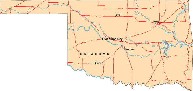
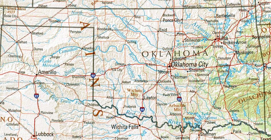
MAP OF OKLAHOMA
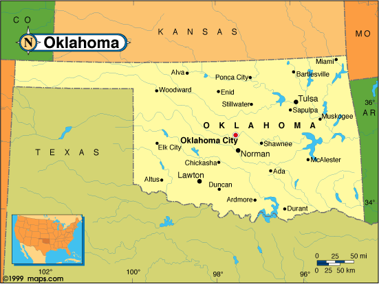
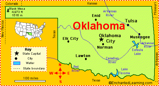
OKLAHOMA MAP
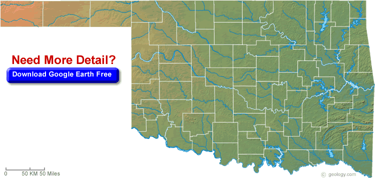
OKLAHOMA BLANK PHYSICAL MAP
OKLAHOMA CITY MAP
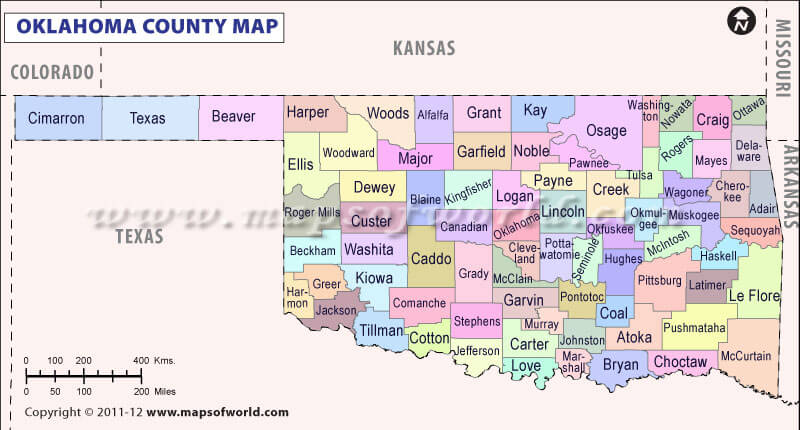
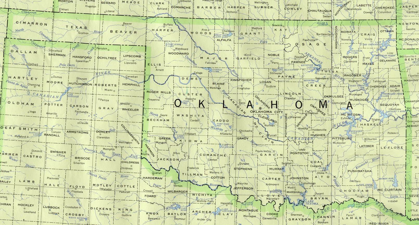
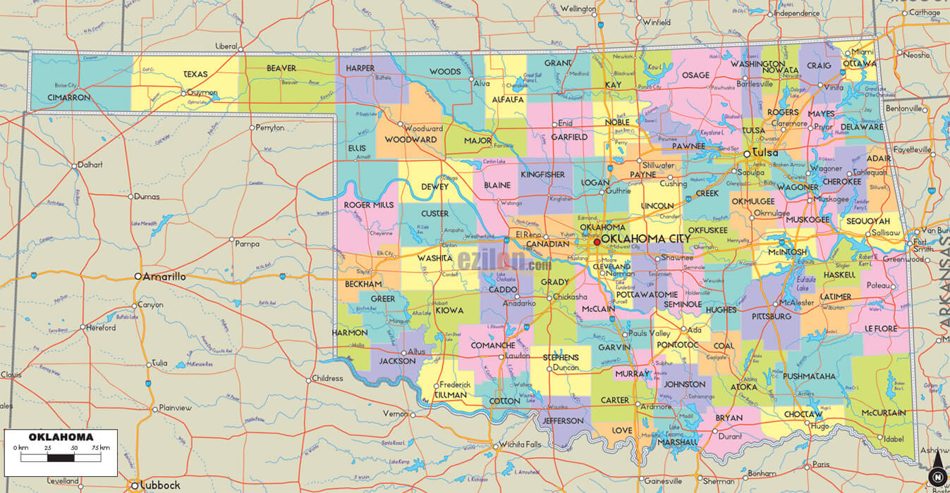
OKLAHOMA COUNTY MAP
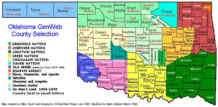
OKLAHOMA COUNTY SELECTION MAP
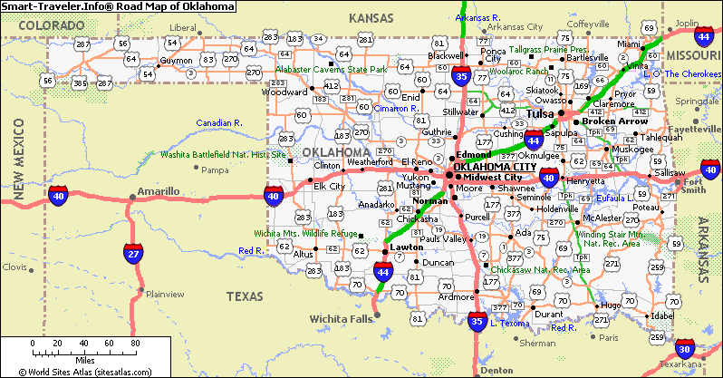
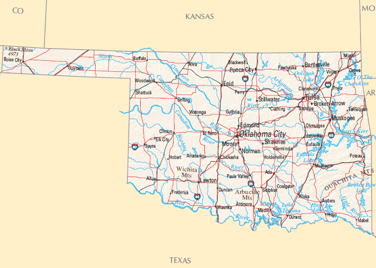
OKLAHOMA HIGHWAYS MAP
OKLAHOMA HISTORICAL MAP
OKLAHOMA MAP
OKLAHOMA MAP OKLAHOMA CITY
OKLAHOMA MAP USA

OKLAHOMA POLITICAL MAP
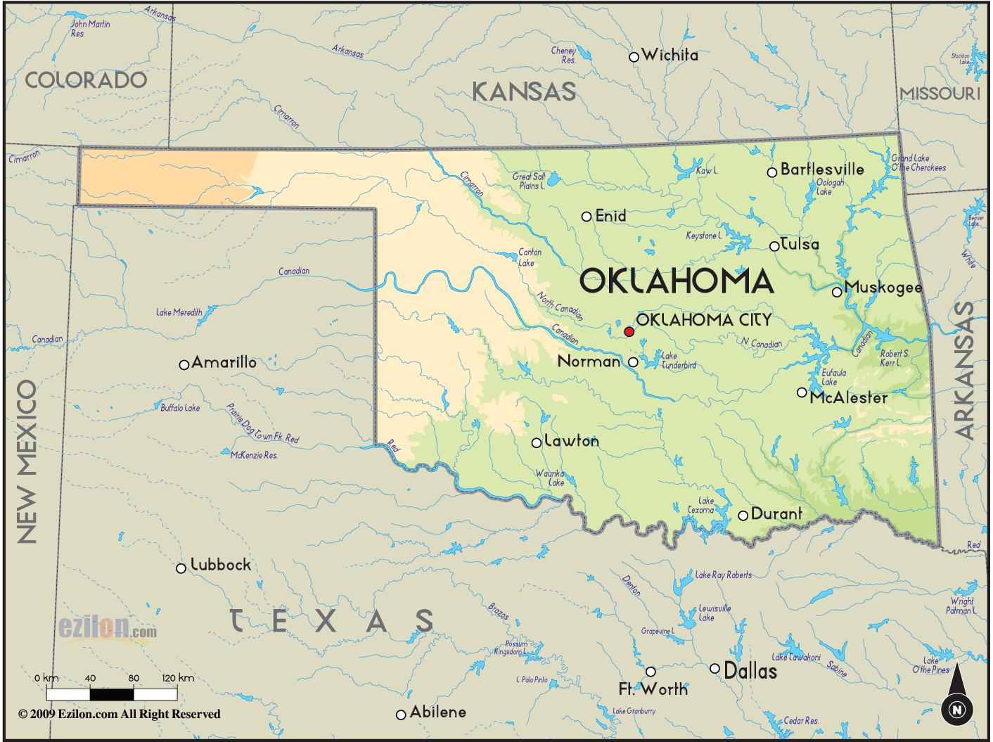
OKLAHOMA RIVERS MAP

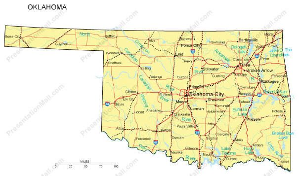
OKLAHOMA ROAD MAP
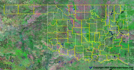
OKLAHOMA SATELLITE IMAGES
OKLAHOMA STATE MAP
OKLAHOMA STATE MAP

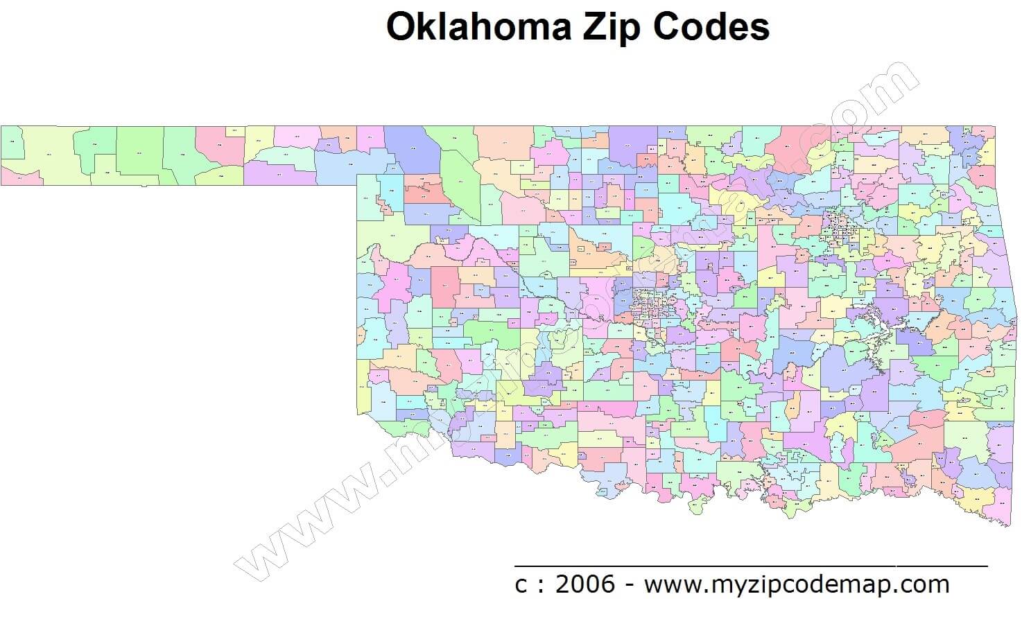
OKLAHOMA ZIP CODE MAP
STATE OF OKLAHOMA MAP
A collection of Oklahoma Maps
- Head of Performance Marketing
- Head of SEO
- Linkedin Profile: linkedin.com/in/arifcagrici
Largest Cities Map of Oklahoma and Population
Oklahoma City Map - 579,999 Tulsa Map - 391,906 Norman Map - 110,925 Broken Arrow Map - 98,850 Lawton Map - 96,867 Edmond Map - 81,405 Moore Map - 55,081 Midwest City Map - 54,371 Enid Map - 49,379 Stillwater Map - 45,688 Muskogee Map - 39,223 Bartlesville Map - 35,750 Shawnee Map - 29,857 Owasso Map - 28,915 Ponca City Map - 25,387Copyright GuideofTheWorld.Net 2006 - 2026. All rights reserved. Privacy Policy | Disclaimer