
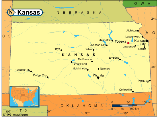
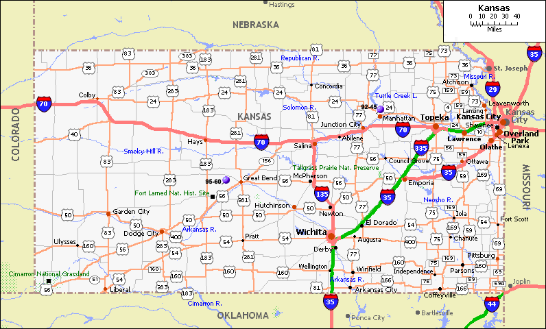
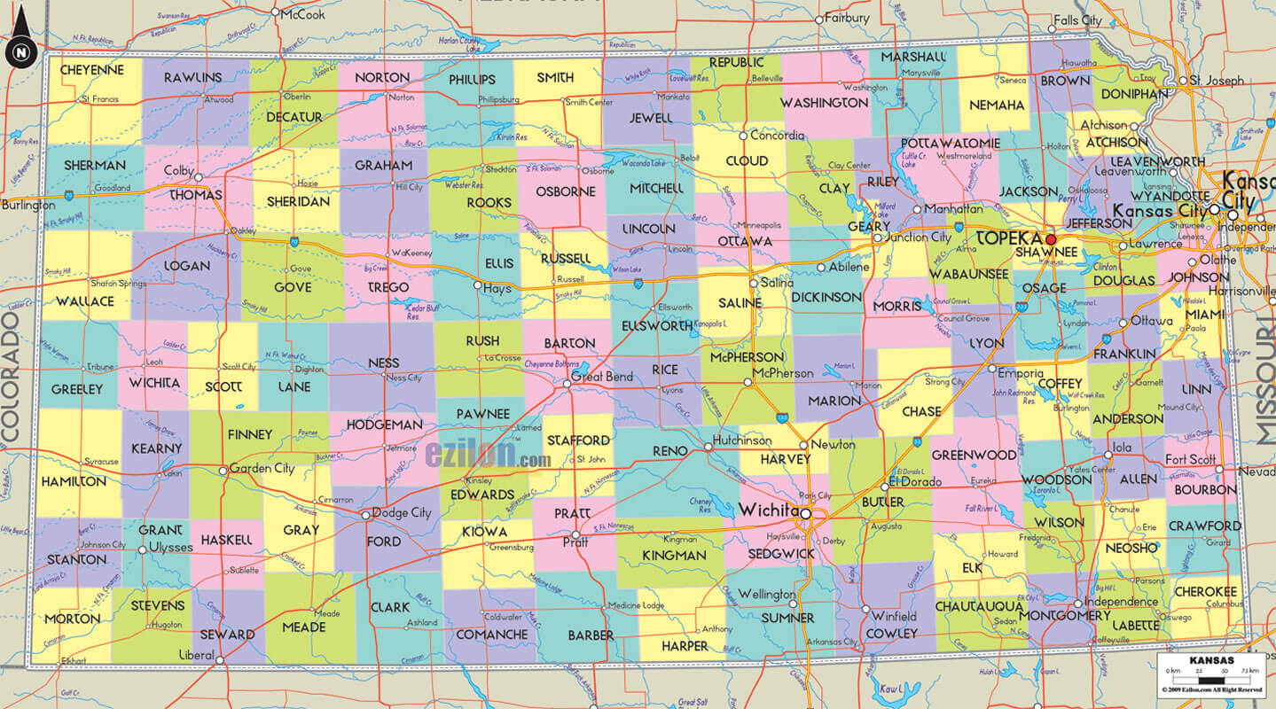
Kansas Map
Explore the state of Kansas with our detailed map featuring cities, highways, and topographic features. Discover popular tourist destinations and landmarks, such as Wichita, Topeka, and the Flint Hills. Plan your next adventure in the Sunflower State with WorldMap1's Kansas map.
On this page, you'll find a comprehensive map that highlights the state's major cities, highways, and topographic features. You'll also discover useful information about popular tourist destinations and landmarks, including Wichita, Topeka, and the Kansas City metropolitan area. Whether you're planning a road trip, looking for new places to visit, or simply want to learn more about Kansas, WorldMap1's Kansas map has got you covered. So, let's get started and discover all the wonders that this great state has to offer!
For all Kansas Cities Map
MAP OF KANSAS
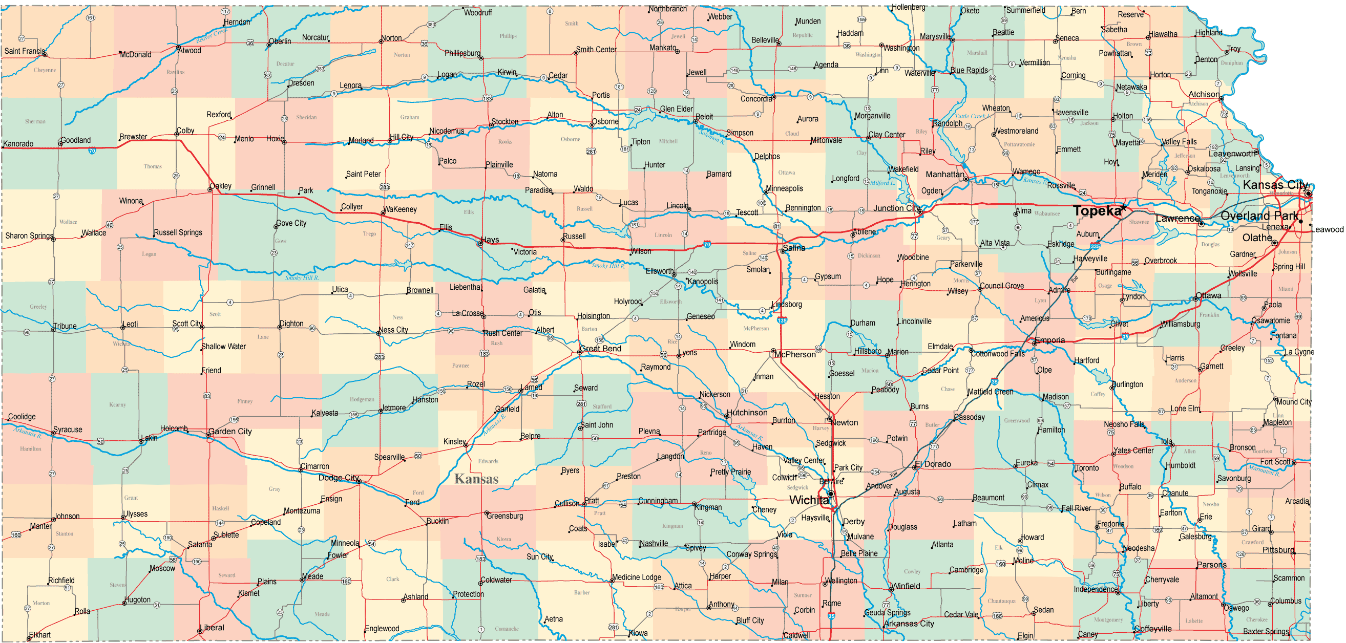
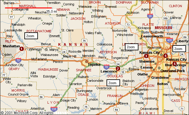
KANSAS CITIES TOWNS MAP
Brief information about Kansas, US
Kansas is a state located in the Midwestern region of the United States. It is bordered by Nebraska to the north, Missouri to the east, Oklahoma to the south, and Colorado to the west. With an area of approximately 82,000 square miles (213,000 square kilometers), Kansas is the 15th largest state in the US. The state's capital is Topeka, and its largest city is Wichita.- Wichita: 395,745
- Overland Park: 194,759
- Kansas City: 150,082
- Topeka: 125,190
- Olathe: 142,841
- White: 84.8%
- Black or African American: 6.2%
- Hispanic or Latino: 12.0%
- Asian: 3.1%
- Native American: 1.2%
A Collection of Kansas Maps and Kansas Satellite Images
MAP OF KANSAS
KANSAS CITIES MAP
KANSAS CITIES MAP

KANSAS CITIES TOWNS MAP
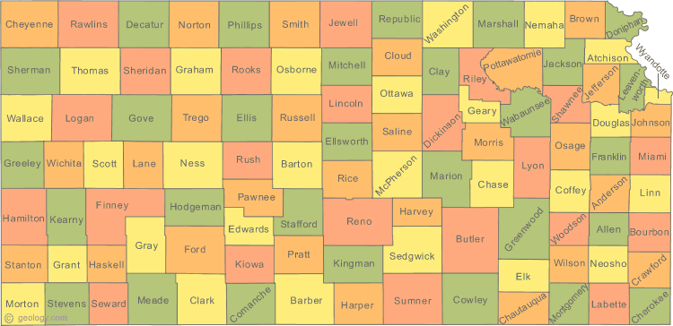
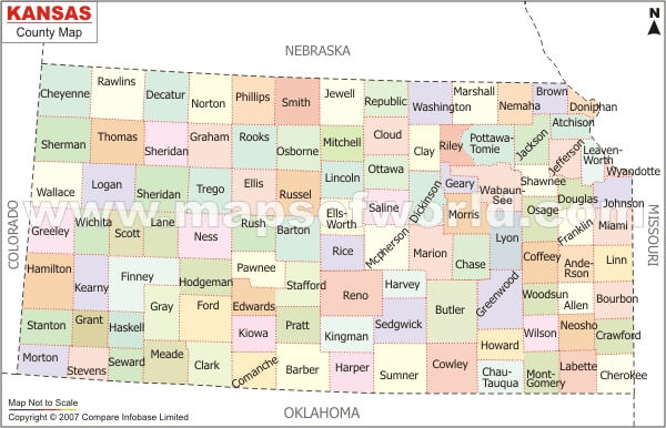
KANSAS COUNTY MAP
KANSAS POLITICAL MAP
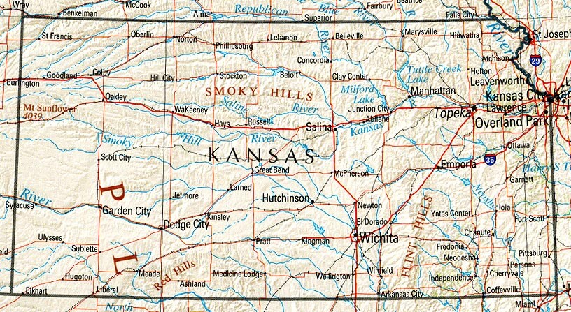
KANSAS REFERENCE MAP
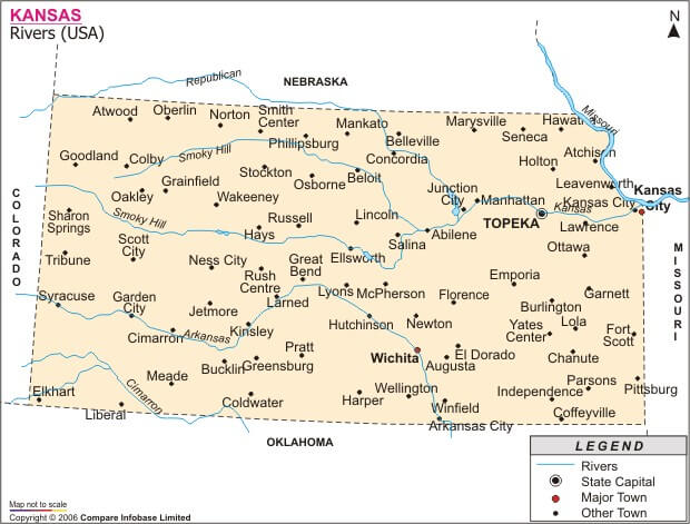
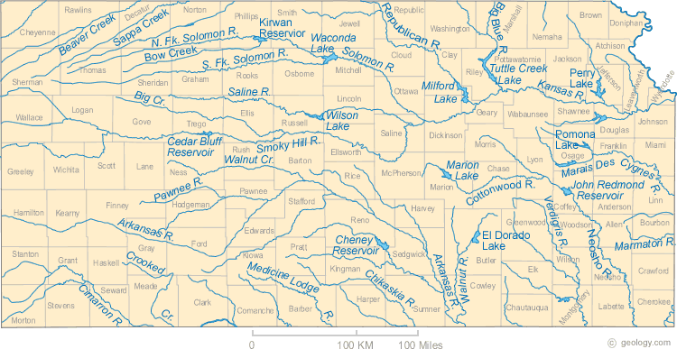
KANSAS RIVERS MAP
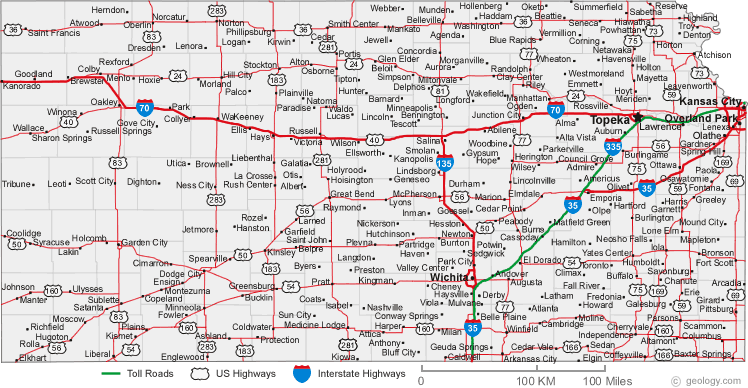
KANSAS ROAD MAP

MAP OF KANSAS CITIES
A collection of Kansas Maps

- Head of Performance Marketing
- Head of SEO
- Linkedin Profile: linkedin.com/in/arifcagrici
Largest Cities Map of Kansas and Population
Wichita Map - 382,368 Overland Park Map - 173,372 Kansas City Map - 145,786 Topeka Map - 127,473 Olathe Map - 125,872 Lawrence Map - 87,643 Shawnee Map - 62,209 Manhattan Map - 52,281 Lenexa Map - 48,190 Salina Map - 47,707 Hutchinson Map - 42,080 Leavenworth Map - 35,251 Leawood Map - 31,867 Dodge City Map - 27,340 Garden City Map - 26,658Copyright GuideofTheWorld.Net 2006 - 2026. All rights reserved. Privacy Policy | Disclaimer