
Discover Indiana: Explore the Hoosier State with our Interactive Map
Explore the state of Indiana with our interactive map. Discover the major cities, highways, and geographical features of the Hoosier State. If you're planning a trip to the Hoosier State, or simply want to explore its cities, highways, and geographical features, you've come to the right place. Our easy-to-use map allows you to zoom in and out, search for specific locations, and get directions to your destination.
For all Indiana Cities Map
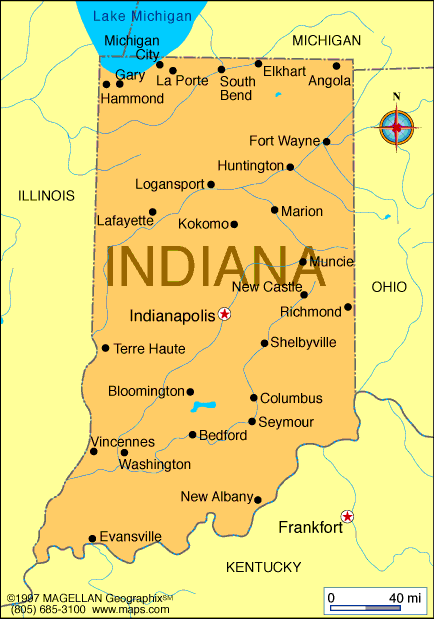
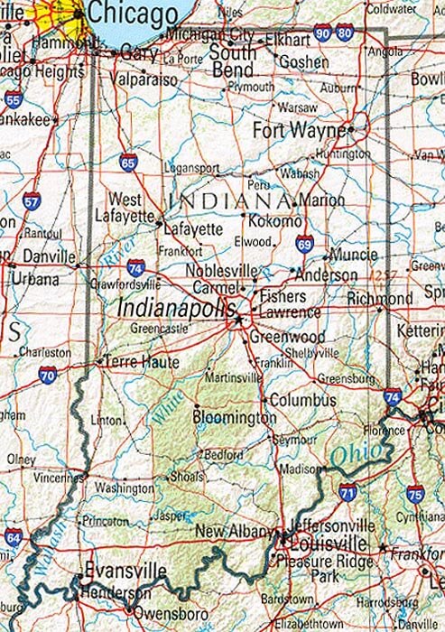
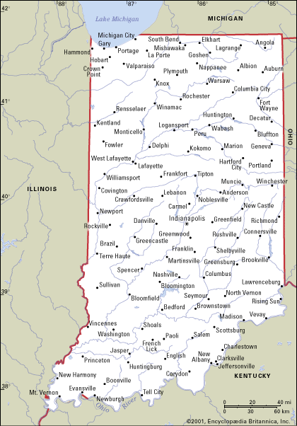
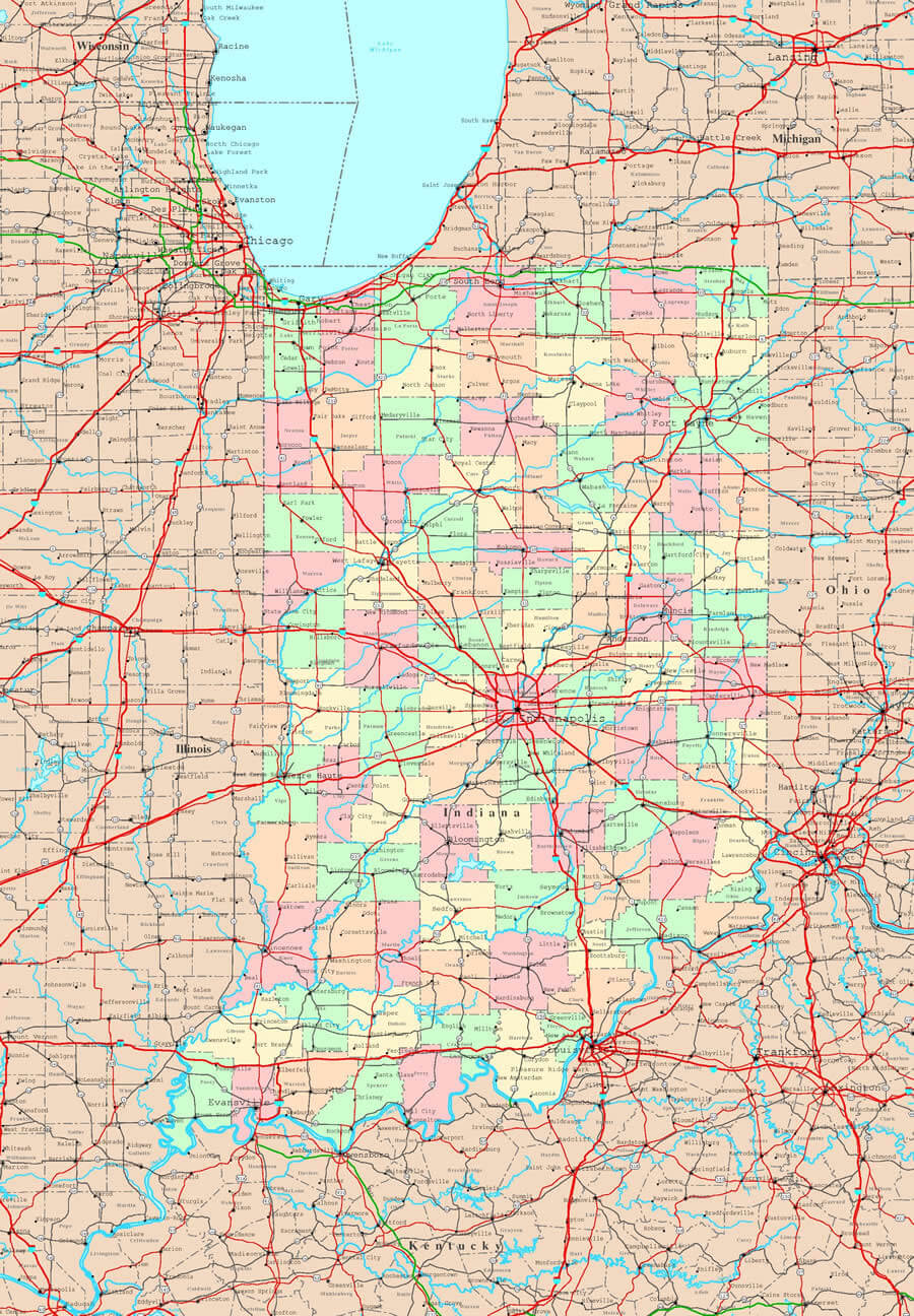
MAP OF INDIANA
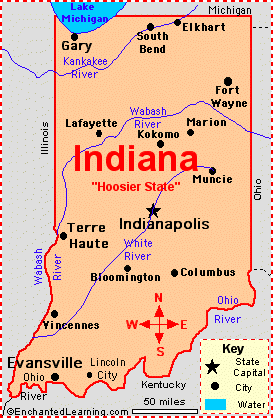
INDIANA MAP
Brief information about Indiana, US
Indiana is a state located in the Midwestern region of the United States. It is the 38th largest state in terms of land area and the 17th most populous state, with a population of approximately 6.7 million people. The state's capital and largest city is Indianapolis, which is known for hosting the Indy 500, one of the world's most famous auto races.A Collection of Indiana Maps and Indiana Satellite Images
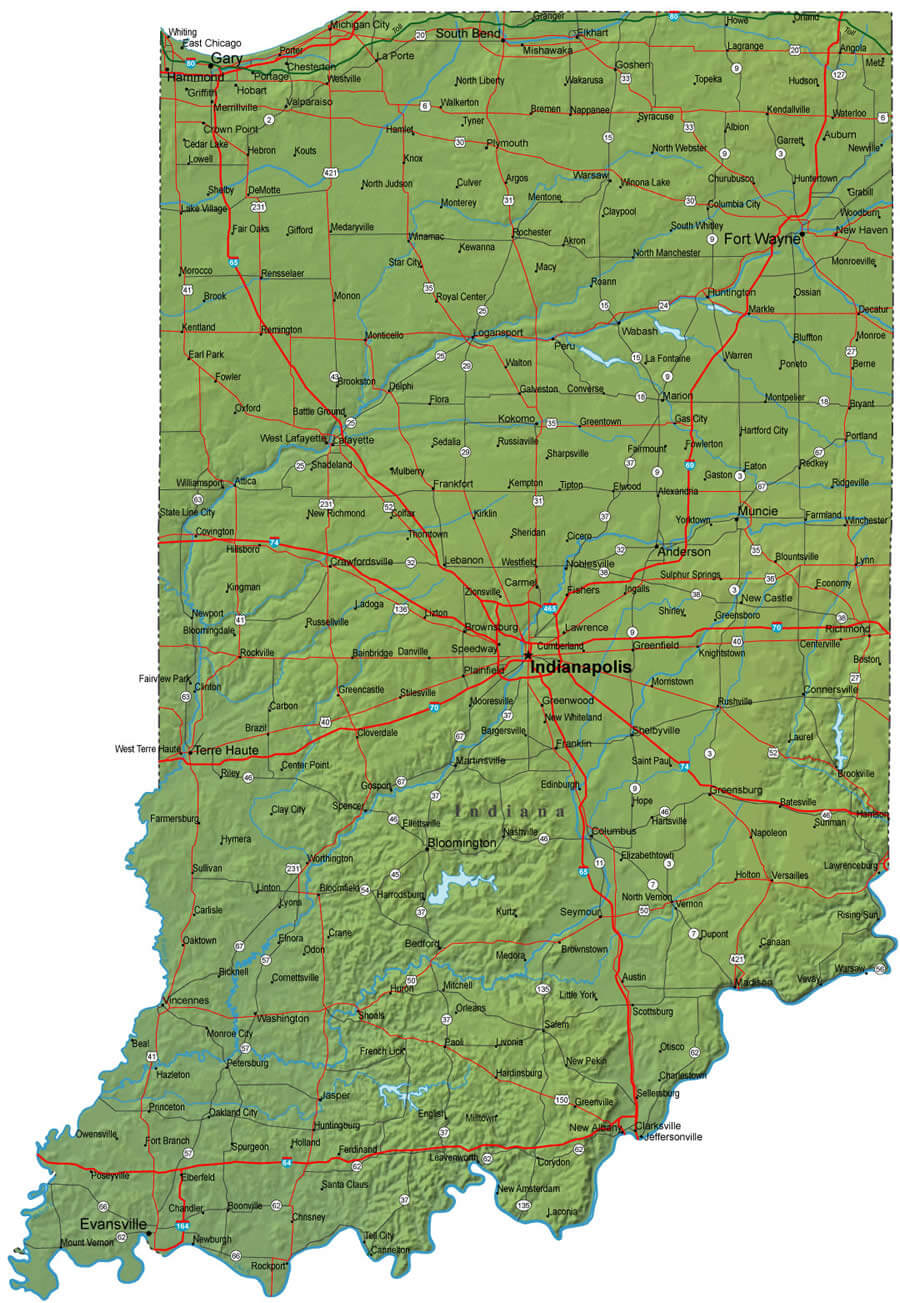
MAP OF INDIANA
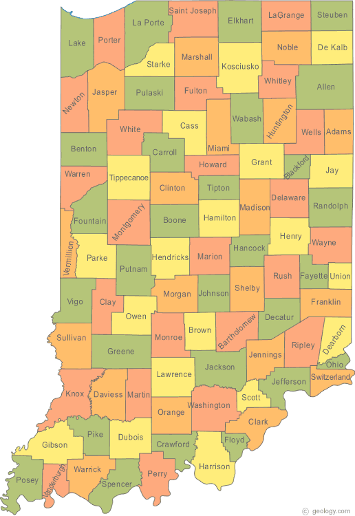
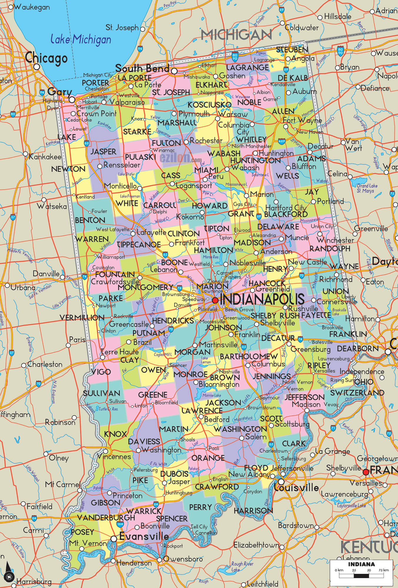
INDIANA COUNTY MAP
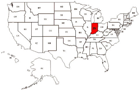
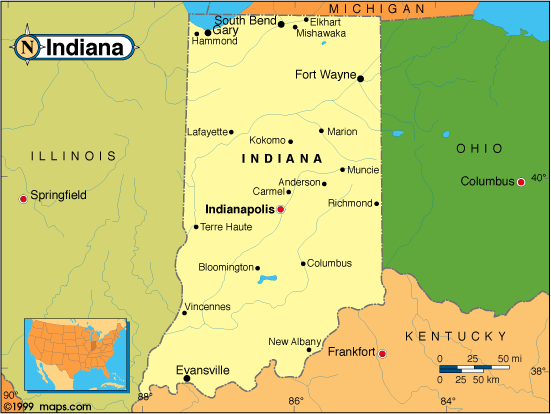
INDIANA MAP USA
INDIANA MAP
INDIANA MAP
INDIANA PHYSICAL MAP
INDIANA POLITICAL MAP

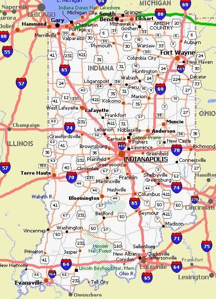
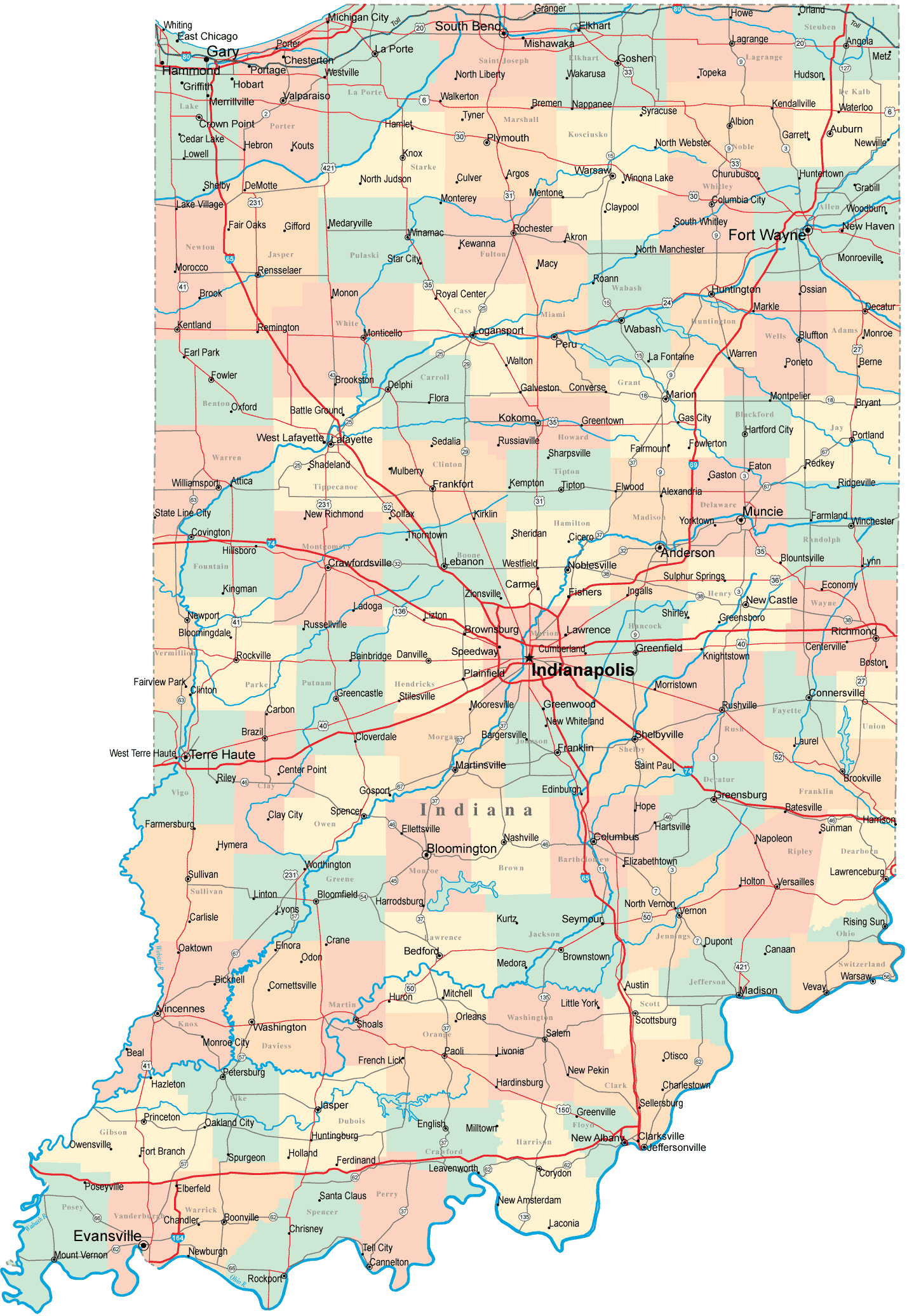
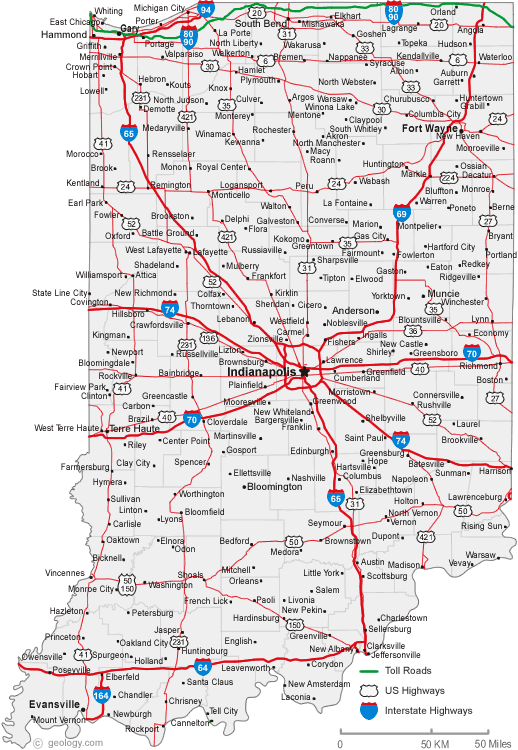
INDIANA ROAD MAP
INDIANA COUNTIES MAP
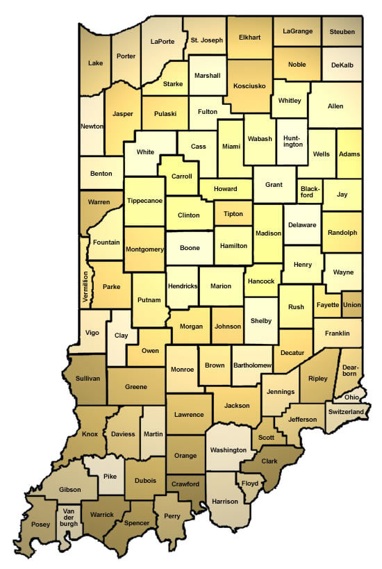
INDIANA COUNTY MAP

INDIANA MAP
INDIANA ROAD MAP
MAP OF INDIANA
ROAD MAP OF INDIANA
A collection of Indiana Maps
- Head of Performance Marketing
- Head of SEO
- Linkedin Profile: linkedin.com/in/arifcagrici
Largest Cities Map of Indiana and Population
Indianapolis Map - 820,445 Fort Wayne Map - 253,691 Evansville Map - 117,429 South Bend Map - 101,168 Hammond Map - 80,830 Bloomington Map - 80,405 Gary Map - 80,294 Carmel Map - 79,191 Fishers Map - 76,794 Muncie Map - 70,085 Lafayette Map - 67,140 Terre Haute Map - 60,785 Anderson Map - 56,129 Noblesville Map - 51,969 Elkhart Map - 50,949Copyright GuideofTheWorld.Net 2006 - 2026. All rights reserved. Privacy Policy | Disclaimer