
Explore the Beauty and Diversity of Alabama with our Comprehensive Alabama Map
Discover the wonders of Alabama with Worldmap1's interactive Alabama map. Navigate through the state's diverse regions and explore its major cities, highways, and geographical features. Our detailed Alabama map provides a comprehensive view of the state's topography, making it a valuable resource for travelers, researchers, and students alike. Start your Alabama adventure today with guideoftheworld.net
For all Alabama Cities Map
Embarking on a Southern Odyssey: The Enchanting Alabama Experience
Please subscribe on "World Guide" channnel on Youtube at youtube.com/c/WorldGuide
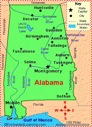
MAP OF ALABAMA
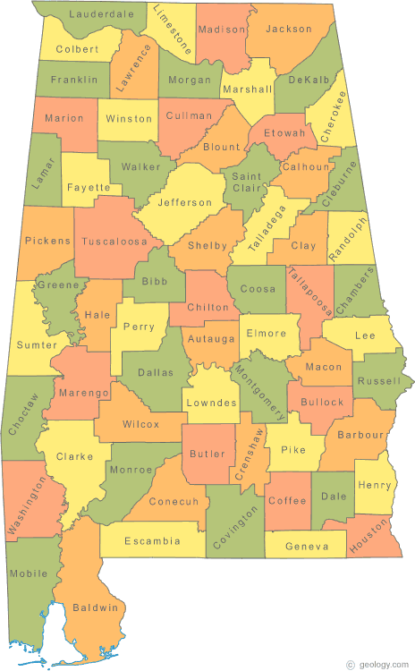
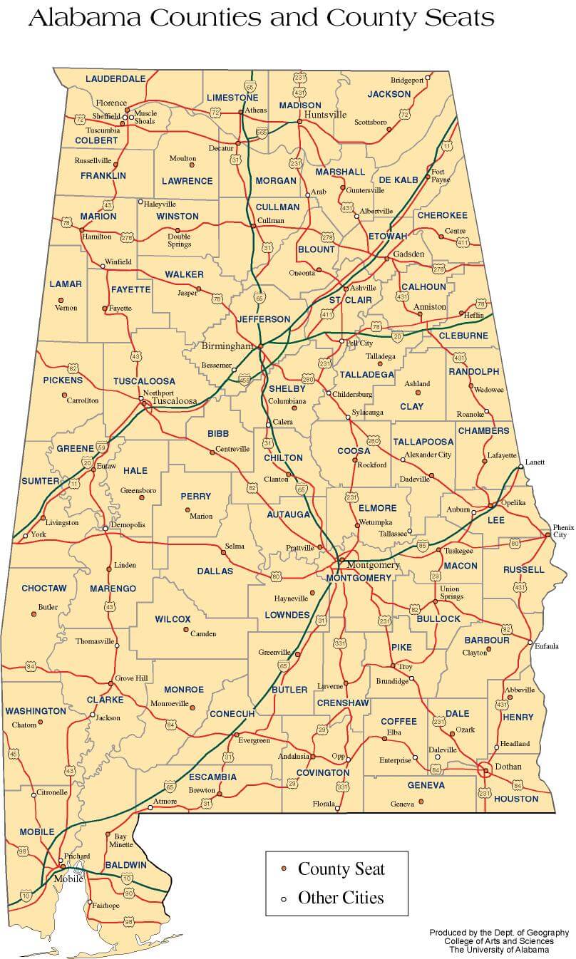
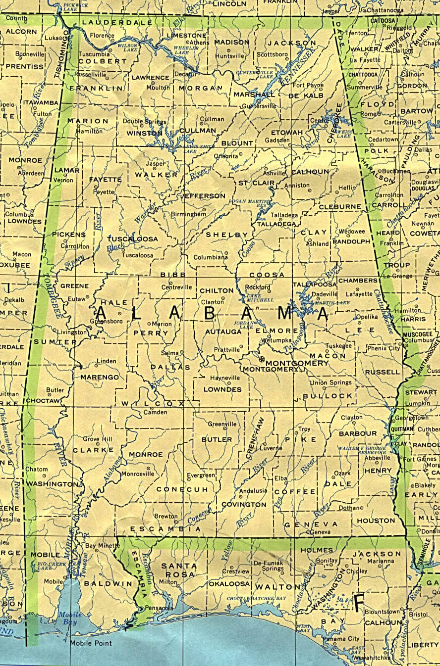
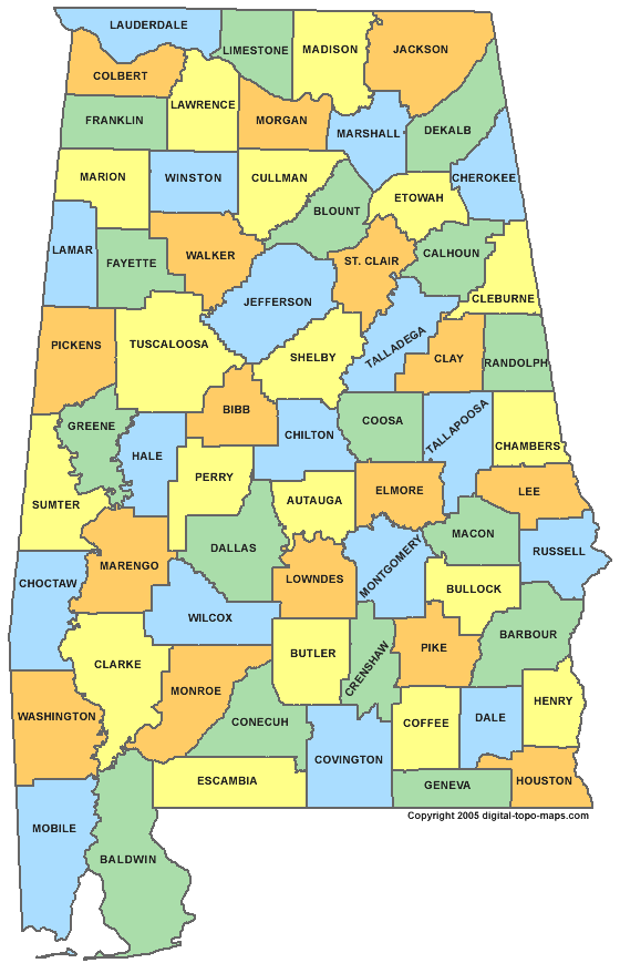
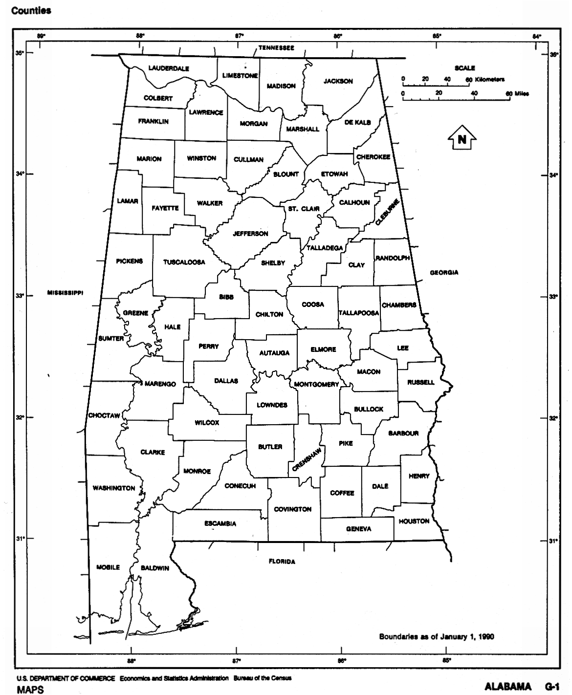
ALABAMA COUNTIES MAP
Brief information about Alabama, US
Alabama is a state located in the southeastern region of the United States. It is the 24th most populous state in the country and covers an area of approximately 52,419 square miles (135,765 km²). The state is known for its diverse landscapes, which include beaches, wetlands, forests, and mountains. Its capital city is Montgomery, and its largest city is Birmingham.A Collection of Alabama Maps and Alabama Satellite Images
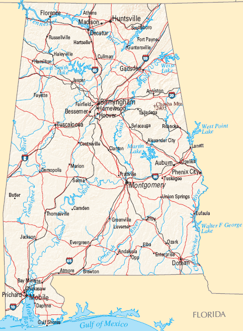
MAP OF ALABAMA
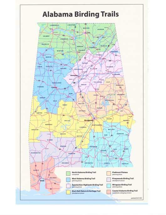
ALABAMA BIRDING TRAILS MAP
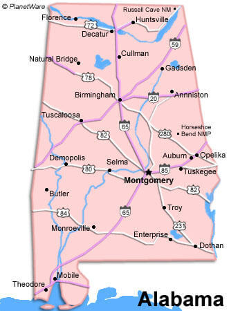
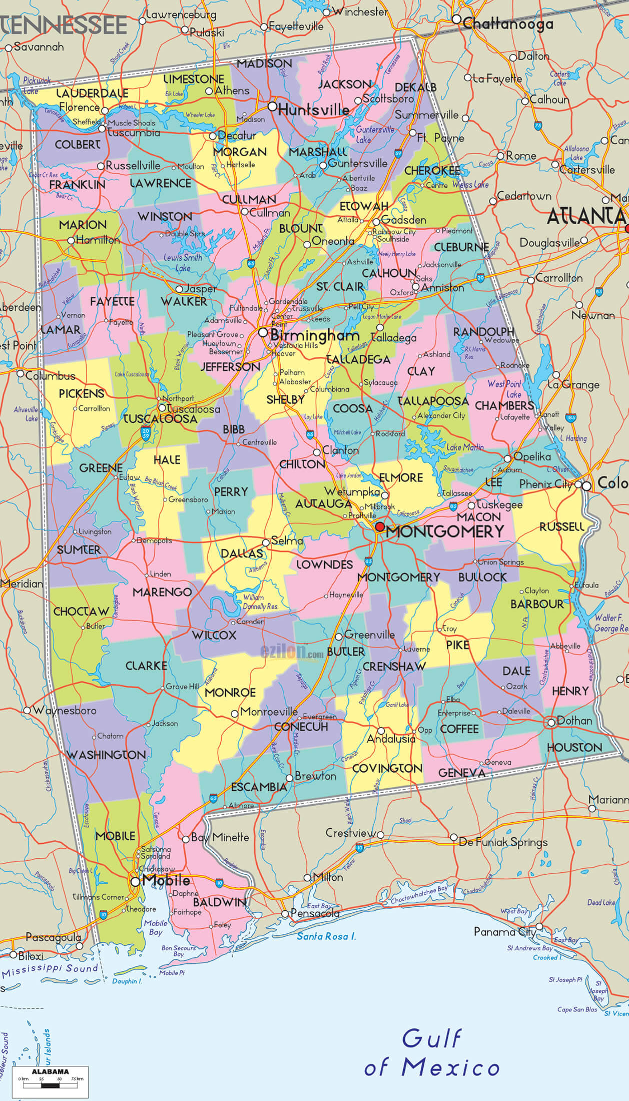
ALABAMA CITIES MAP
ALABAMA COUNTIES MAP
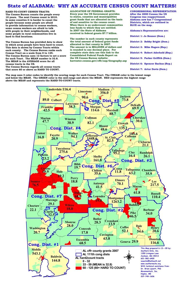
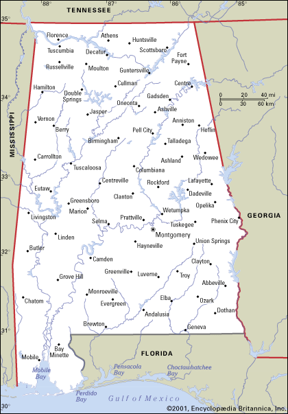
ALABAMA HISTORICAL MAP
ALABAMA MAIN CITIES MAP
ALABAMA PHYSICAL MAP
ALABAMA POLITICAL MAP

ALABAMA POPULATION MAP
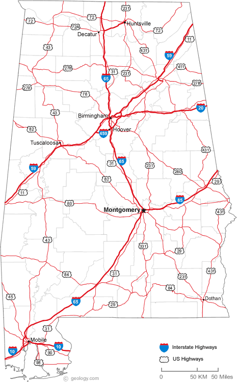
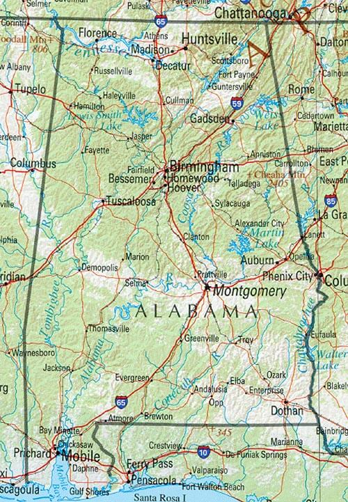
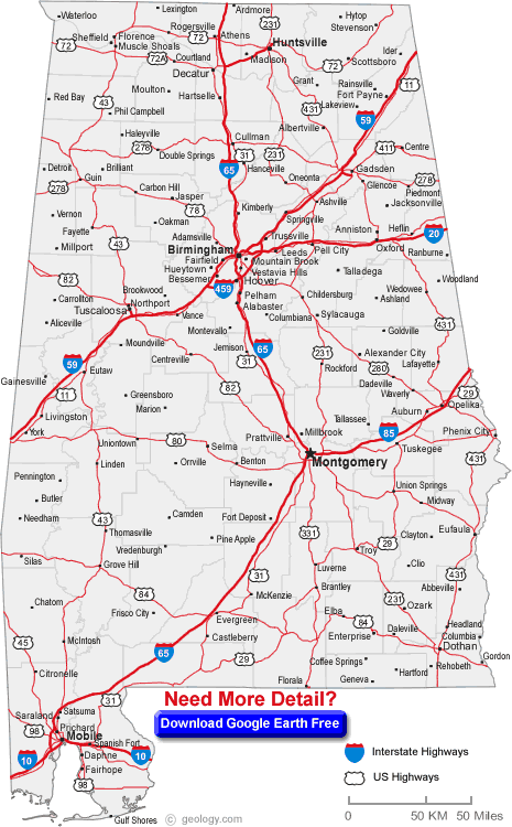
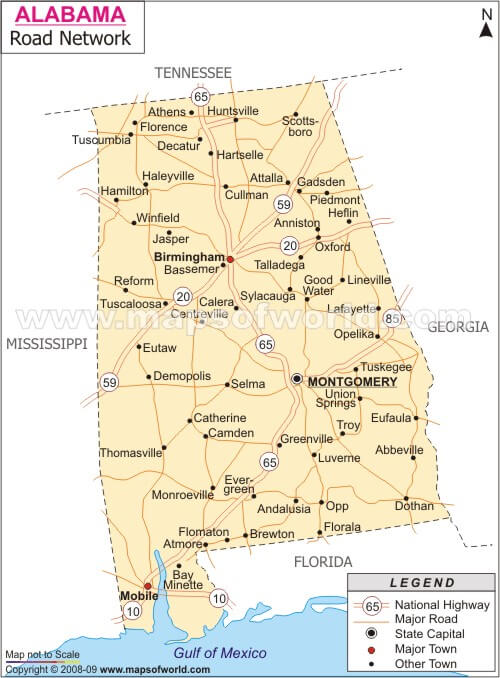
ALABAMA ROAD MAP
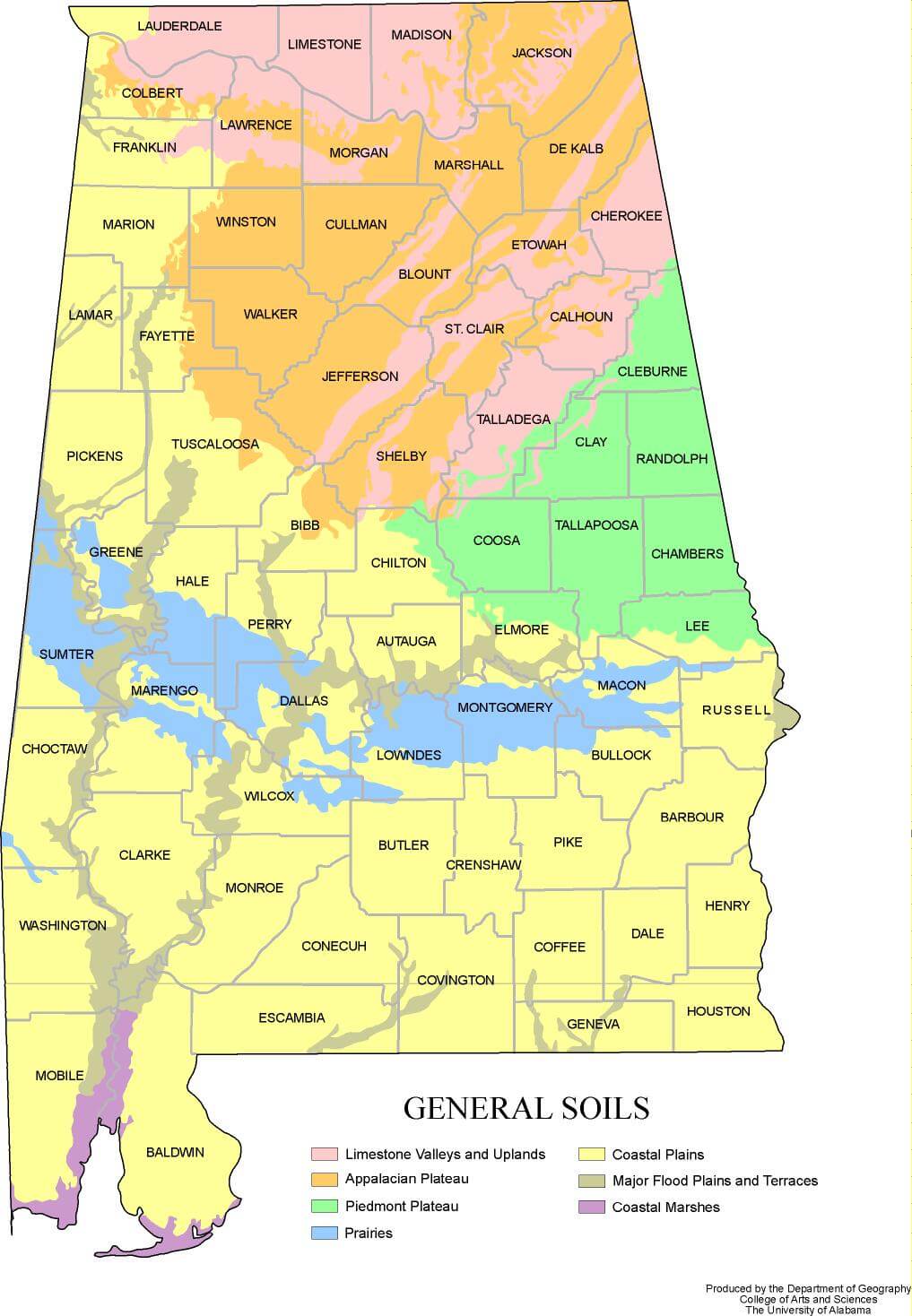
ALABAMA SOIL MAP
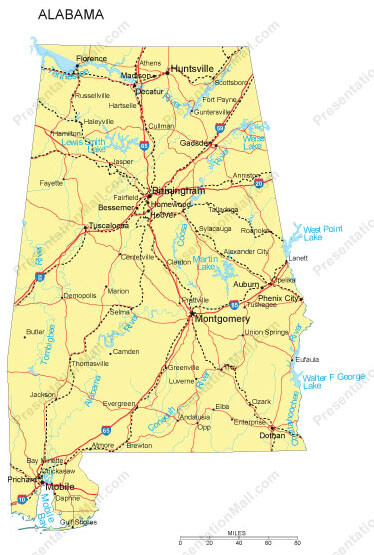
ALABAMA STATE MAP
ALABAMA USA MAP

CITIES MAP OF ALABAMA
COUNTIES MAP OF ALABAMA MAP

COUNTY MAP OF ALABAMA
LARGEST CITIES MAP OF ALABAMA
POLITICAL MAP OF ALABAMA
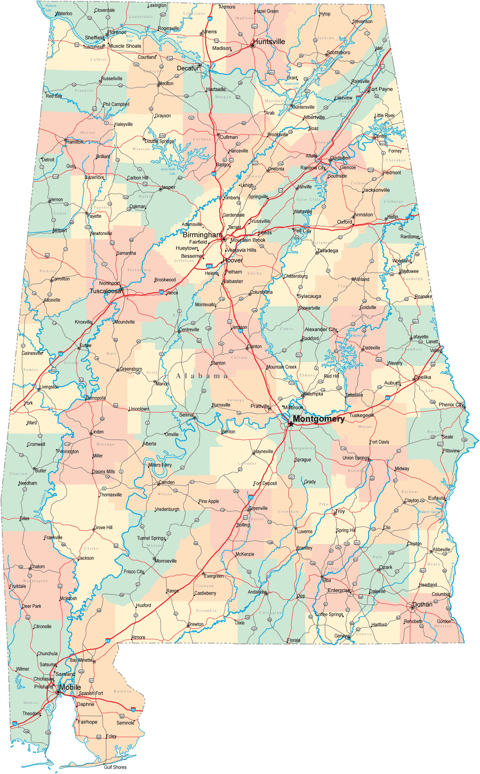
RAIL MAP OF ALABAMA
ROAD MAP OF ALABAMA
A collection of Alabama Maps
- Head of Performance Marketing
- Head of SEO
- Linkedin Profile: linkedin.com/in/arifcagrici
Largest Cities Map of Alabama and Population
Birmingham Map - 212,237 Montgomery Map - 205,764 Mobile Map - 195,111 Huntsville Map - 180,105 Tuscaloosa Map - 90,468 Hoover Map - 81,619 Dothan Map - 65,496 Decatur Map - 55,683 Auburn Map - 53,380 Madison Map - 42,938 Florence Map - 39,319 Gadsden Map - 36,856 Vestavia Hills Map - 34,033 Prattville Map - 33,960 Phenix City Map - 32,822 Blountsville Map - 1,684Copyright GuideofTheWorld.Net 2006 - 2026. All rights reserved. Privacy Policy | Disclaimer