
Montana Map
Explore the beautiful state of Montana with our map! Montana is known for its stunning natural beauty, including Glacier National Park, Yellowstone National Park, and the Rocky Mountains. On our Montana map, you can discover the state's cities, highways, topography, and landmarks. Whether you're planning a trip to Montana, studying geography, or simply curious about this scenic state, our map has something for everyone.
For all Montana Cities Map
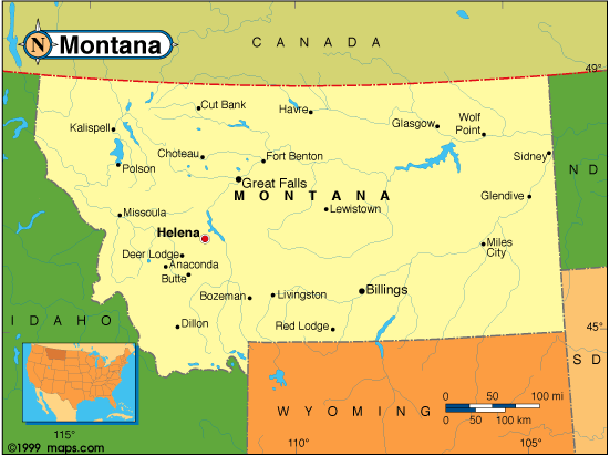
MAP OF MONTANA

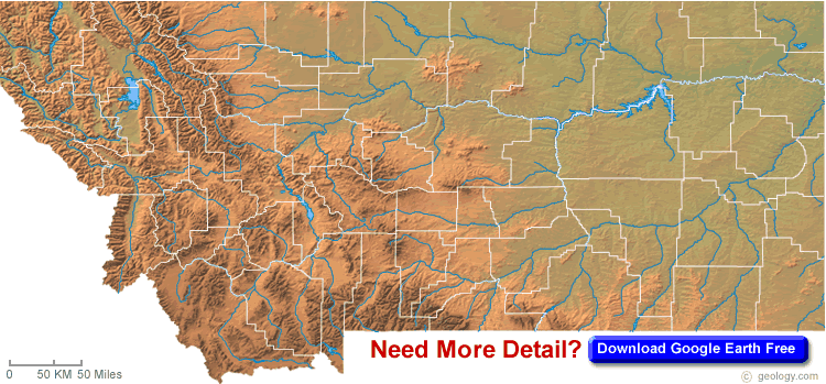
MONTANA BLANK PHYSICAL MAP
Brief information about Montana, US
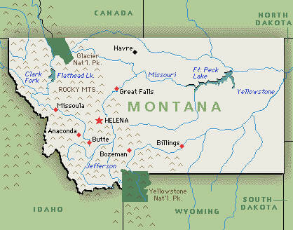
Montana is a state located in the northwestern region of the United States. It is the fourth largest state by land area, covering an area of 147,040 square miles (380,800 square kilometers). The state is known for its stunning natural beauty, which includes Glacier National Park, Yellowstone National Park, and the Rocky Mountains. Montana is also home to a diverse array of wildlife, including grizzly bears, elk, and bison.A Collection of Montana Maps and Montana Satellite Images
MAP OF MONTANA
MONTANA MAP
MONTANA PHYSICAL MAP

MONTANA BLANK PHYSICAL MAP
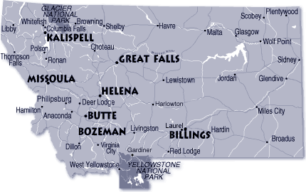
MONTANA CITIES MAP
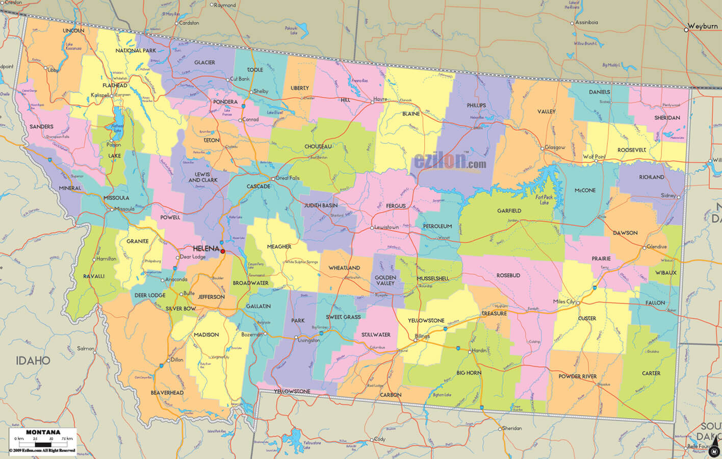
MONTANA COUNTY MAP

MONTANA GEOGRAPHIC MAP
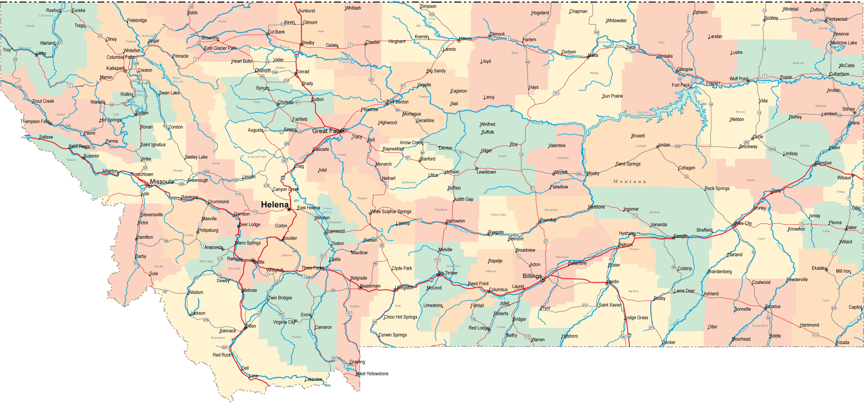
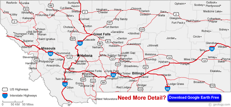
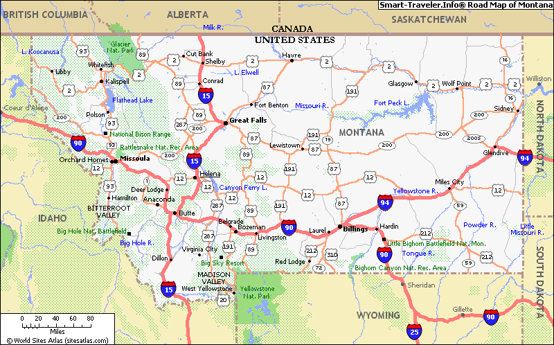
MONTANA HIGHWAYS MAP
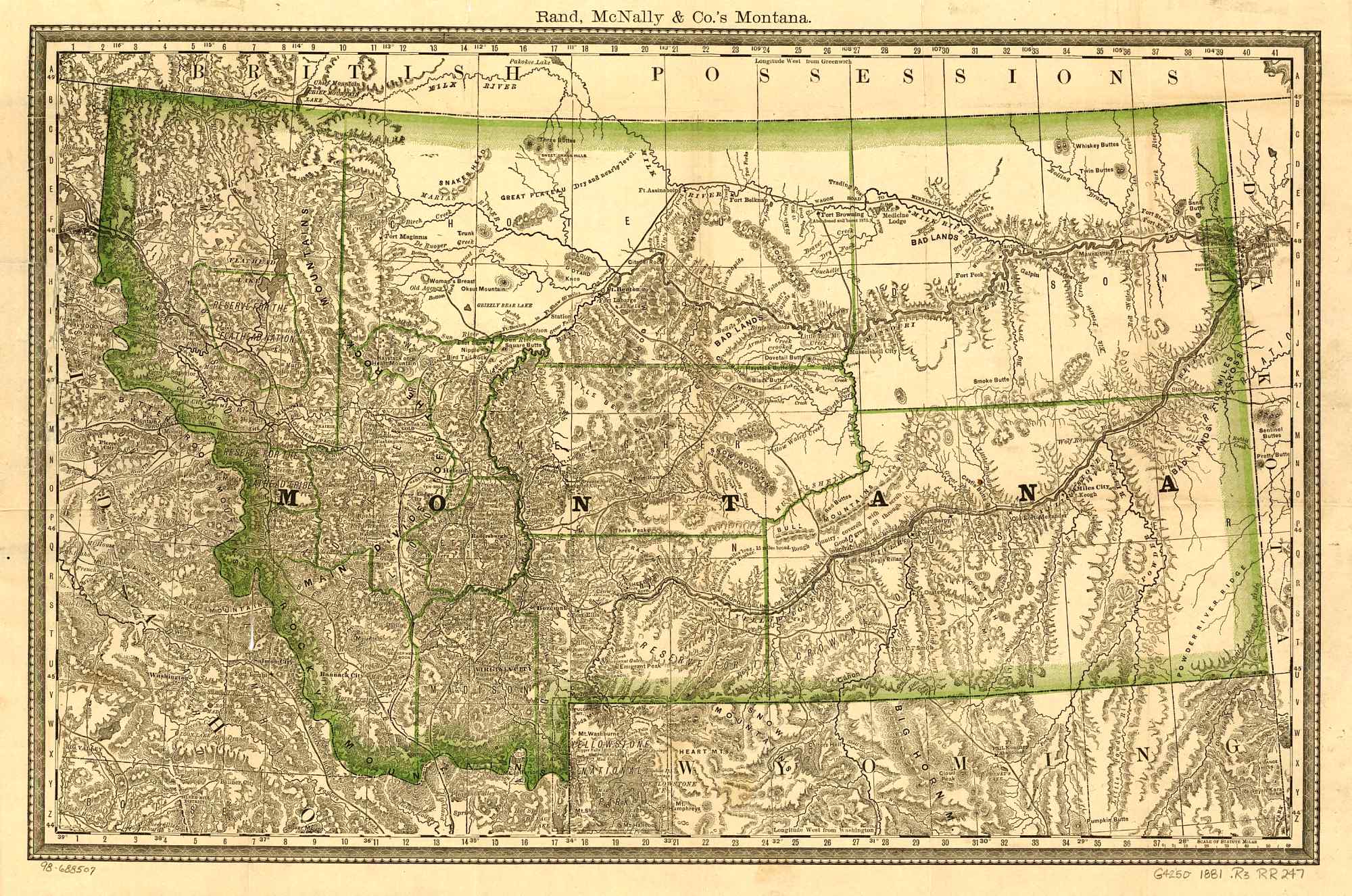
MONTANA HISTORICAL MAP
MONTANA MAP

MONTANA MAP GREAT FALLS
MONTANA NATIONAL PARK MAP

MONTANA PHYSICAL MAP
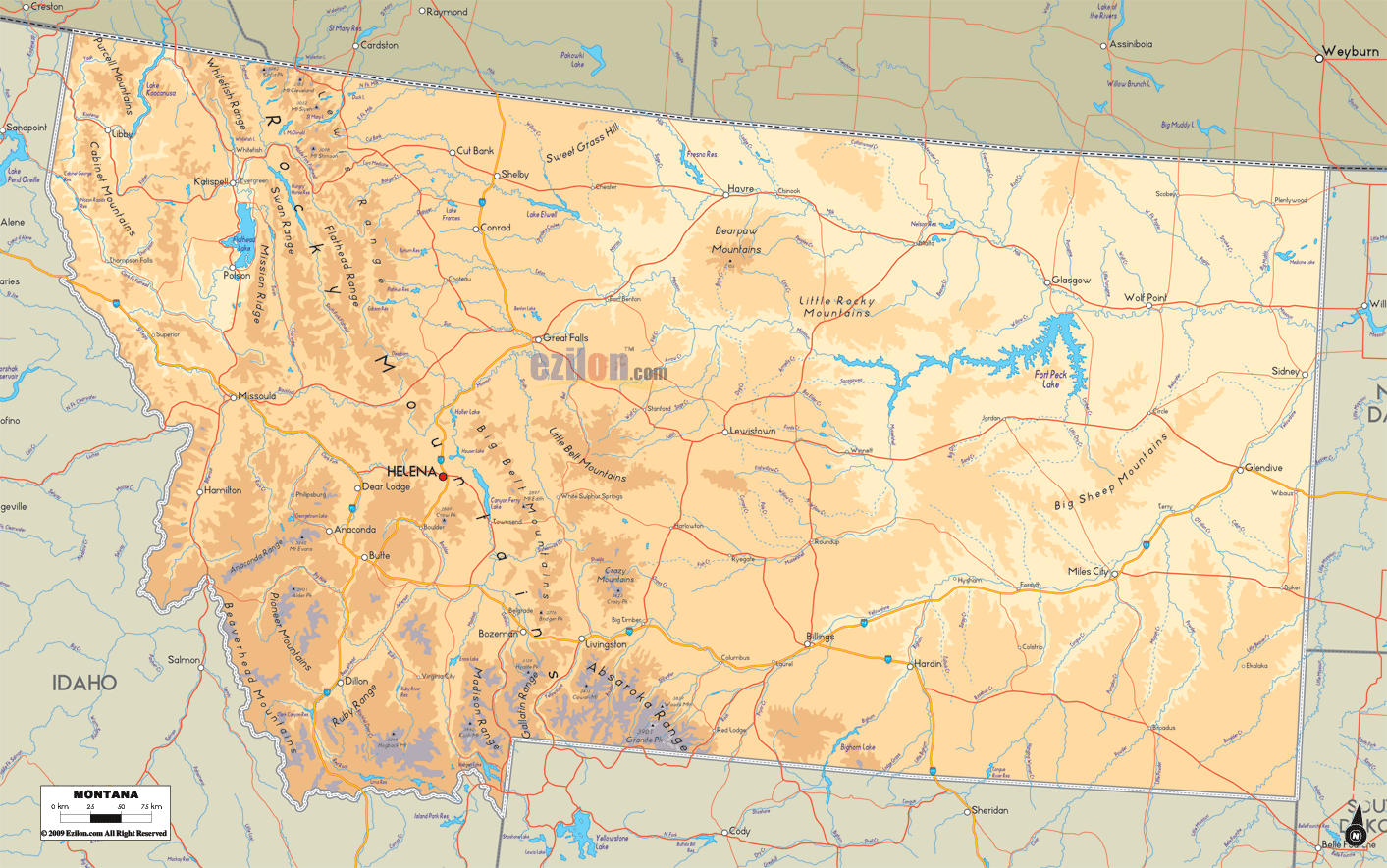
MONTANA PHYSICAL MAP

MONTANA POLITICAL MAP
MONTANA RIVERS MAP

MONTANA ROUTE MAP

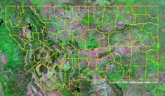
MONTANA SATELLITE IMAGE
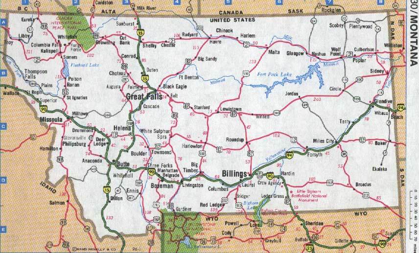
ROAD MAP OF MONTANA
A collection of Montana Maps


- Head of Performance Marketing
- Head of SEO
- Linkedin Profile: linkedin.com/in/arifcagrici
Largest Cities Map of Montana and Population
Billings Map - 104,170 Missoula Map - 66,788 Great Falls Map - 58,505 Bozeman Map - 37,280 Butte Silver Bow Map - 33,525 Helena Map - 28,190 Kalispell Map - 19,927 Havre Map - 9,310 Anaconda Deer Lodge Map - 9,298 Miles City Map - 8,410 Helena Valley Southeast Map - 8,227 Helena Valley West Central Map - 7,883 Evergreen Map - 7,616 Belgrade Map - 7,389 Livingston Map - 7,044Copyright GuideofTheWorld.Net 2006 - 2026. All rights reserved. Privacy Policy | Disclaimer