
Washington Map
Explore the beautiful state of Washington with our detailed map. Find your way around the state's cities, national parks, and landmarks with ease. Our Washington map is interactive, zoomable, and includes satellite imagery. Start planning your trip to Washington today!
For all Washington Cities Map
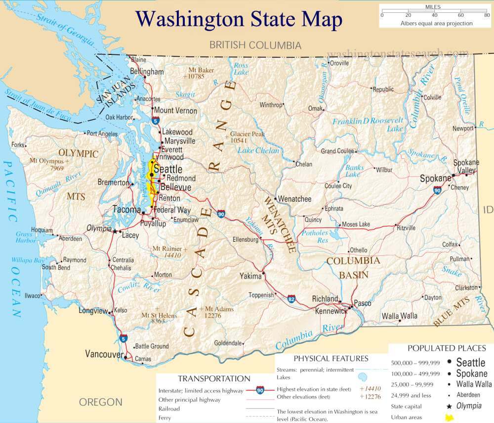
MAP OF WASHINGTON
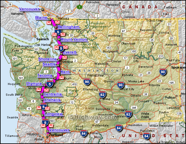
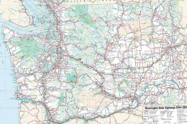
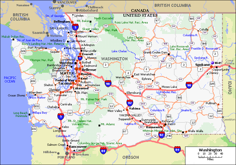
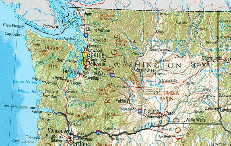
INTERSTATE 5 WASHINGTON MAP
Brief information about Washington, US
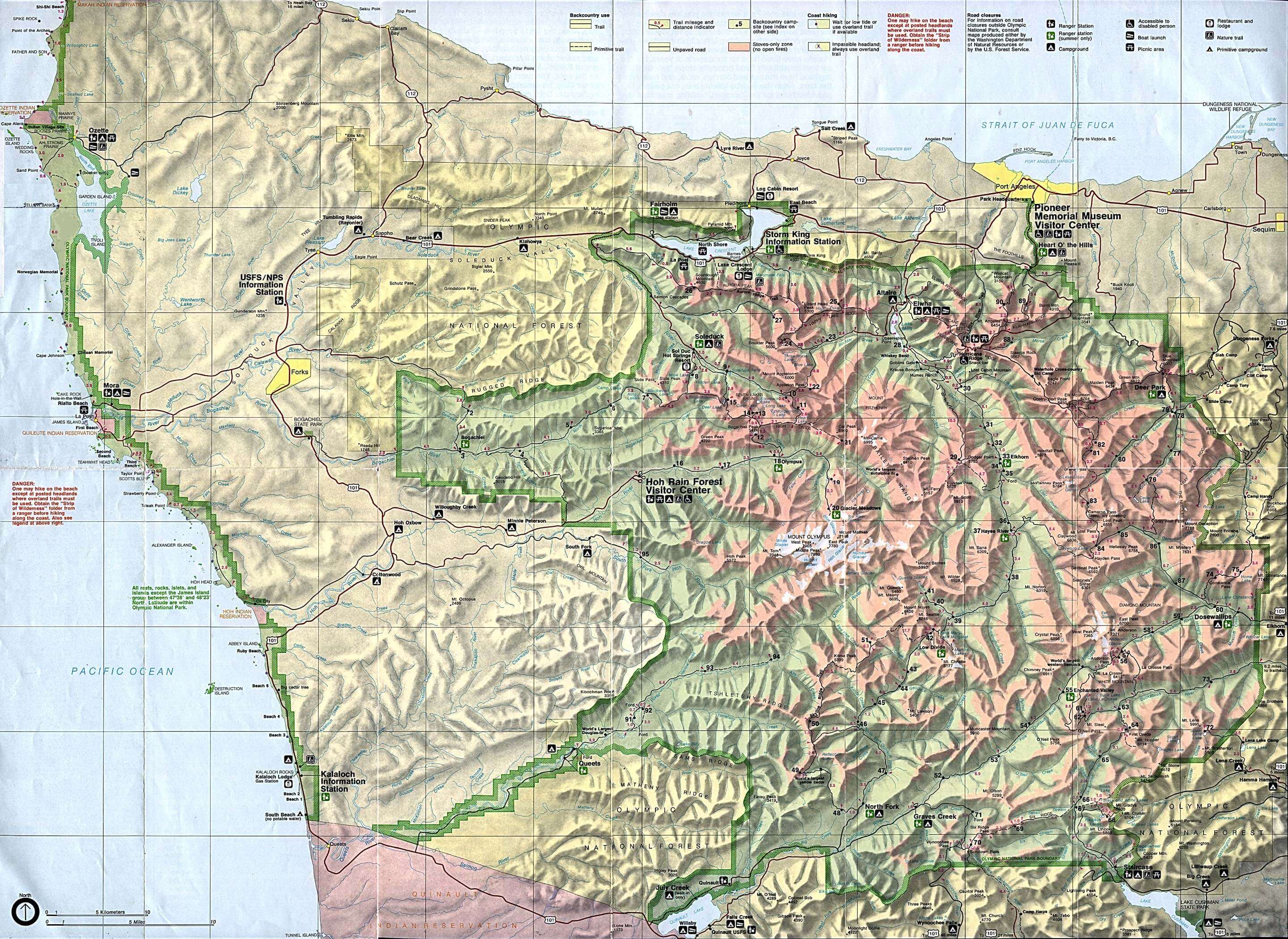
Washington is a state located in the Pacific Northwest region of the United States. It is the 18th largest state by land area and the 13th most populous, with an estimated population of over 7.7 million people as of 2020. The state's largest city is Seattle, which is known for its thriving music and arts scene, as well as its iconic Space Needle. Other major cities in Washington include Spokane, Tacoma, and Vancouver. The state is home to a diverse range of natural landscapes, including the Cascade Range mountains, Puget Sound, and Olympic National Park. Washington's economy is driven by a mix of industries, including technology, aerospace, agriculture, and tourism. The state is home to several major tech companies, including Amazon, Microsoft, and Boeing. Washington is also known for its excellent universities, including the University of Washington and Washington State University.A Collection of Washington Maps and Washington Satellite Images
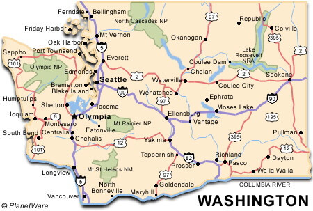
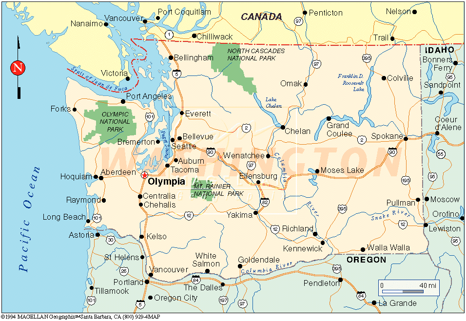
MAP OF WASHINGTON
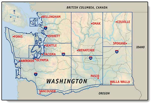
CITIES MAP OF WASHINGTON
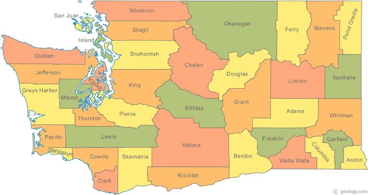
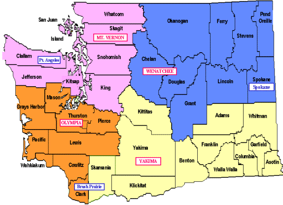
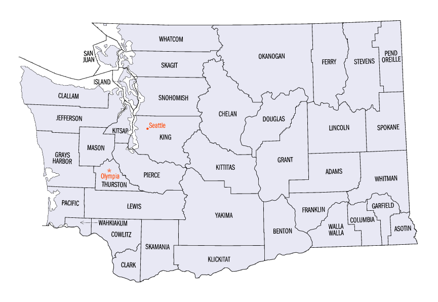
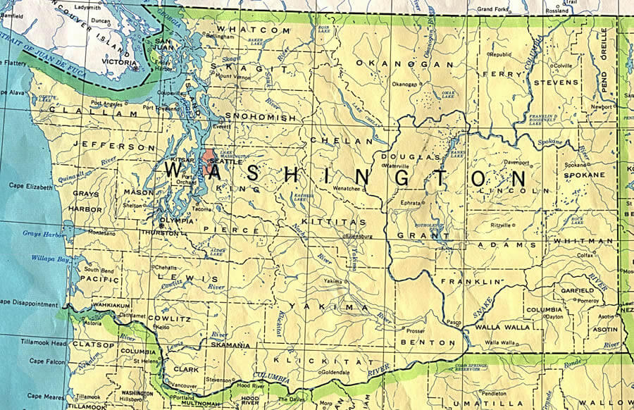
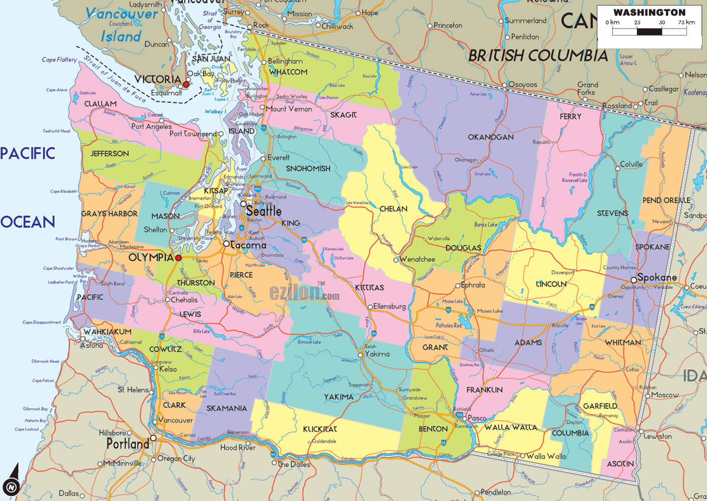
COUNTIES MAP OF WASHINGTON
INTERSTATE 5 WASHINGTON MAP
MAP OF WASHINGTON
MAP WASHINGTON
STATE MAP OF WASHINGTON
STATE MAP WASHINGTON
WASHINGTON COUNTY MAP
WASHINGTON MAP
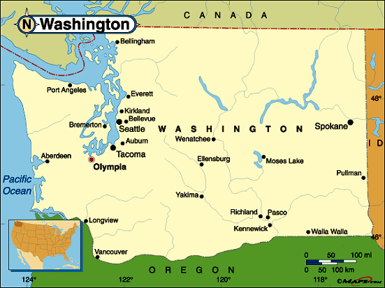
WASHINGTON MAP
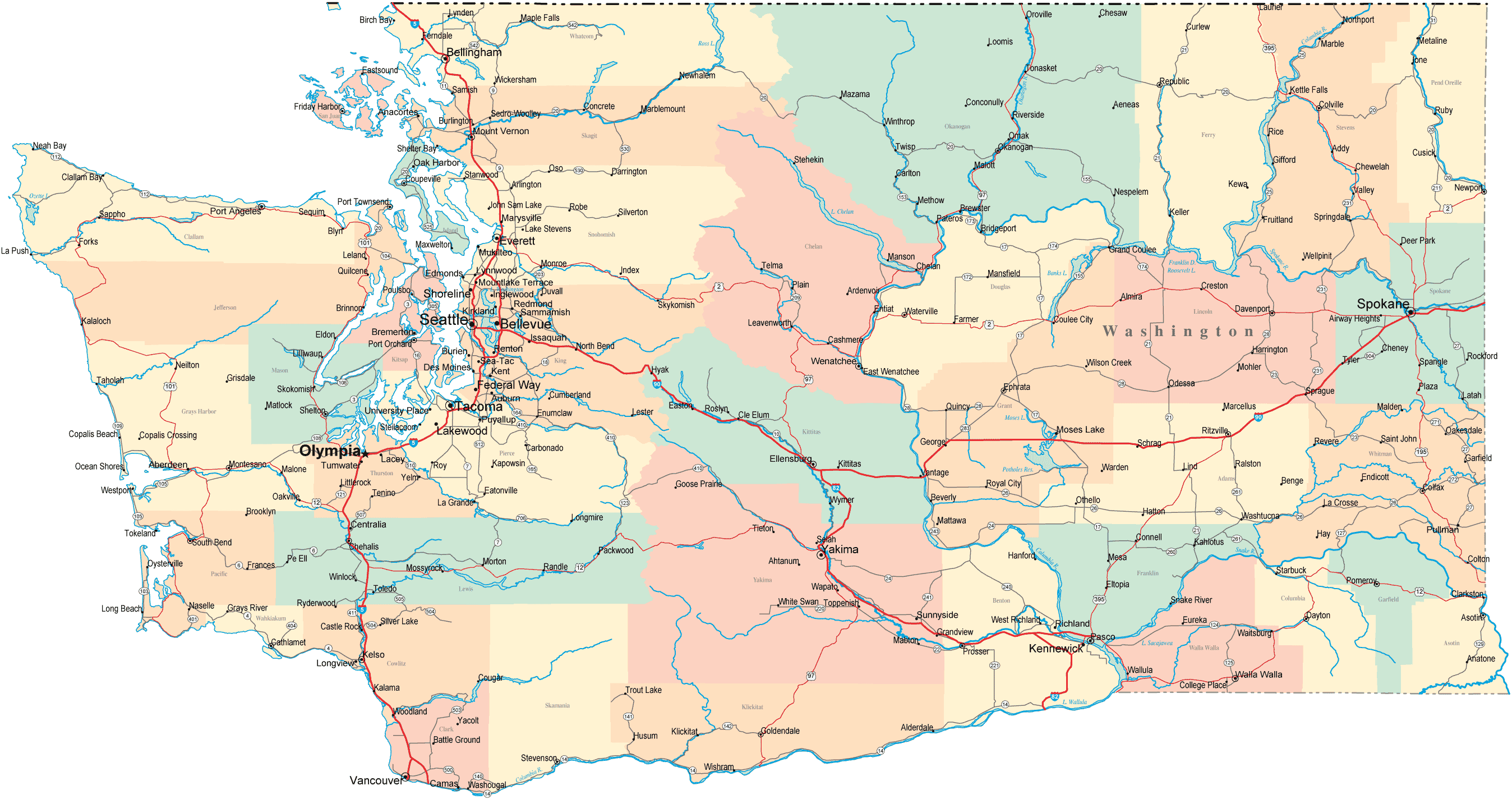
WASHINGTON ROAD MAP
WASHINGTON STATE MAP
WASHINGTON STATE ROAD MAP
WASHINGTON CITIES MAP
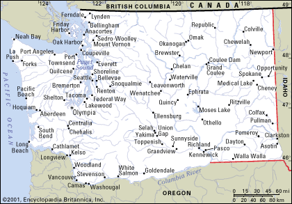
WASHINGTON COUNTIES MAP

WASHINGTON COUNTY MAP

WASHINGTON MAP
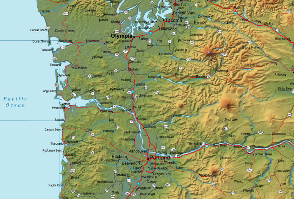
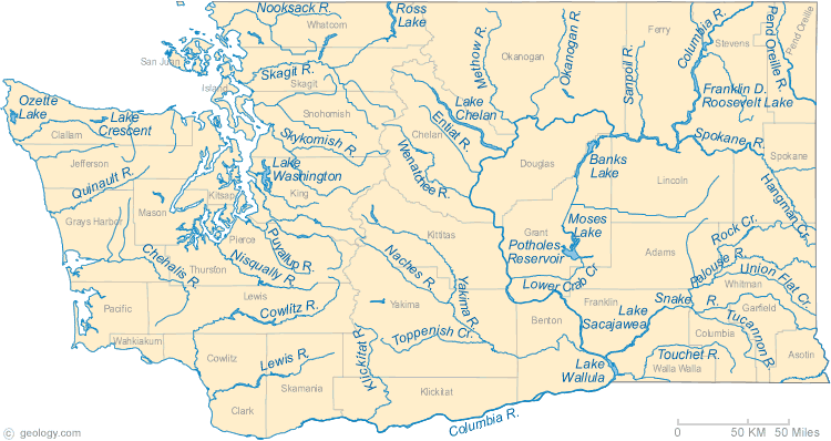
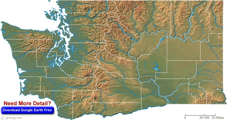
WASHINGTON PHYSICAL MAP
WASHINGTON POLITICAL MAP
WASHINGTON STATE MAP
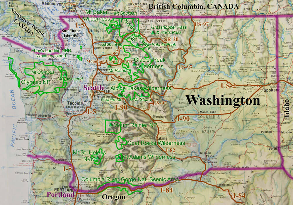
WASHINGTON STATE ROAD RECREATION MAP
A collection of Washington Maps
- Head of Performance Marketing
- Head of SEO
- Linkedin Profile: linkedin.com/in/arifcagrici
Largest Cities Map of Washington and Population
Seattle Map - 608,660 Spokane Map - 208,916 Tacoma Map - 198,397 Vancouver Map - 161,791 Bellevue Map - 122,363 Everett Map - 103,019 Kent Map - 92,411 Yakima Map - 91,067 Renton Map - 90,927 Spokane Valley Map - 89,755 Federal Way Map - 89,306 Bellingham Map - 80,885 Kennewick Map - 73,917 Auburn Map - 70,180 Marysville Map - 60,020 Pasco Map - 59,781 Lakewood Map - 58,163 Redmond Map - 54,144 Shoreline Map - 53,007 South Hill Map - 52,431Copyright GuideofTheWorld.Net 2006 - 2026. All rights reserved. Privacy Policy | Disclaimer