
Saudi Arabia Map
Navigate Saudi Arabia map, satellite images of the Saudi Arabia, states, largest cities, political map, capitals and physical maps.
- Capital : Riyadh
- Population : 26,534,504
- GDP : $666.805 billion
- Per Capita : $22,663
- Calling Code : +966
- Jobless Rate : 10.50%
- Time Zone : +3
Relief Map of Saudi Arabia
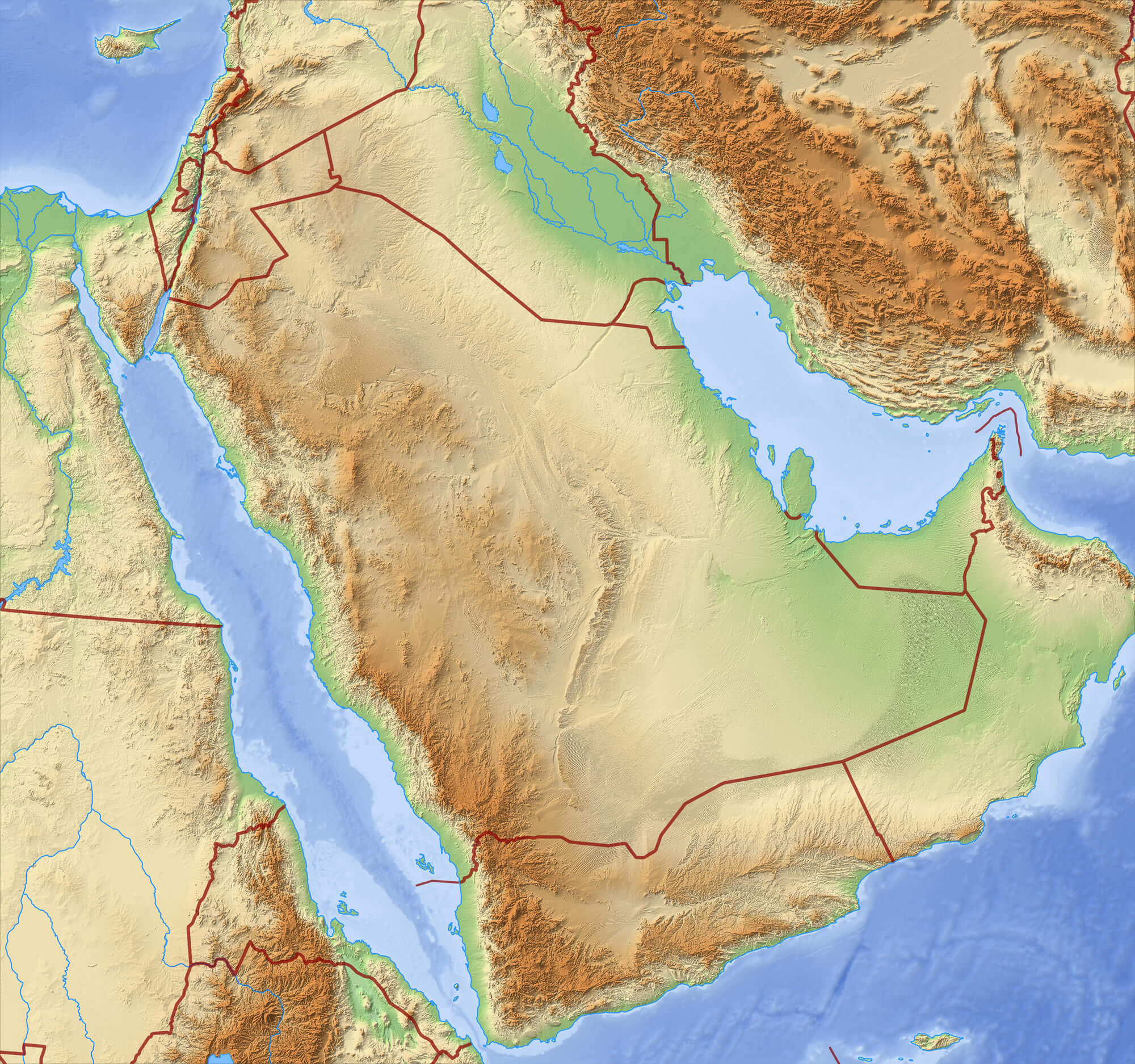 Relief Map of Saudi Arabia - 3D-Rendering.
Saudi Arabia Middle East Map
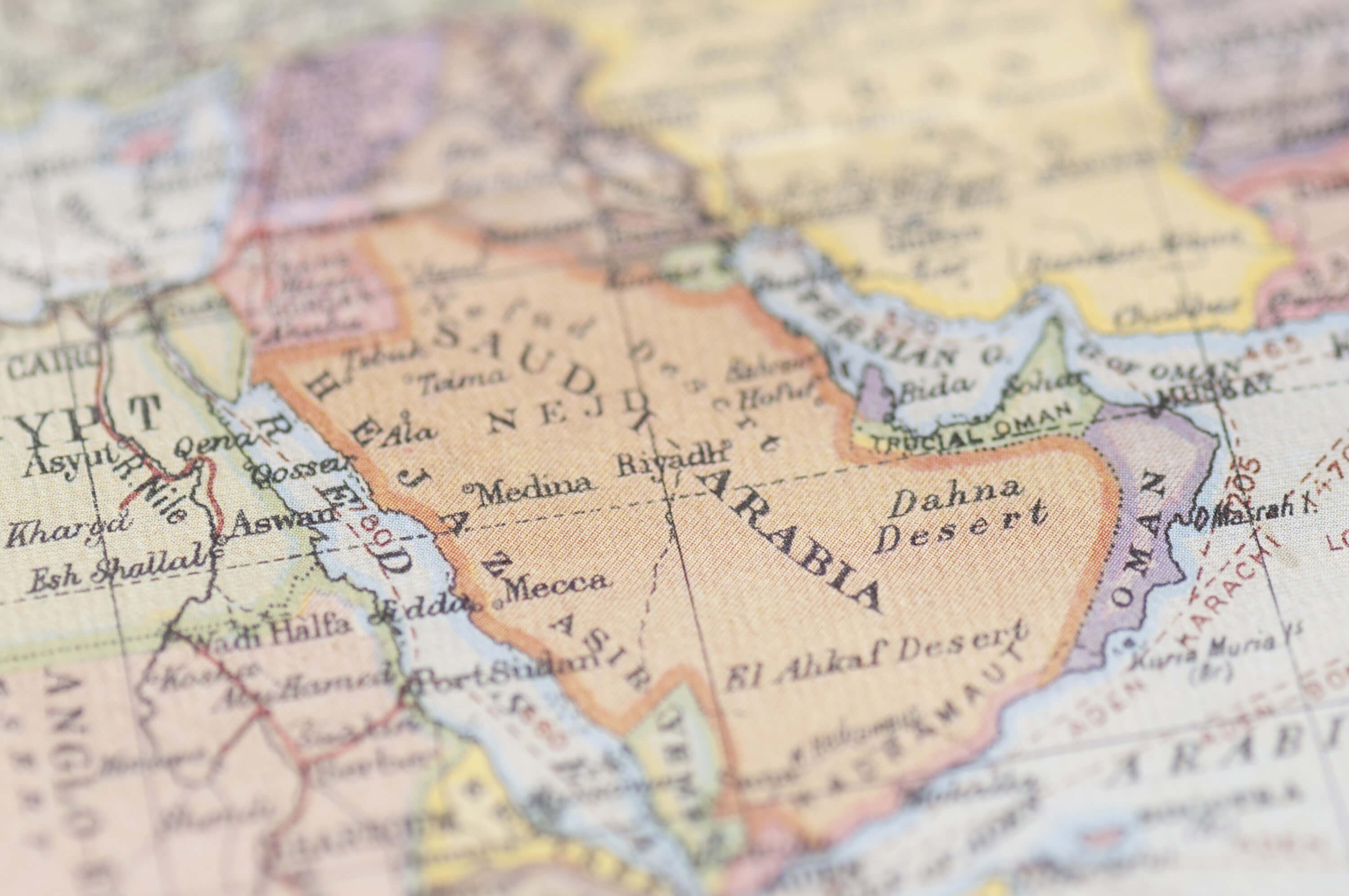 Saudi Arabia Middle East Map of the World.
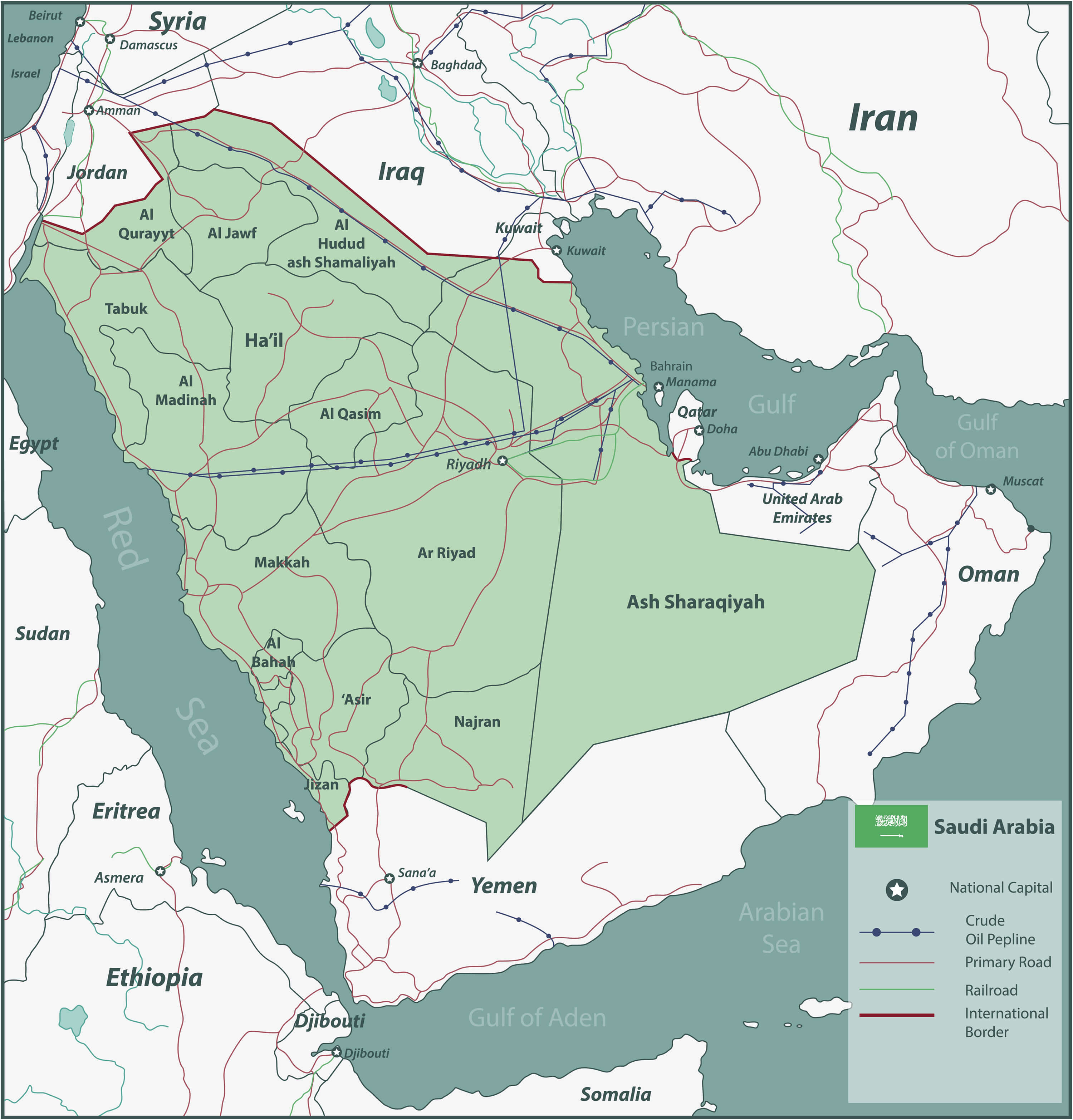
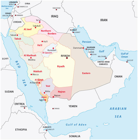
Saudi Arabia Political Map with Provinces
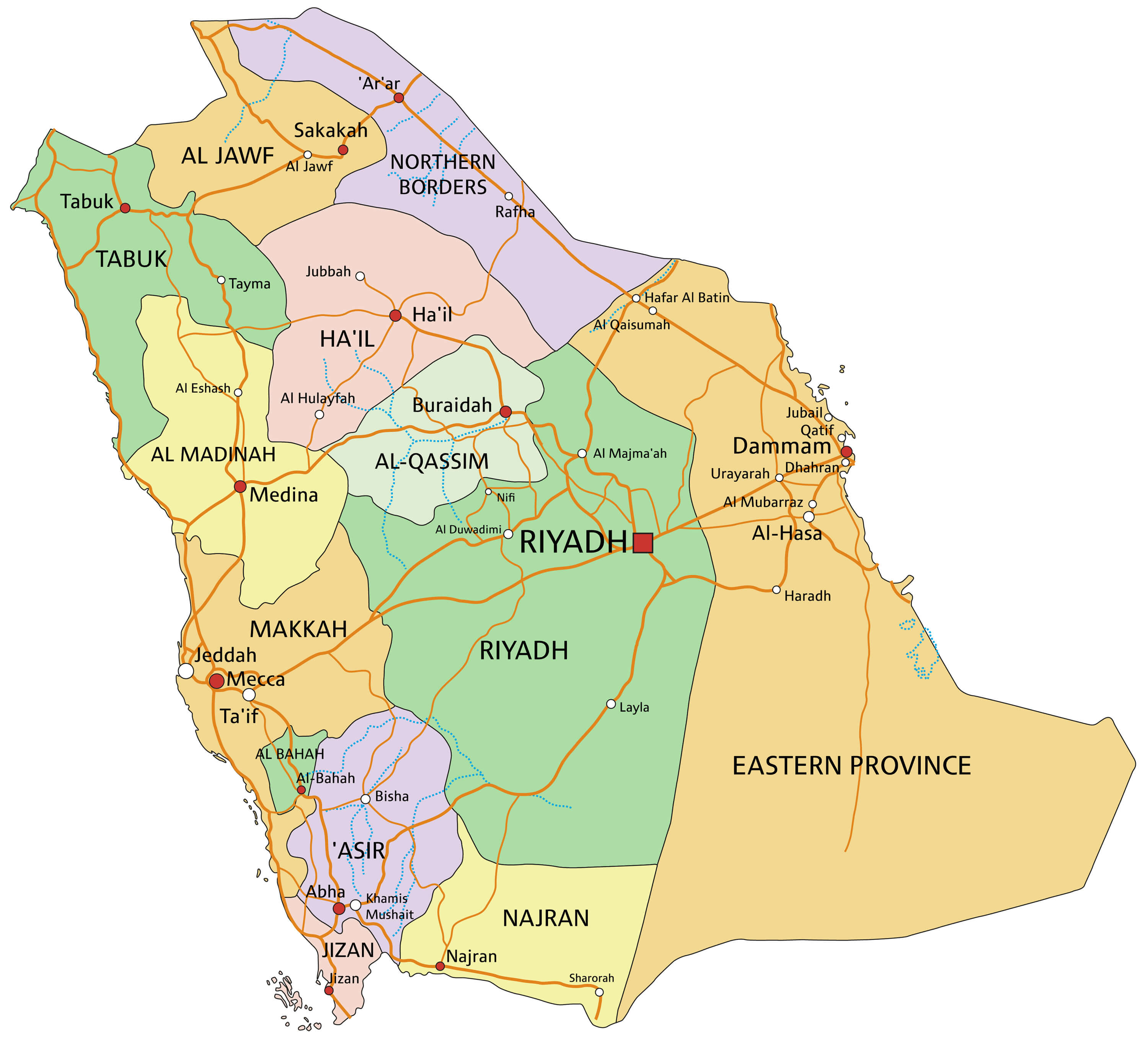 Saudi Arabia - Highly detailed editable political map with provinces.
Saudi Arabia Territories Map
 Saudi Arabia map with selectable territories. Vector illustration
Saudi Arabia Earth Map
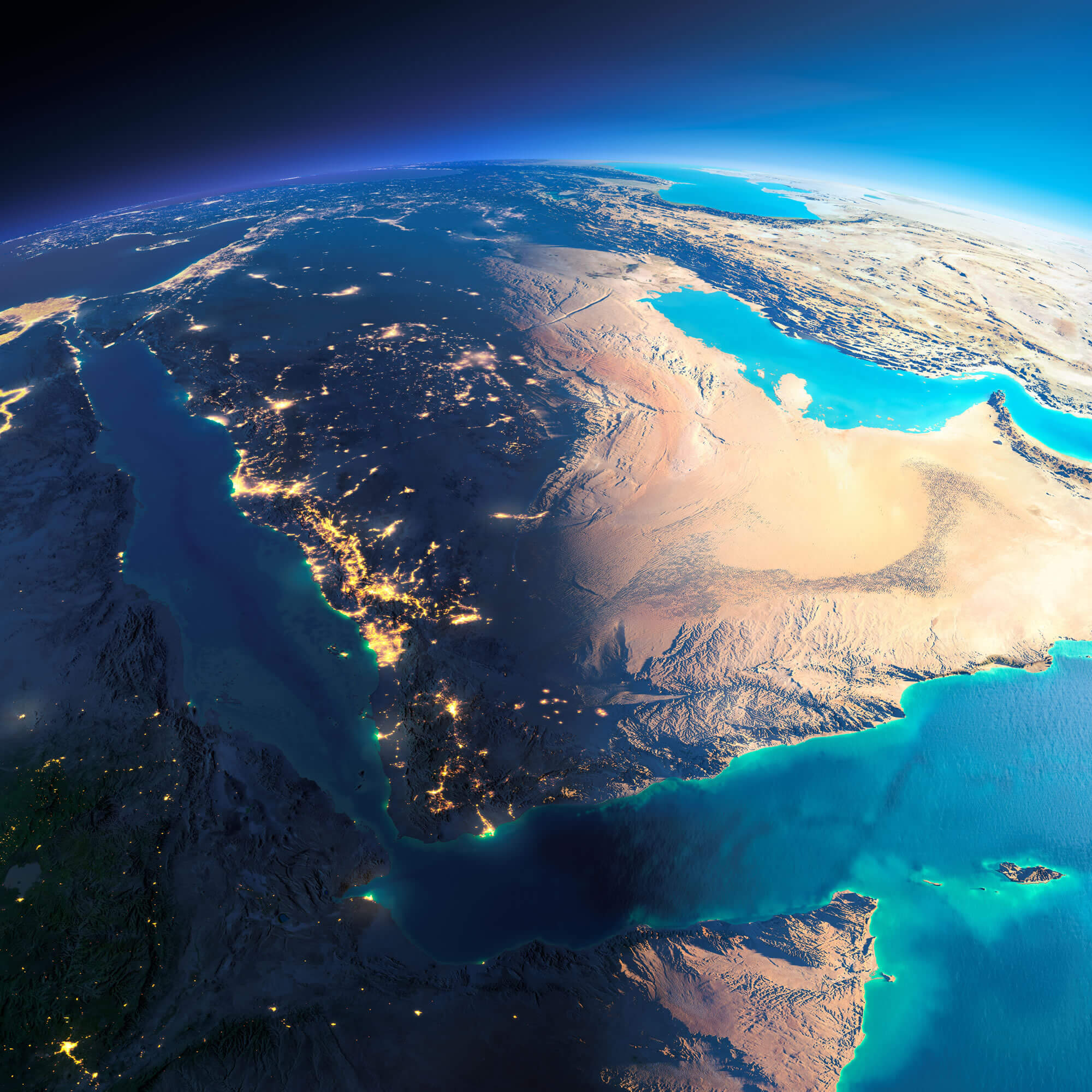 Highly detailed planet Earth. Night with glowing city lights gives way to day. The boundary of the night & day. Saudi Arabia. Elements of this image furnished by NASA.
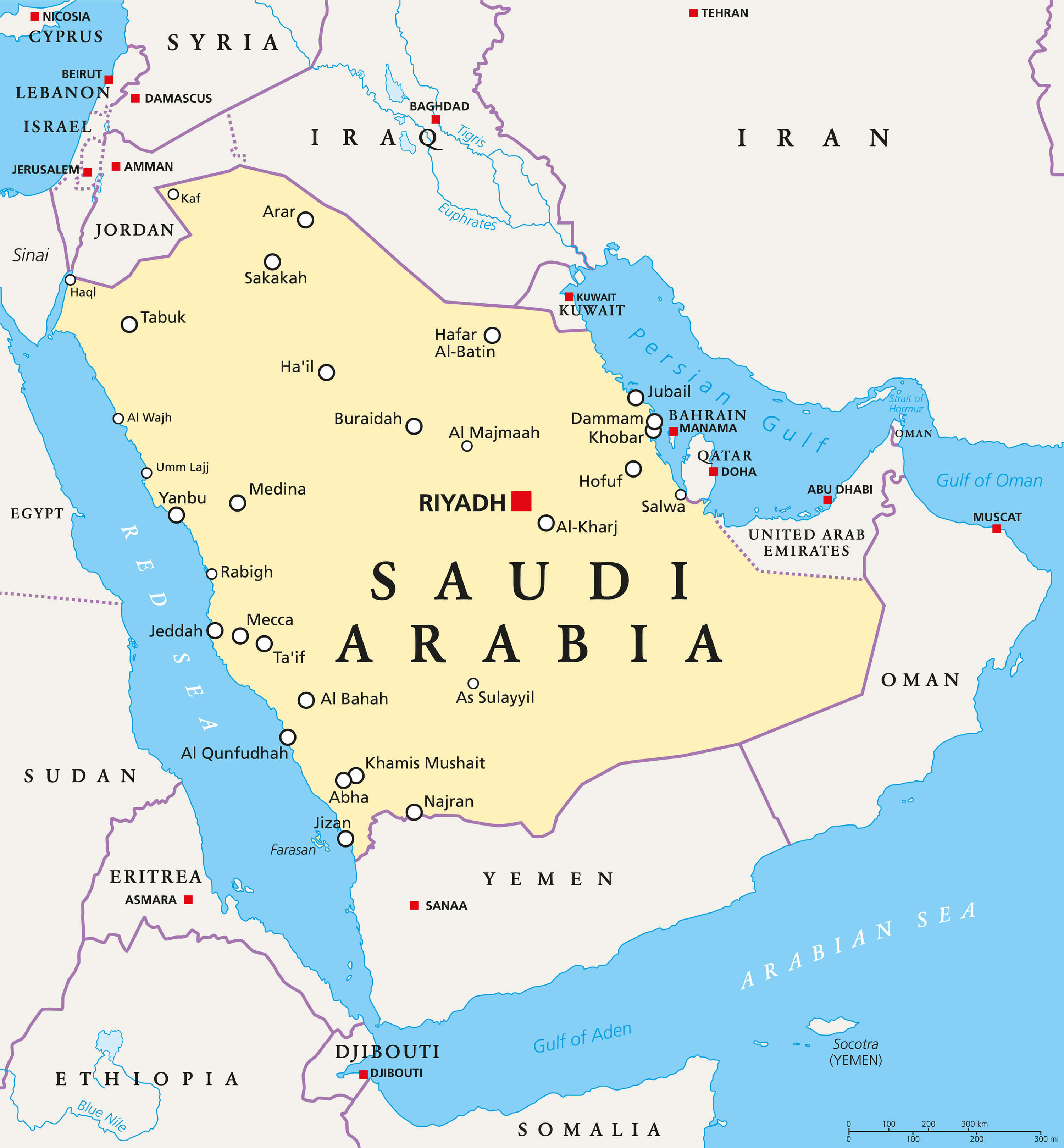
Saudi Arabia Map
 Saudi Arabia Map with main cities.
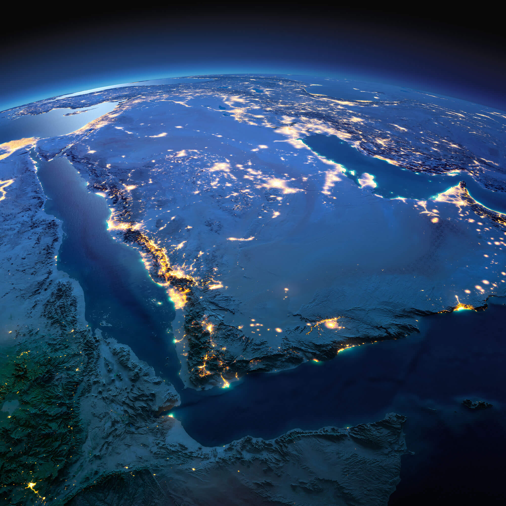
Saudi Arabia Satellite Map
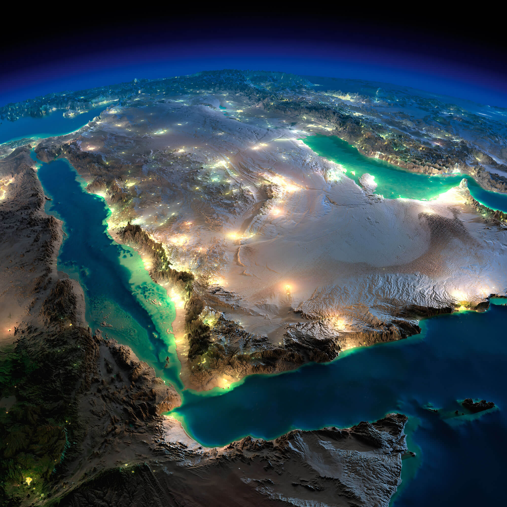 Highly detailed Earth, illuminated by moonlight. The glow of cities sheds light on the detailed exaggerated terrain. Night Earth. Saudi Arabia.
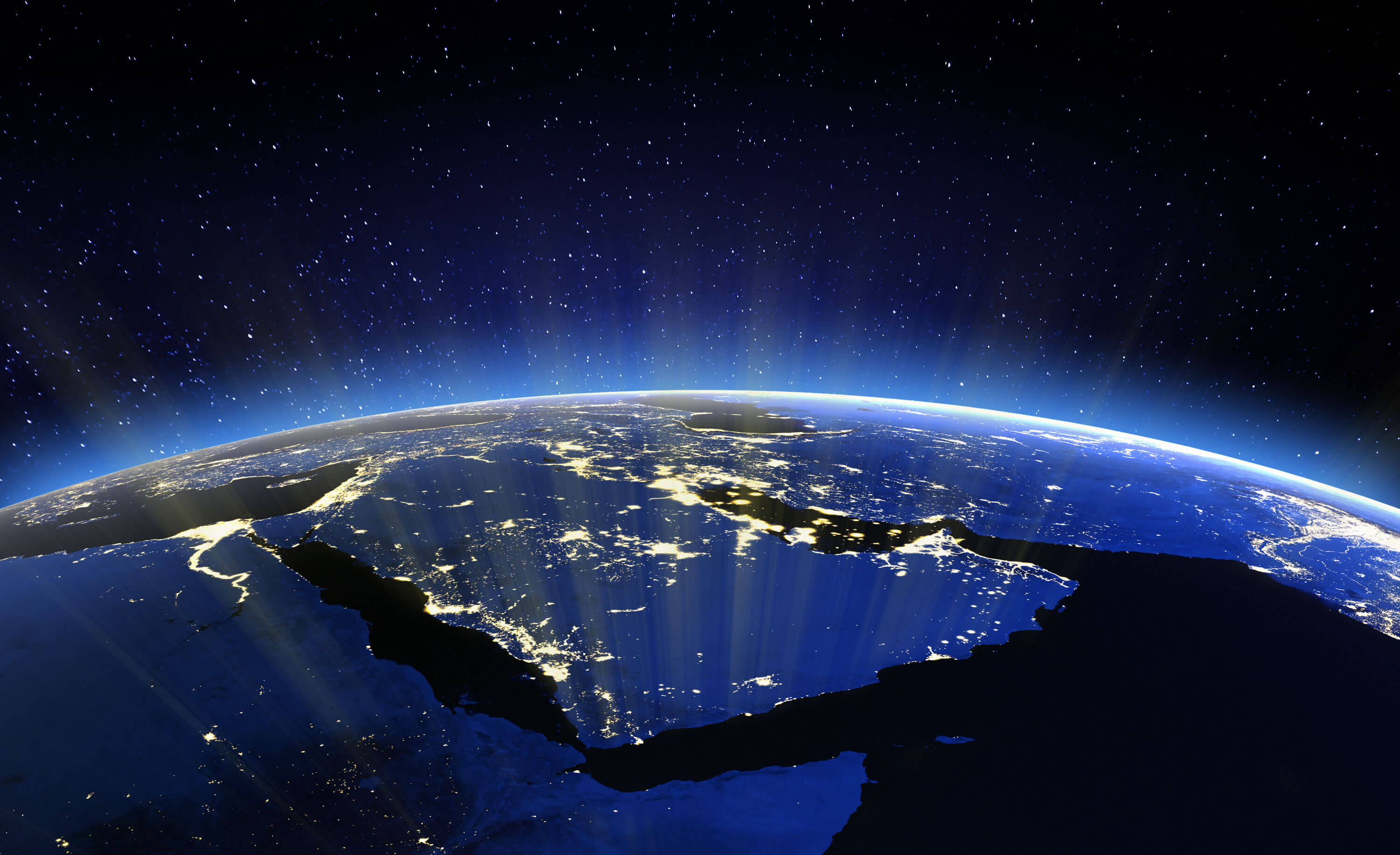
Saudi Arabia Satellite Map in Night
 Saudi Arabia Satellite Map in Night Highly detailed Earth, illuminated by moonlight.
Saudi Arabia Political Map
 Saudi Arabia political map with capital Riyadh, national borders and important cities. English labeling and scaling.
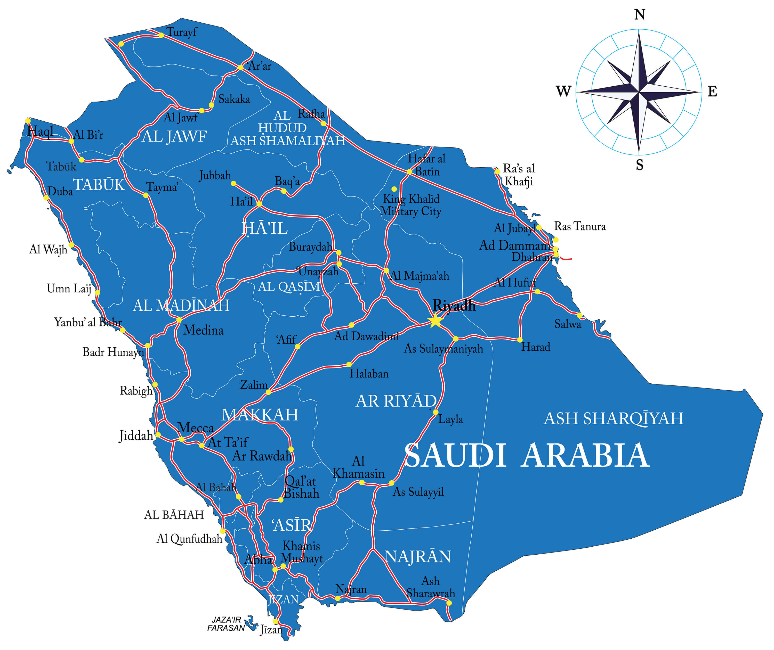
Saudi Arabia Administrative Map
 Saudi Administrative Map with major cities.
Saudi Arabia Map Middle East
 Middle East. 3D Rendering. Stars my own photo. Elements of this image furnished by NASA.
Largest Cities' Map of Saudi Arabia
Abha Map Dammam Map Al Hawiyah Map Al Jubayl Map Al Kharj Map Al Khubar Map Medina Map Al Mubarraz Map Al Qurayyah Map Arar Map Riyadh Map Ath Thuqbah Map At Taif Map Buraydah Map Hafar al Batin Map Jidda Map Khamis Mushayt Map Mecca Map Aba as Suud Map Sakakah Map Tabuk Map Yanbu al Bahr MapCopyright GuideofTheWorld.Net 2006 - 2026. All rights reserved. Privacy Policy | Disclaimer