
Map Cuba
Navigate Cuba map, satellite images of the Cuba, states, largest cities, political map, capitals and physical maps.
- Capital : Havana
- Population : 11,163,934
- GDP : $68.715 billion (63rd)
- Per Capita : $6,106 (88th)
- Calling Code : +53
- Jobless Rate : 2.50%
- Time Zone : -5
A Collection of Cuba Maps
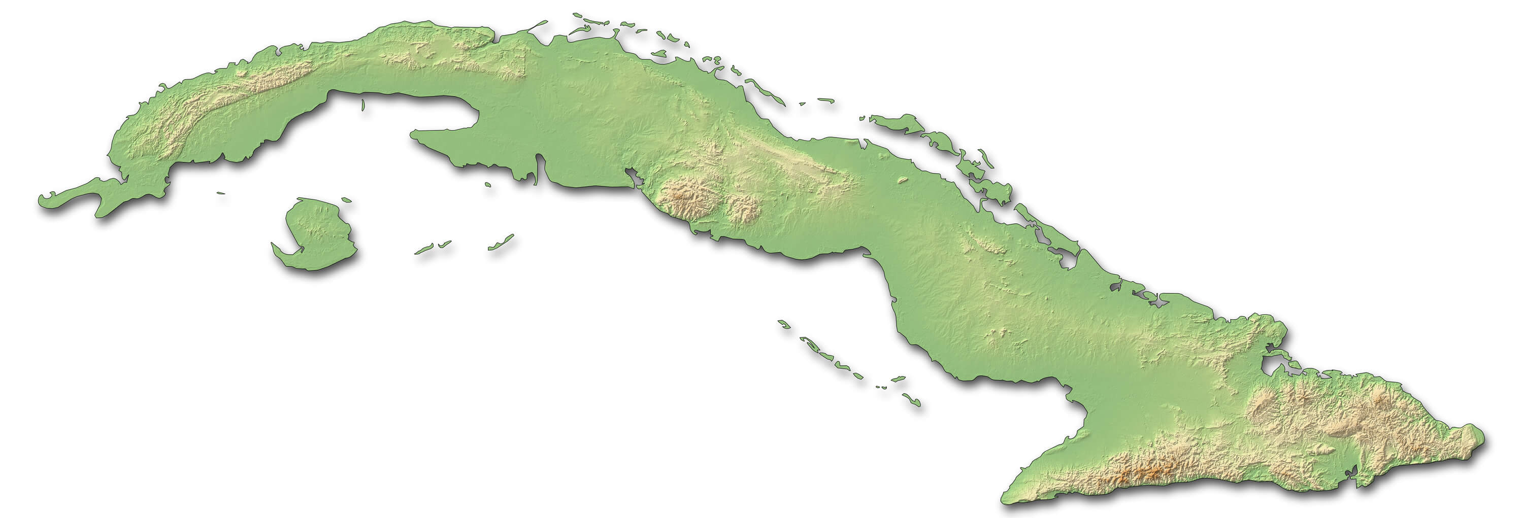
Cuba Shaded Relief Map
 Cuba shaded relief map. Surrounding territory greyed out. Colored according to vegetation. Includes clip path for the state area.
Republic of Cuba Map
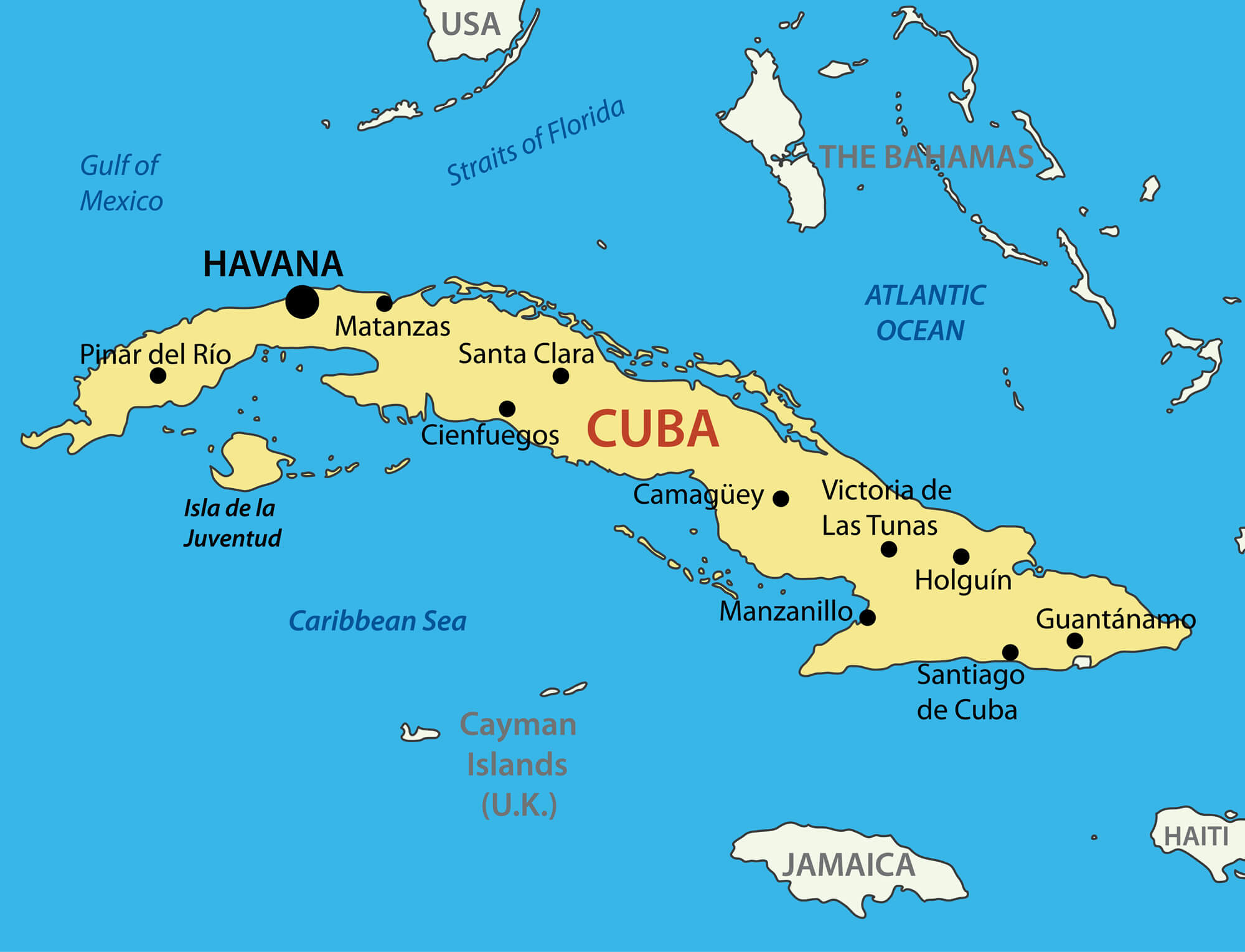 Republic of Cuba Map with Major Cities
Cuba Greater Antilles map
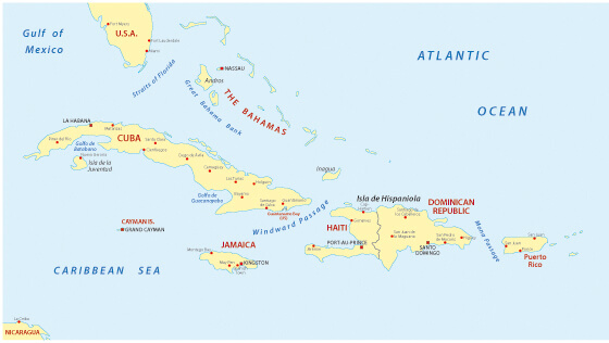 Cuba Greater Antilles map
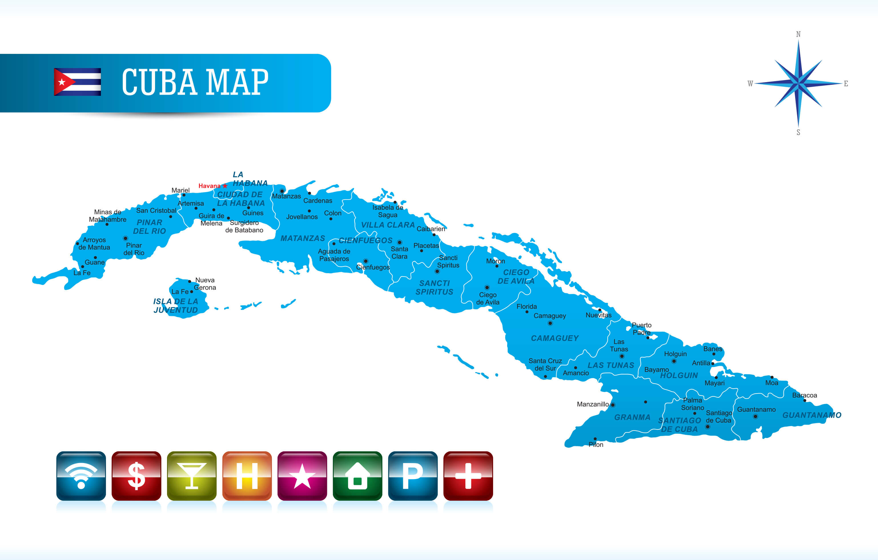
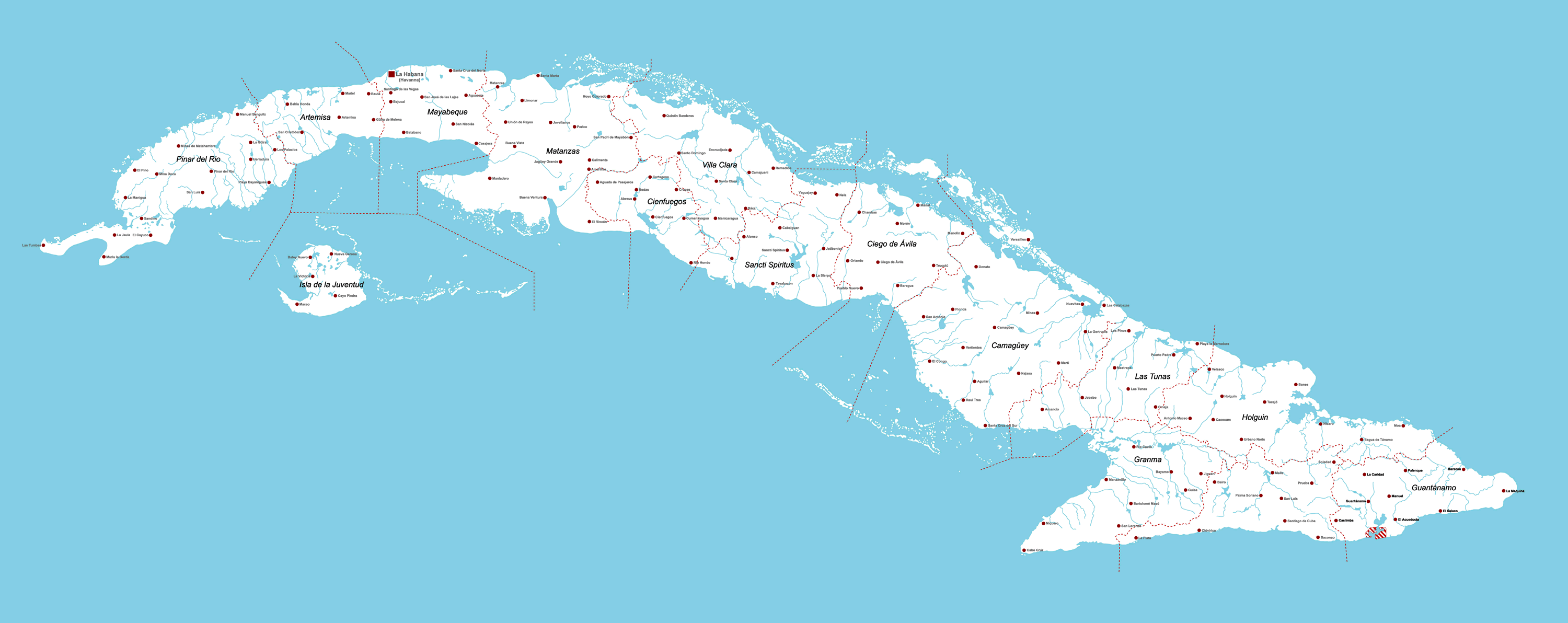
Cuba Administrative Map
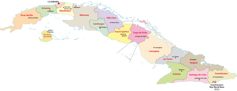 Cuba administrative divisions map with provinces
Cuba Map
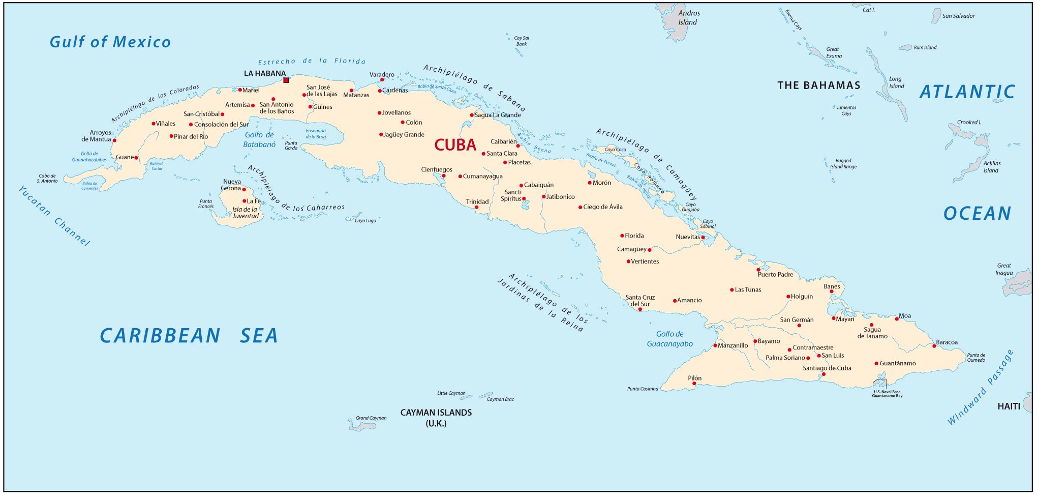 Cuba Map with main cities
Cuba Political Map
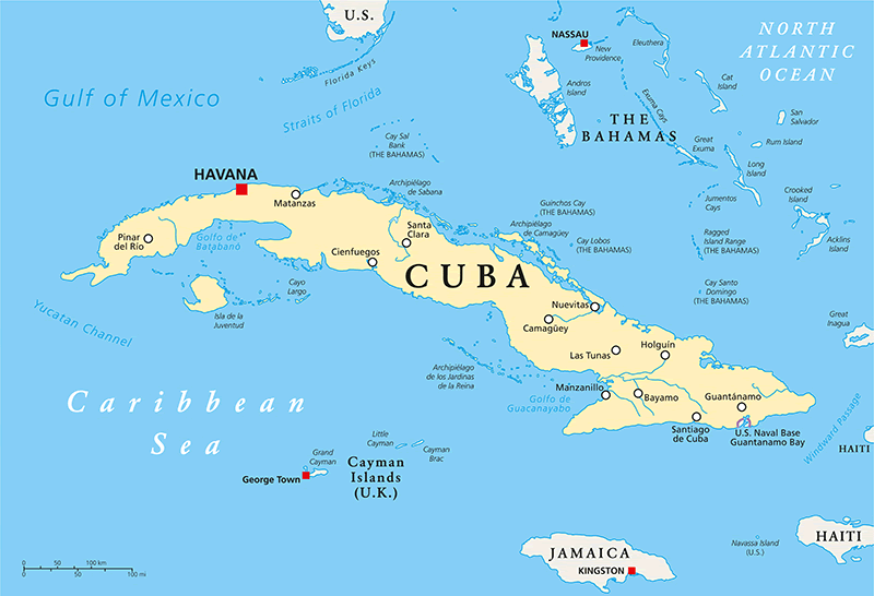 Cuba Political Map with capital Havana, national borders, most important cities and rivers. English labeling and scaling.
Cuba Map with Navigation
 Cuba Map with Navigation Icons
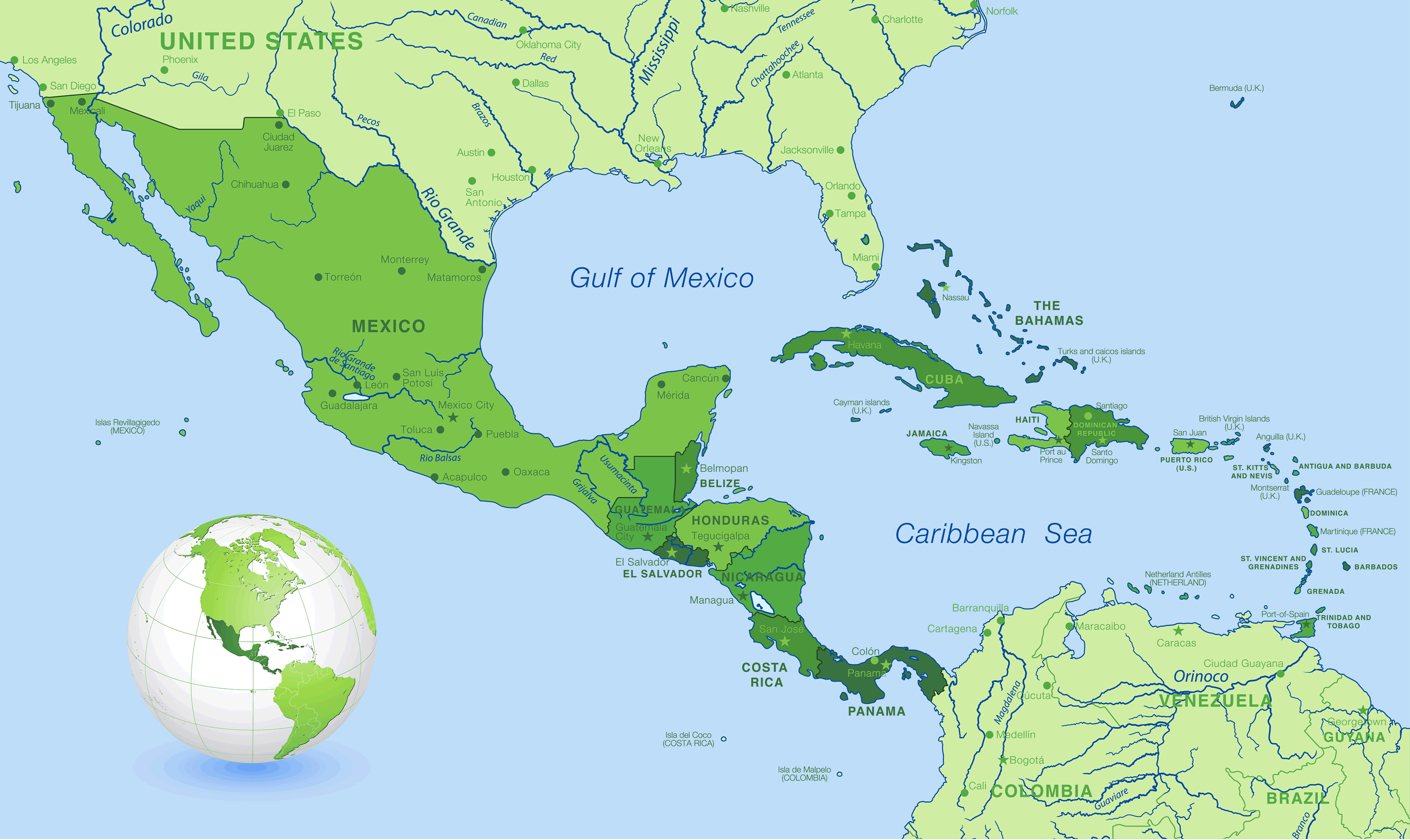
Cuba Central America Map
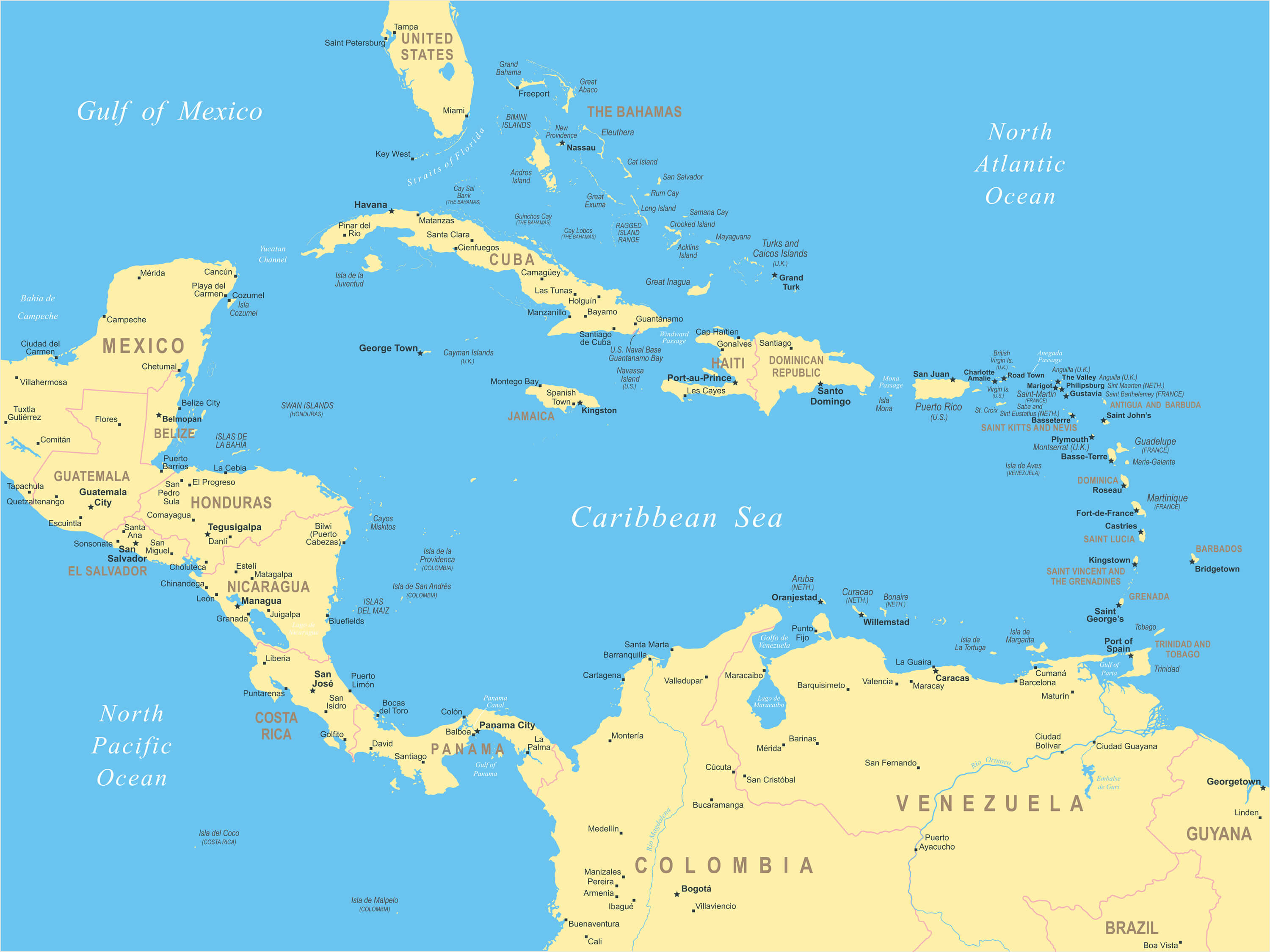 Highly Central America map highly detailed vector illustration.
Cuba Satellite Map Caribbean islands, Haiti, Jamaica
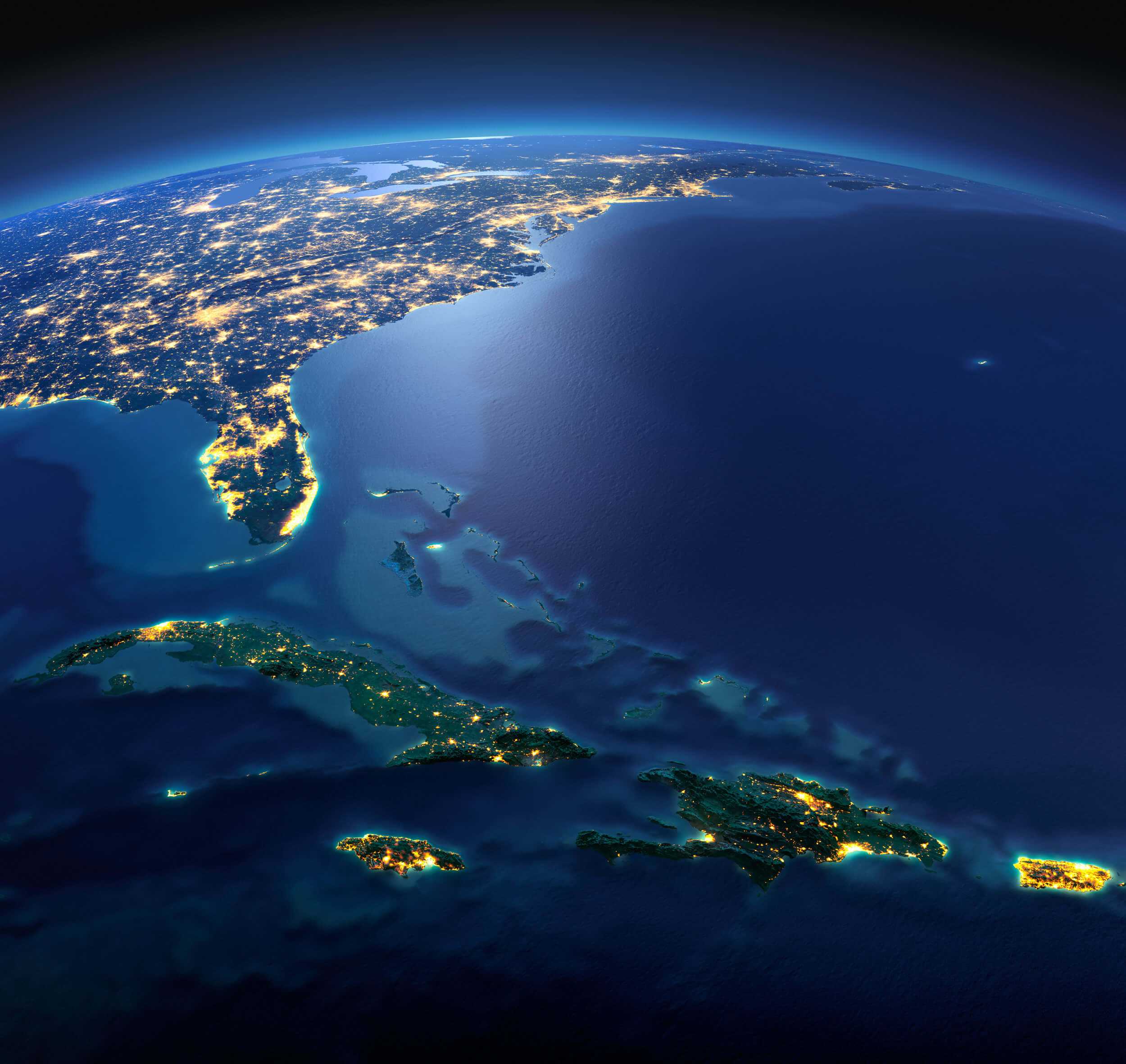 Night planet Earth with precise detailed relief and city lights illuminated by moonlight. South America, Cuba, Caribbean islands, Haiti, Jamaica.
Detailed Map of Cuba
 A large and detailed map of Cuba with all provinces and main cities.
Relief Map of Cuba
 Relief map of Cuba - 3D Rendering
Cuba Detailed Map Central America
 High detail map of Central america, with a 3D Globe centered on these countries.
Largest Cities' Map of Cuba
La Habana Map Santiago de Cuba Map Camaguey Map Holguin Map Santa Clara Map Guantanamo Map Bayamo Map Las Tunas MapCopyright GuideofTheWorld.Net 2006 - 2026. All rights reserved. Privacy Policy | Disclaimer