
Map Australia
Navigate Australia map, satellite images of the Australia, states, largest cities, political map, capitals and physical maps.

- Capital : Canberra
- Population : 22,875,792
- GDP : $1.487 trillion (12th)
- Per Capita : $66,371 (5th)
- Calling Code : +61
- Jobless Rate : 5.40%
- Time Zone : +8 - +10,5
Australia Detailed Political Map
Australia highly detailed editable political map with separated layers.
Top 10 Must-See Destinations in Melbourne for Travelers
Please subscribe on "World Guide" channnel on Youtube at youtube.com/c/WorldGuide
Australia Maps Collection: Navigating the Land of Kangaroos and Koalas
A Collection of Australia Maps
Australia Shaded relief map with major urban areas
 Australia Shaded relief map with major urban areas. Colored according to vegetation. Includes clip path for the state area.
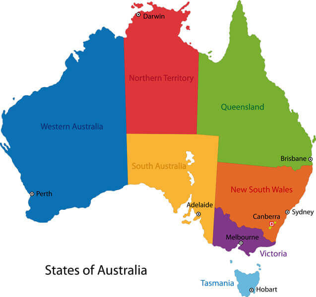
Australia Map Color with Regions
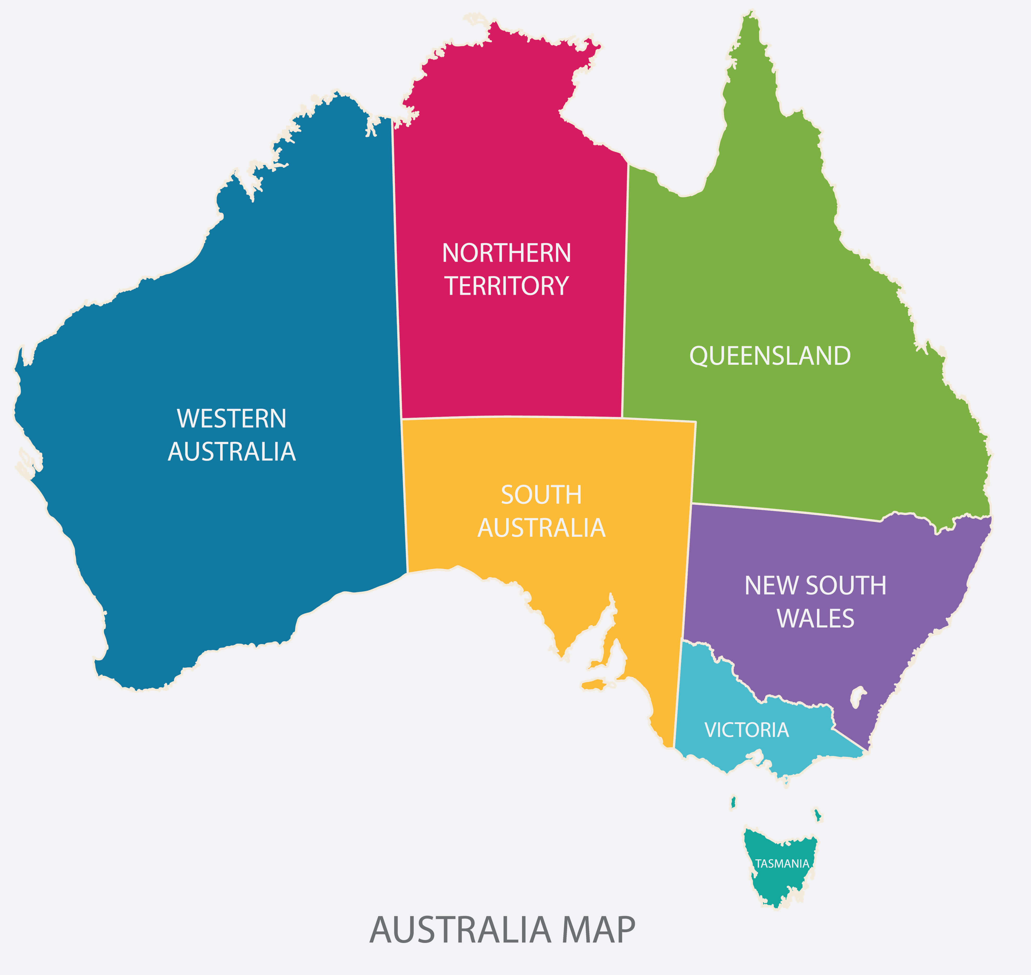 Australia Map Color with Regions flat design illustration vector.
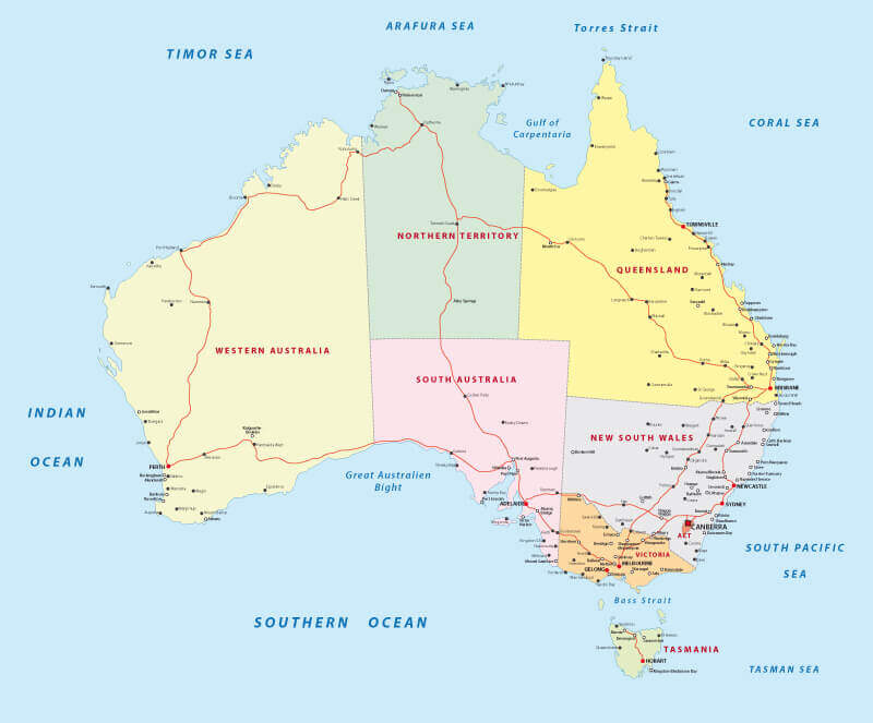
Australia Road Map
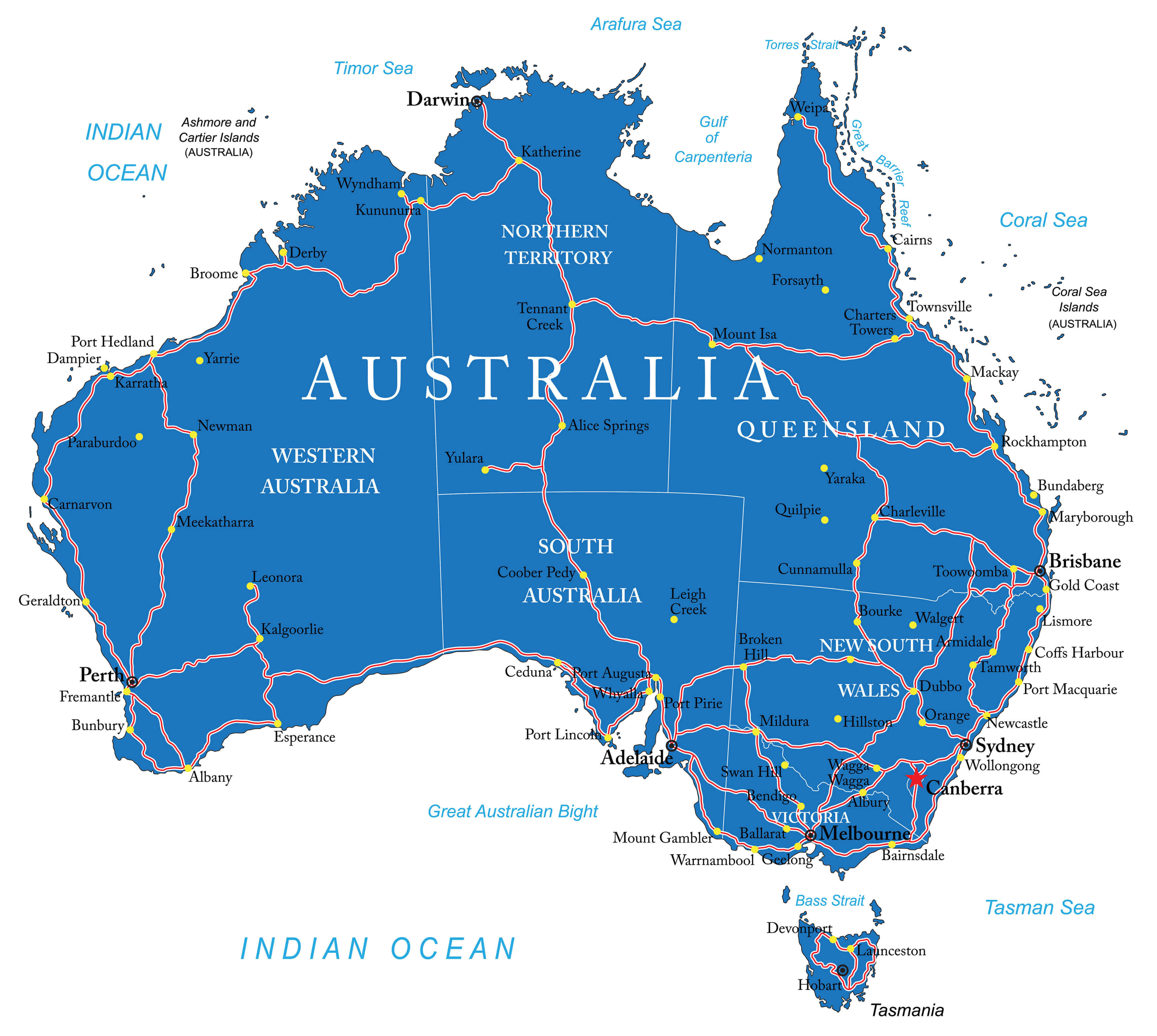 Australia Road Map with states and major cities.
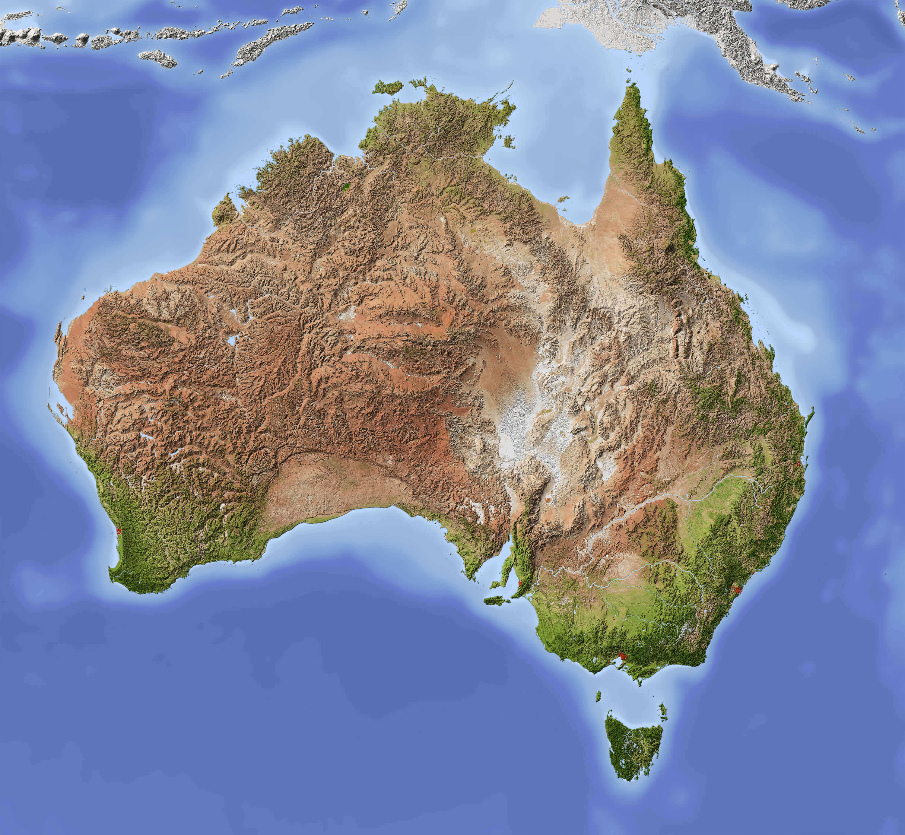
Australia 3D Topography Map
 Australia 3D (Topography map comes from earthobervatory / NASA)
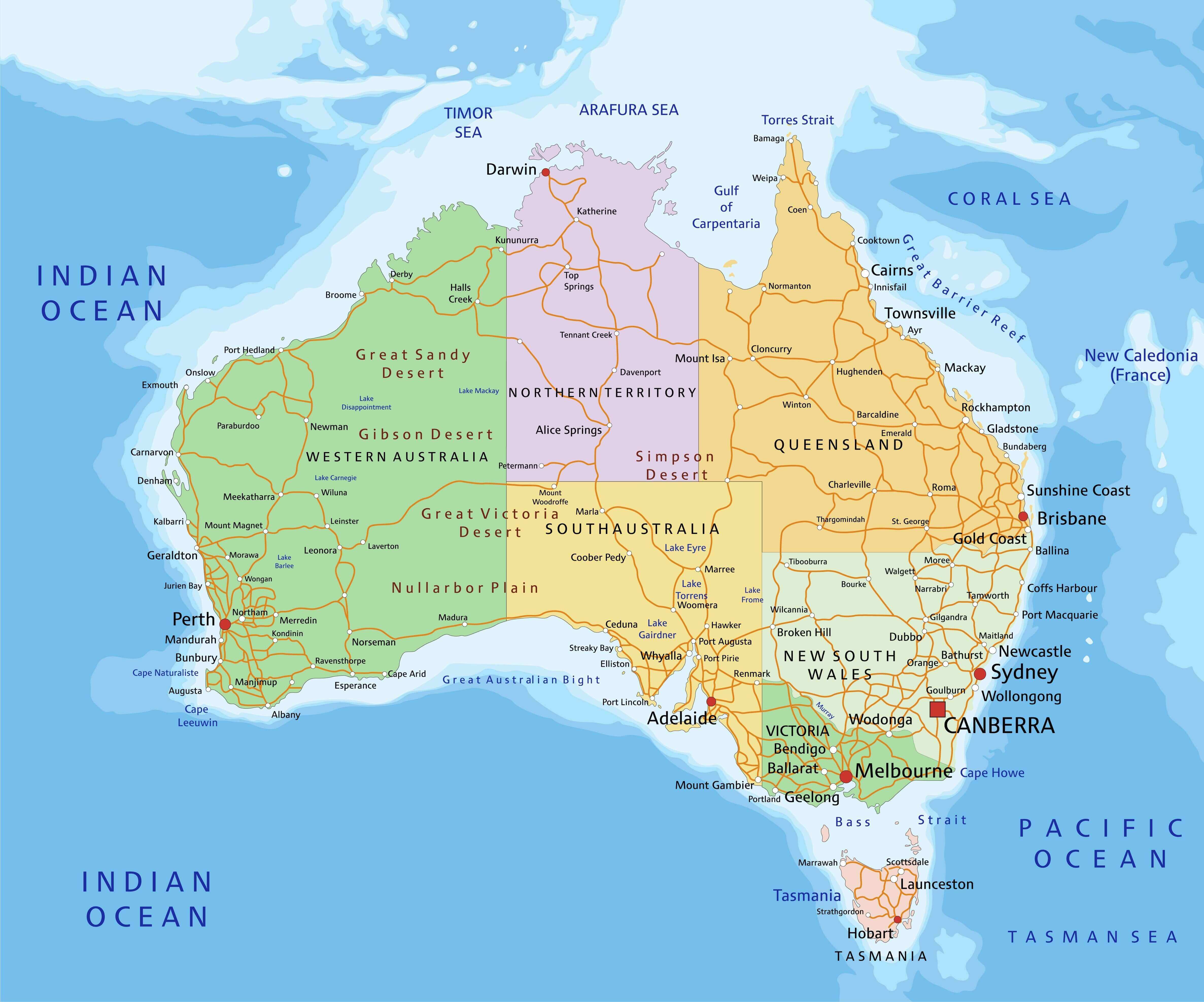
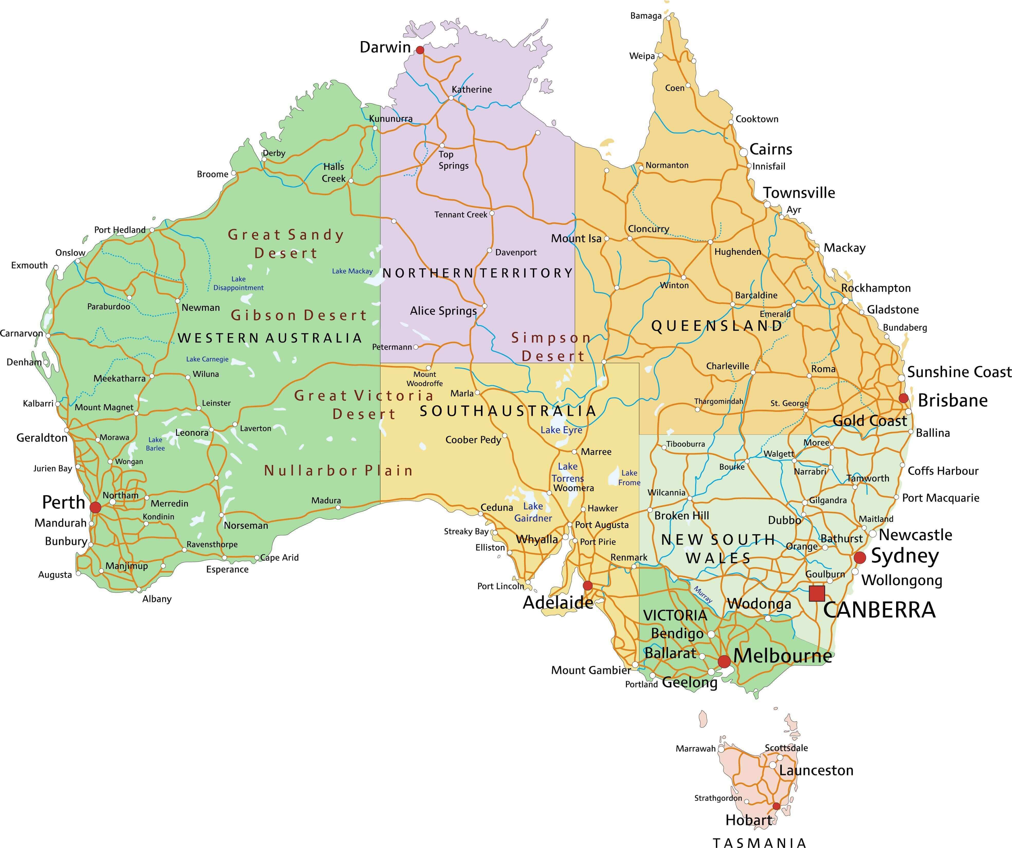
Australia Regions and Major Cities Map
 Colorful Australia map with regions and main cities.
Australia Physical Map 1894 Paris
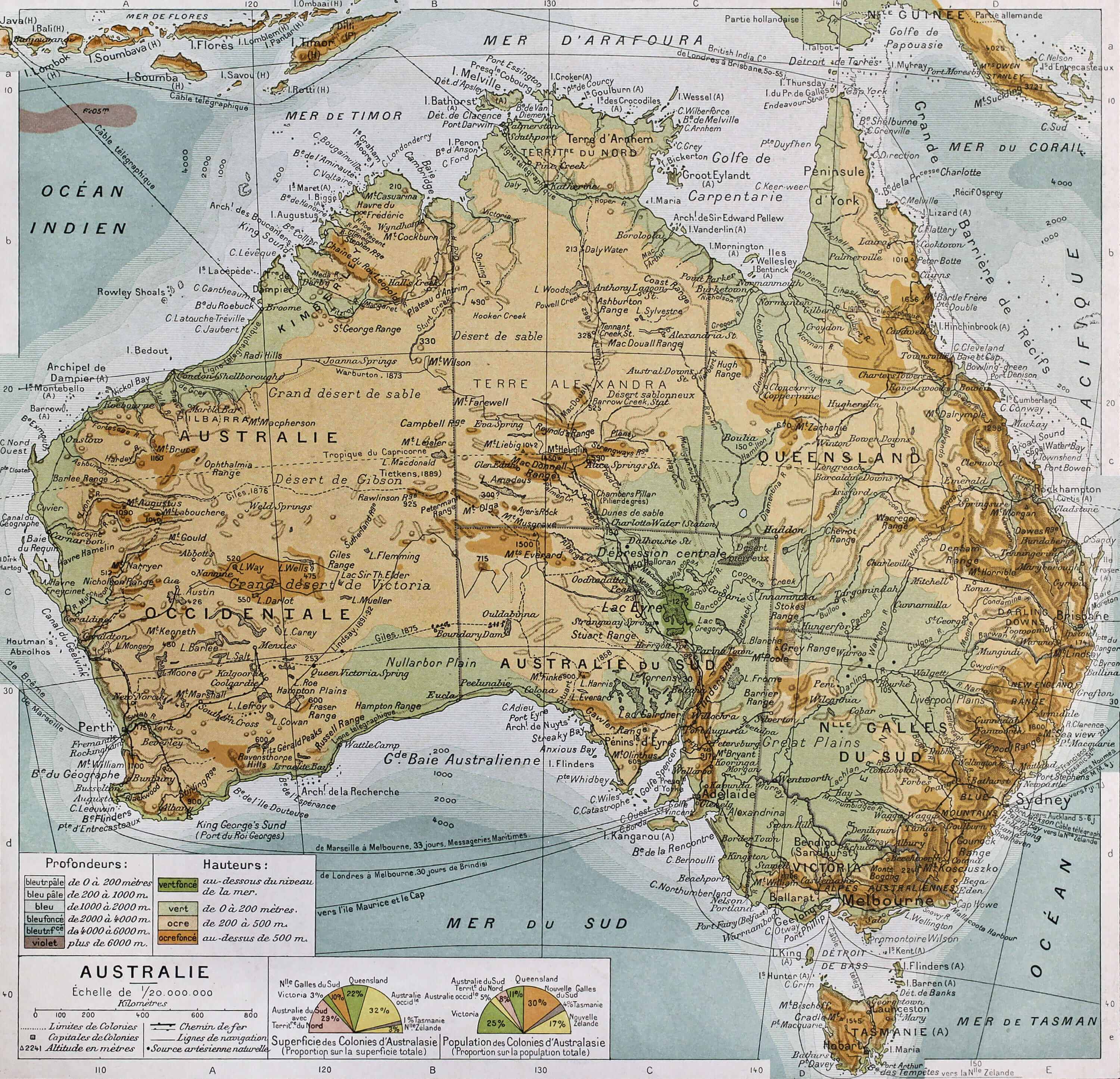 Australia physical map. By Paul Vidal de Lablache, Atlas Classique, Librerie Colin, Paris, 1894 (first edition)
Australia Highly Detailed Map
 Australia highly detailed map. All elements are separated in editable layers clearly labeled.
Australia Road Map with Cities
 Australia Road Map with Cities.
High detailed Australia physical map
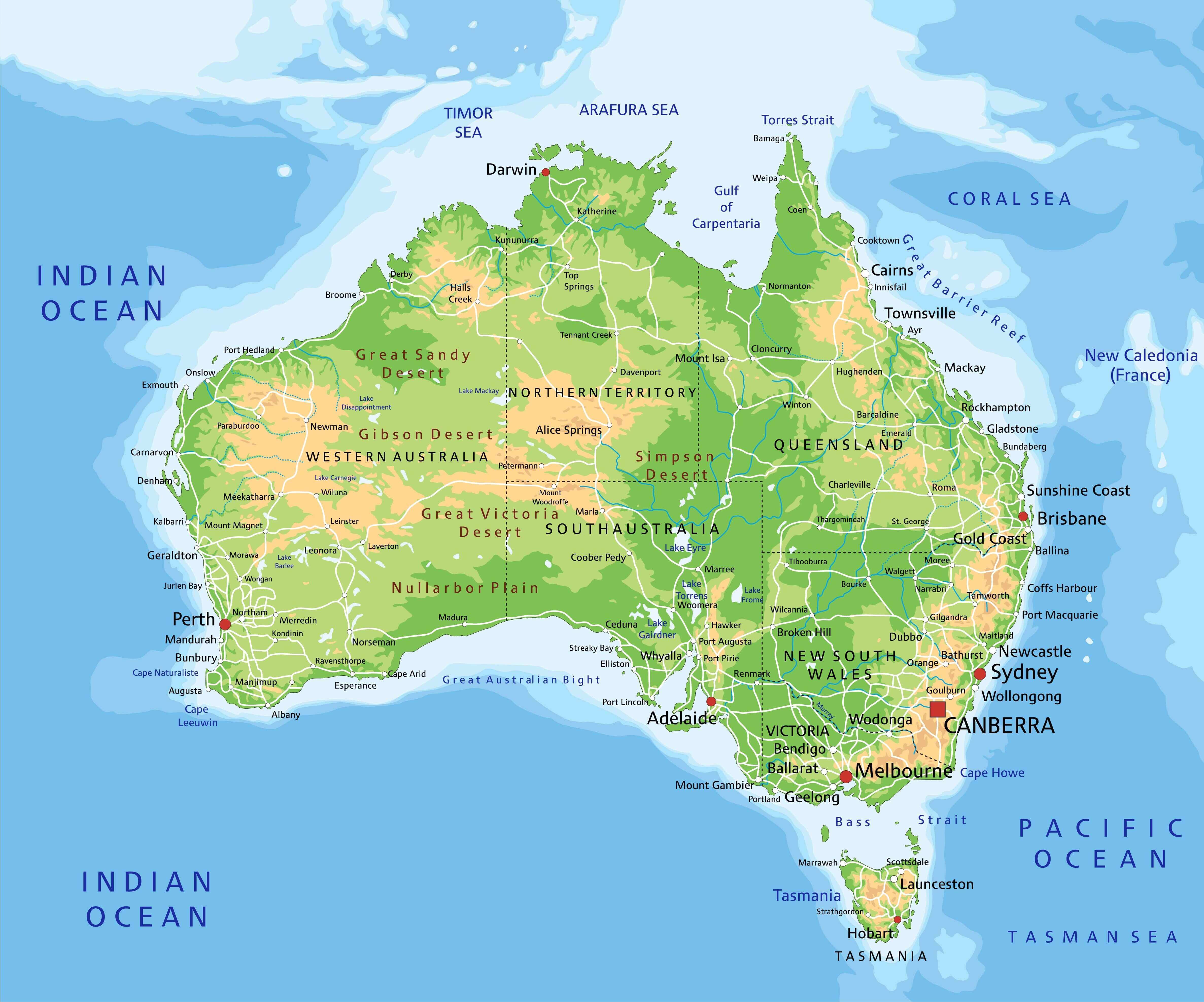 High detailed Australia physical map with labeling.
Australia detailed political map with cities, regions and states
 Australia highly detailed editable political map with cities, regions and states.
Australia with embedded flag Map
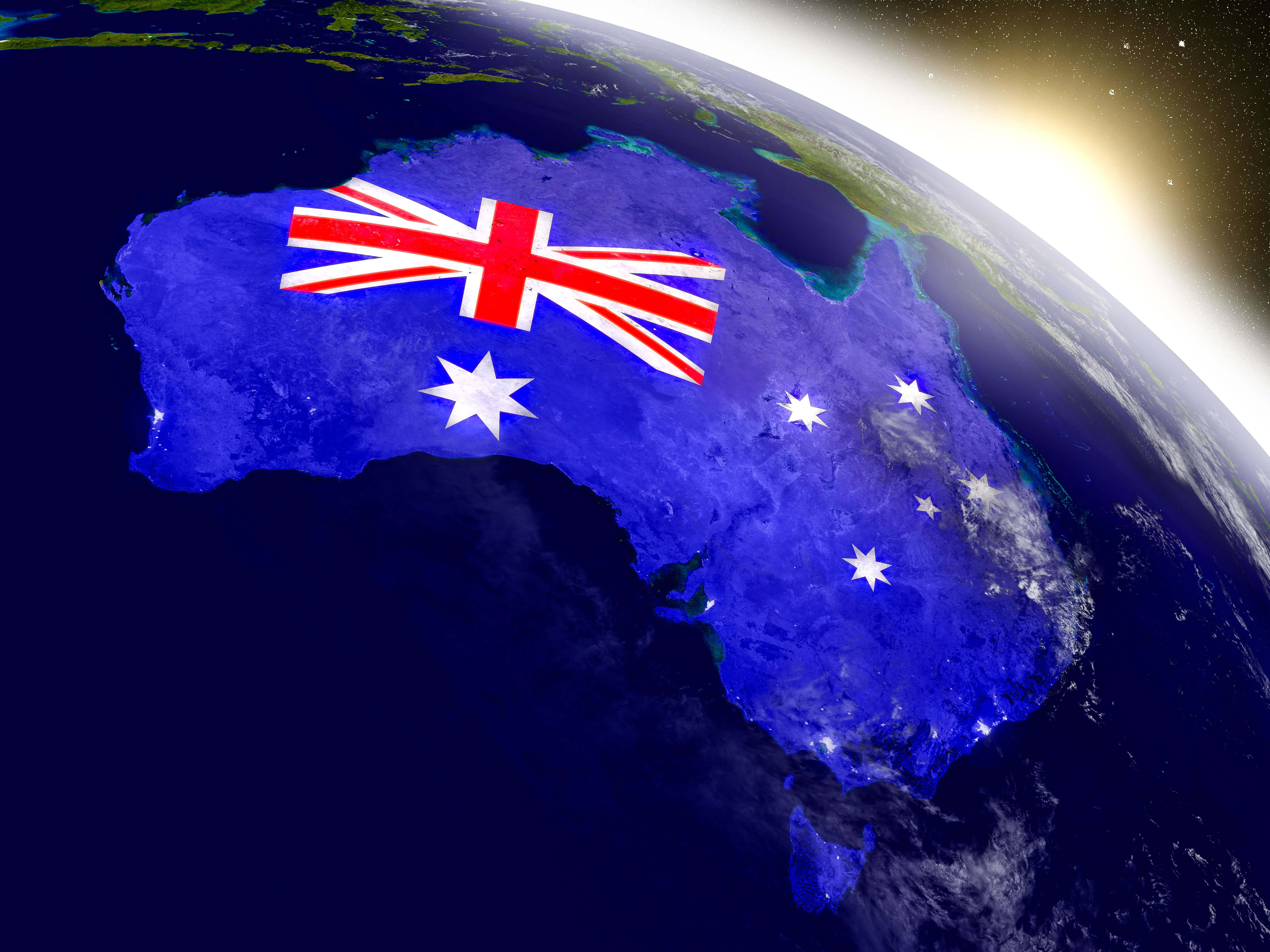
Australia with embedded flag Map
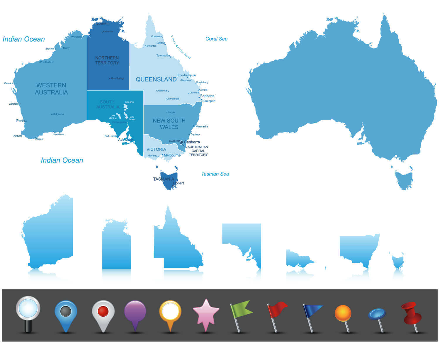
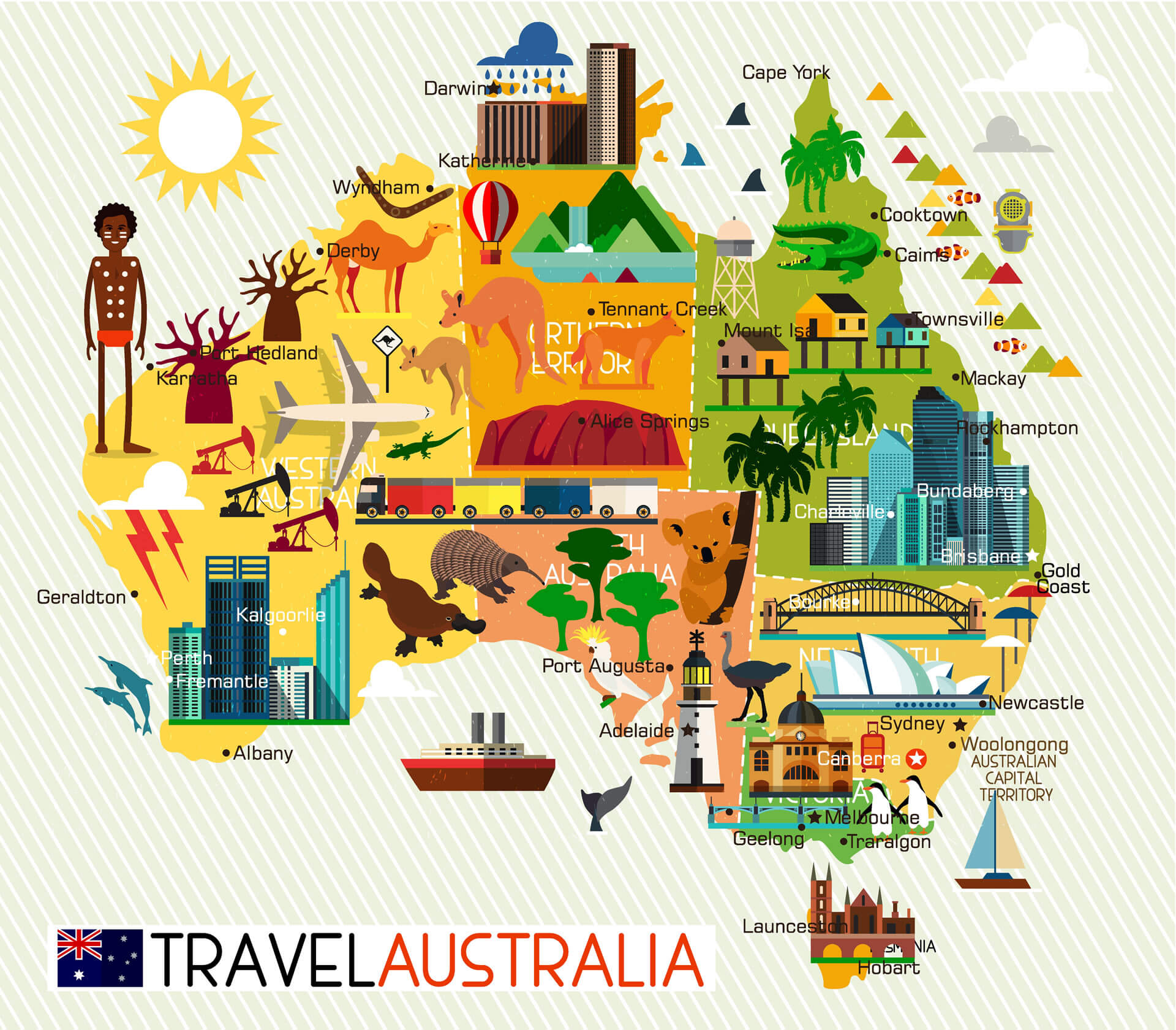 Map of the Australia and Travel Icons. Australia Travel Map.
Largest Cities' Map of Australia
Sydney Map Melbourne Map Brisbane Map Perth Map Adelaide Map Gold Coast Map Canberra Map Newcastle Australia Map Central Coast Map Wollongong Map Sunshine Coast Map Gosford Map Geelong Map Townsville Map Hobart Map Cairns Map Toowoomba Map Ballarat Map Bendigo Map Albury Map Launceston Map Mandurah Map Rockingham Map Mackay Map Darwin Map Maitland Map Rockhampton Map Bunbury Map Bundaberg Map Wagga Wagga Map Hervey Bay Map Port Macquarie Map Shepparton Map Melton Map Tamworth Map Orange Map Dubbo Map Mildura Map Sunbury Map Bathurst Map Gladstone Map Kalgoorlie Map Warrnambool Map Nowra Map Geraldton Map Lismore Map Coffs Harbour Map Albany Map Richmond Map Palmerston Map Mount Gambier Map Karratha Map Port Hedland Map Broome MapCopyright GuideofTheWorld.Net 2006 - 2026. All rights reserved. Privacy Policy | Disclaimer