
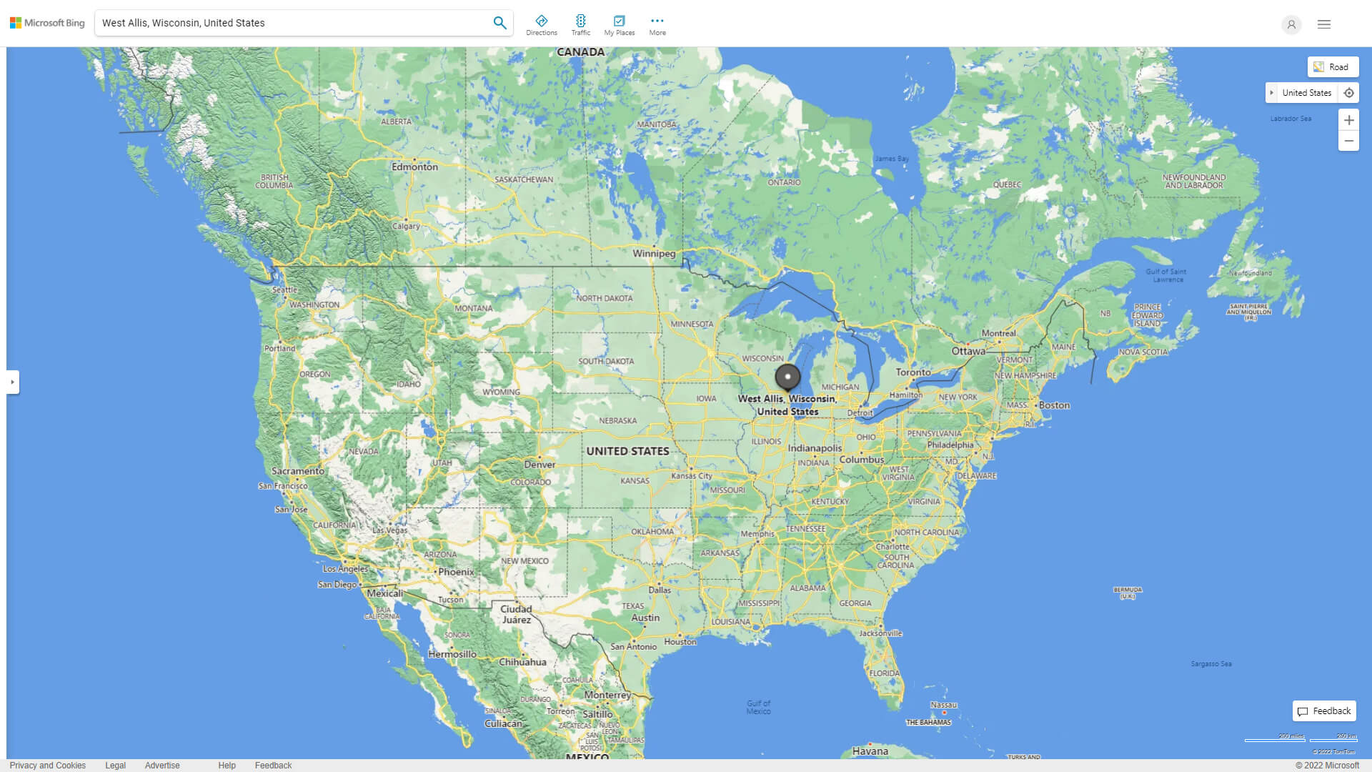
Map of West Allis Wisconsin, United States
Navigate West Allis Wisconsin map, West Allis Wisconsin country map, satellite images of West Allis Wisconsin, West Allis Wisconsin largest cities, towns maps, political map of West Allis Wisconsin, driving directions, physical, atlas and traffic maps in United States.
West Allis Wisconsin City Town Maps
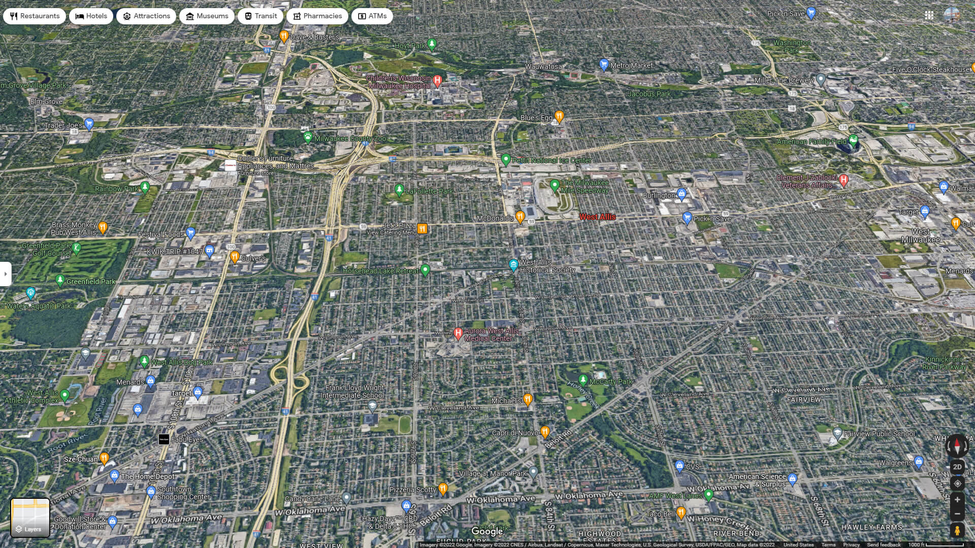
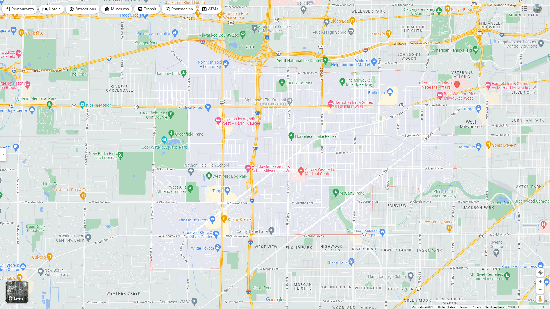
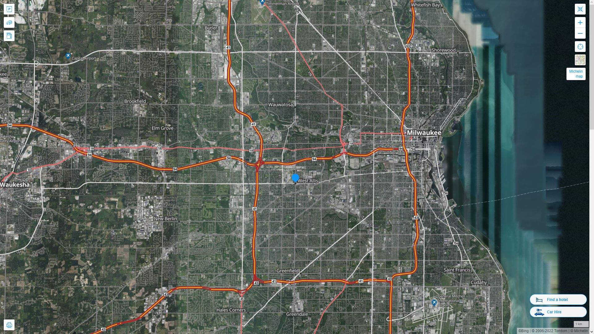
WEST ALLIS AERIAL MAP WISCONSIN
A Collection of West Allis Wisconsin Maps and West Allis Wisconsin Satellite Images
WEST ALLIS MAP
WEST ALLIS MAP WISCONSIN
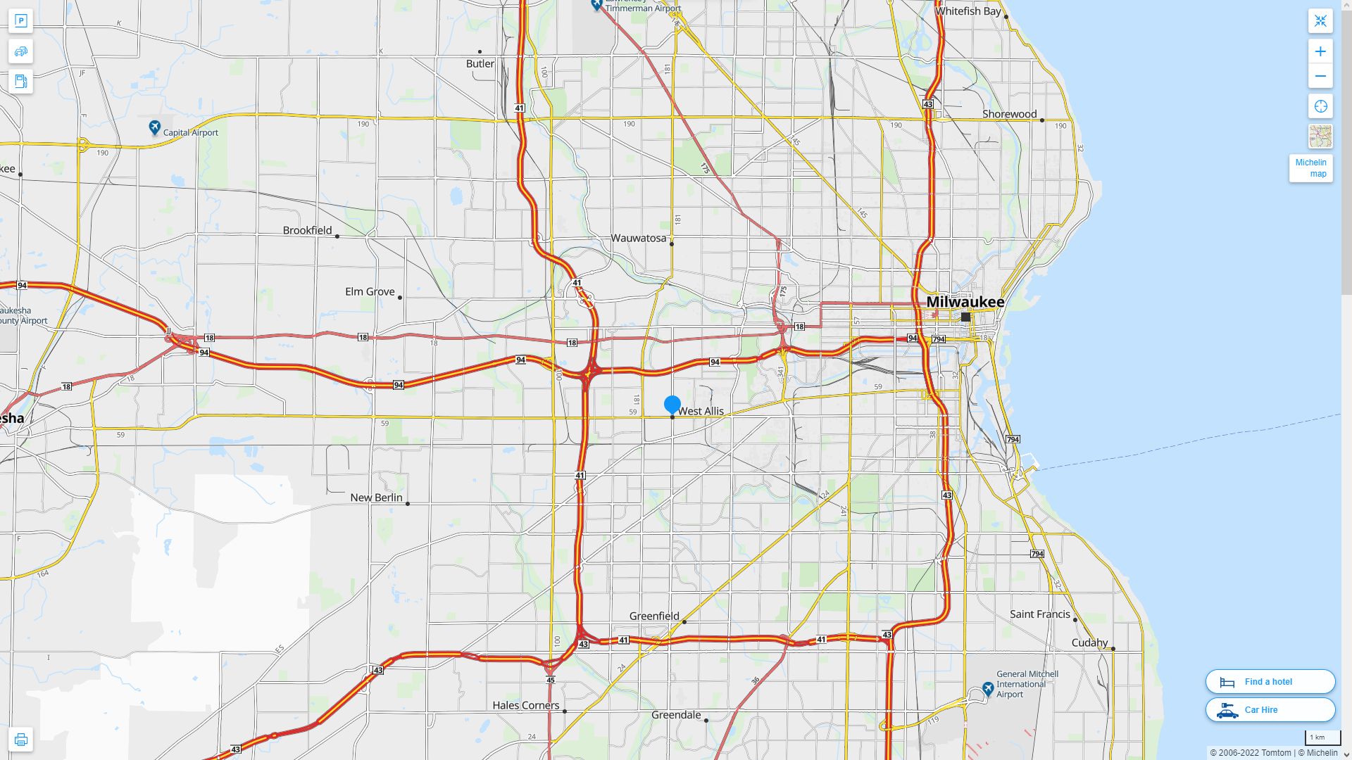
WEST ALLIS DETAILED MAP
WEST ALLIS AERIAL MAP WISCONSIN
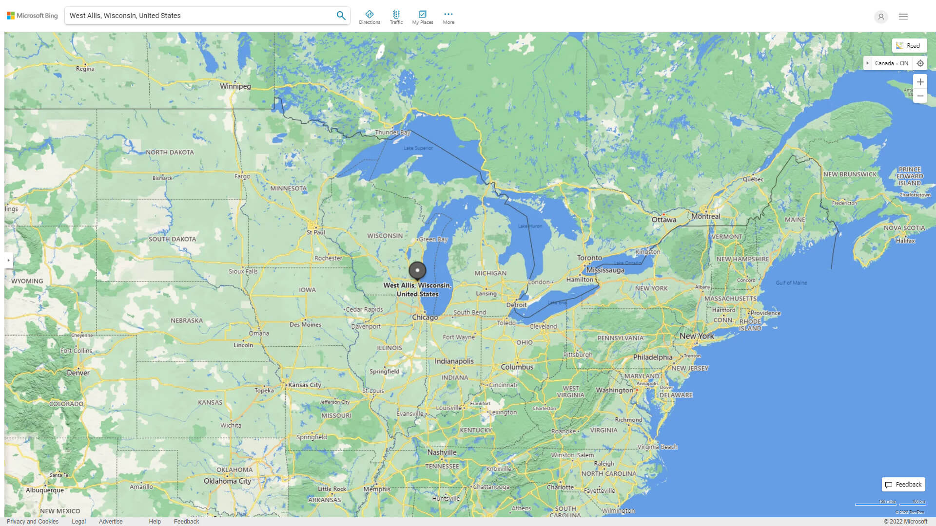
WHERE IS WEST ALLIS IN THE US
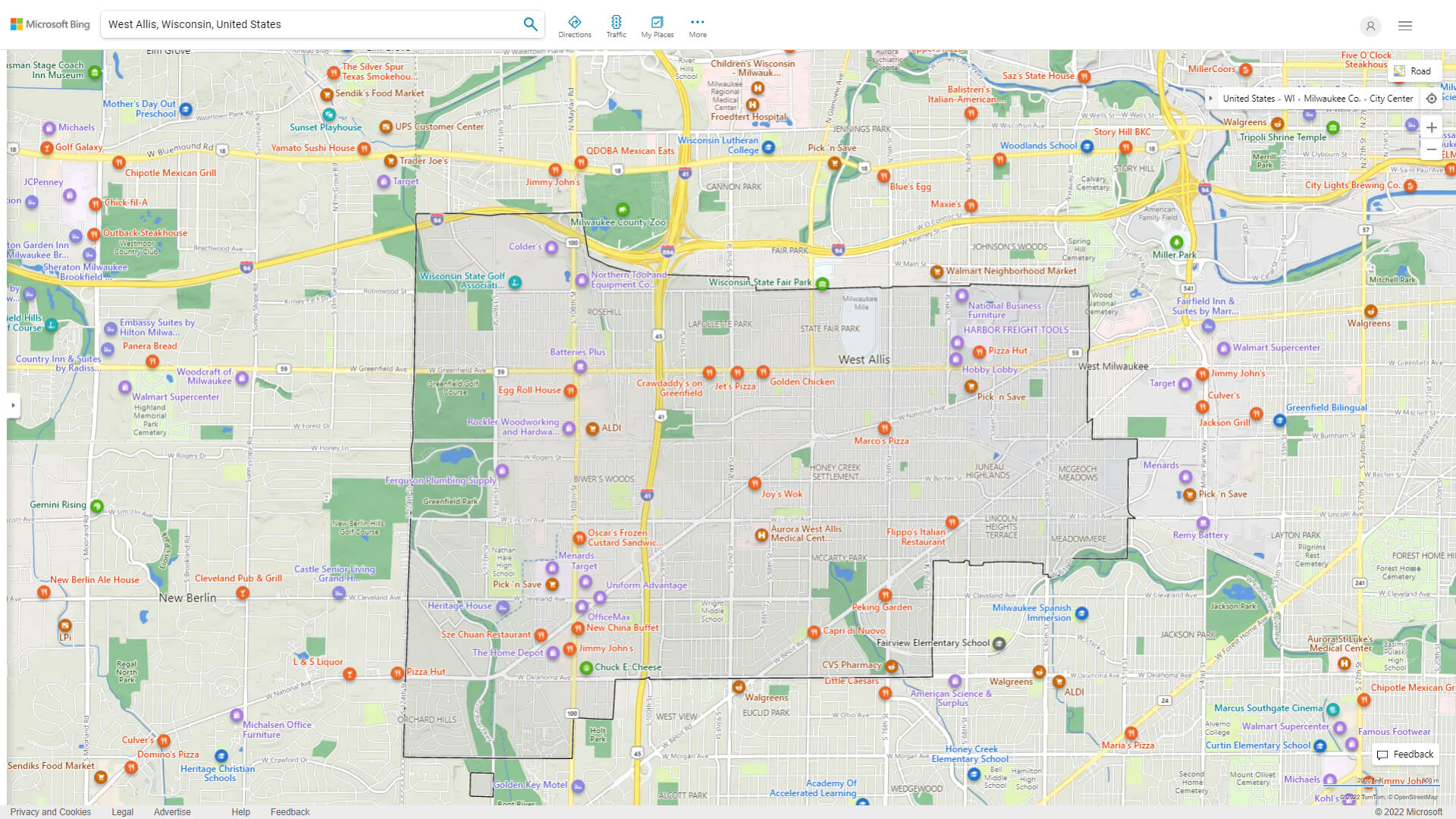
WEST ALLIS WISCONSIN HIGHWAY AND ROAD MAP WITH SATELLITE VIEW
WEST ALLIS WISCONSIN HIGHWAY AND ROAD MAP
Largest Wisconsin Cities by Population
Milwaukee Wisconsin Map Madison Wisconsin Map Green Bay Wisconsin Map Kenosha Wisconsin Map Racine Wisconsin Map Appleton Wisconsin Map Waukesha Wisconsin Map Oshkosh Wisconsin Map Eau Claire Wisconsin Map Janesville Wisconsin Map West Allis Wisconsin Map La Crosse Wisconsin Map Sheboygan Wisconsin Map Wauwatosa Wisconsin Map Fond du Lac Wisconsin MapFor all Wisconsin Cities Map
- Head of Performance Marketing
- Head of SEO
- Linkedin Profile: linkedin.com/in/arifcagrici
See Also
West Allis Wisconsin Google Map, Street Views, Maps Directions, Satellite Images
guideoftheworld.net offers a collection of West Allis Wisconsin map, google map, West Allis Wisconsin atlas, political, physical, satellite view, country infos, cities map and more map of West Allis Wisconsin.
United States Largest Cities Map by Population
New York City Map Los Angeles Map Chicago Map Brooklyn Map Houston Map Philadelphia Map Manhattan Map Phoenix Map San Antonio Map San Diego Map Dallas Map San Jose Map Jacksonville Map Indianapolis Map San Francisco Map Austin Map Columbus Map Fort Worth Map Charlotte Map Detroit MapCopyright GuideofTheWorld.Net 2006 - 2026. All rights reserved. Privacy Policy | Disclaimer