
Antananarivo Map
Navigate Antananarivo Map, Antananarivo city map, satellite images of Antananarivo, Antananarivo towns map, political map of Antananarivo, driving directions and traffic maps.
For more >> Madagascar Maps
For more info >> Madagascar
A Collection of Antananarivo Maps
Antananarivo map
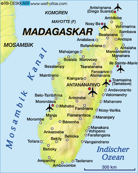
Antananarivo Google Map, Street Views, Maps Directions, Satellite Images
GuideoftheWorld.net offers a collection of Antananarivo map, google map, Antananarivo atlas, political, physical, satellite view, country infos, cities map and more map of Antananarivo.
Largest Cities' Map of Madagascar
Antananarivo Map Fianarantsoa Map Mahajanga Map Toamasina Map Toliara MapCopyright GuideofTheWorld.Net 2006 - 2026. All rights reserved. Privacy Policy | Disclaimer