
Map of Louisville Kentucky, United States
Navigate Louisville Kentucky map, Louisville Kentucky country map, satellite images of Louisville Kentucky, Louisville Kentucky largest cities, towns maps, political map of Louisville Kentucky, driving directions, physical, atlas and traffic maps in United States.
Louisville Kentucky City Town Maps
LOUISVILLE MAP KENTUCKY
A Collection of Louisville Kentucky Maps and Louisville Kentucky Satellite Images
LOUISVILLE MAP
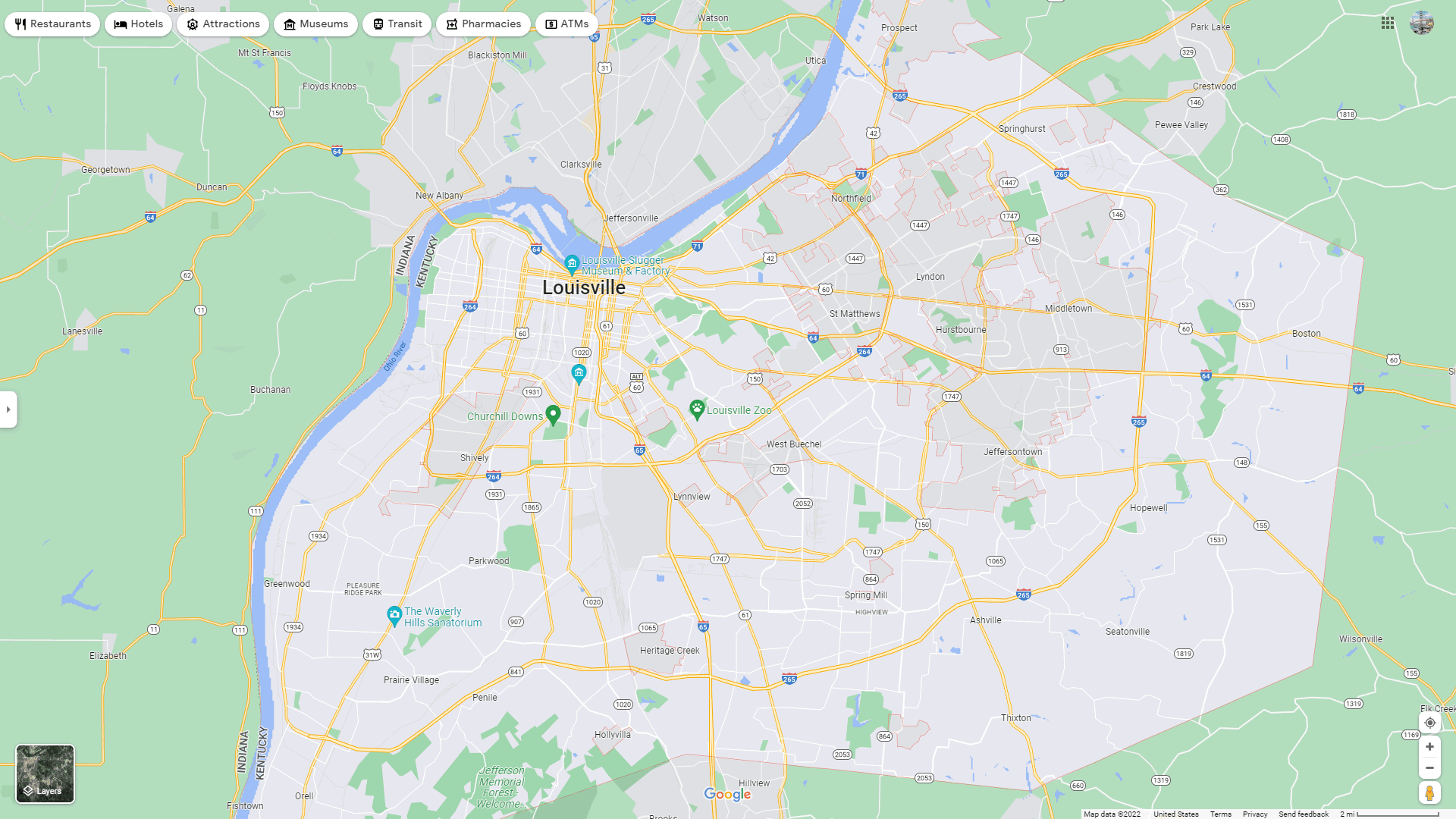
LOUISVILLE DETAILED MAP
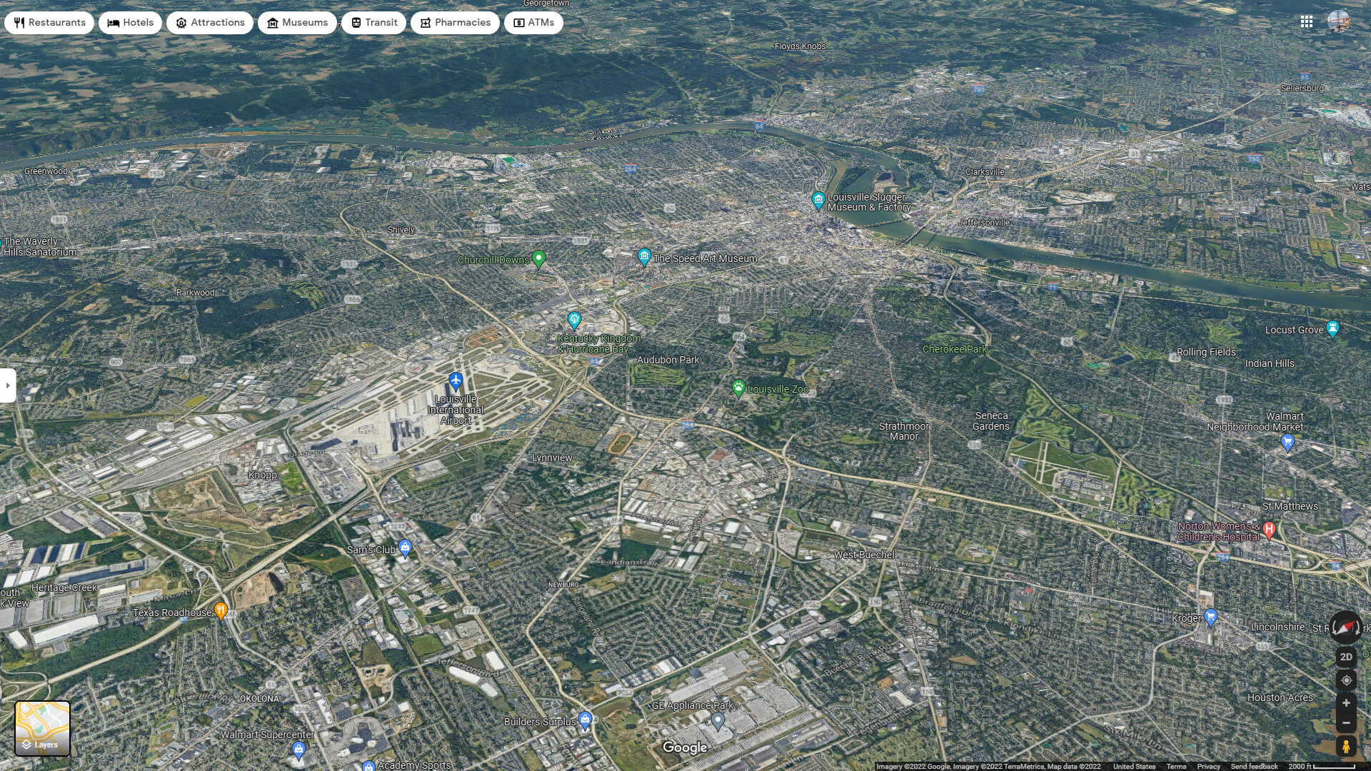
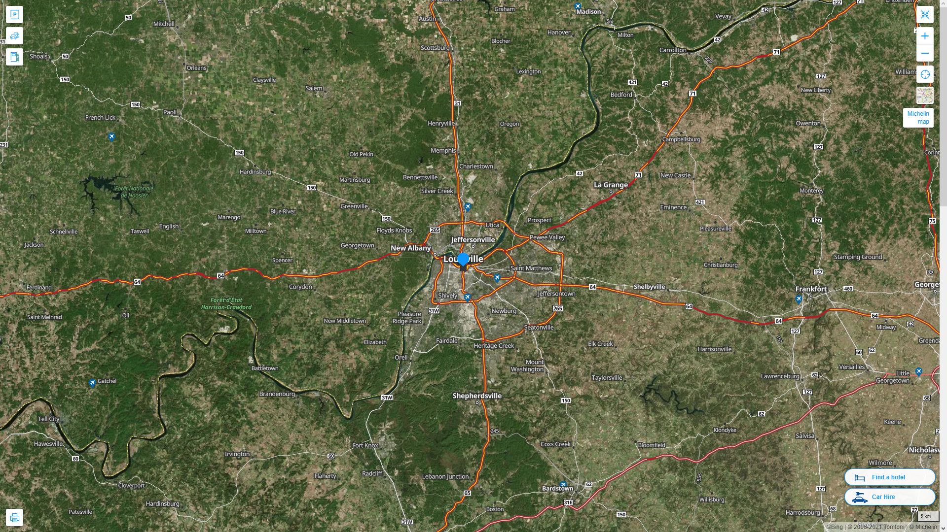
LOUISVILLE AERIAL MAP KENTUCKY
LOUISVILLE MAP KENTUCKY
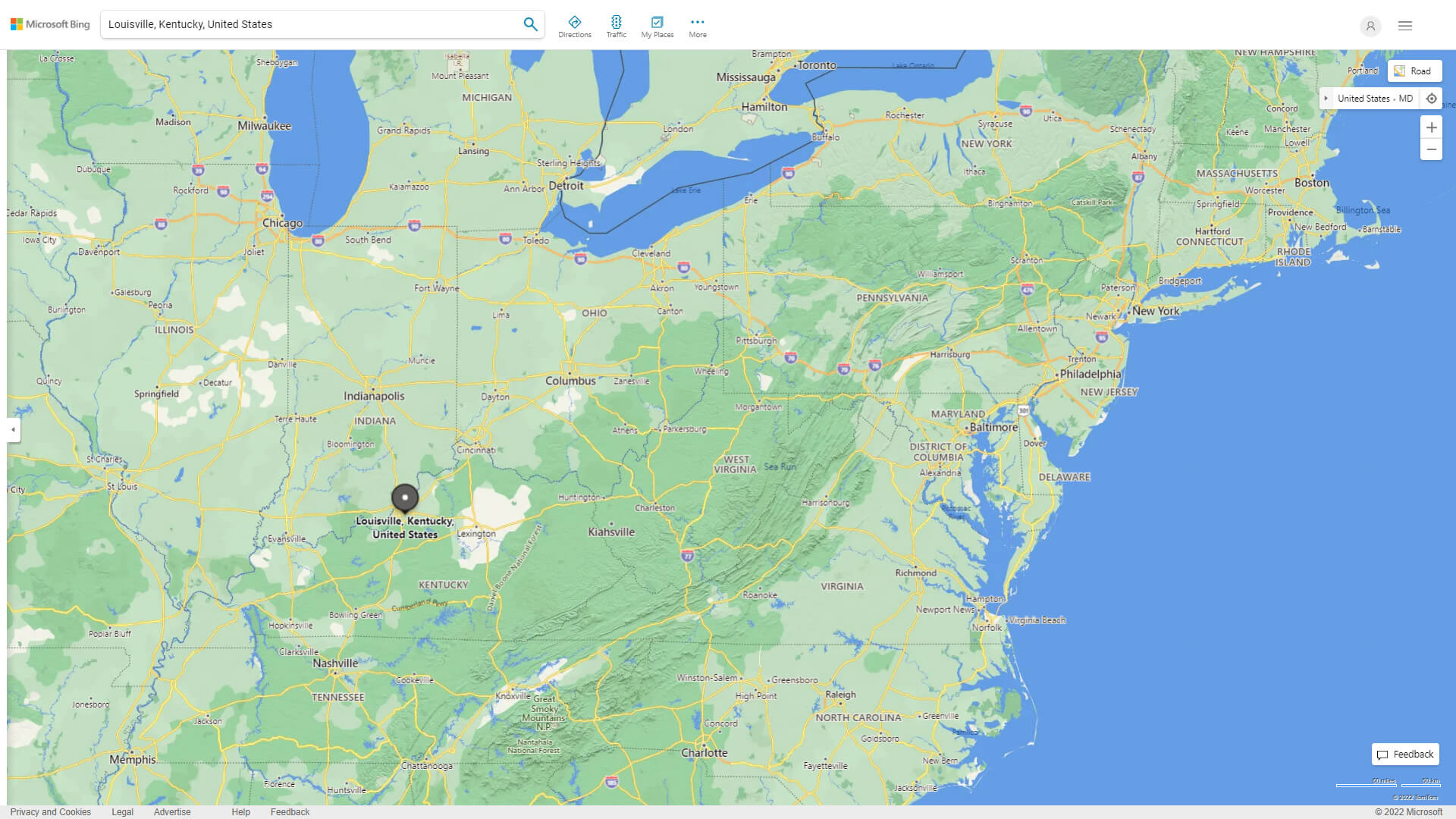
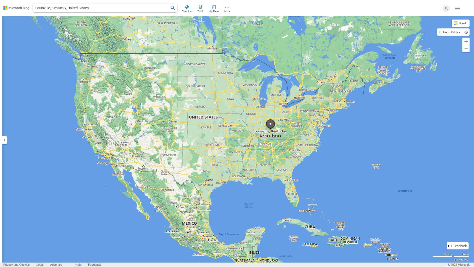
WHERE IS LOUISVILLE IN THE US
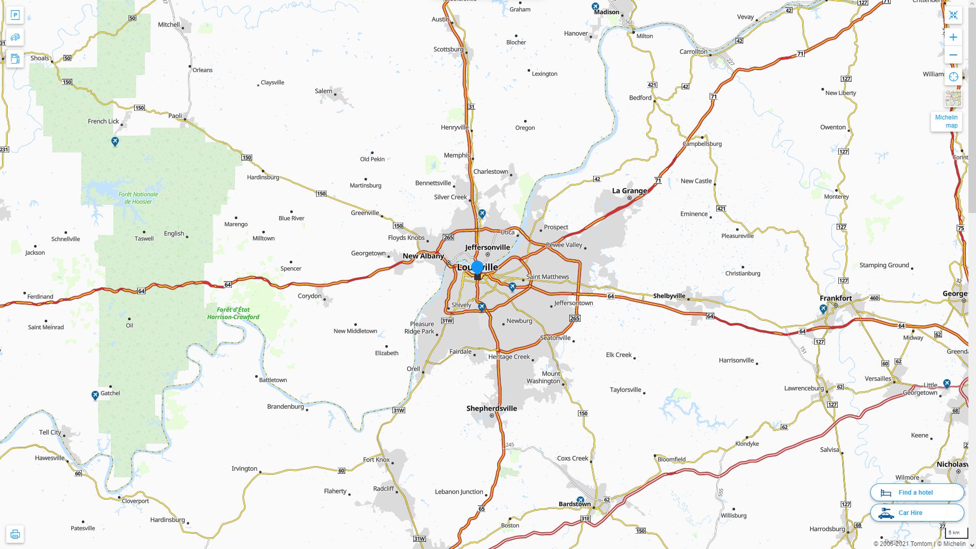
LOUISVILLE KENTUCKY HIGHWAY AND ROAD MAP WITH SATELLITE VIEW
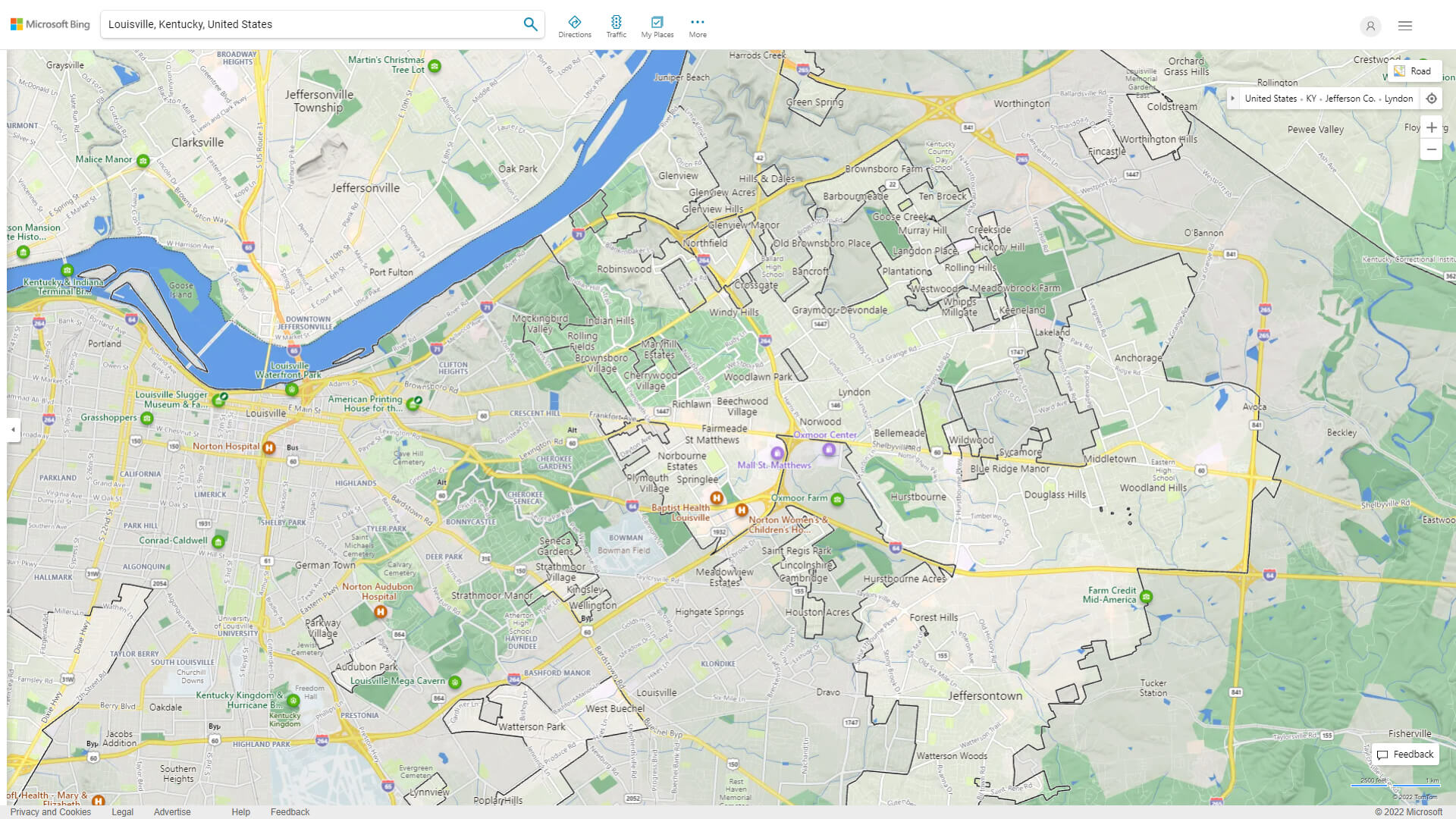
LOUISVILLE KENTUCKY HIGHWAY AND ROAD MAP
Largest Kentucky Cities by Population
Louisville Kentucky Map Lexington Fayette Kentucky Map Bowling Green Kentucky Map Owensboro Kentucky Map Covington Kentucky Map Hopkinsville Kentucky Map Richmond Kentucky Map Florence Kentucky Map Georgetown Kentucky Map Henderson Kentucky Map Elizabethtown Kentucky Map Nicholasville Kentucky Map Jeffersontown Kentucky Map Frankfort Kentucky Map Paducah Kentucky Map Mayfield Kentucky MapFor all Kentucky Cities Map
- Head of Performance Marketing
- Head of SEO
- Linkedin Profile: linkedin.com/in/arifcagrici
See Also
Louisville Kentucky Google Map, Street Views, Maps Directions, Satellite Images
guideoftheworld.net offers a collection of Louisville Kentucky map, google map, Louisville Kentucky atlas, political, physical, satellite view, country infos, cities map and more map of Louisville Kentucky.
United States Largest Cities Map by Population
New York City Map Los Angeles Map Chicago Map Brooklyn Map Houston Map Philadelphia Map Manhattan Map Phoenix Map San Antonio Map San Diego Map Dallas Map San Jose Map Jacksonville Map Indianapolis Map San Francisco Map Austin Map Columbus Map Fort Worth Map Charlotte Map Detroit MapCopyright GuideofTheWorld.Net 2006 - 2026. All rights reserved. Privacy Policy | Disclaimer