
Zahedan Map
Navigate Zahedan Map, Zahedan city map, satellite images of Zahedan, Zahedan towns map, political map of Zahedan, driving directions and traffic maps.
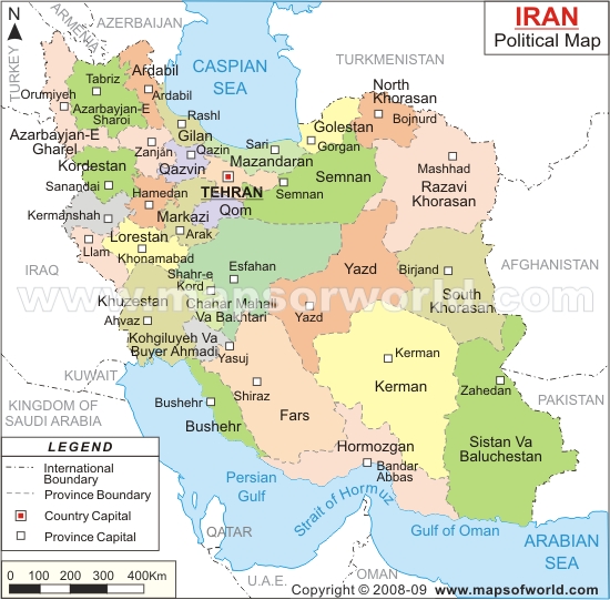
For more >> Iran Maps
For more info >> Iran
Zahedan Map - Political, physical, touristic city maps and satellite images
Zahedan map
A Collection of Zahedan and Satellite Images
ZAHEDAN MAP
Zahedan Google Map, Street Views, Maps Directions, Satellite Images
GuideoftheWorld.net offers a collection of Zahedan map, google map, Zahedan atlas, political, physical, satellite view, country infos, cities map and more map of Zahedan.
Largest Cities' Map of Iran
Ahvaz Map Isfahan Map Karaj Map Kerman Map Bakhtaran Map Mashhad Map Orumieh Map Qom Map Rasht Map Shiraz Map Tabriz Map Tehran Map Zahedan MapCopyright GuideofTheWorld.Net 2006 - 2026. All rights reserved. Privacy Policy | Disclaimer