
Map of Bal Harbour Florida, United States
Navigate Bal Harbour Florida map, Bal Harbour Florida country map, satellite images of Bal Harbour Florida, Bal Harbour Florida largest cities, towns maps, political map of Bal Harbour Florida, driving directions, physical, atlas and traffic maps in United States.
Feel the Pulse of Miami: Exploring the City's Top 10 Hotspots
Please subscribe on "World Guide" channnel on Youtube at youtube.com/c/WorldGuide
Where is Florida in the US and Cities Map of Florida
Please subscribe on "World Guide" channnel on Youtube at youtube.com/c/WorldGuide
Bal Harbour Florida City Town Maps
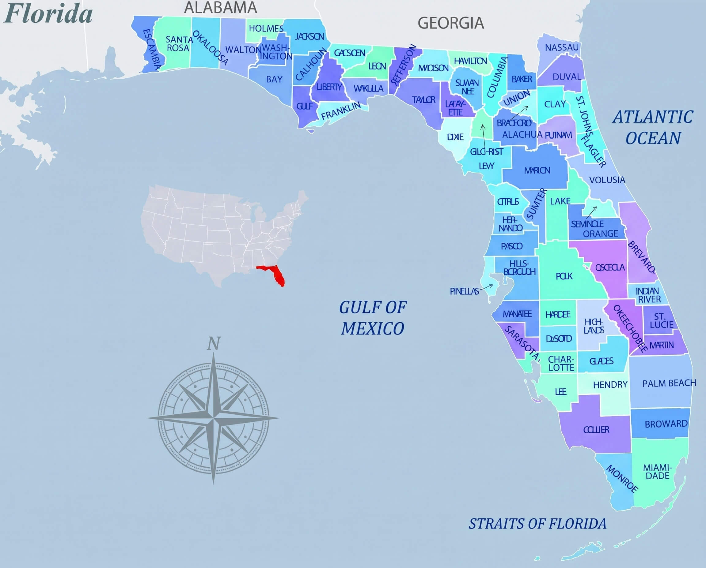
FLORIDA COUNTY MAP MULTICOLOR
- Head of Performance Marketing
- Head of SEO
- Linkedin Profile: linkedin.com/in/arifcagrici
See Also
Florida's Largest Cities:
- Jacksonville Map
- Miami Map
- Tampa Map
- St. Petersburg Map
- Orlando Map
- Hialeah Map
- Tallahassee Map
- Fort Lauderdale Map
- Port St. Lucie Map
- Pembroke Pines Map
Bal Harbour Florida Google Map, Street Views, Maps Directions, Satellite Images
guideoftheworld.net offers a collection of Bal Harbour Florida map, google map, Bal Harbour Florida atlas, political, physical, satellite view, country infos, cities map and more map of Bal Harbour Florida.
United States Largest Cities Map by Population
New York City Map Los Angeles Map Chicago Map Brooklyn Map Houston Map Philadelphia Map Manhattan Map Phoenix Map San Antonio Map San Diego Map Dallas Map San Jose Map Jacksonville Map Indianapolis Map San Francisco Map Austin Map Columbus Map Fort Worth Map Charlotte Map Detroit MapCopyright GuideofTheWorld.Net 2006 - 2026. All rights reserved. Privacy Policy | Disclaimer