
Map United Kingdom
Navigate United Kingdom map, satellite images of the United Kingdom, states, largest cities, political map, capitals and physical maps.
- Capital : London
- Population : 63,181,775
- GDP : $2.434 trillion (7th)
- Per Capita : $38,591
- Calling Code : +44
- Jobless Rate : 7.70%
- Time Zone : +0
A Collection of United Kingdom Maps
United Kingdom Political Map
 United Kingdom Highly detailed editable political map with separated layers.
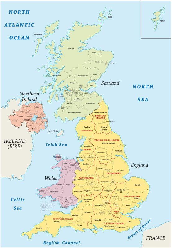
United Kingdom Regions Map
 UK, Highly detailed map of Great Britain's regions,
United Kingdom Satellite Map
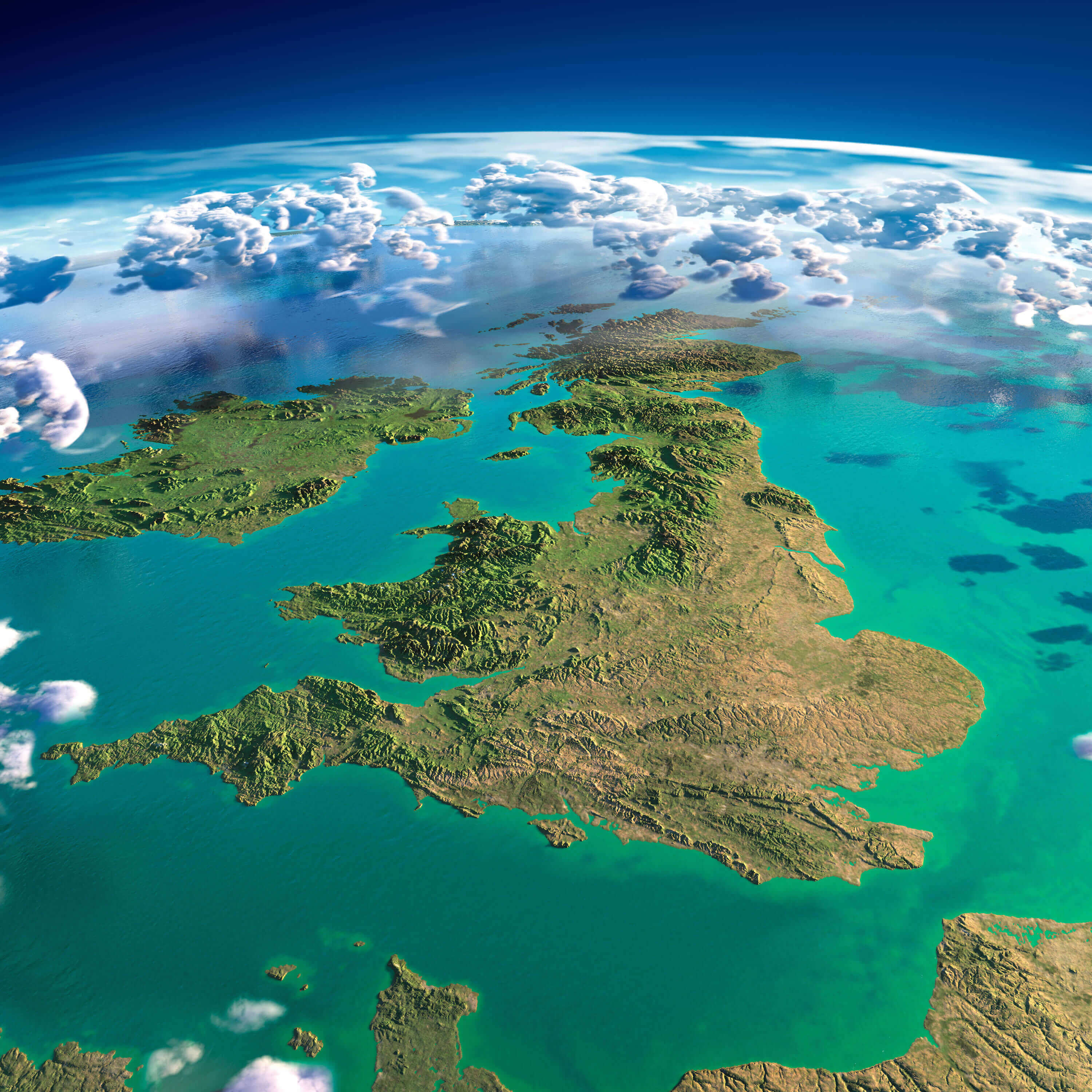 United Kingdom highly detailed fragments of the planet Earth with exaggerated relief, translucent ocean, illuminated by the morning sun. United Kingdom and Ireland. Elements of this image furnished by NASA
United Kingdom Road Map
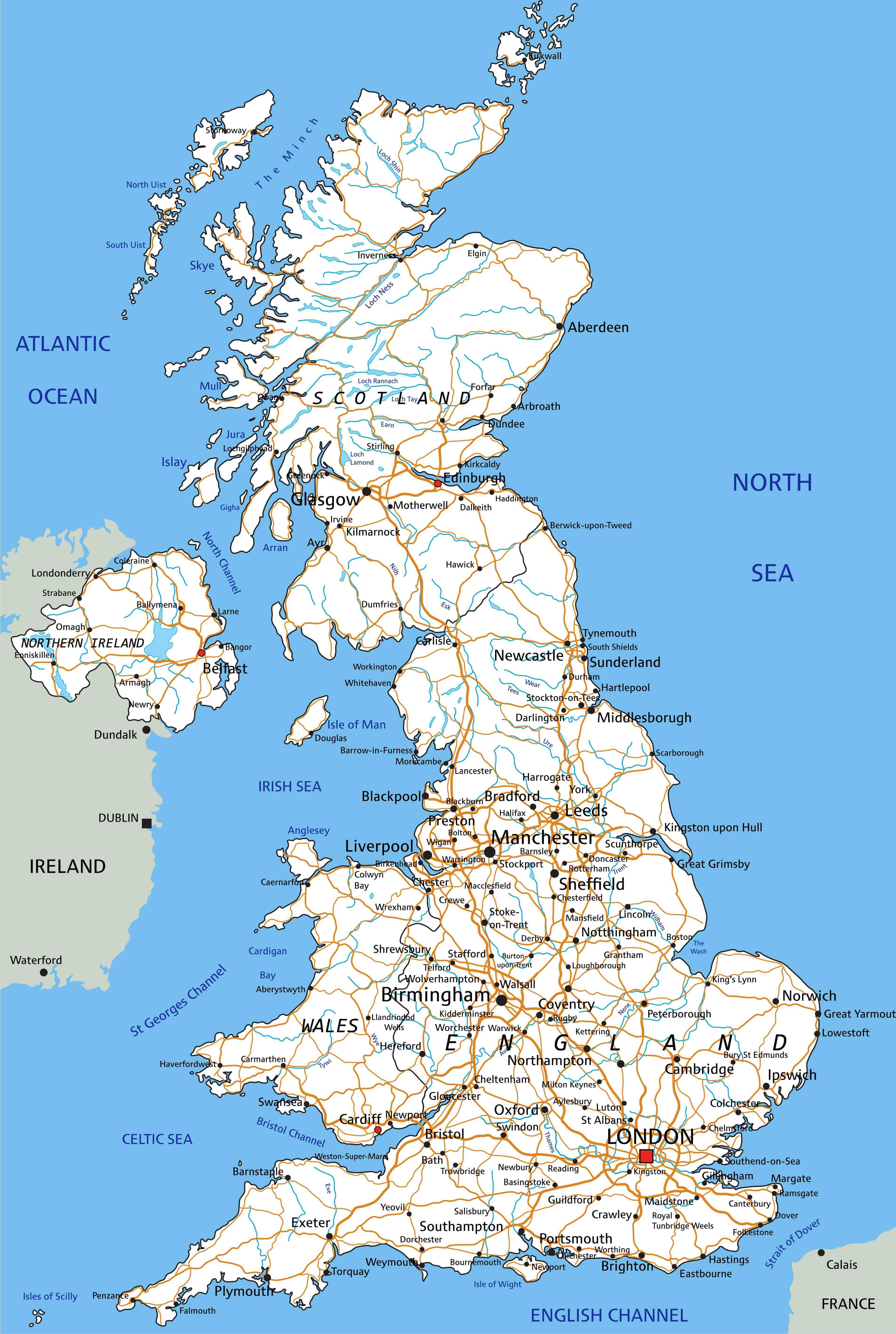 High detailed United Kingdom road map with labeling.
United Kingdom Administrative Map
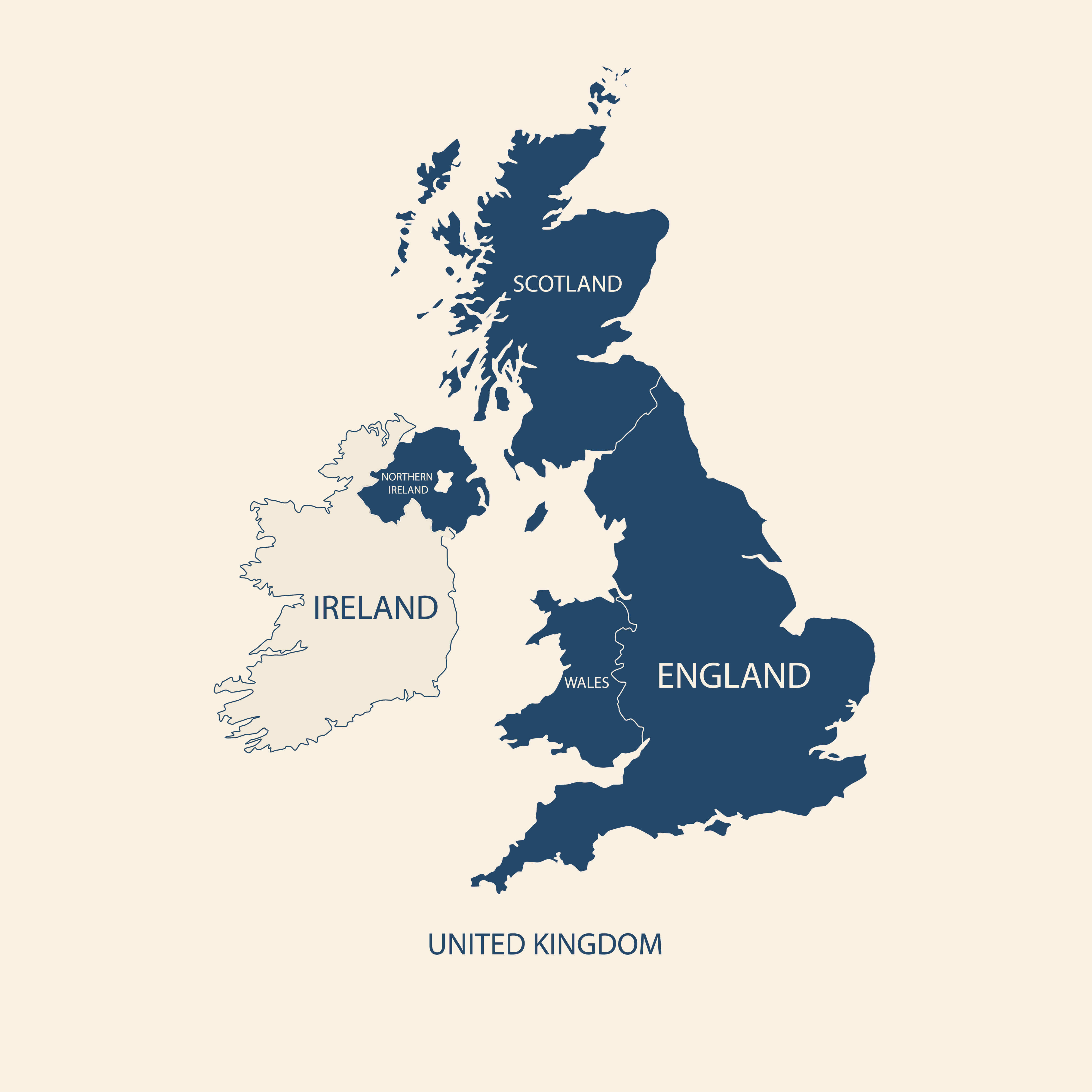 United Kingdom Administrative Map, UK, England, Wales, Scotland, Northern Ireland. Ireland.
United Kingdom Colorful Map
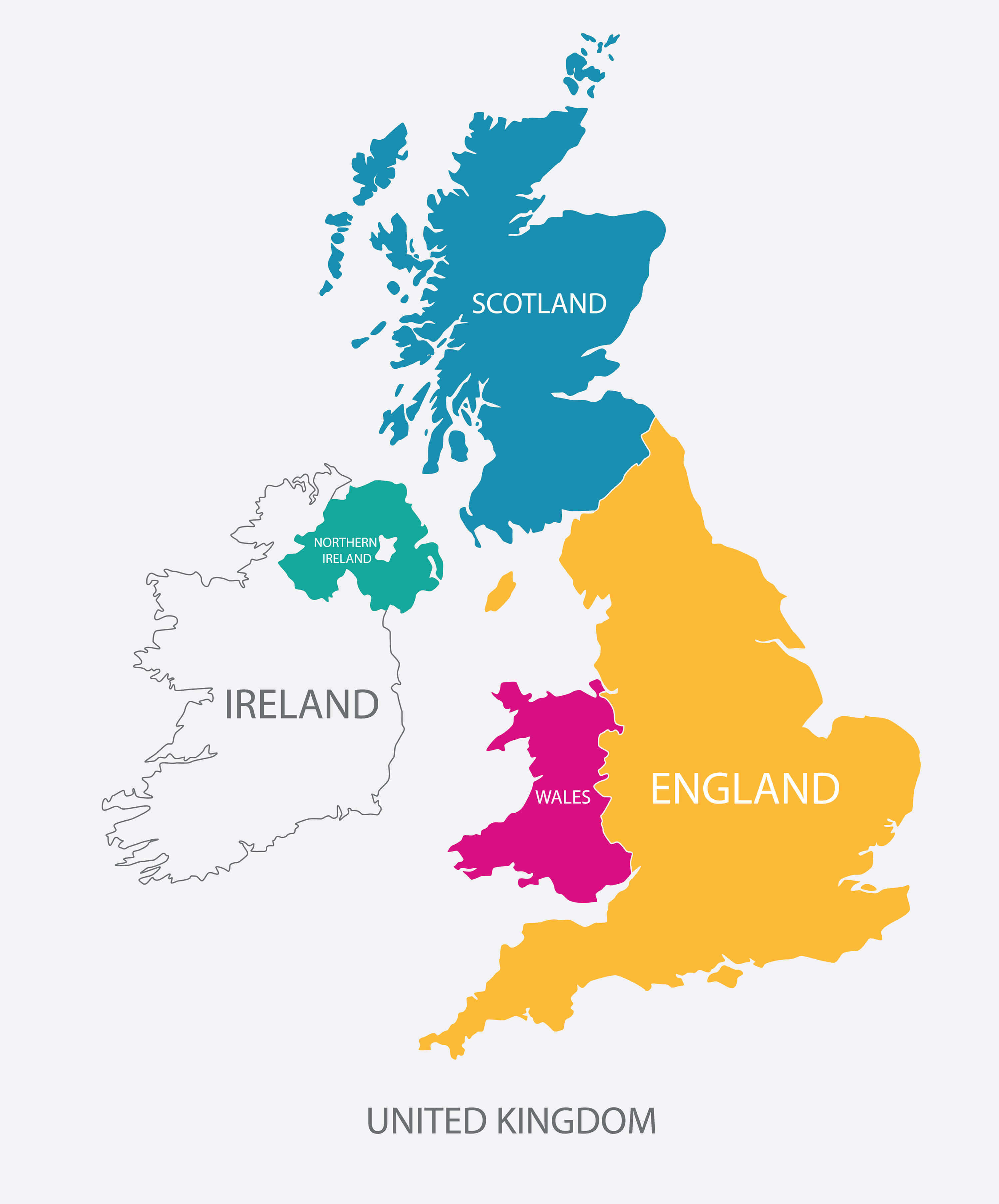 United Kingdom Map, UK Map with borders in different color.
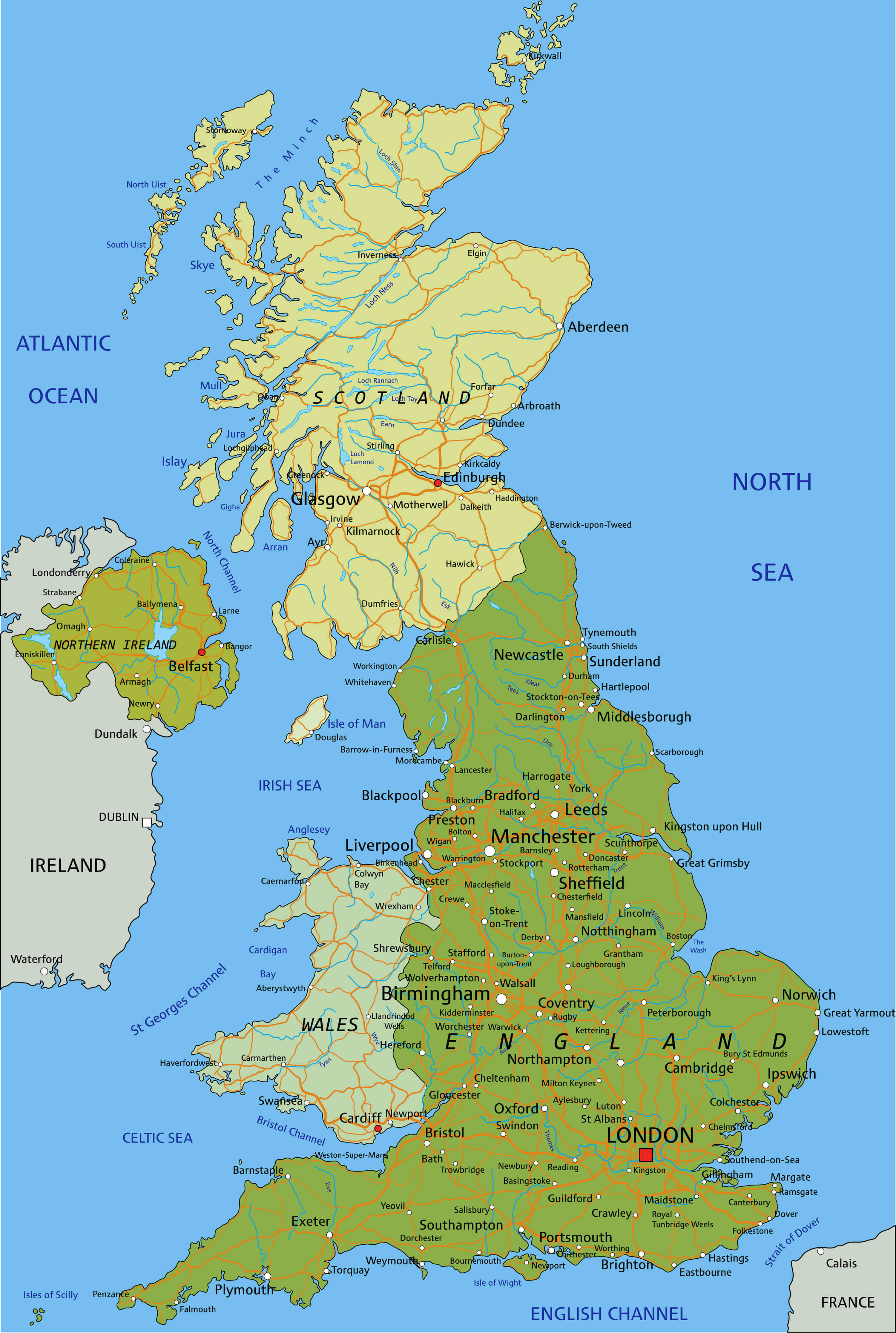
United Kingdom Main Cities Map
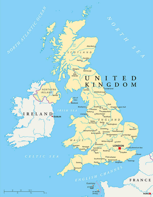 United Kingdom Political Map with capital London, national borders, most important cities, rivers and lakes. Vector illustration with English labeling and scaling.
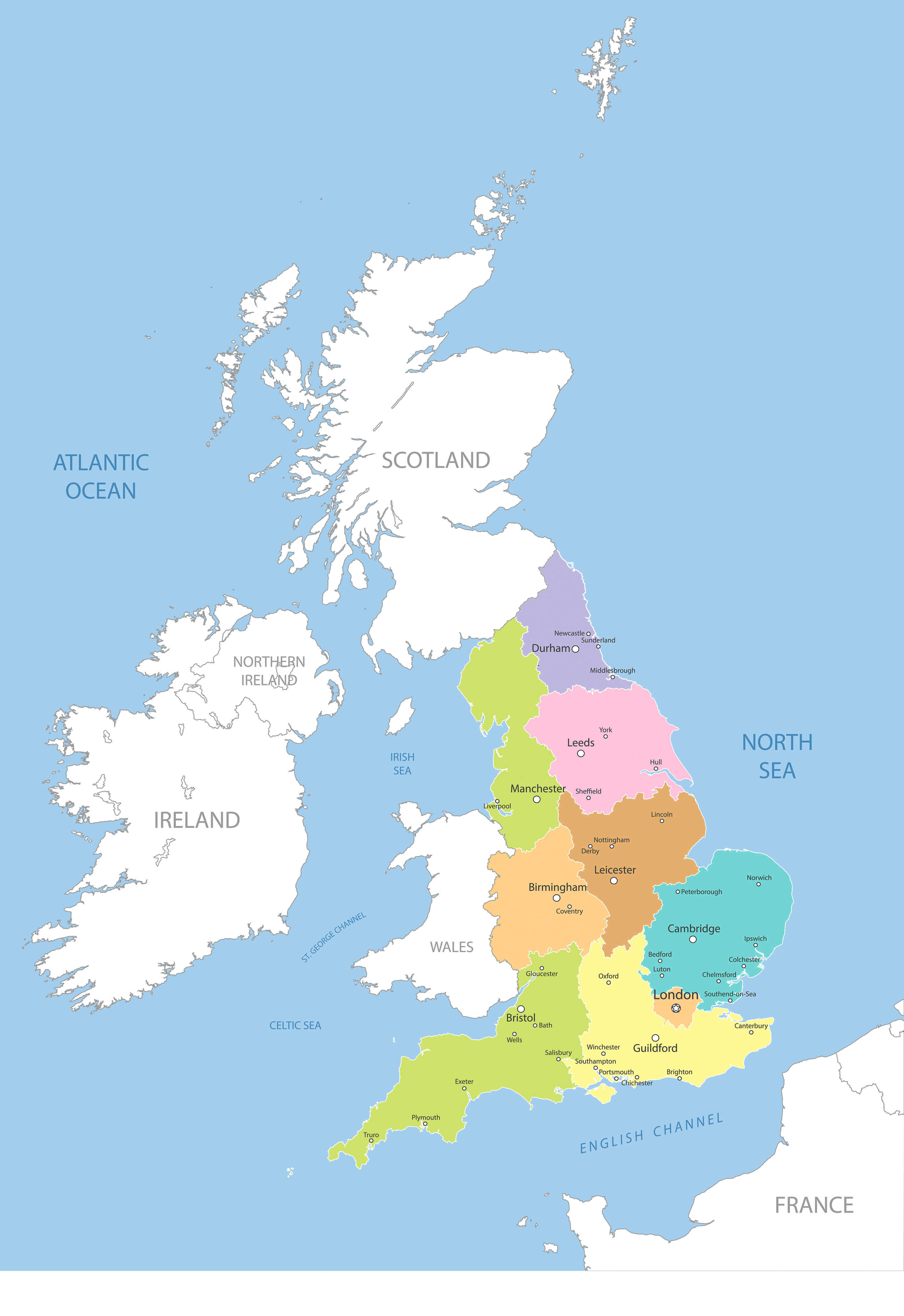
United Kingdom Reginal & Major Cities Map
 United Kingdom Reginal & Major Cities Map
United Kingdom Blank Map
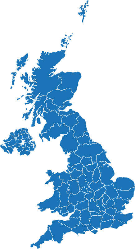 United Kingdom Blank Map
Largest Cities' Map of United Kingdom
London Map Birmingham Map Glasgow Map Liverpool Map Leeds Map Sheffield Map Edinburgh Map Bristol Map Manchester Map Leicester Map Coventry Map Kingston Upon Hull Map Bradford Map Cardiff Map Belfast Map Stoke on Trent Map Wolverhampton Map Nottingham Map Plymouth Map Southampton Map Reading Map Derby Map Dudley Map Northampton Map Portsmouth Map Luton Map Preston Map Aberdeen Map Milton Keynes Map Sunderland Map Norwich Map Walsall Map Bournemouth Map Southend on Sea Map Swindon Map Dundee Map Huddersfield Map Poole Map Oxford Map Middlesbrough Map Blackpool Map Bolton Map Ipswich Map Telford Map York Map Peterborough Map Stockport Map Brighton Map Slough Map Gloucester Map Rotherham Map Newport Map Cambridge Map Exeter Map Eastbourne Map Sutton Coldfield Map Blackburn Map Colchester Map Oldham Map St Helens Map Woking Map Crawley Map Chelmsford Map Basildon Map Cheltenham Map Gillingham Map Worthing Map Rochdale Map Solihull Map Worcester Map Derry Map Southport Map Basingstoke Map Bath Map Maidstone Map Harlow Map Grimsby Map Darlington Map Hartlepool Map Lincoln Map Hastings Map Birkenhead Map Halifax Map Hemel Hempstead Map South Shields Map Bedford Map St Albans Map Stevenage Map Wigan Map Warrington Map Chester Map Stockton on Tees Map Gateshead Map Weston super Mare Map High Wycombe Map Wakefield Map Redditch Map Newcastle under Lyme Map Newcastle Map Paisley Map East Kilbride Map Chatham Map Burnley Map Salford Map Scunthorpe Map Hove Map Carlisle Map Tamworth Map Barnsley Map Harrogate Map Lisburn Map Bracknell Map Nuneaton Map Chesterfield Map Mansfield Map Guildford Map Gosport Map Aylesbury Map Lowestoft Map Doncaster Map Crewe Map Shrewsbury Map Ellesmere Port Map Cannock Map Grays Map Torquay Map Stafford Map Waterlooville Map Kingswood Map Bognor Regis Map Newtownabbey Map Rugby Map Royal Leamington Spa Map Bury Map Royal Tunbridge Wells Map Runcorn Map Rhondda Map Bootle Map Ashford Map Maidenhead Map Wallasey Map Margate Map Bangor Map Taunton Map Aldershot Map Great Yarmouth Map Farnborough Map Bebington Map Dartford Map Hereford Map Fareham Map Littlehampton Map Widnes Map Stourbridge Map Kidderminster Map Cheshunt Map Halesowen Map Loughborough Map Sale Map Dewsbury Map Morley Map Washington UK Map Gravesend Map Eastleigh Map Crosby Map Clacton on Sea Map Kettering Map Livingston Map Dunstable Map Macclesfield Map Barry Map Staines Map Swansea Map West Bromwich Map Watford MapCopyright GuideofTheWorld.Net 2006 - 2026. All rights reserved. Privacy Policy | Disclaimer