
Map Sweden
Navigate Sweden map, satellite images of the Sweden, states, largest cities, political map, capitals and physical maps.

- Capital : Stockholm
- Population : 9,540,065
- GDP : $538.237 billion
- Per Capita : $56,956
- Calling Code : +46
- Jobless Rate : 7.40%
- Time Zone : +1
A Collection of Sweden Maps
Sweden and Norway Map
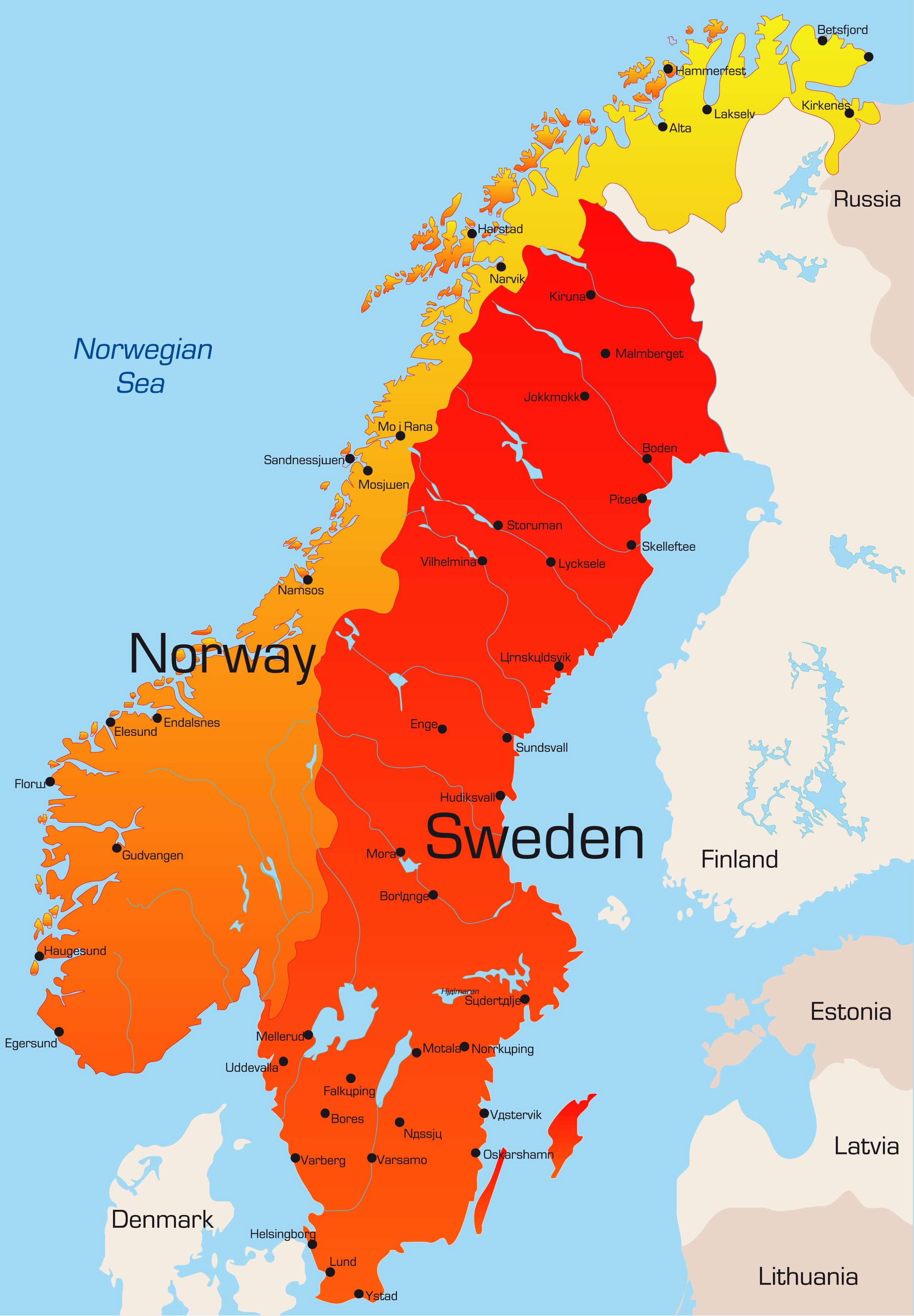 Abstract vector color map of Norway and Sweden country.
Sweden Map
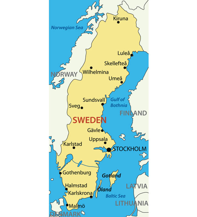 Kingdom of Sweden - Sweden vector map with main cities.
Overview Map of Sweden
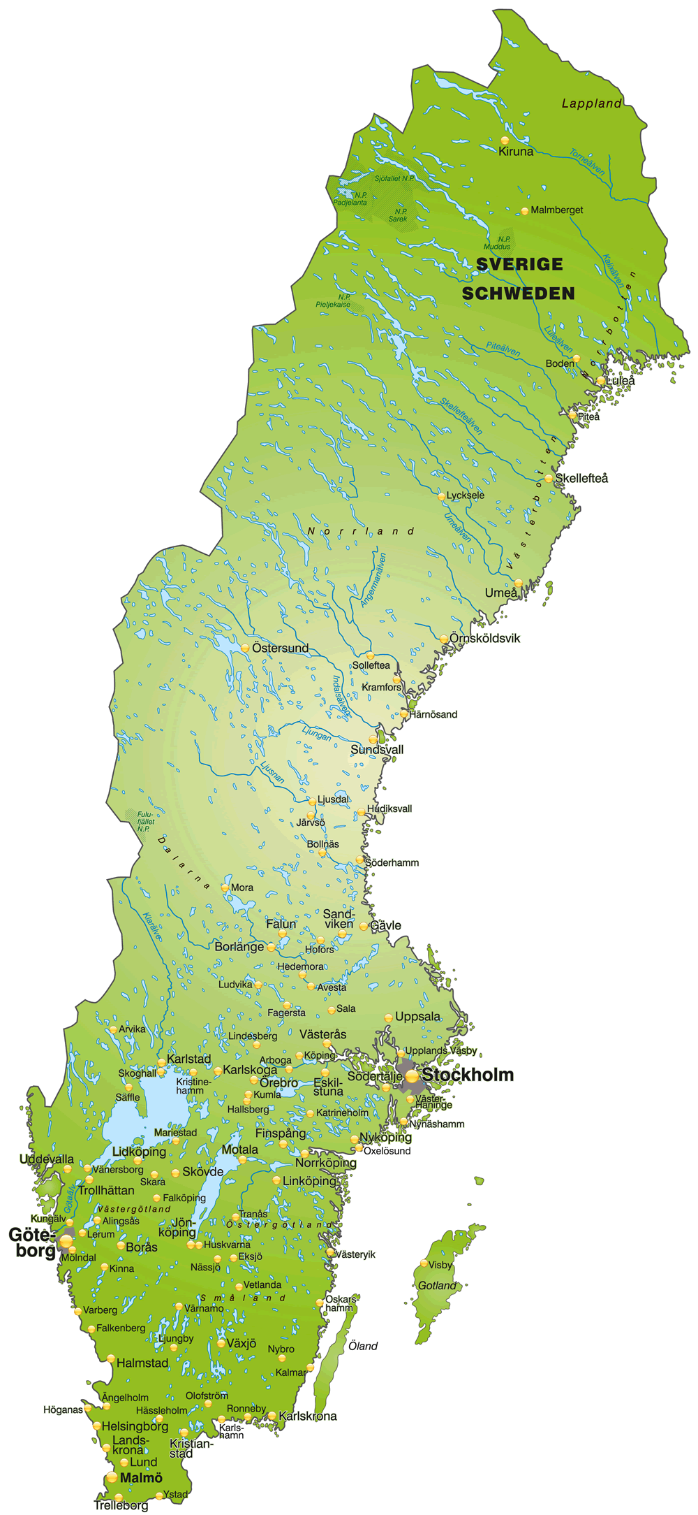 Overview map of Sweden with cities and towns.
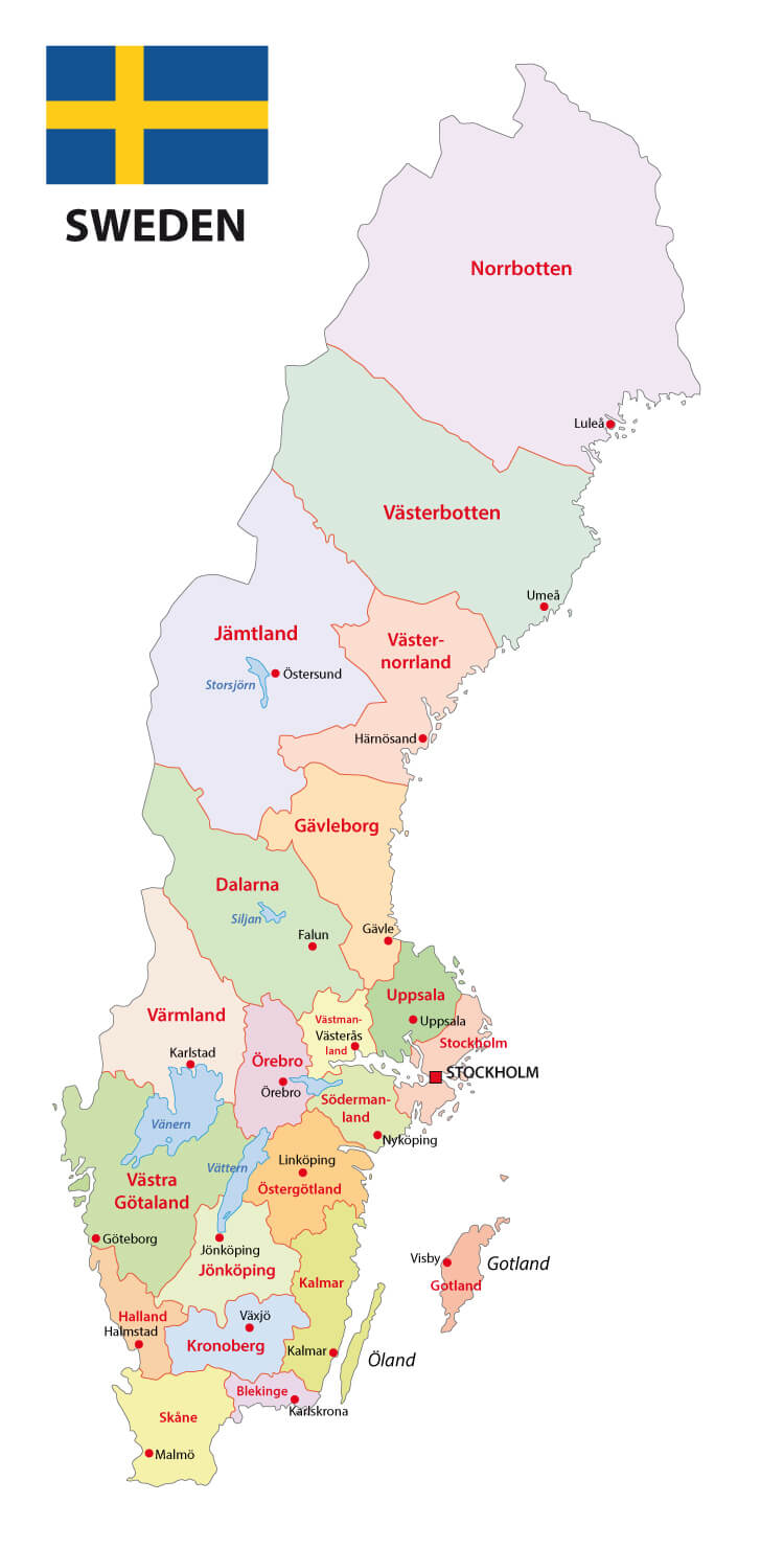
Sweden Regions Map
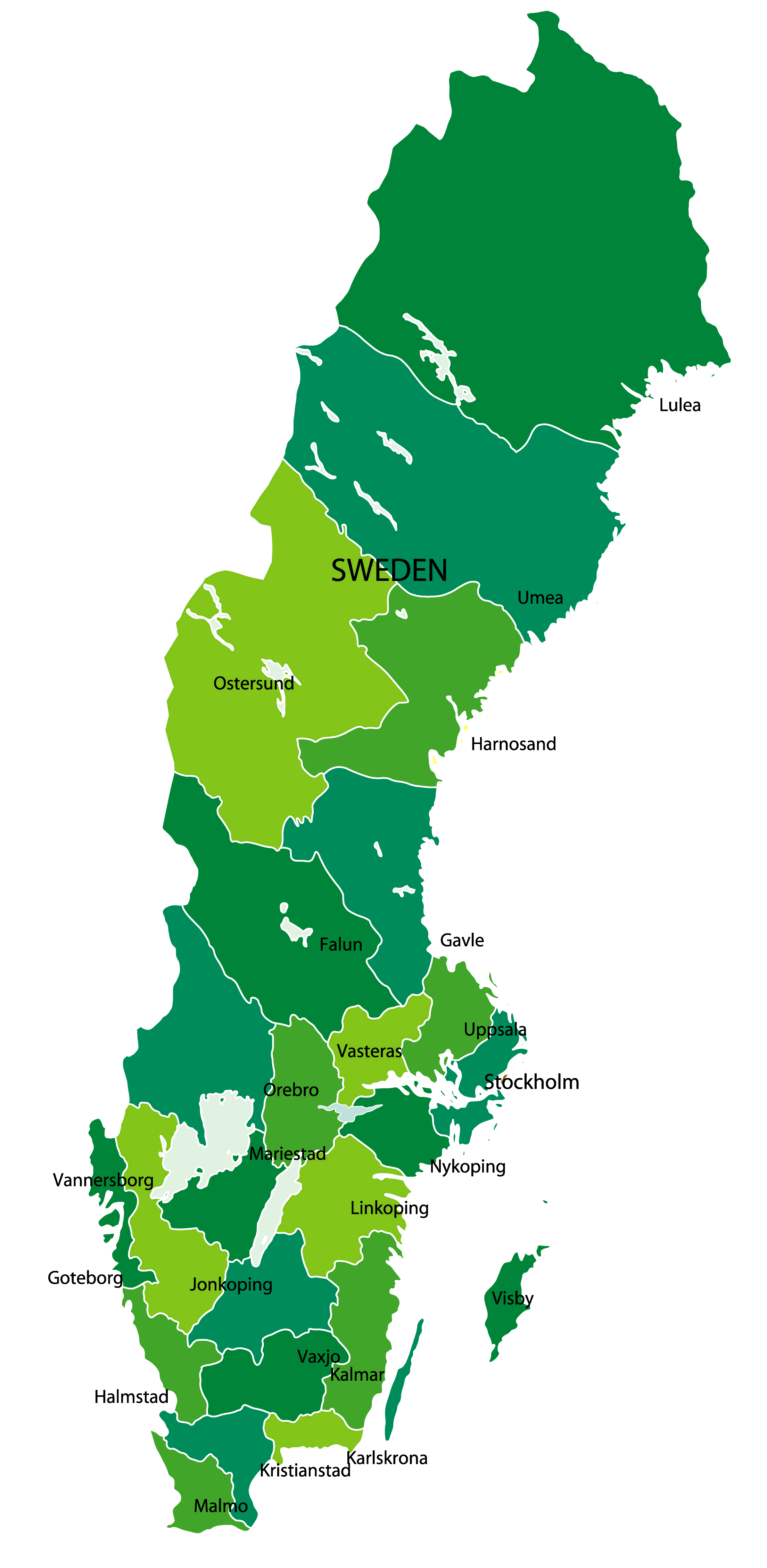 Sweden Regions Map with with major cities.
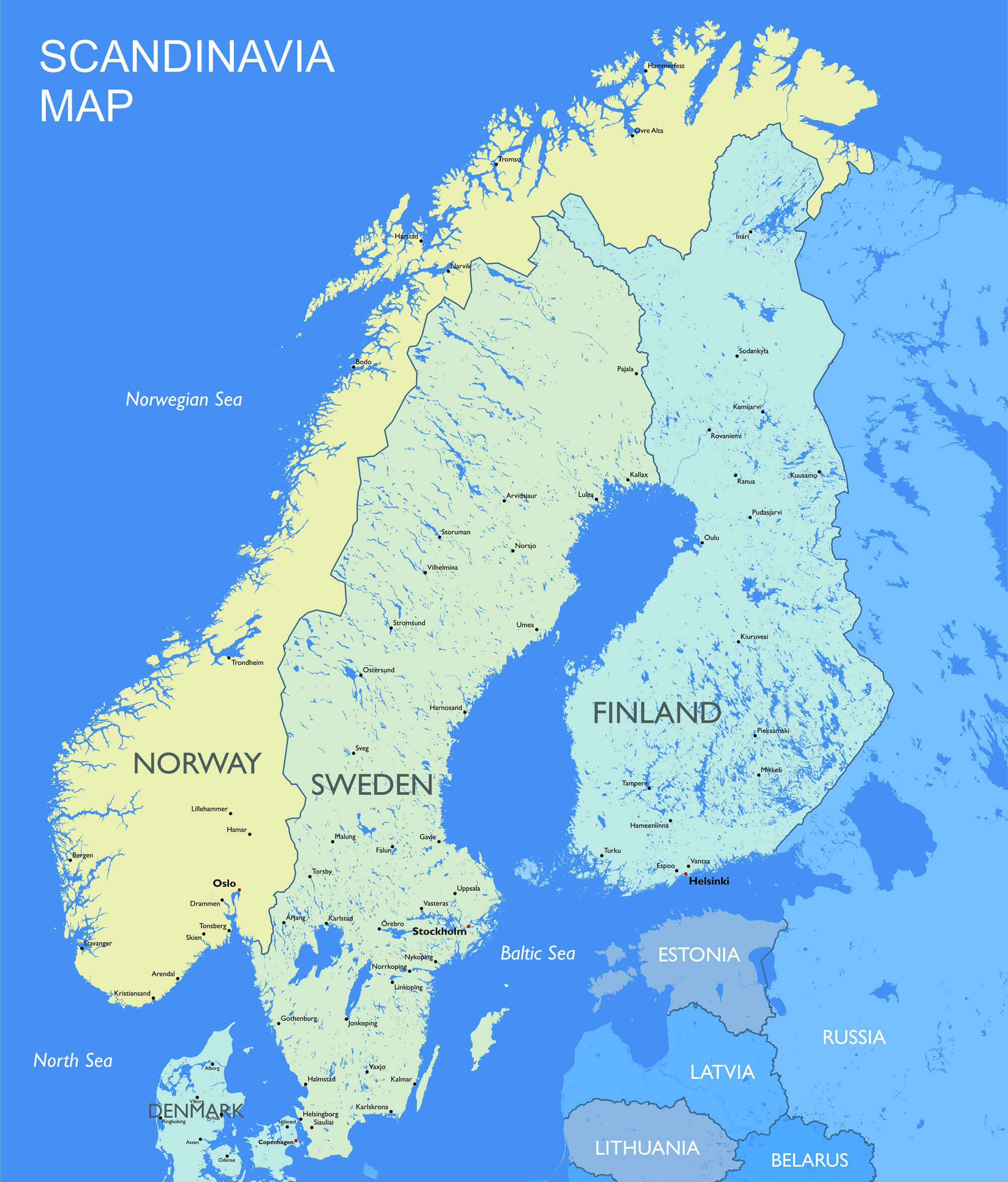
Sweden Map Scandinavia and Baltic States
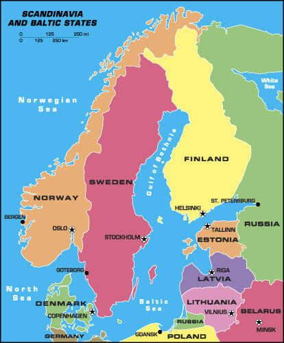 Sweden map Scandinavia and Baltic States, Denmark, Norway, Finland, Estonia,Latvia, Lithunia.
Sweden Administrative Map
 Sweden administrative map with flag.
Sweden Earth Map
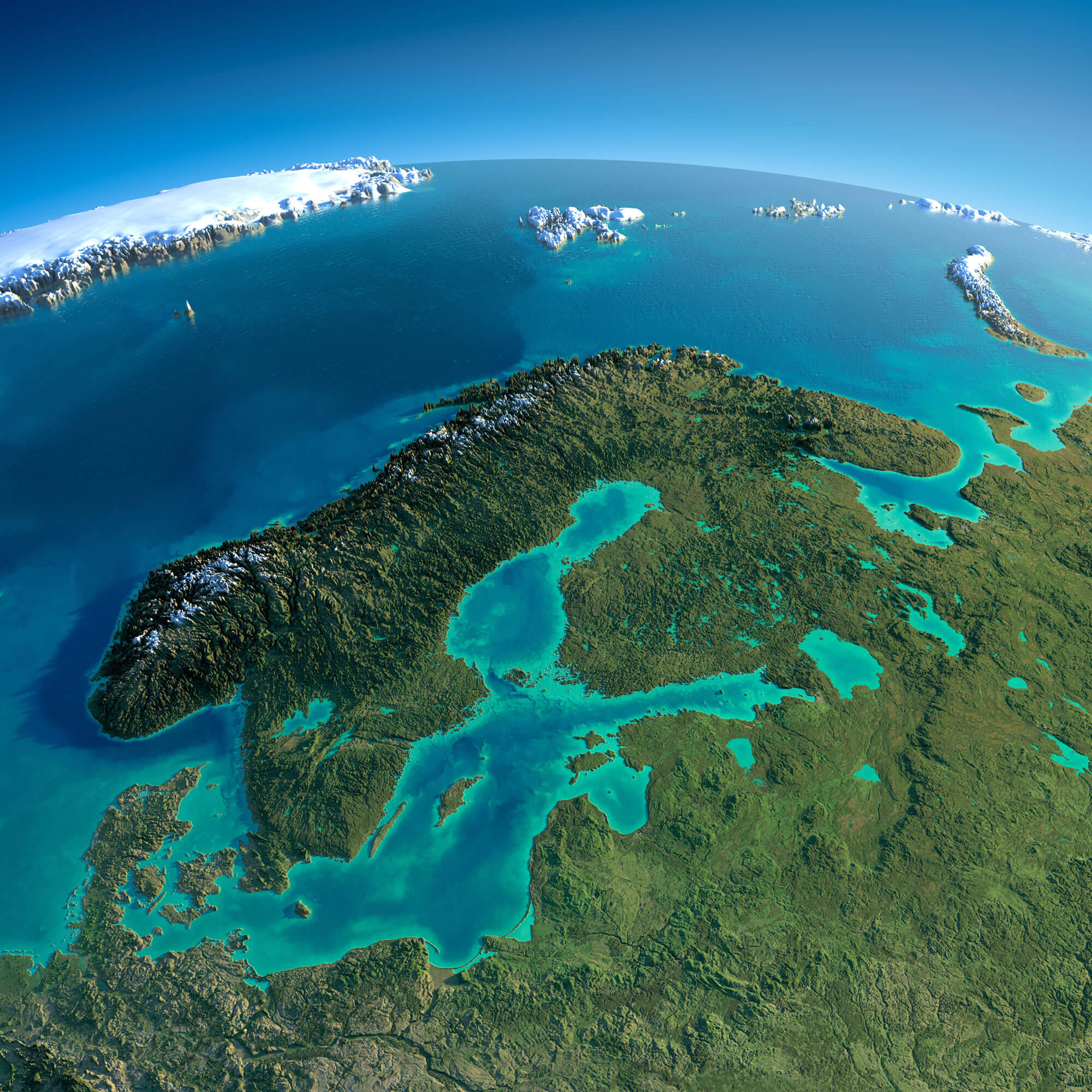 Highly detailed planet Earth in the morning. Exaggerated precise relief lit morning sun. Detailed Earth. Europe. Scandinavia.
Sweden Satellite Map
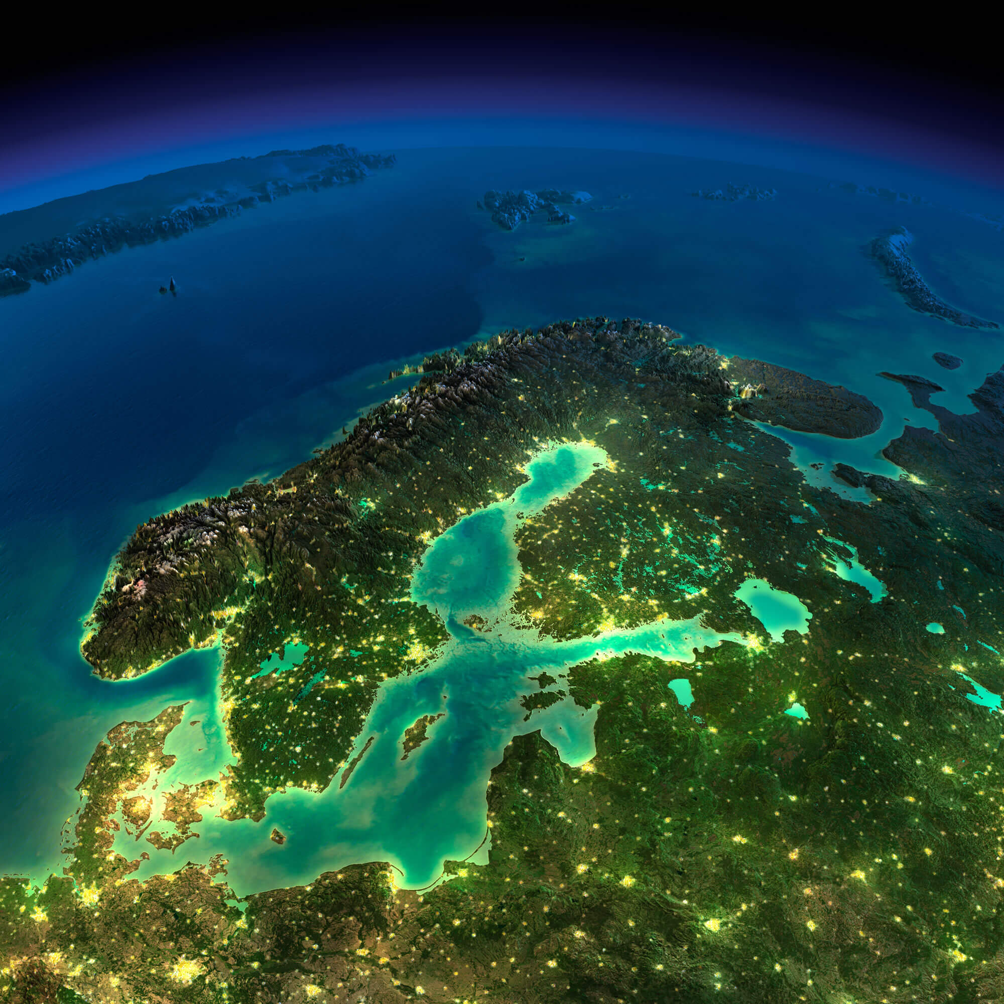 Highly detailed Earth, illuminated by moonlight. The glow of cities sheds light on the detailed exaggerated terrain. Night Earth. Europe. Scandinavia.
Sweden Political Map
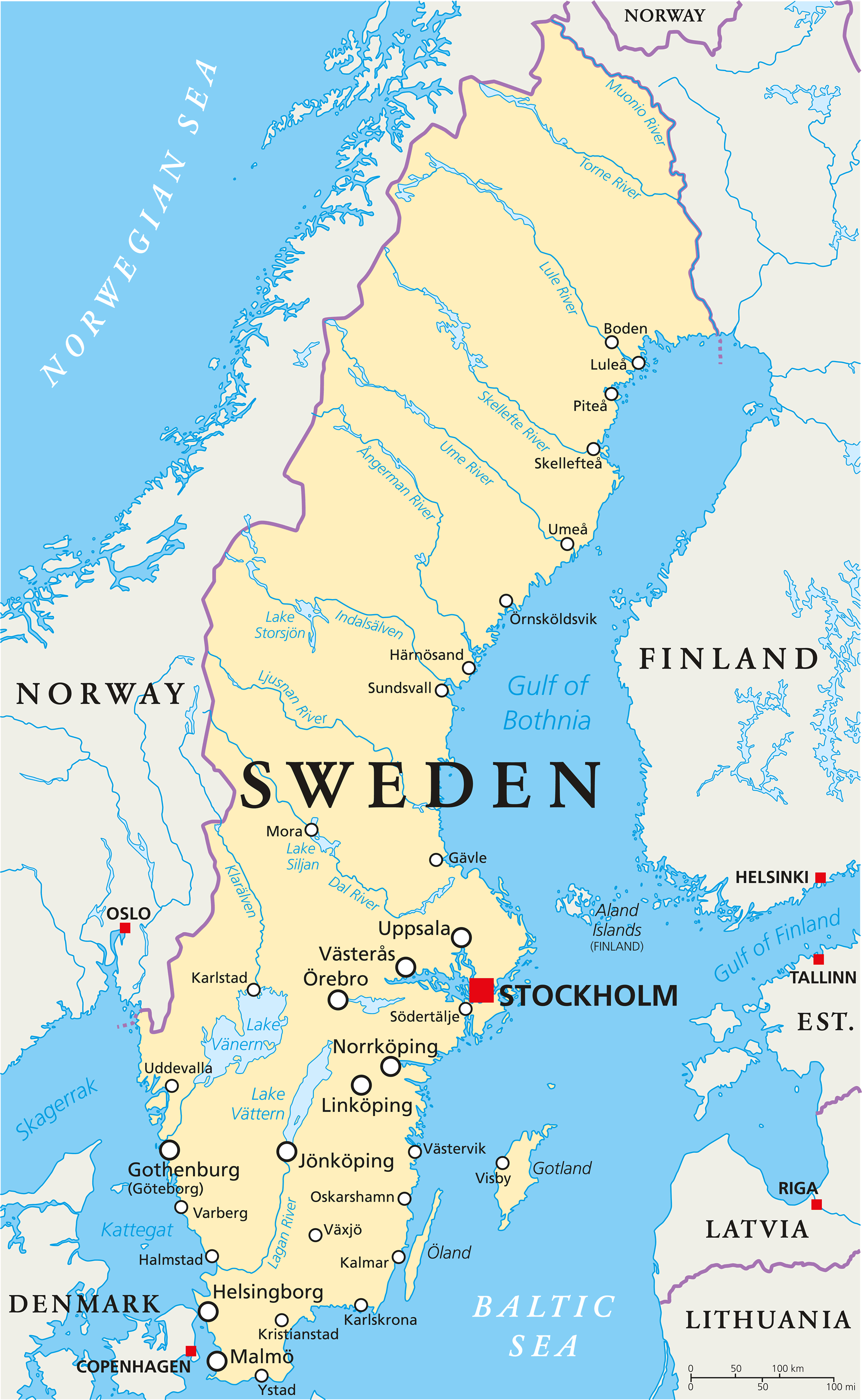 Sweden Political Map with capital Stockholm, national borders, important cities, rivers and lakes. English labeling and scaling.
Sweden Scandinavia Map
 Detailed Scandinavia map Vector political Scandinavia countries map.
Sweden Physical Map
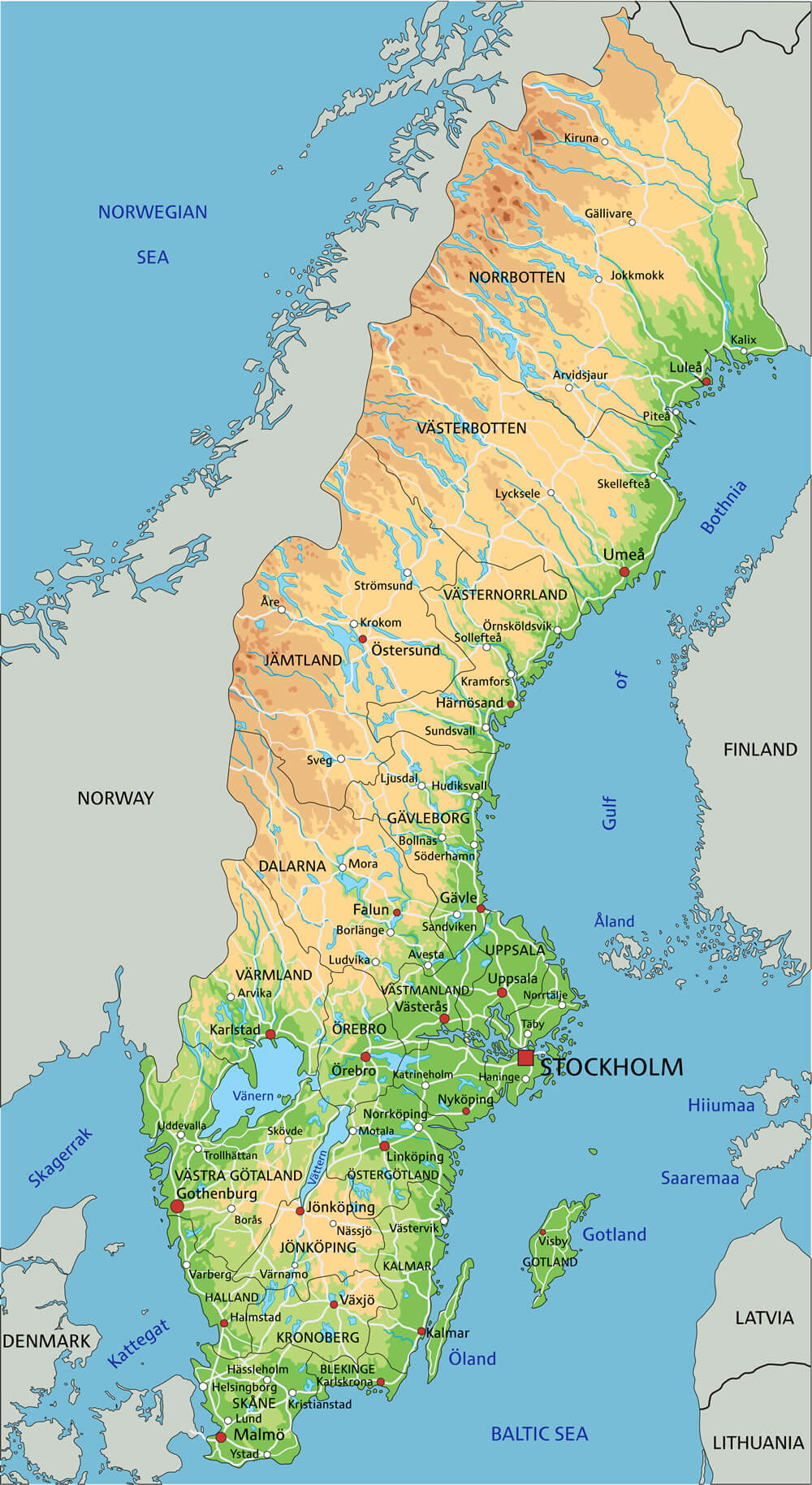 High detailed Sweden physical map with labeling.
Largest Cities' Map of Sweden
Boras Map Goteborg Map Helsingborg Map Jonkopin Map Linkoping Map Lund Map Malmo Map Norrkoping Map Orebro Map Stockholm Map Umea Map Uppsala Map Vasteras MapCopyright GuideofTheWorld.Net 2006 - 2026. All rights reserved. Privacy Policy | Disclaimer