
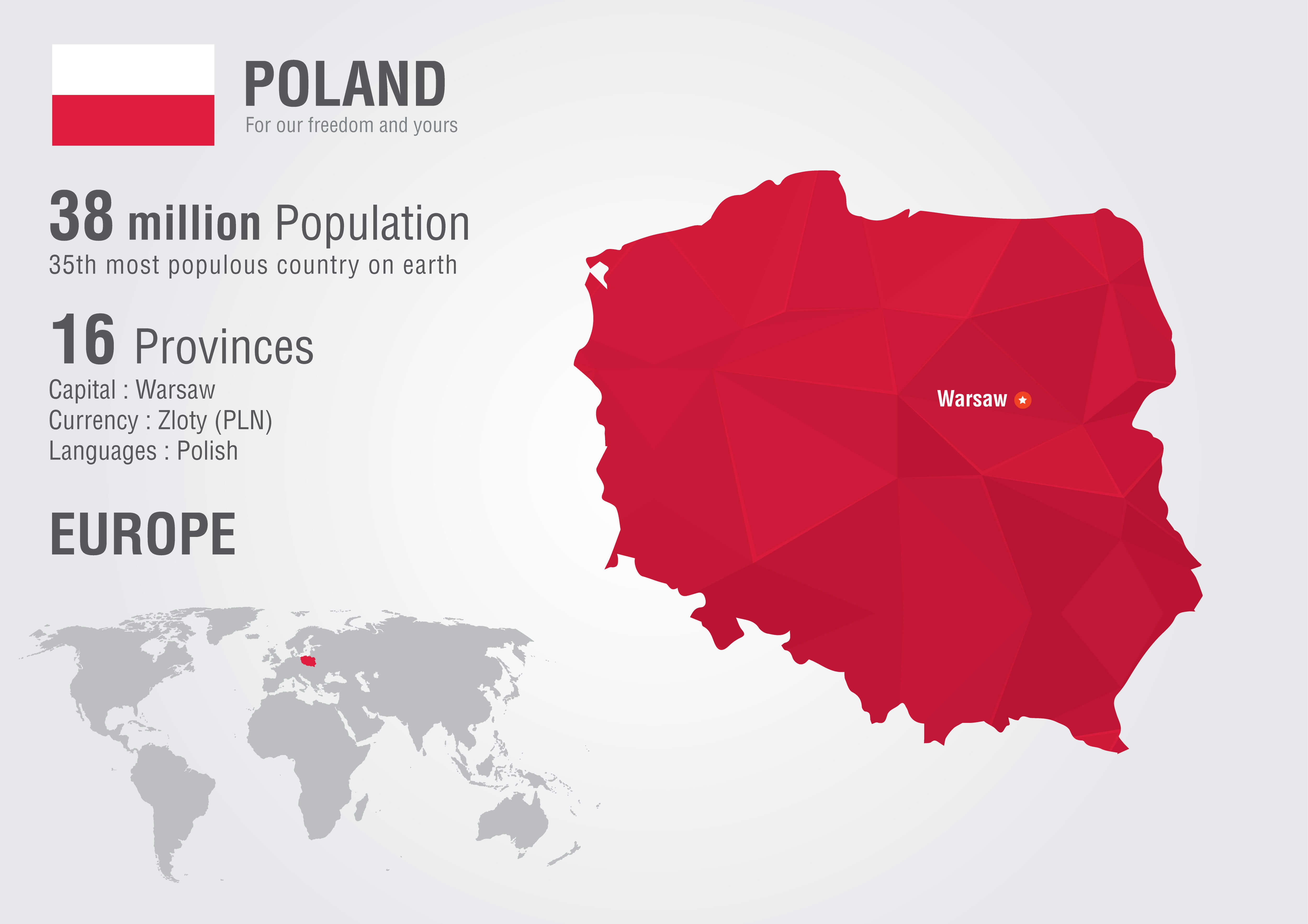
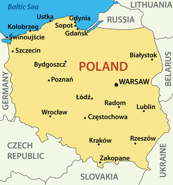
Poland Map
Navigate Poland map, satellite images of the Poland, states, largest cities, political map, capitals and physical maps.

- Capital : Warsaw
- Population : 38,186,860
- GDP : $513.821 billion
- Per Capita : $13,540
- Calling Code : +48
- Jobless Rate : 13.40%
- Time Zone : +1
Poland Shaded Relief Map
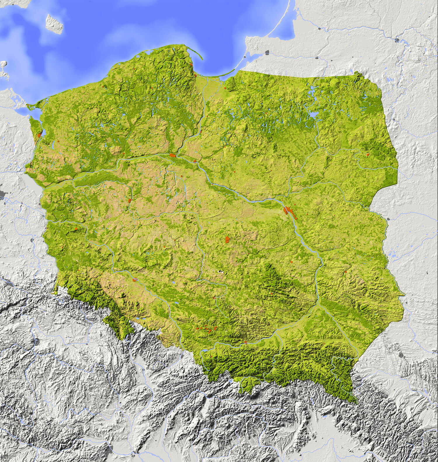 Poland Shaded relief map with major urban areas. Surrounding territory greyed out. Colored according to vegetation. Includes clip path for the state area.
Poland Relief Map
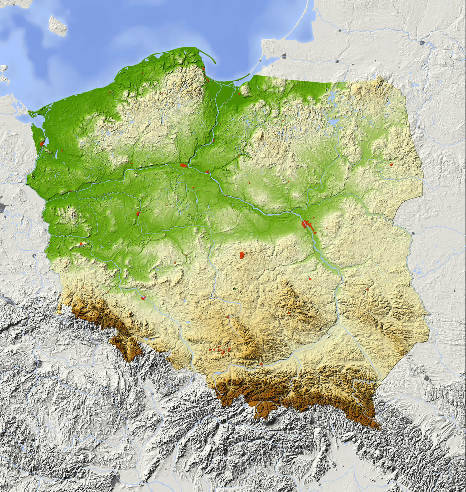 Poland relief map with major urban areas. Surrounding territory greyed out. Colored according to elevation. Includes clip path for the state area.
Color Map of Poland
 Abstract vector color map of Poland country.
Poland Statistics Map
 Poland statistics world map with a pixel diamond texture. World geography.
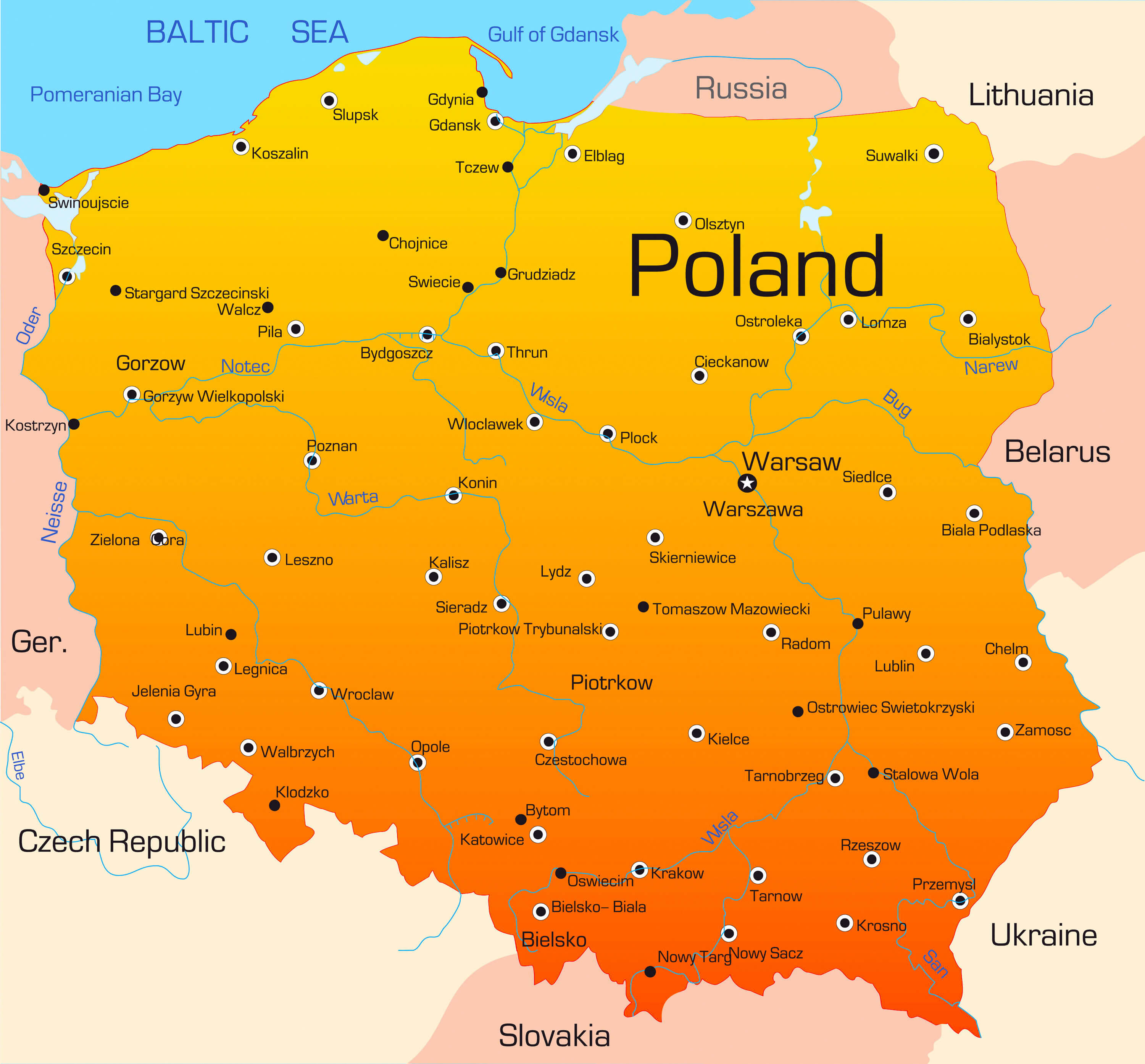
Poland Administrative Map
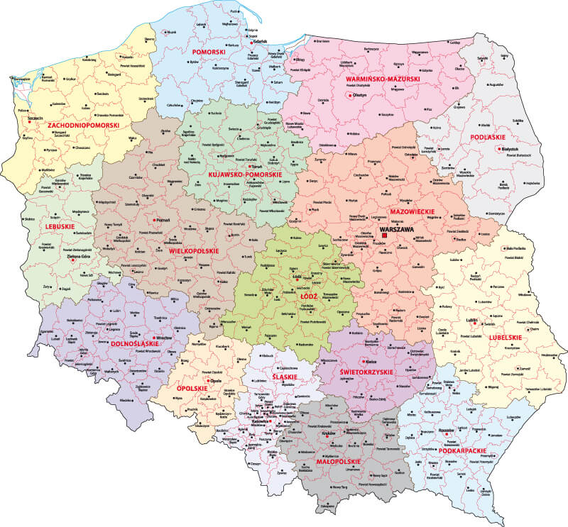 Poland Administrative Map with main cities and provinces.
Map of Poland with voivodships
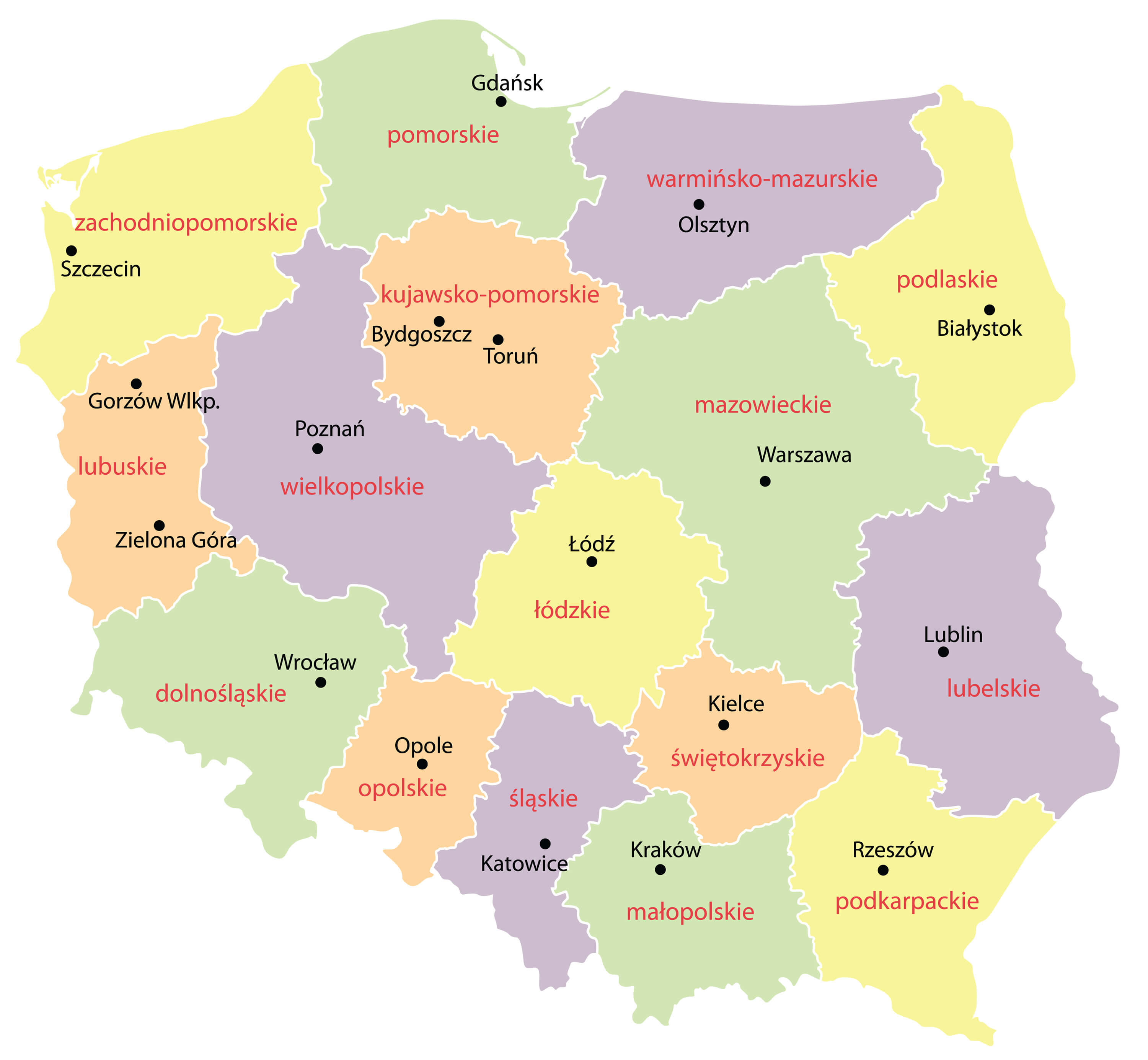 Map of Poland with voivodships (vector illustration).
Poland Political Map
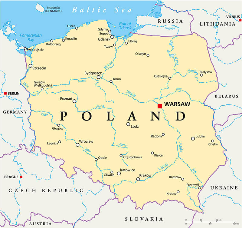 Poland Political Map with capital Warsaw, national borders, most important cities, rivers and lakes. English labeling and scaling.
Colorful Administrative Map of Poland
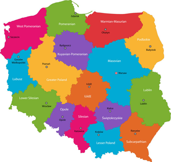 Vector color map of administrative divisions of Poland with capital cities.
Map of Poland
 Map of Poland - vector illustration.
Largest Cities' Map of Poland
Bialystok Map Bydgoszcz Map Czestochowa Map Gdansk Map Katowice Map Kielce Map Krakow Map Lodz Map Lublin Map Poznan Map Radom Map Sosnowiec Map Szczecin Map Torun Map Warsaw Map Wroclaw MapCopyright GuideofTheWorld.Net 2006 - 2026. All rights reserved. Privacy Policy | Disclaimer