
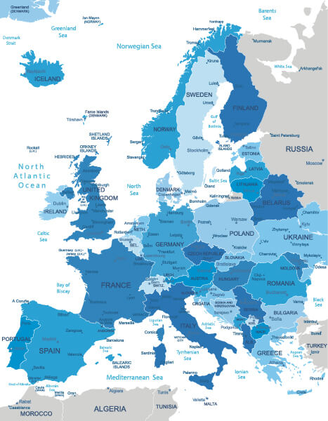
Norway Map
Navigate Norway map, satellite images of the Norway, states, largest cities, political map, capitals and physical maps.
- Capital : Oslo
- Population : 5,033,675
- GDP : $483.650 billion
- Per Capita : $97,254
- Calling Code : +47
- Jobless Rate : 3.50%
- Time Zone : +1
Map of Norway with Sweden and Denmark (1886 - 1891)
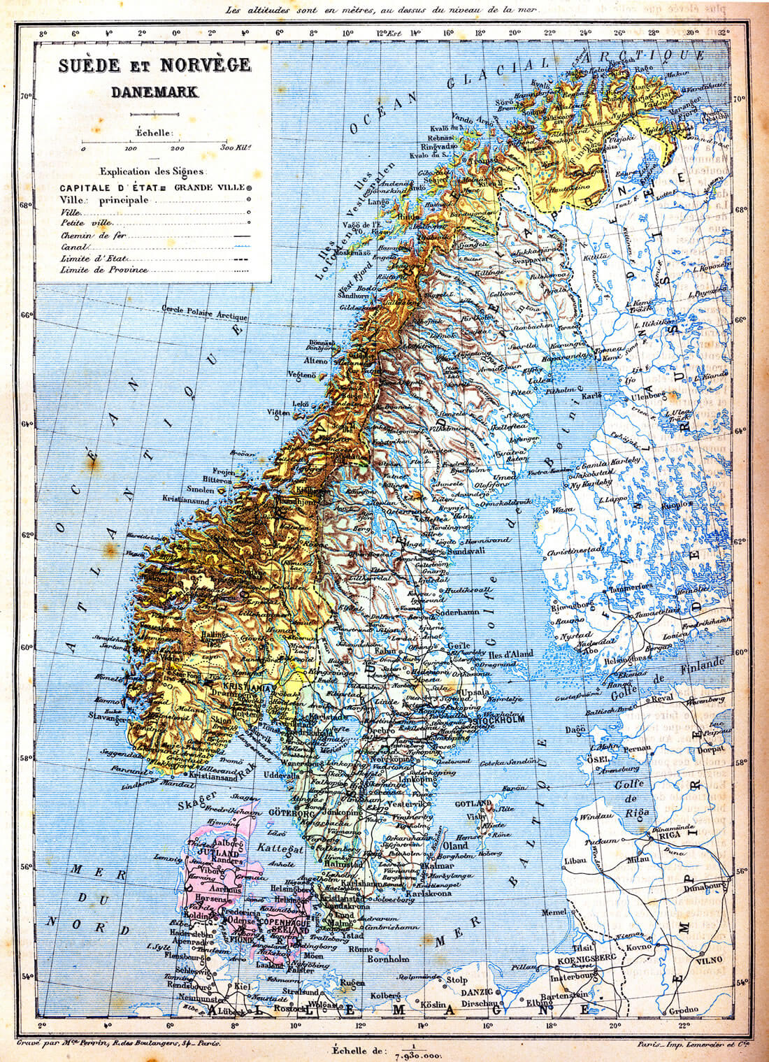 The map of Sweden, Norway and Denmark with explanation of signs on it. Old vintage map from the late 19th century, Trousset encyclopedia (1886 - 1891).
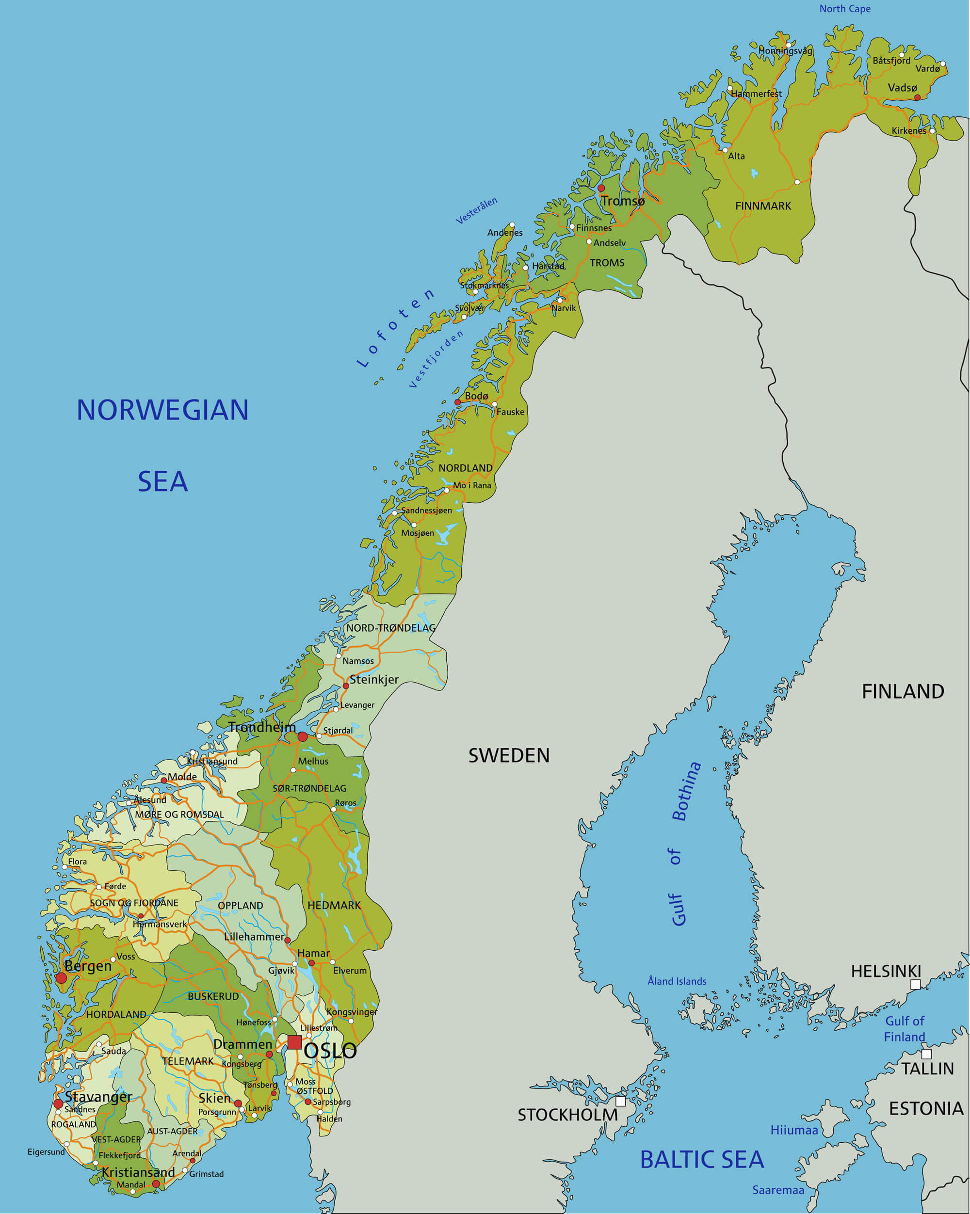
Norway Political Map
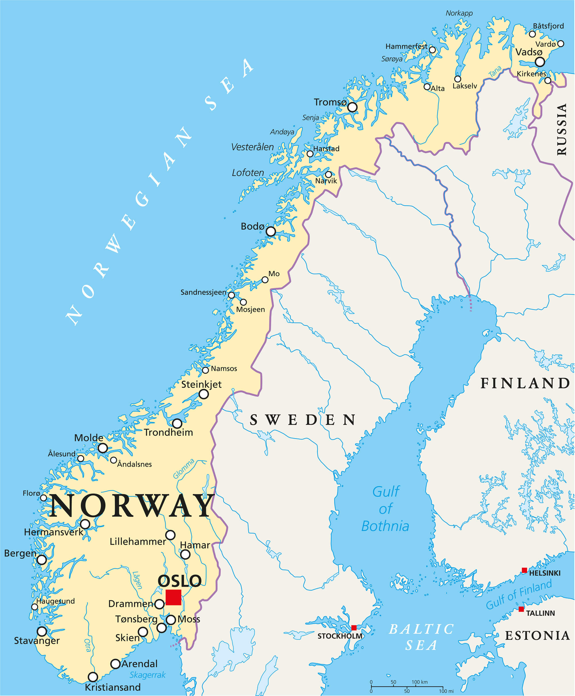 Norway Political Map with capital Oslo, national borders, important cities, rivers and lakes. English labeling and scaling.
Norway Map with Earth, Europe, Scandinavia
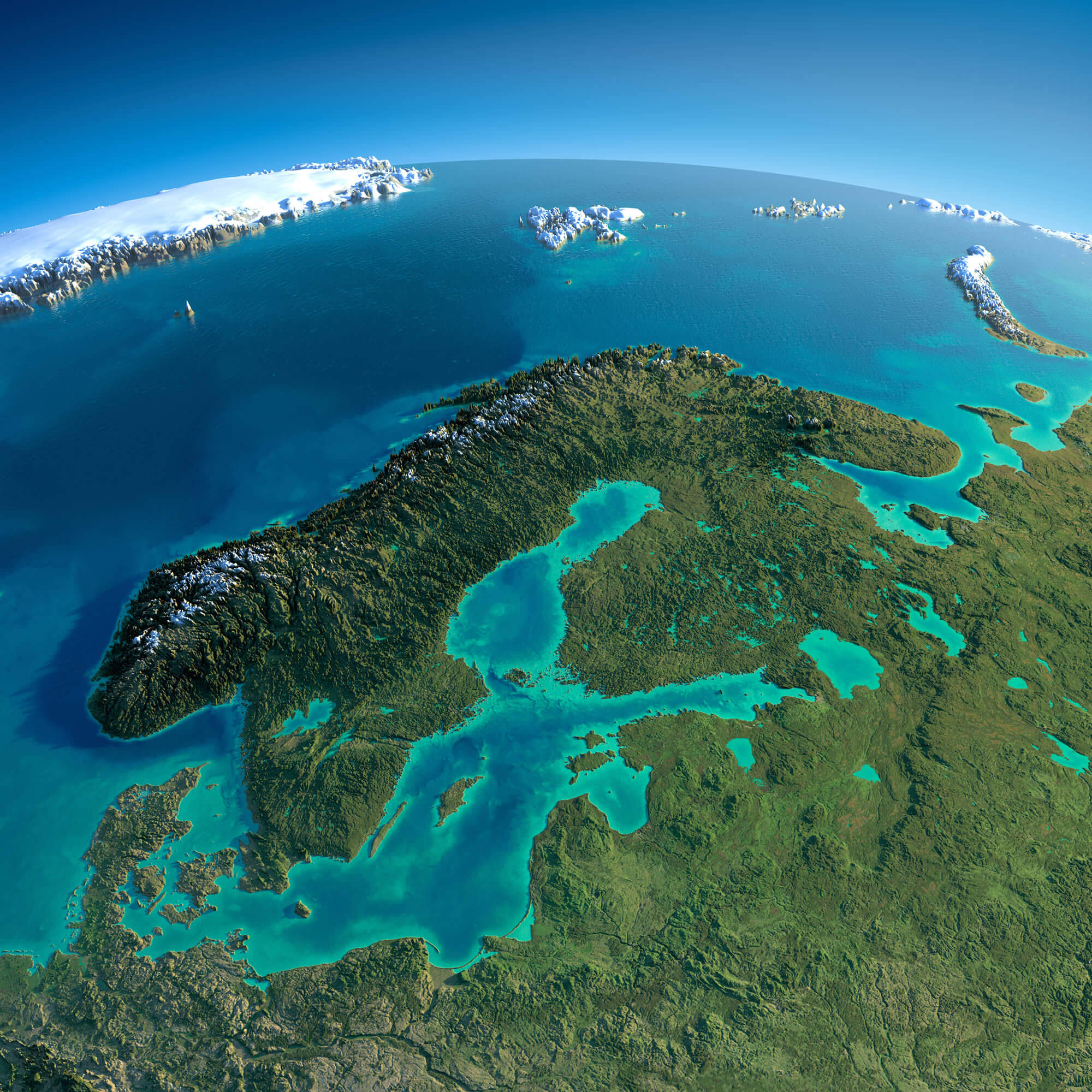 Highly detailed planet Earth in the morning. Exaggerated precise relief lit morning sun. Detailed Norway Map with Earth, Europe, Scandinavia. Elements of this image furnished by NASA.
Norway Shaded Relief Map
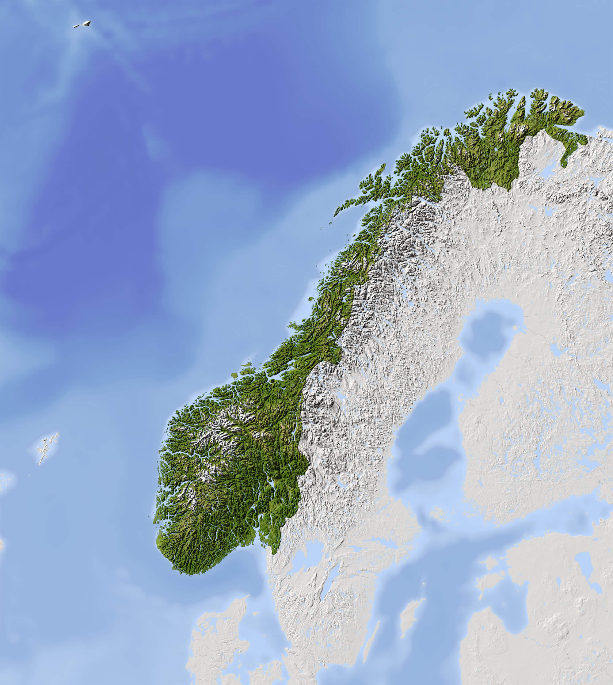 Norway Shaded relief map. Surrounding territory greyed out. Colored according to vegetation. Includes clip path for the state area.
Norway Satellite Map
 Norway Satellite Map, Night planet Earth with precise detailed relief and city lights illuminated by moonlight Europe, Scandinavia.
Political Map of Norway
 Highly detailed editable political map of Norway with separated layers.
Vector Map of Norway, Europe
 Vector Map of Norway, Europe map colored by countries with regions borders. Navigation, location and travel icons collection.
Map of Norway
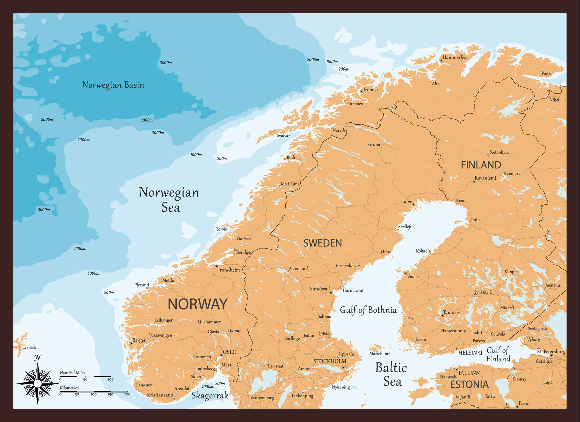 Map of Norway and the sea depths in layers, Sweden, Norway, Estonia.
Norway Europa Detailed Map
 Norway Europa highly detailed map. All elements are separated in editable layers clearly labeled.
Norway Map with Main Cities
 Norway Map with Main Cities, Sweden, Finland and Estonia national borders.
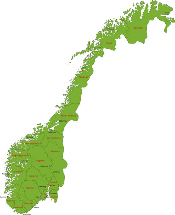
Norway Administrative Map
 Map of administrative divisions of Norway with the capital cities.
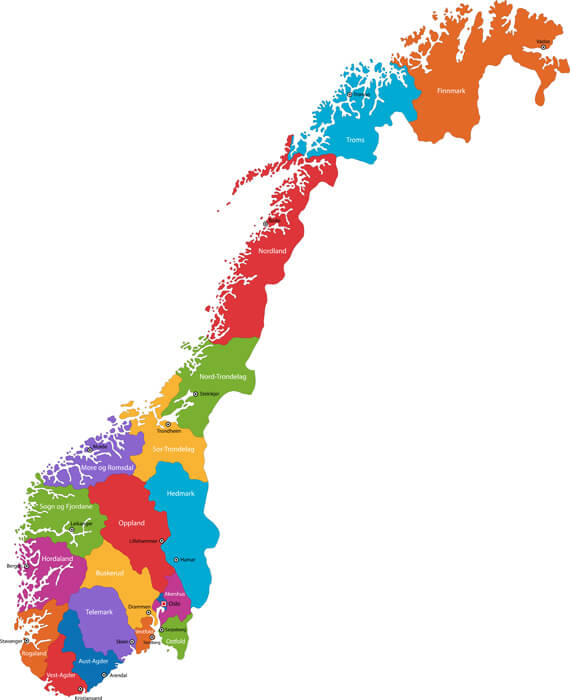
Norway Regions Map
 Map of administrative and regional divisions of Norway.
Administrative Map of Norway
 Norway administrative map with major cities.
Largest Cities' Map of Norway
Oslo Map Bergen Map Trondheim Map Stavanger Map Baerum Map Kristiansand Map Fredrikstad Map Tromso Map Sandnes Map Skien Map Drammen Map Sarpsborg Map Bodo Map Sandefjord Map Alesund Map Larvik Map Arendal Map Tonsberg Map Porsgrunn Map Haugesund Map Hamar Map Moss Map Halden Map Gjovik Map Lillehammer Map Horten Map Molde Map Kongsberg Map Harstad Map Kristiansund Map Steinkjer Map Grimstad Map Narvik Map Kongsvinger Map Honefoss Map Mandal Map Egersund Map Namsos Map Notodden Map Holmestrand Map Farsund Map Hammerfest Map Flekkefjord Map Floro Map Risor Map Vadso Map Vardo MapCopyright GuideofTheWorld.Net 2006 - 2026. All rights reserved. Privacy Policy | Disclaimer