
Map North Korea
Navigate North Korea map, satellite images of the North Korea, states, largest cities, political map, capitals and physical maps.
- Capital : Pyongyang
- Population : 24,554,000
- GDP : $32.7 billion
- Per Capita : $1,800
- Calling Code : +850
- Jobless Rate : N/a
- Time Zone : +9
A Collection of North Korea Maps
North Korea Relief Map
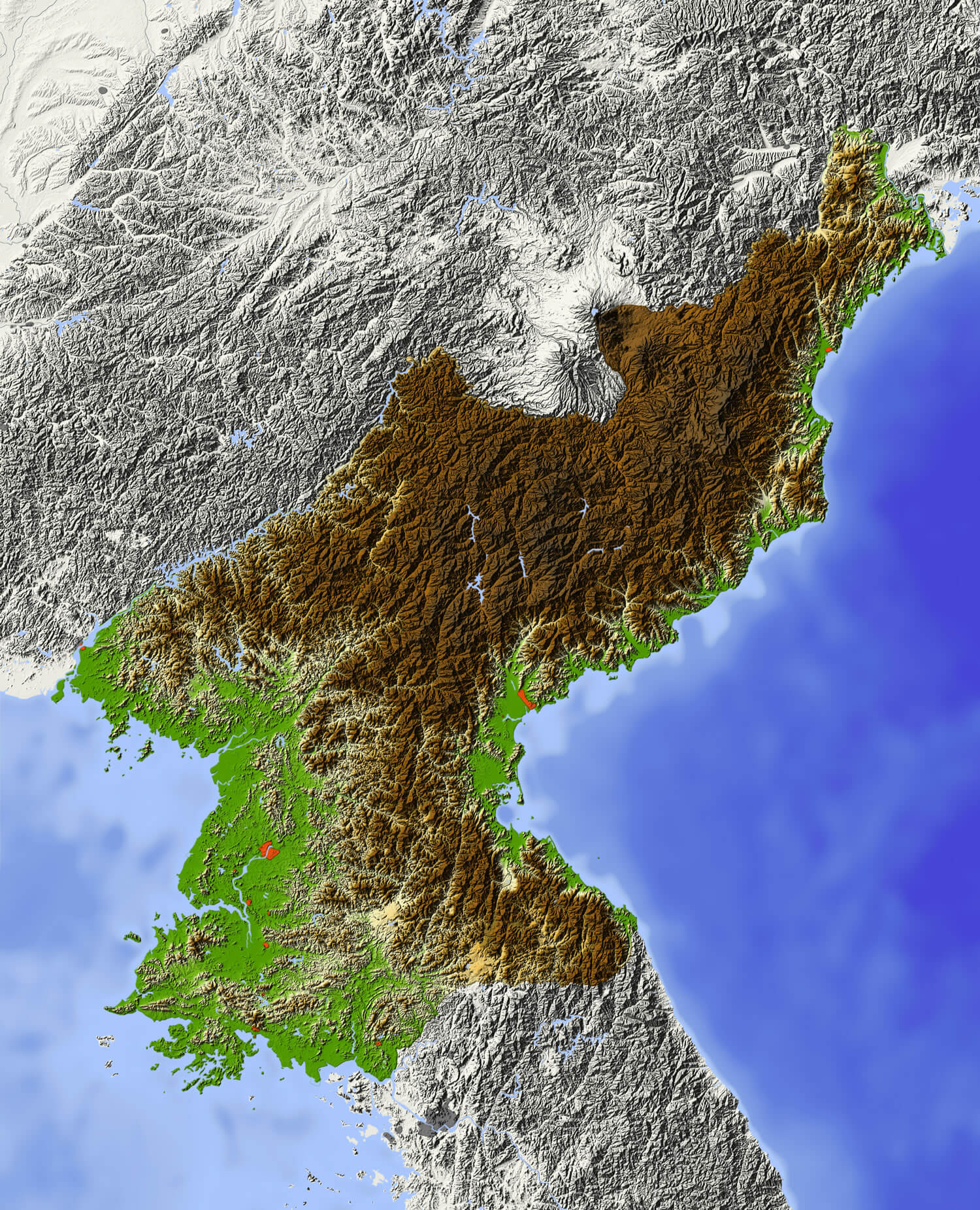 North Korea Shaded relief map, with major urban areas. Surrounding territory greyed out. Colored according to elevation. Includes clip path for the state area.
Democratic People's Republic of Korea Map
 Democratic People's Republic of Korea - vector map.
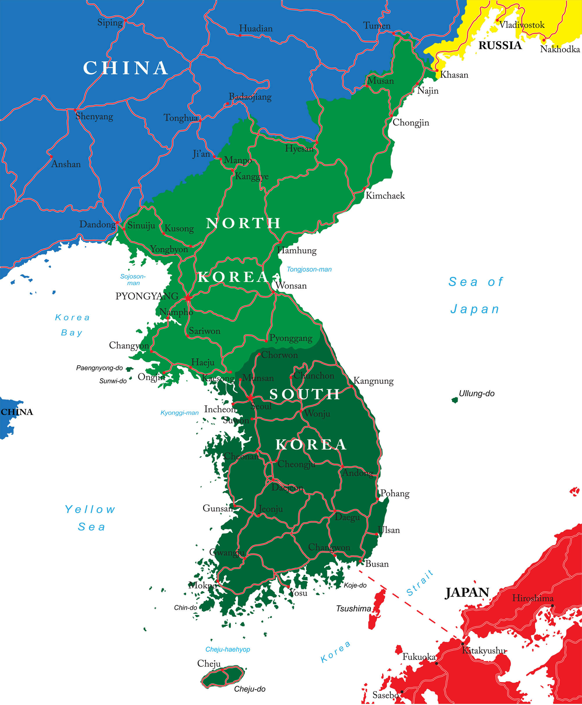
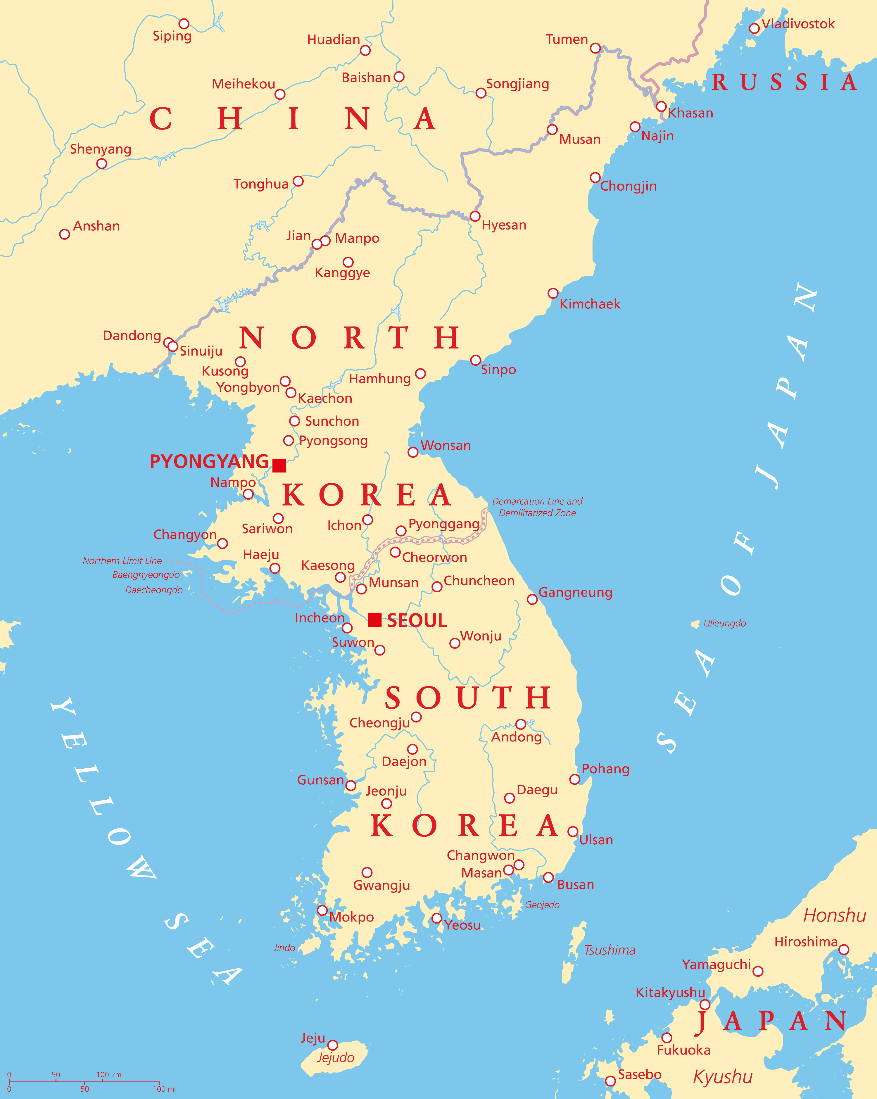
Japan and the Korean Peninsula Map
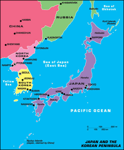 Japan and the Korean Peninsula Map, North Korea and South Korea.
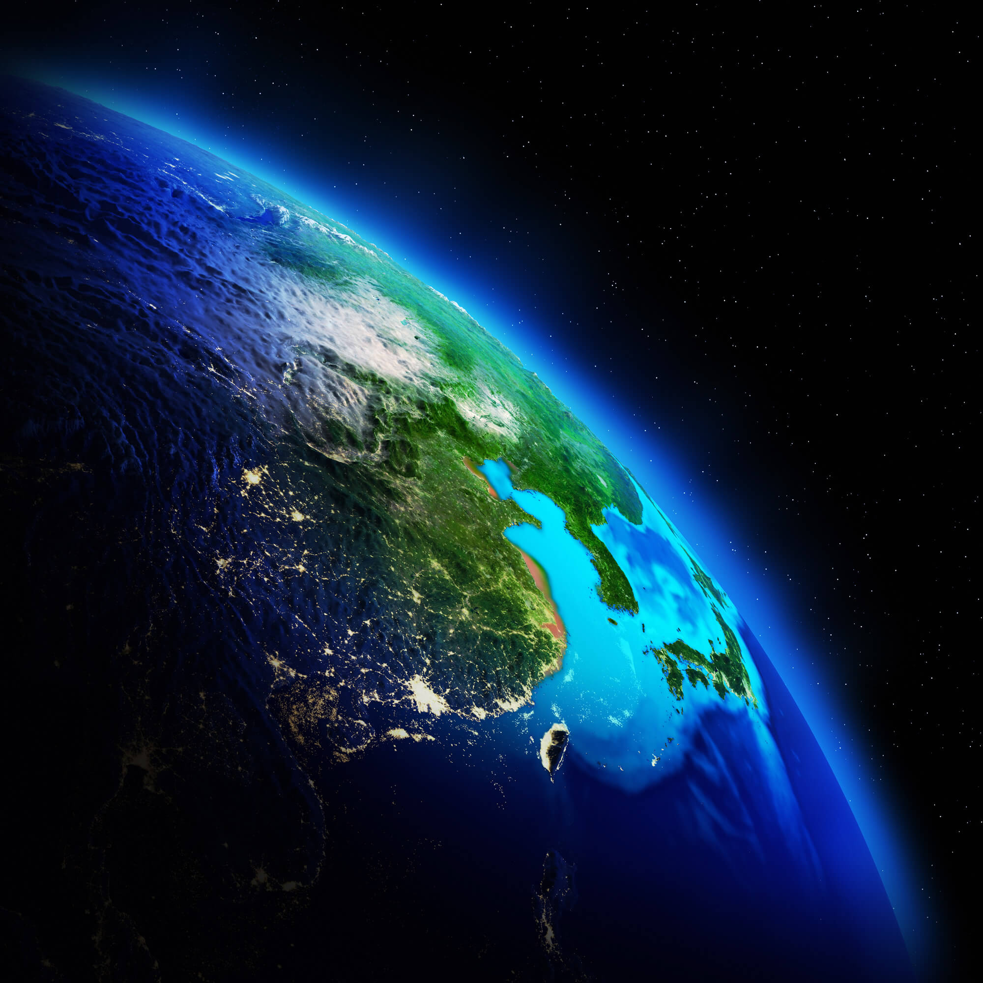
North Korea Earth Map
 Highly detailed Earth, illuminated by moonlight. The glow of cities sheds light on the detailed exaggerated terrain and translucent water of the oceans.
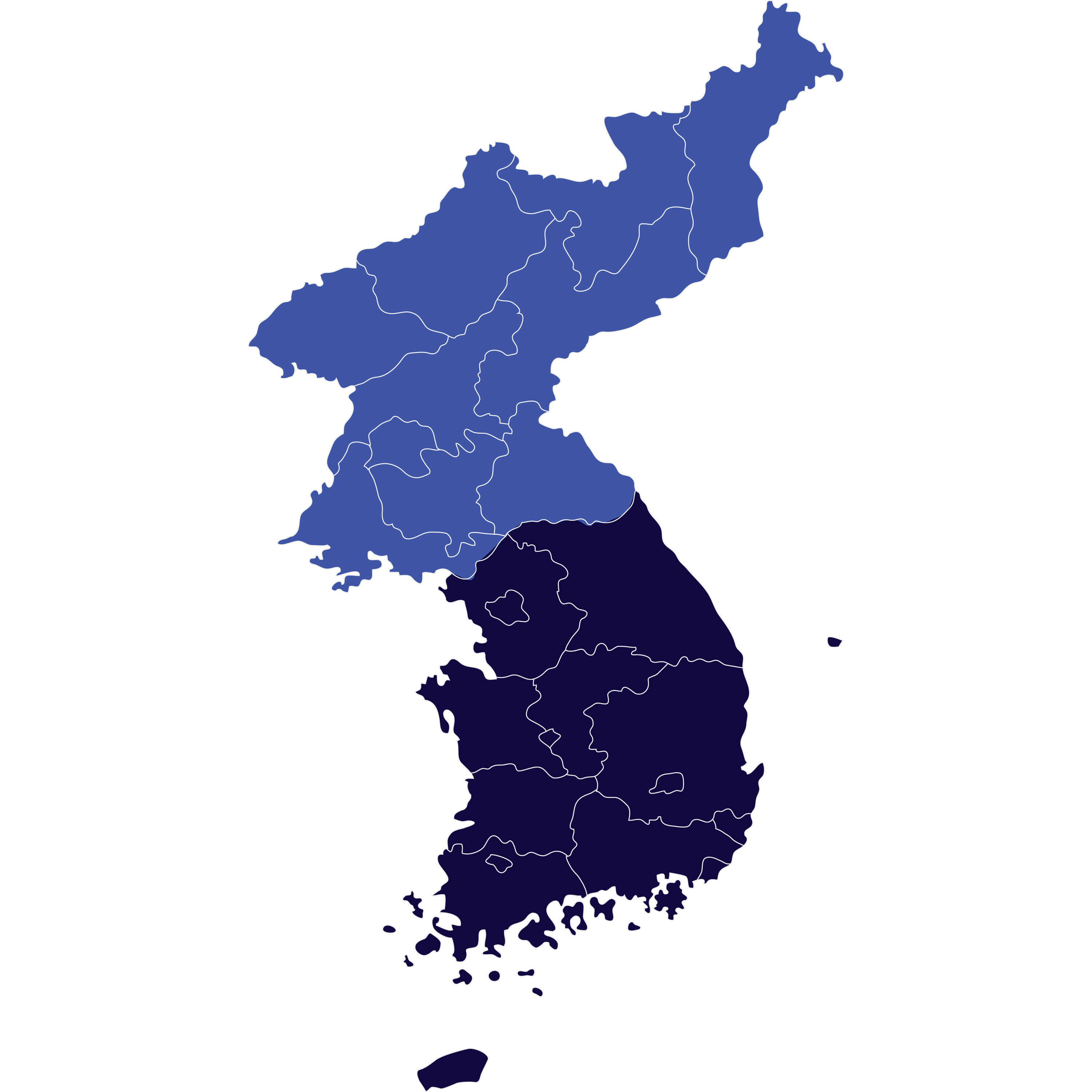
South and North Korea Map
 South and North Korea map.
Korean Peninsula Map
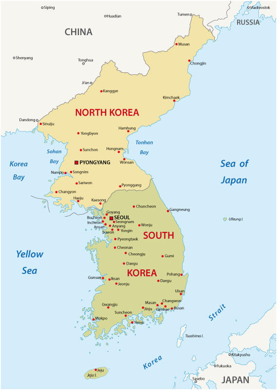 Korean peninsula map, Noth Korea and South Korea major cities.
North Korea Administrative Map
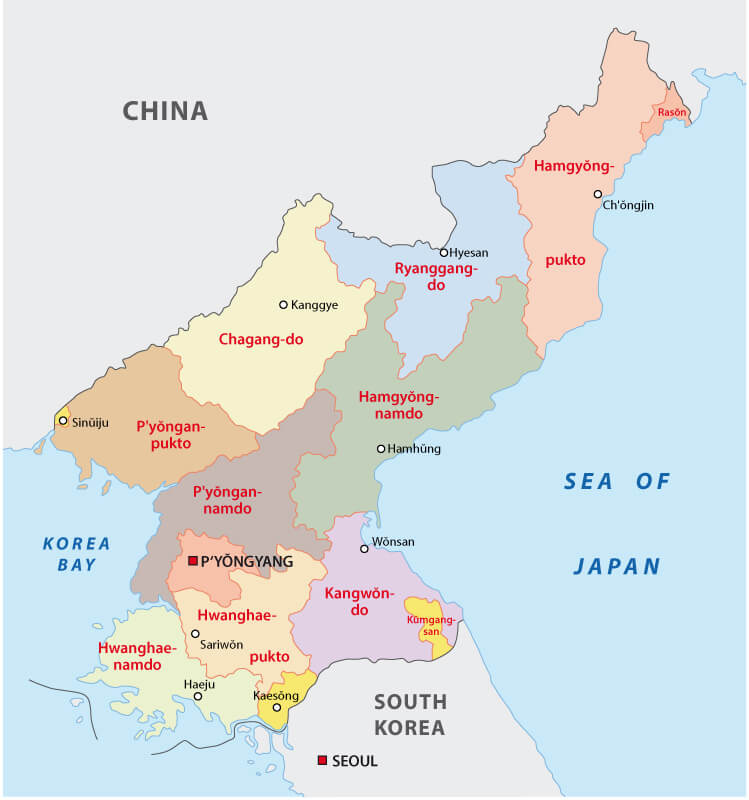 North Korea Administrative Map with regions.
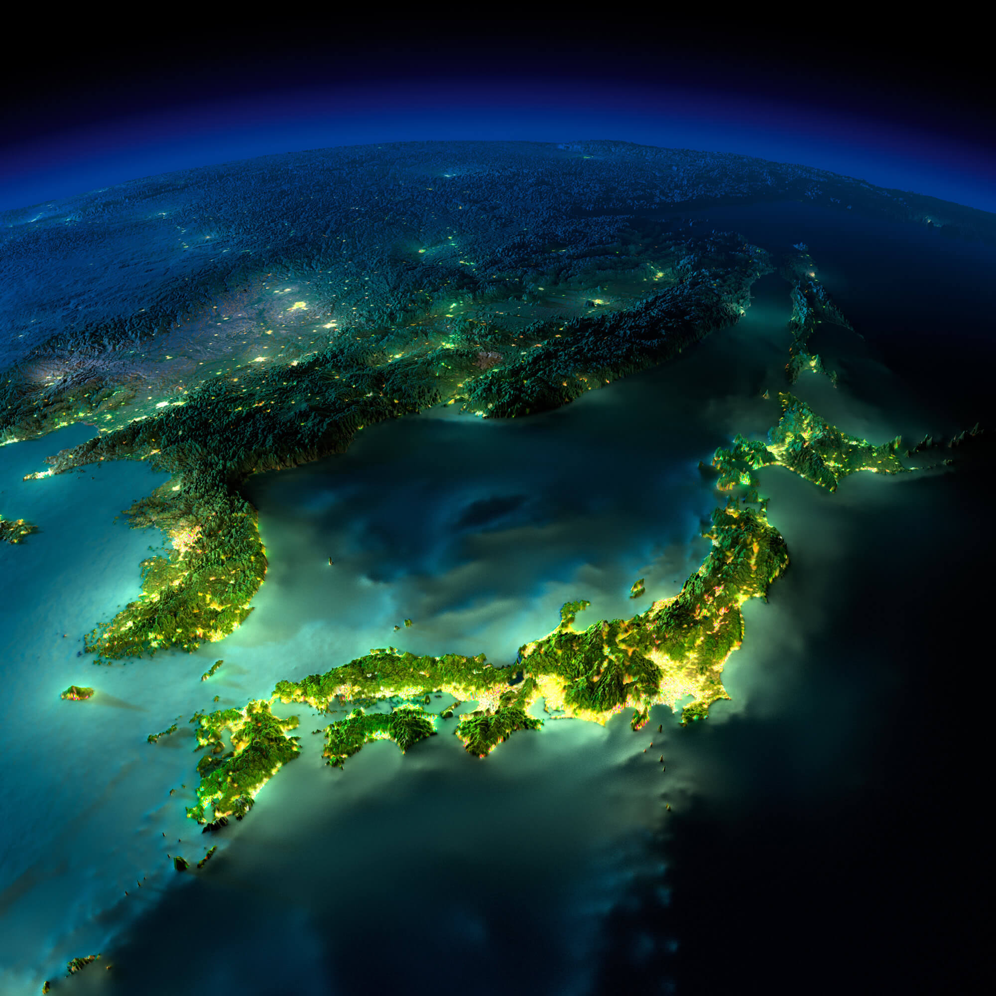
Korea and Japan Satellite Map
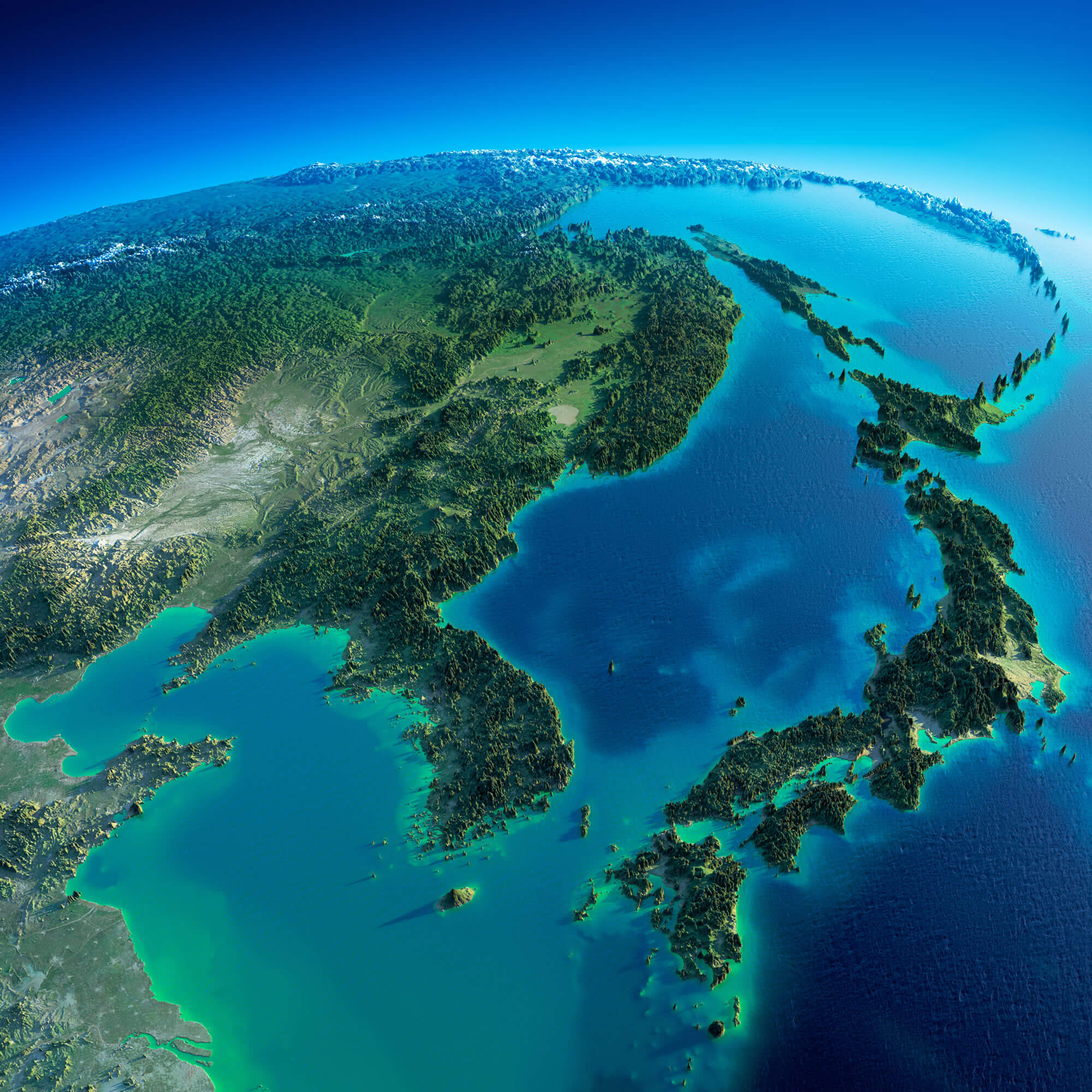 Highly detailed planet Earth in the morning. Exaggerated precise relief lit morning sun. Detailed Earth. Korea and Japan.
Korea Blank Map
 Korea Peninsula Blank Map, South Korea and North Korea.
Japan Korea Map
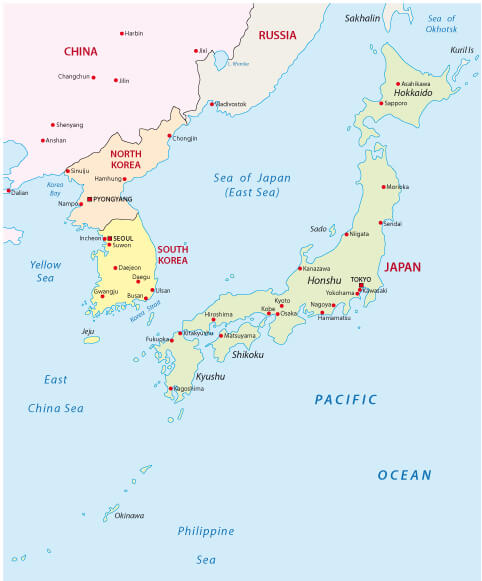 Japan Korea Map with major cities.
North Korea Planet Night Map
 North Korea Planet night map. Elements of this image furnished by NASA.
North Korea Asia Map
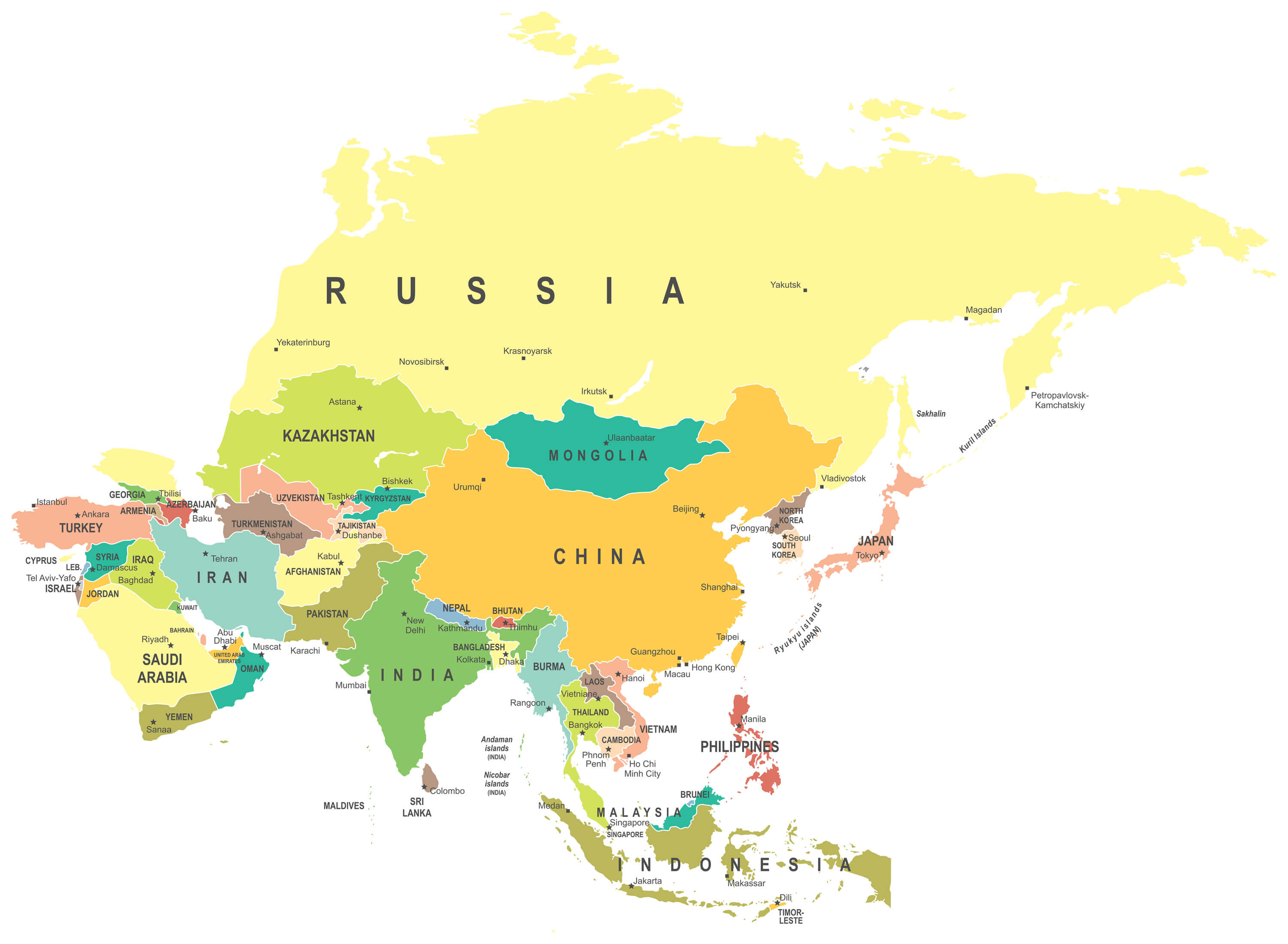 North Korea Asia map - highly detailed vector illustration.
Korean peninsula political Map
 Korean peninsula political map with North and South Korea and the capitals Pyongyang and Seoul, national borders, important cities, rivers and lakes. English labeling and scaling.
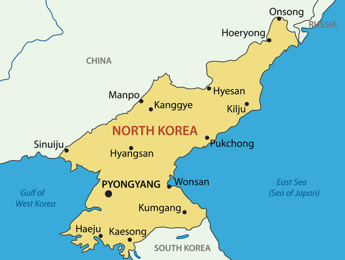
North Korea Map with flag
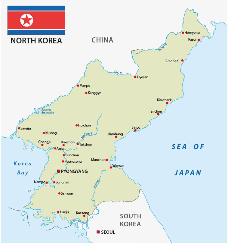 North Korea map with flag capital city of Pyongyang and main cities.
North Korea from Earth
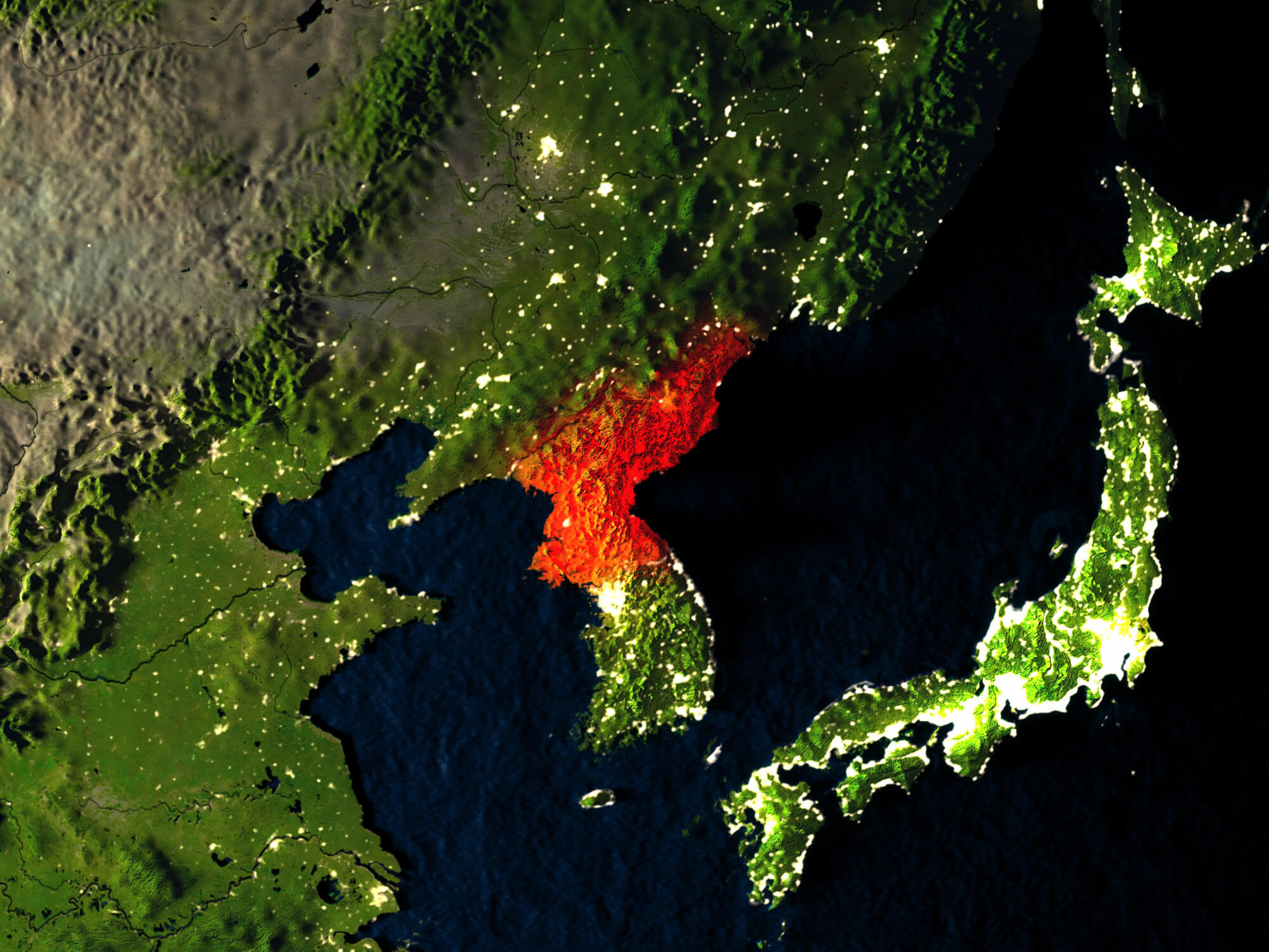 North Korea in red at night as seen from Earth's orbit in space. 3D illustration with highly detailed realistic planet surface.
North Korea Map landmass texture
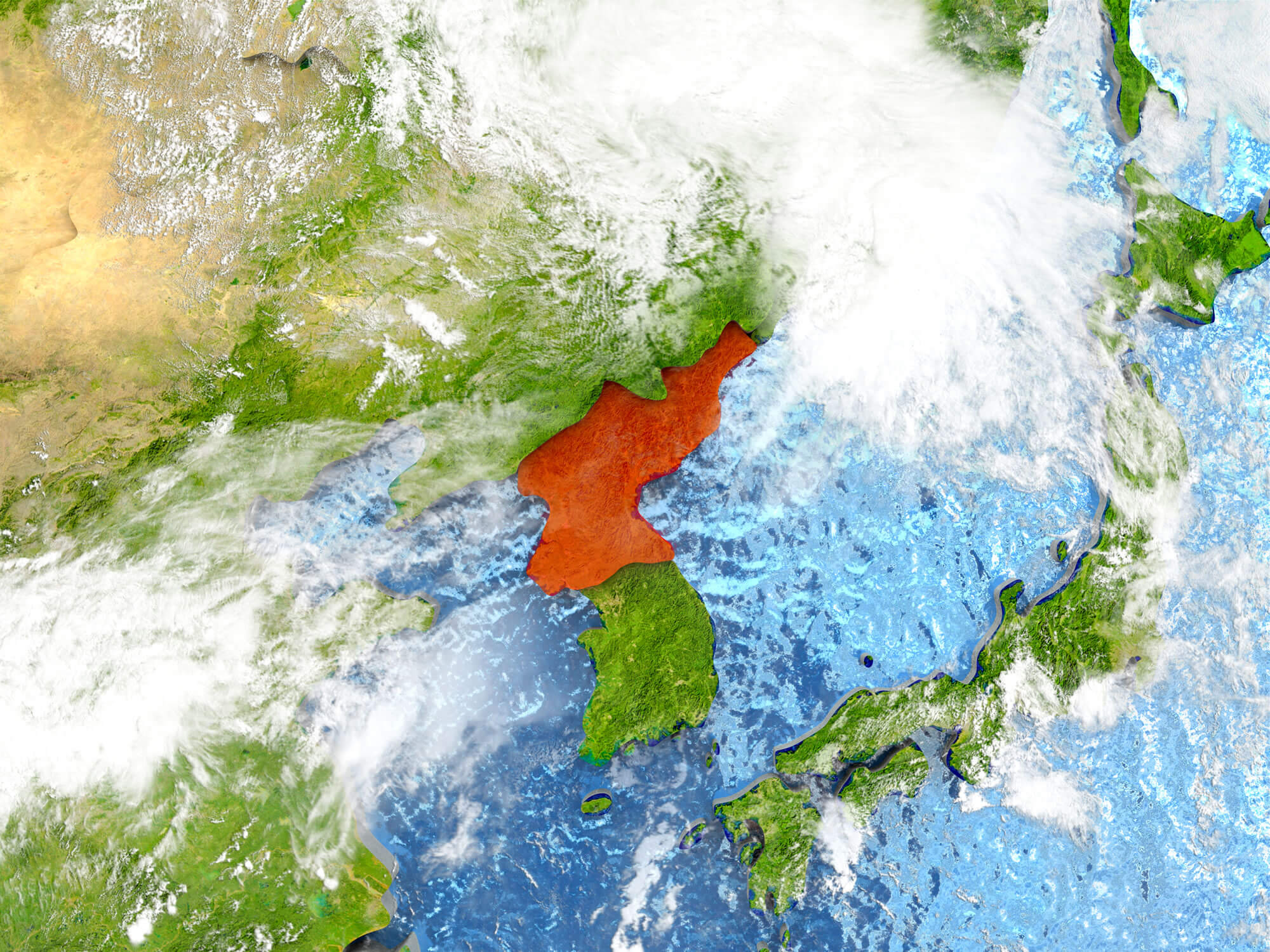 North Korea in red on map with detailed landmass texture, realistic watery oceans and clouds above the surface. 3D illustration. Elements of this image furnished by NASA.
Satellite Map of North Korea
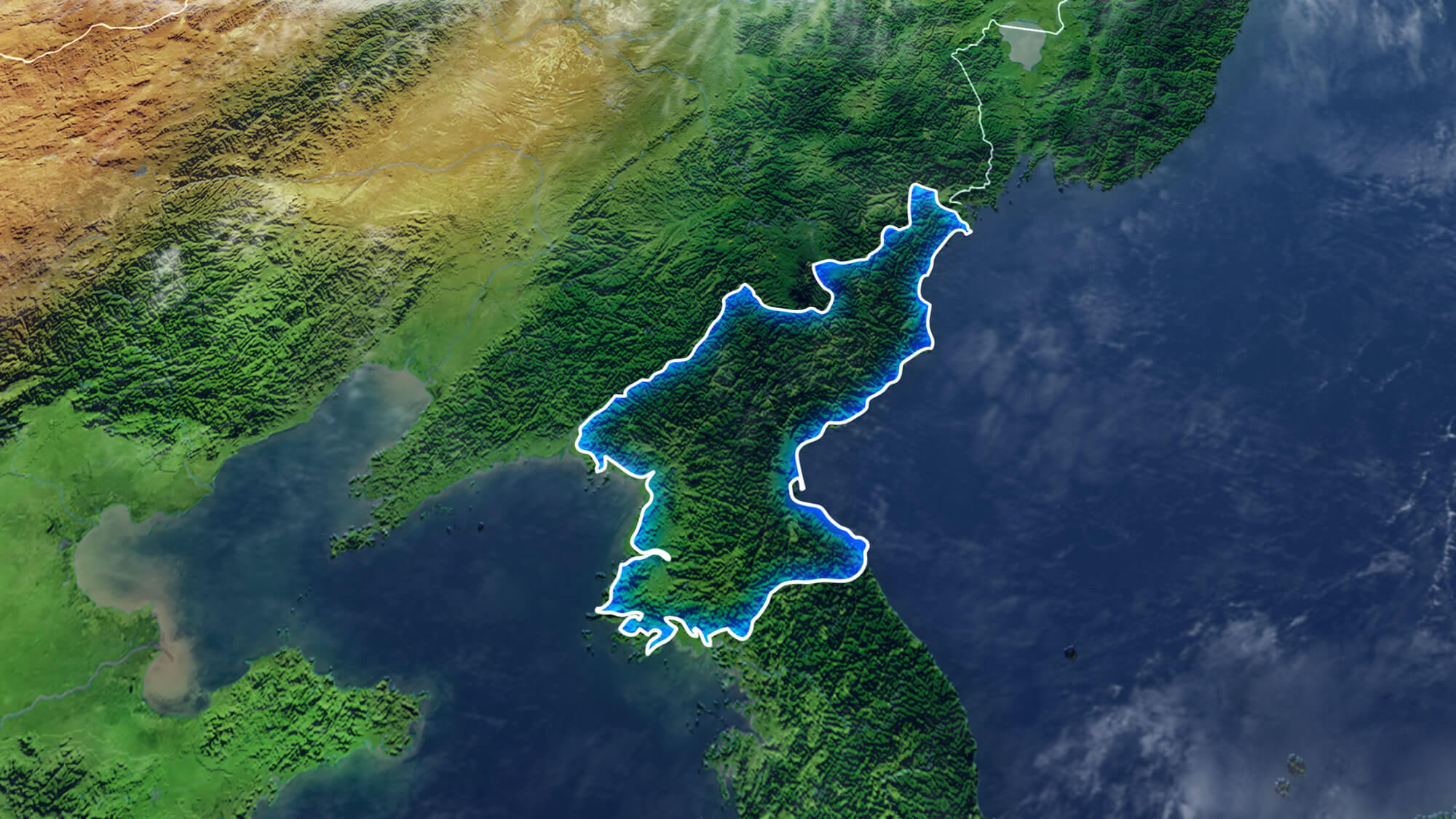 Map Of NORTH KOREA Elements of this image furnished by NASA 3D rendering 3D illustration.
Copyright GuideofTheWorld.Net 2006 - 2026. All rights reserved. Privacy Policy | Disclaimer