
Map Italy
Navigate Italy map, satellite images of the Italy, states, largest cities, political map, capitals and physical maps.

- Capital : Rome
- Population : 60,813,326
- GDP : $1.980 trillion (8th)
- Per Capita : $32,522 (24th)
- Calling Code : +39
- Jobless Rate : 11.20%
- Time Zone : +1
A Collection of Italy Maps
Italy Satellite Map
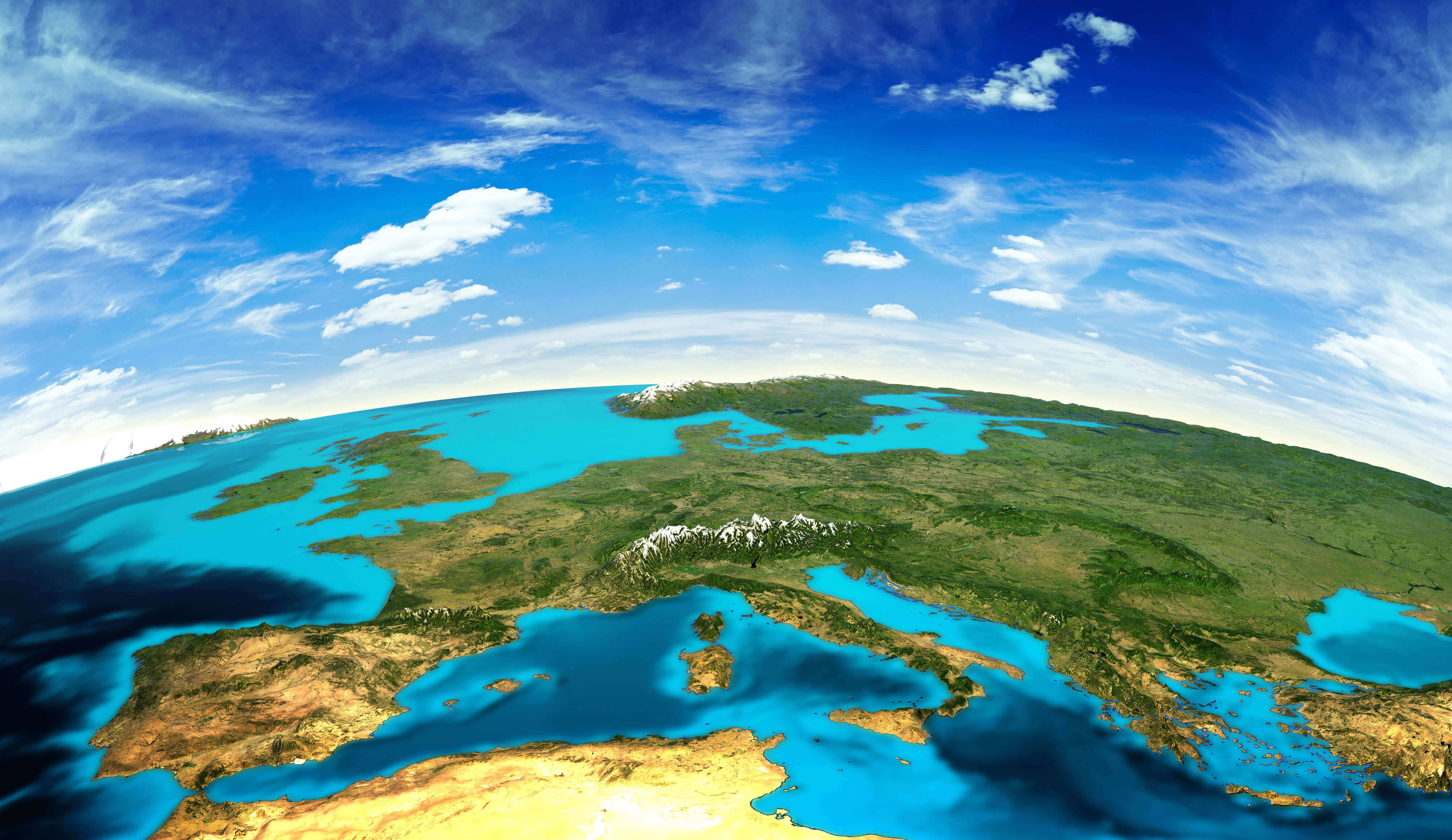 Europe landscape from space, Italy Satellite Image and Mediterranean region.
Map of Italy, the time of Emperor Augustus
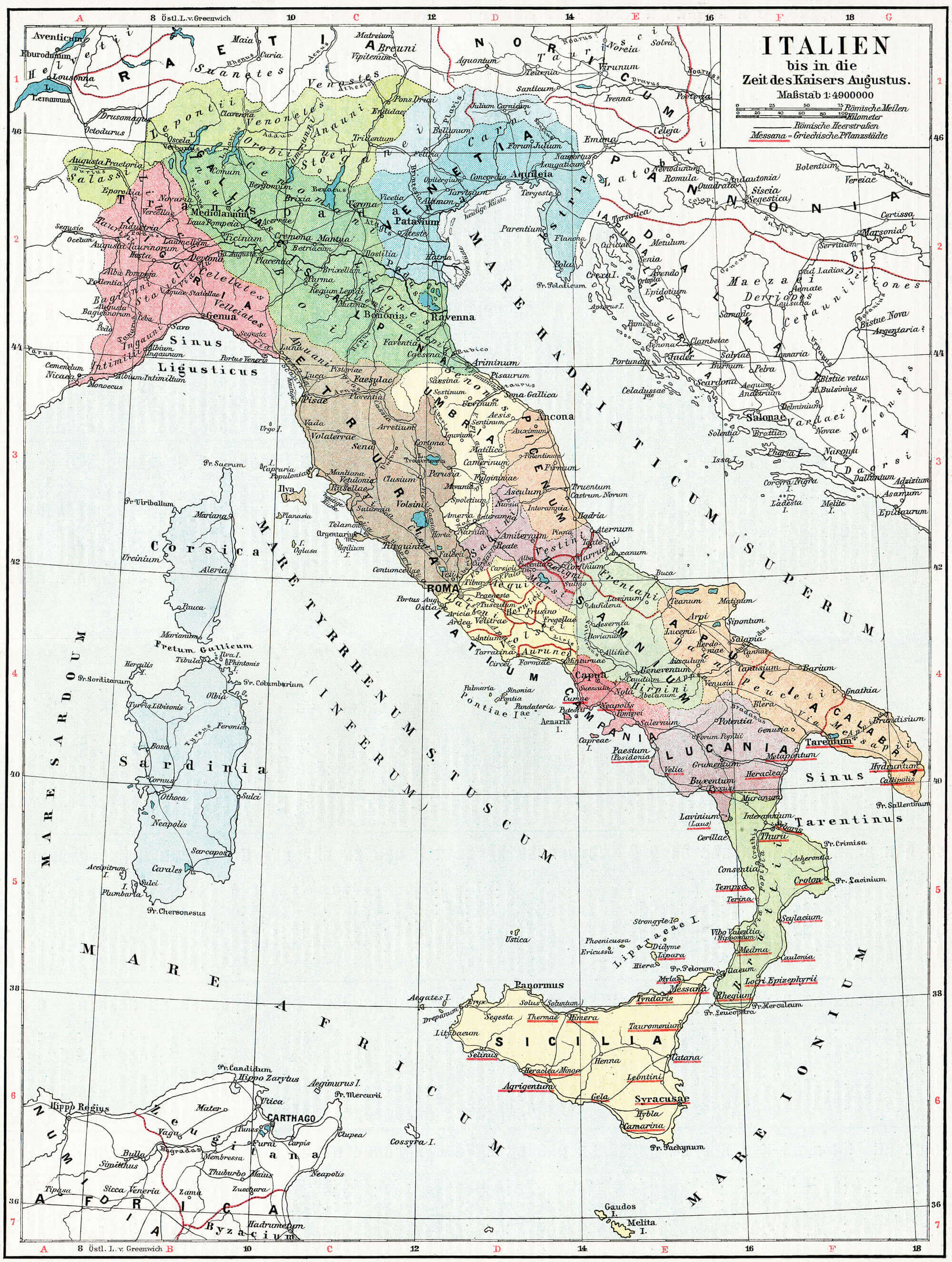 Map of Italy, the time of Emperor Augustus. Publication of the book "Meyers Konversations-Lexikon", Volume 7, Leipzig, Germany, 1910
Map of Italy
 Map of Italy and main cities.
Map of Italy, drawn with ink on paper.
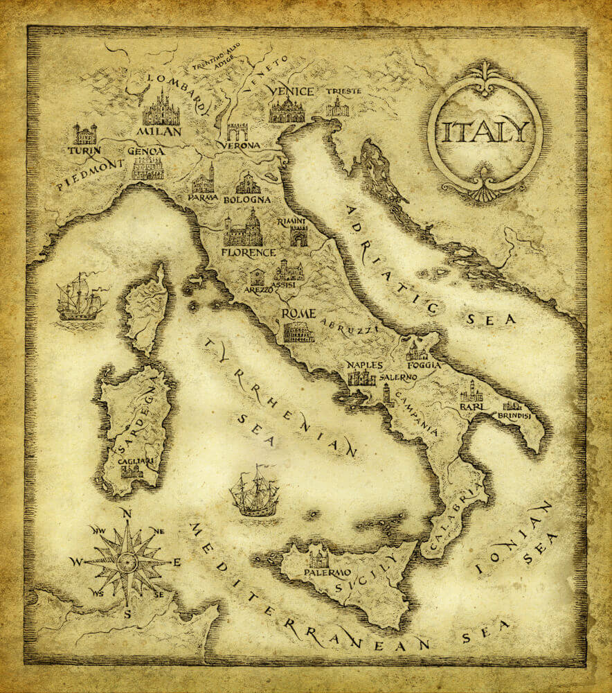 Map of Italy, drawn with ink on paper.
Italy map with vector icons
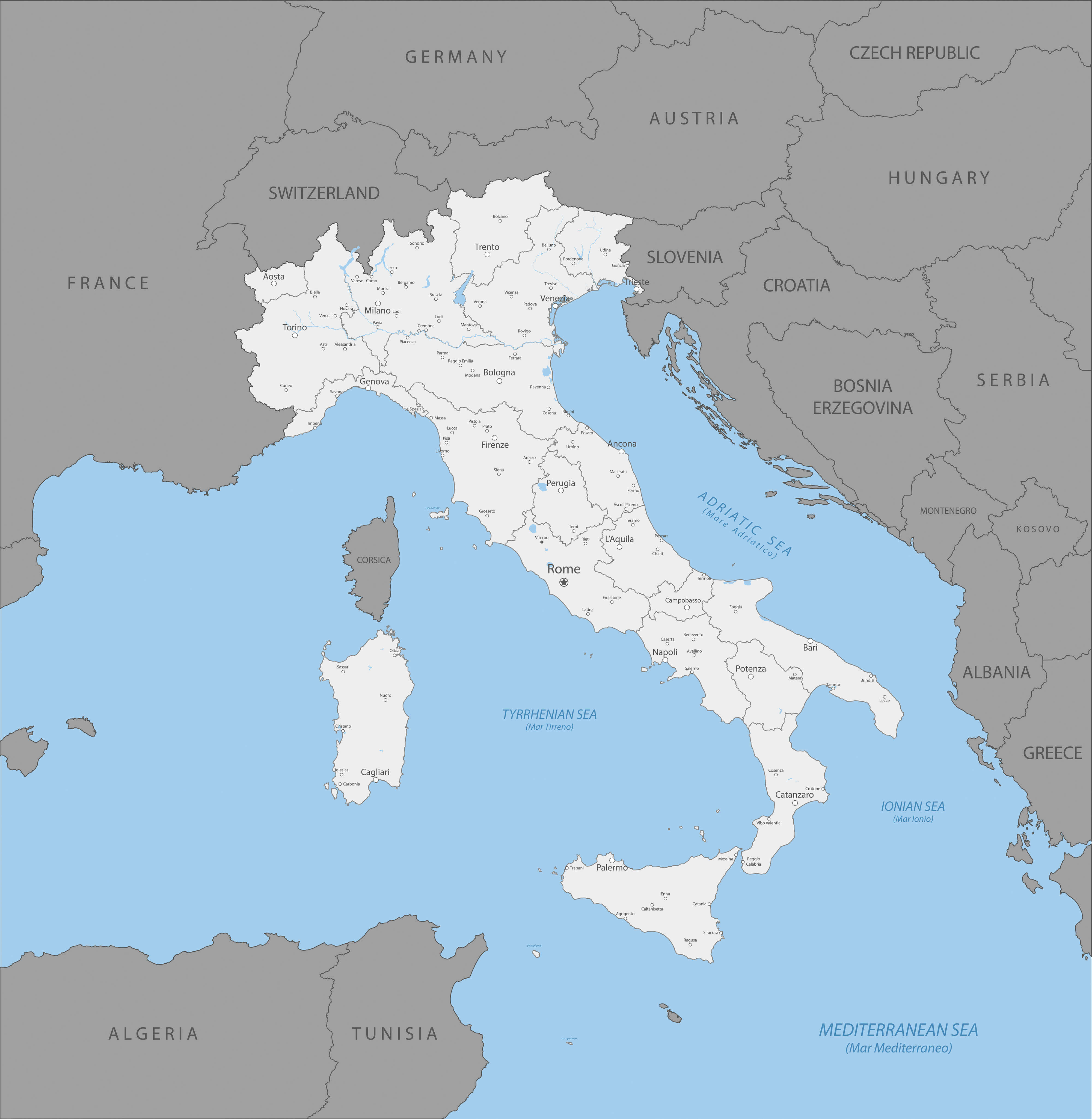
Political map of Italy
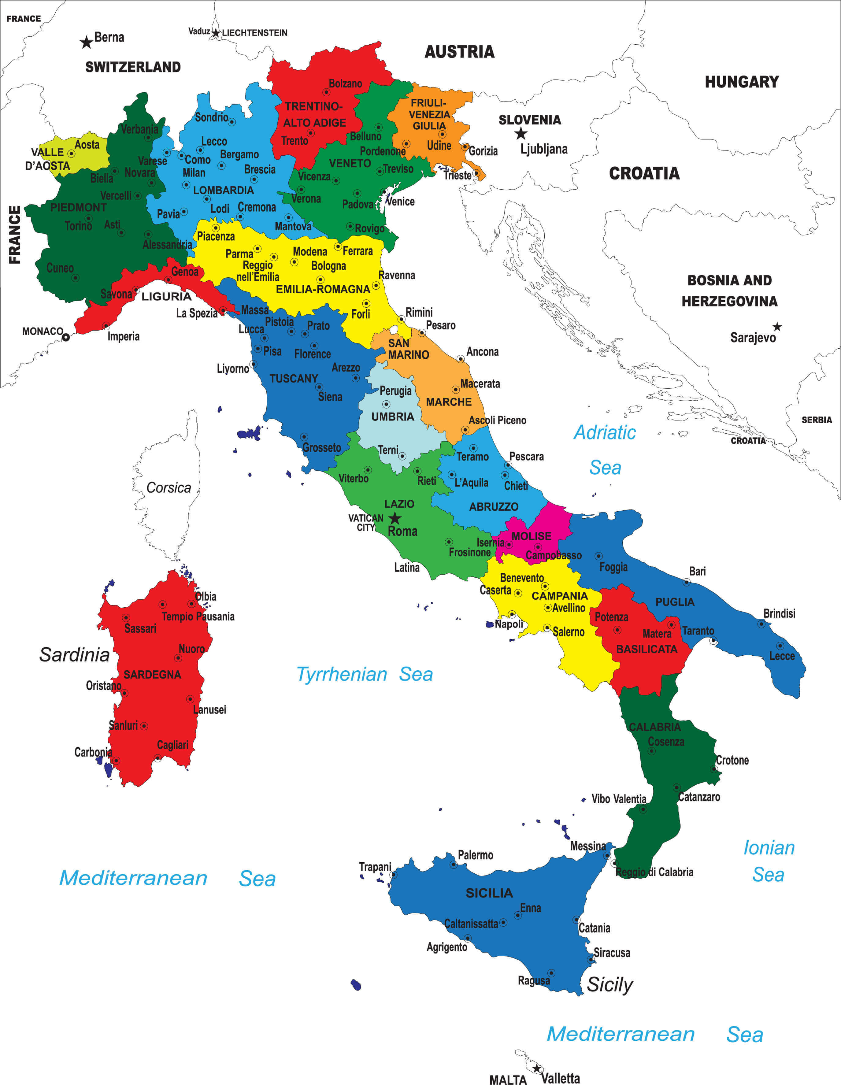 Political map of Italy.
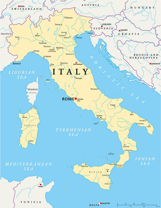
Italy Map with Major Cities.
 Italy Map with Major Cities.
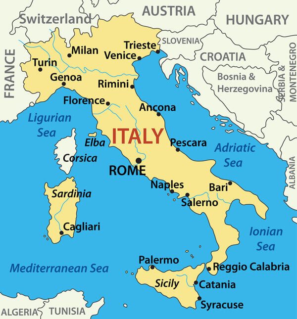
Country Map of Italy
 Country Map of Italy
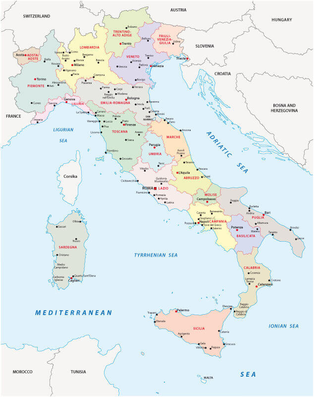
Italy Map Rivers Cities Borders
 Italy Map - Hand drawn map of Italy with the capital Rome, the Vatican and San Marino, national borders, most important cities, rivers and lakes.
Map of Italy Vector Illustration.
 Map of Italy Vector Illustration.
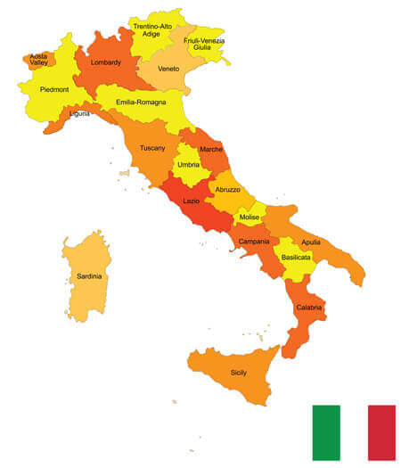
Italy Administrative Map
 Italy Administrative Map
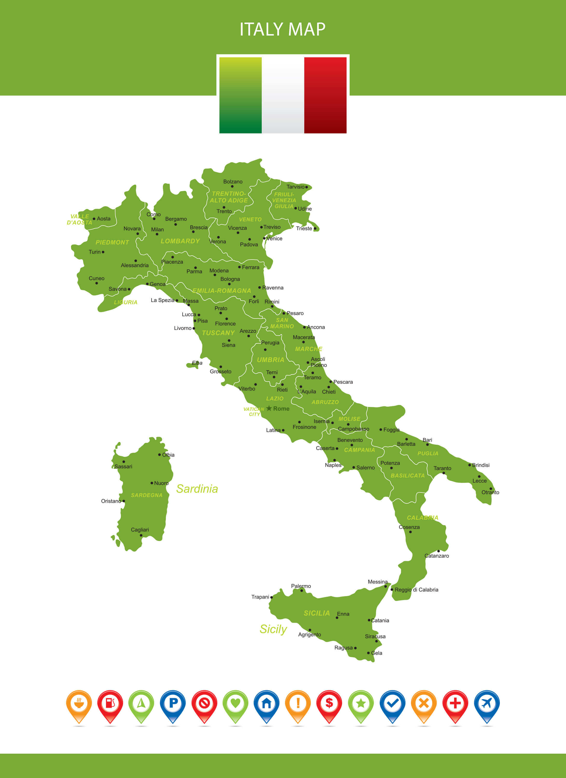
Italy Regions Map
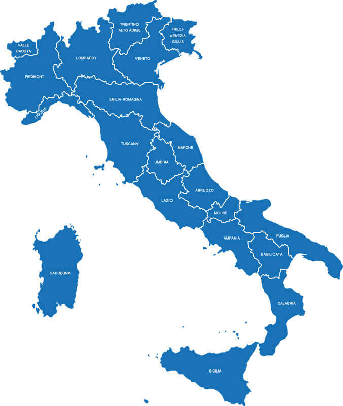 Italy Regions Map
Colorful Italy Map Main Cities
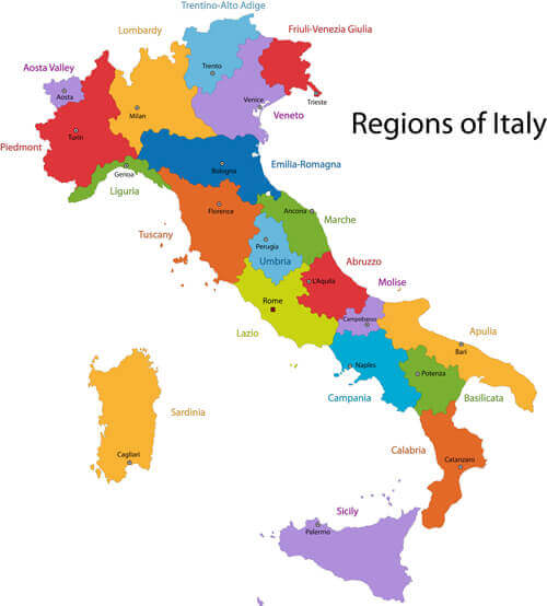 Colorful Italy map with regions and main cities.
Italy Provinces Map
 Italy Provinces Map
Largest Cities' Map of Italy
Rome Map Milan Map Milano Map Naples Map Turin Map Palermo Map Genoa Map Bologna Map Florence Map Bari Map Catania Map Cesena Map Como Map Ferrara Map Brescia Map Brindisi Map Cagliari Map Bergamo Map Foggia Map Forli Map Imola Map Latina Map Livorno Map Messina Map Parma Map Perugia Map Pesaro Map Pescara Map Piacenza Map Pisa Map Prato Map Ravenna Map Salerno Map Sassari Map Siracusa Map Taranto Map Terni Map Treviso Map Trieste Map Udine Map Venice Map Verona Map Vicenza Map Ancona Map Napoli Map Roma Map Novara Map Padua Map Modena Map Monza MapCopyright GuideofTheWorld.Net 2006 - 2026. All rights reserved. Privacy Policy | Disclaimer