
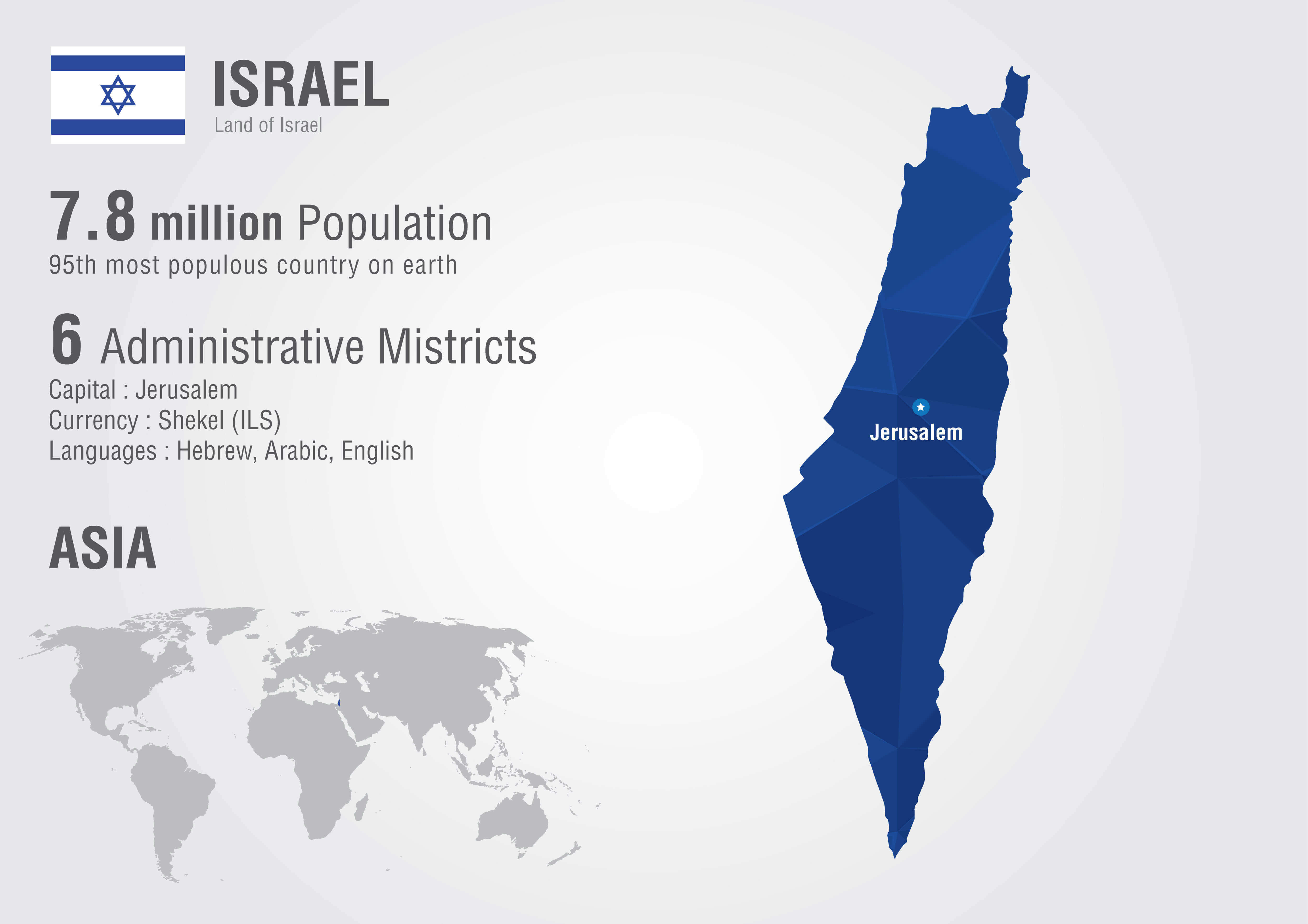
Map Israel
Navigate Israel map, satellite images of the Israel, states, largest cities, political map, capitals and physical maps.
- Capital : Jerusalem
- Population : 7,968,300
- GDP : $243.654 billion (41st)
- Per Capita : $32,351 (27th)
- Calling Code : +972
- Jobless Rate : 6.90%
- Time Zone : +2
A Collection of Israel Maps
Israel Satellite Map
 Highly detailed planet Earth in the morning. Exaggerated precise relief lit morning sun. Africa and Middle East.
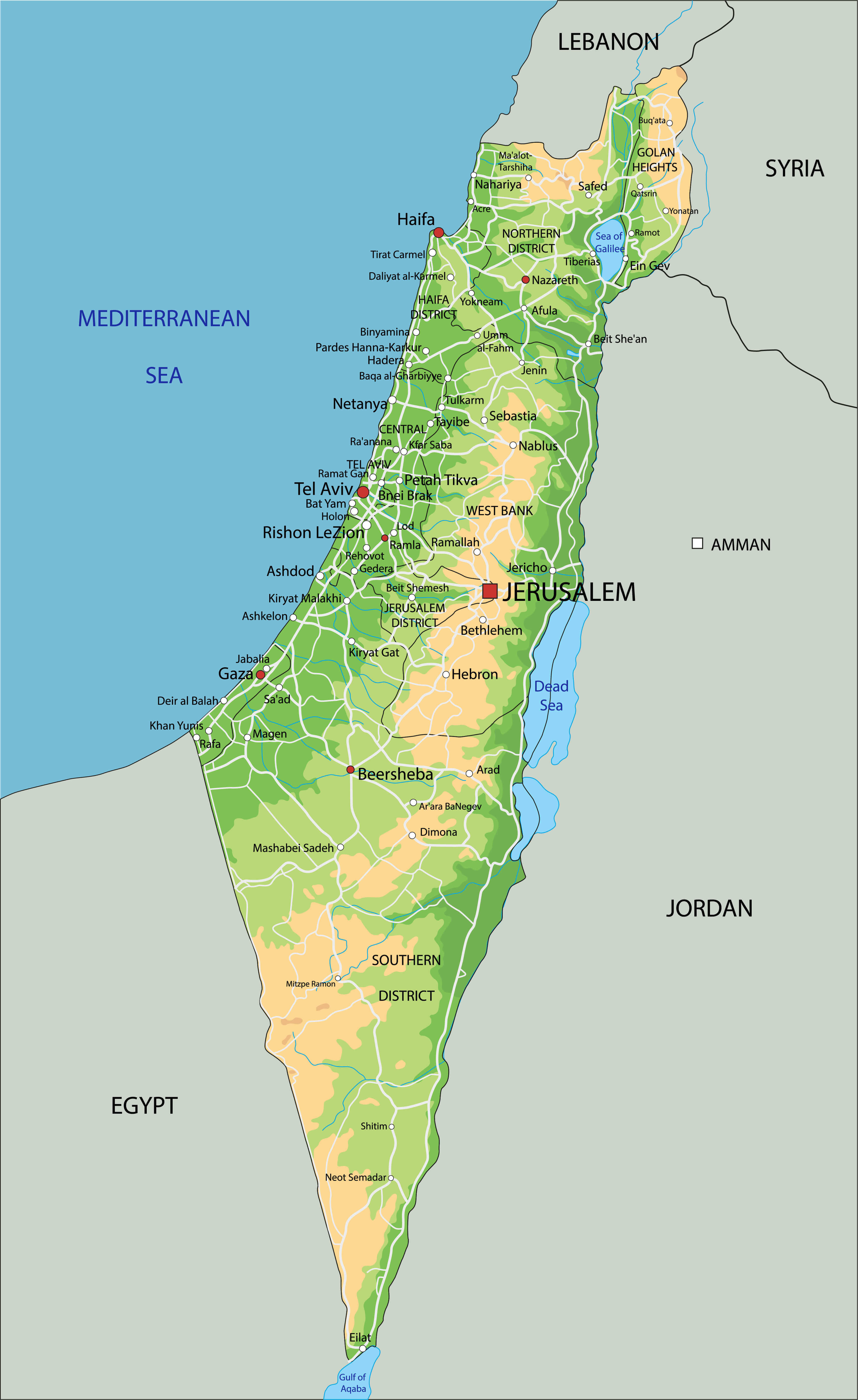
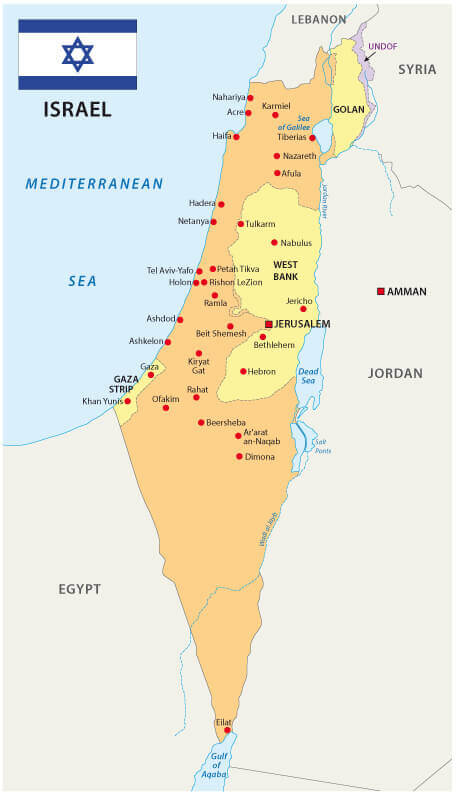
Israel Political Map
 Israel political map with capital Jerusalem, national borders, important cities, rivers and lakes. English labeling and scaling.
Political Map of Israel
 Political Map of Israel and Middle East under magnifier.
Israel Palestine Unfolded Map
 Palestine on unfolded map sheet with thumbtacks. Map colored according to vegetation. Includes clip path for the background.
Israel Eastern Mediterranean Political Map
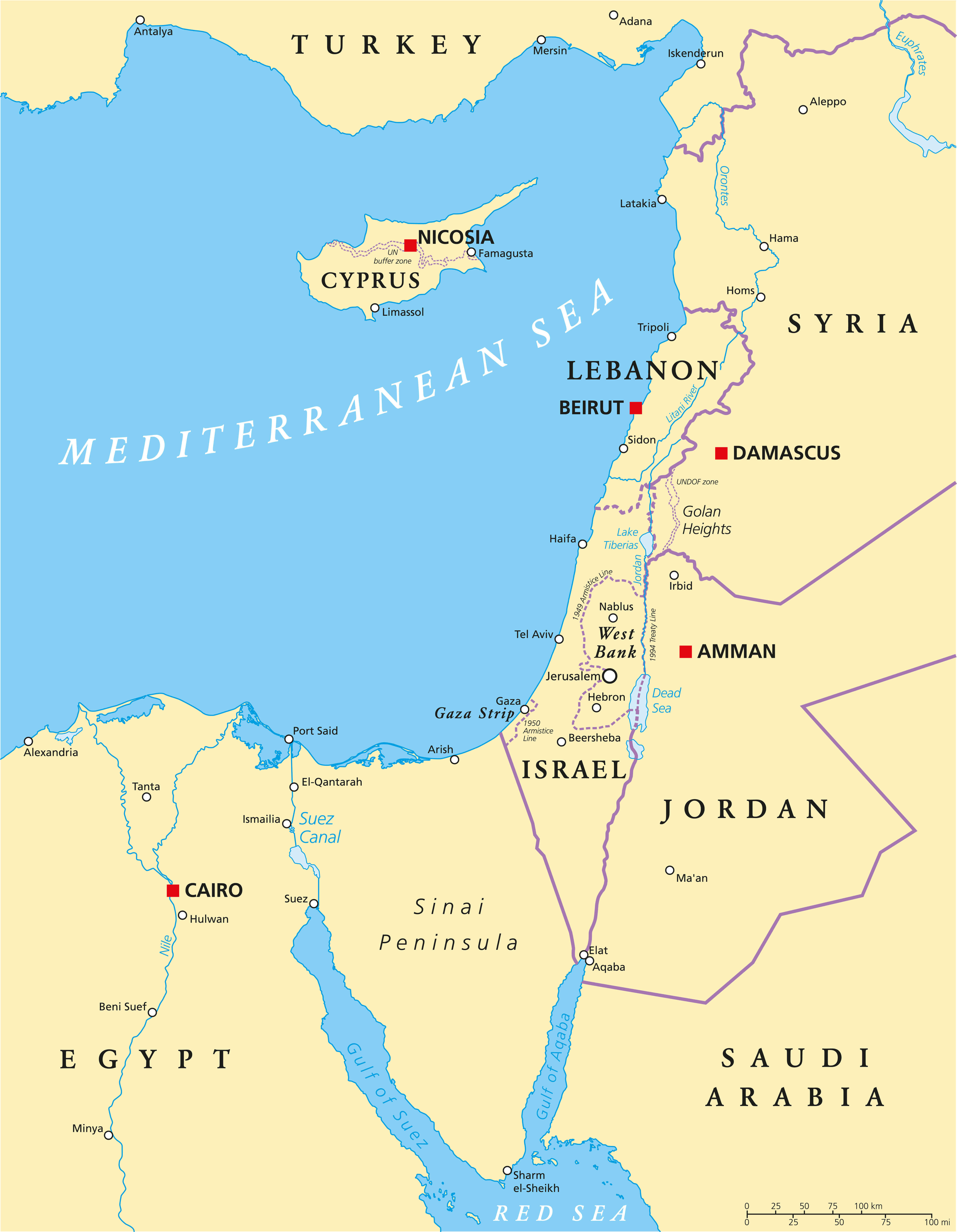 Eastern Mediterranean Political Map with capitals national borders, important cities, rivers and lakes. English labeling and scaling.
Israel Physical Map
 High detailed Israel physical map with labeling.
Detailed Israel Physical Map
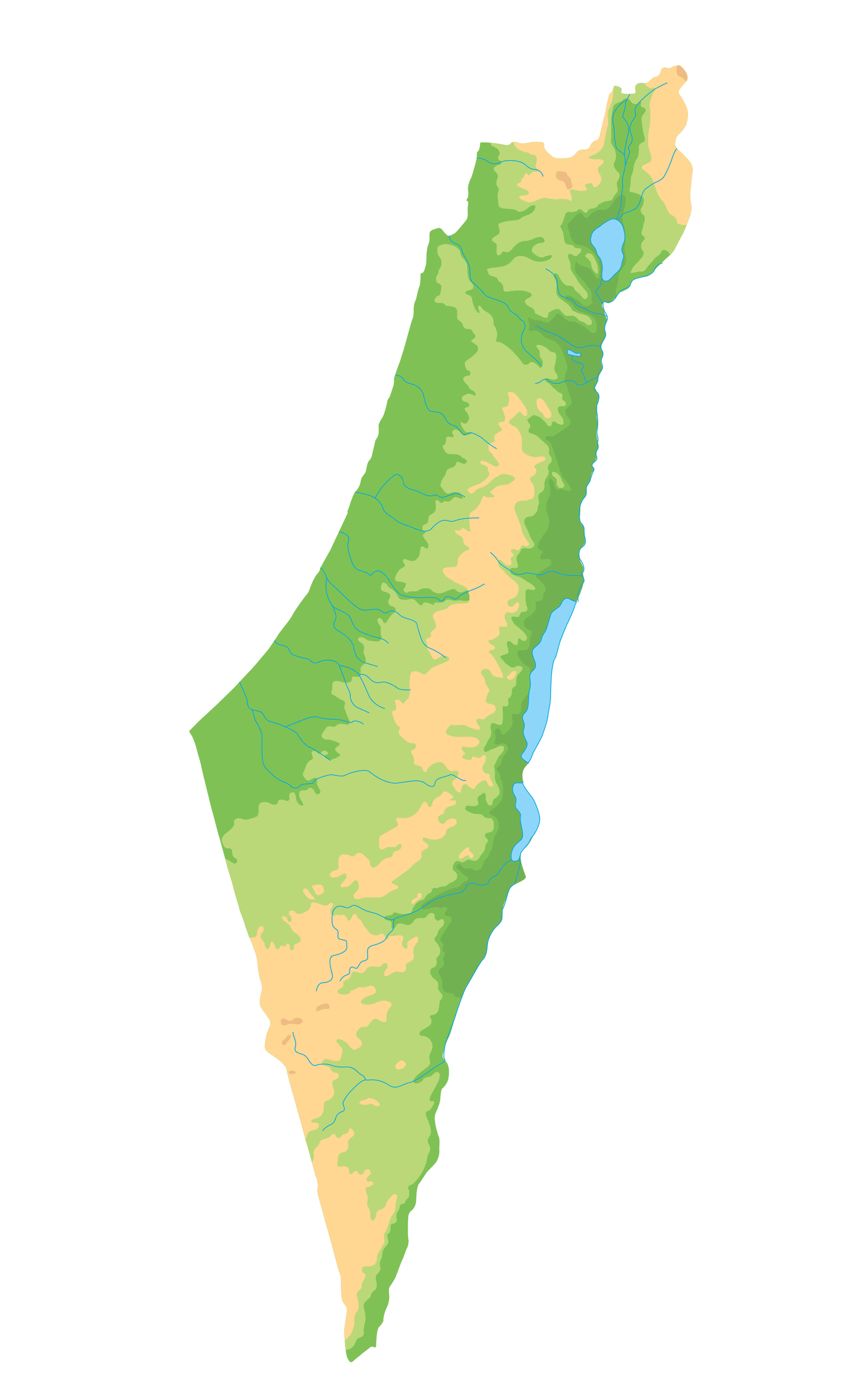 High detailed Israel physical map.
Country Map of Israel with Flag
 Abstract vector color map of Israel country colored by national flag.
Israel World Map
 Israel world map with a pixel diamond texture. World geography.
Israel Middle East Map
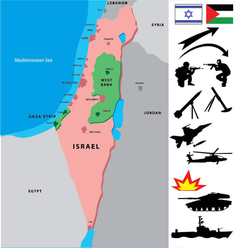 Israel map with a collection of war silhouettes. Middle East conflicts.
Israel Vectorel Map
 State of Israel and Israel vectorel map.
Israel Map with Flag
 Israel map with flag
Israel National Map
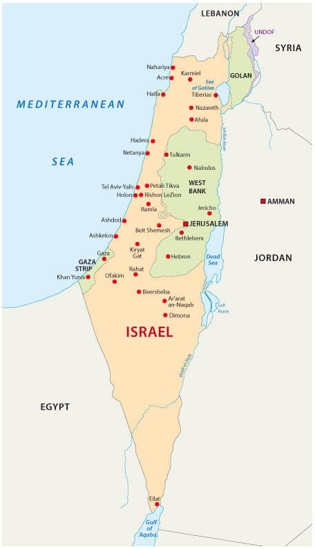 Israel National map with country borders, Palestine, West Bank.
Largest Cities' Map of Israel
Ashdod Map Ashkelon Map Bat Yam Map Be'er Sheva Map Bene Beraq Map Haifa Map Holon Map Netanya Map Petah Tiqwa Map Ramat Gan Map Rehovot Map Tel Aviv Yafo Map Jerusalem MapCopyright GuideofTheWorld.Net 2006 - 2026. All rights reserved. Privacy Policy | Disclaimer