
Map Ireland
Navigate Ireland map, satellite images of the Ireland, states, largest cities, political map, capitals and physical maps.

- Capital : Dublin
- Population : 4,588,252
- GDP : $217.669 billion
- Per Capita : $47,513
- Calling Code : +353
- Jobless Rate : 14.60%
- Time Zone : +0
Ireland Political Map
 Ireland Political Map
Ireland Blank Map
 Ireland Blank Map
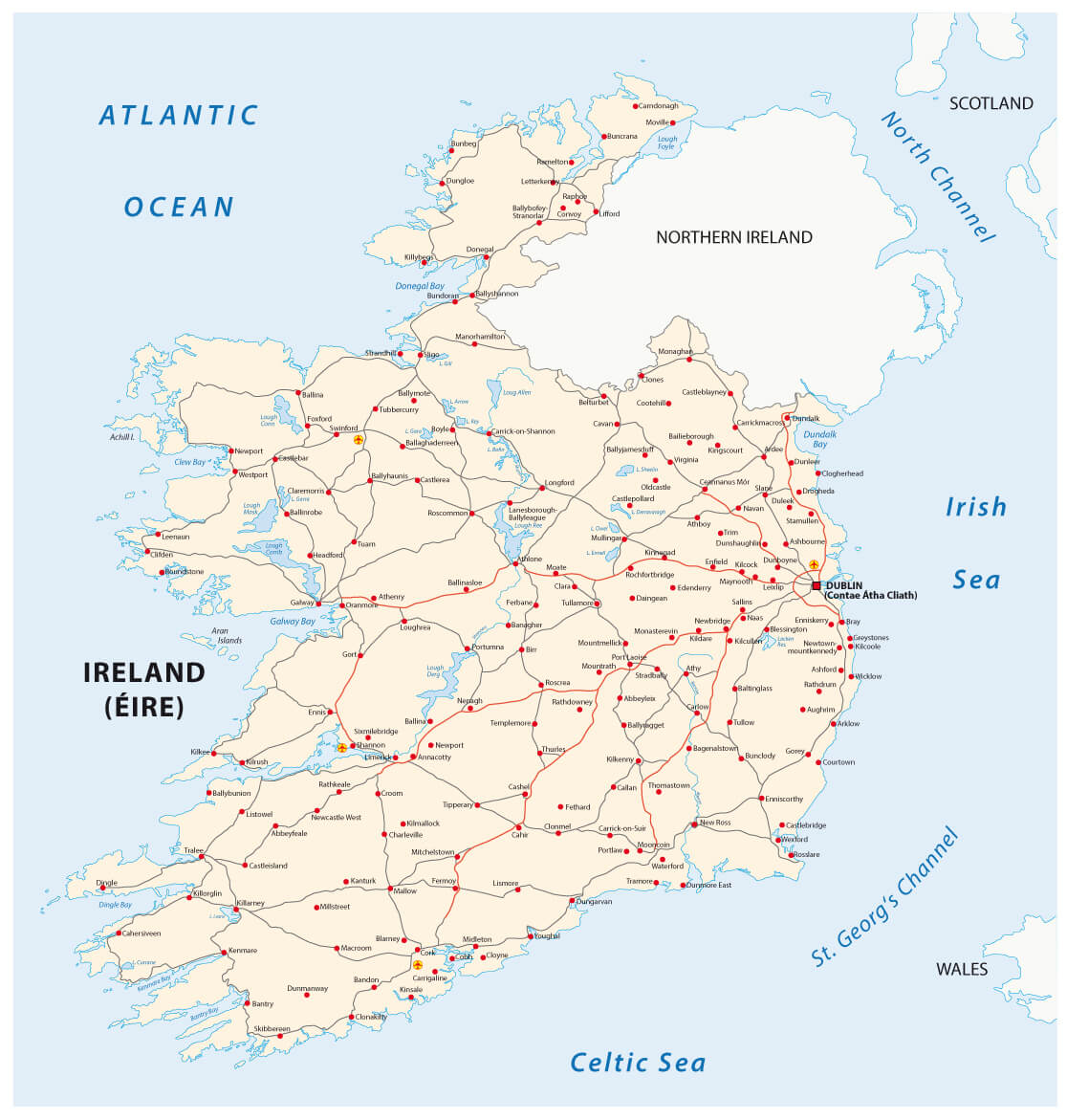
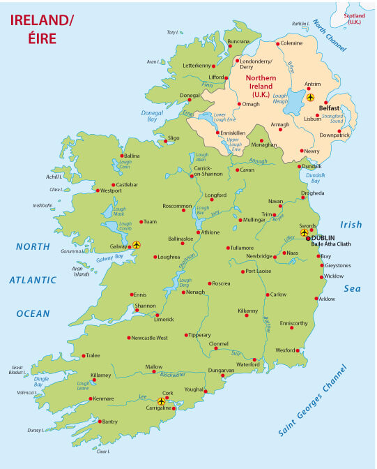
Travel map of Ireland
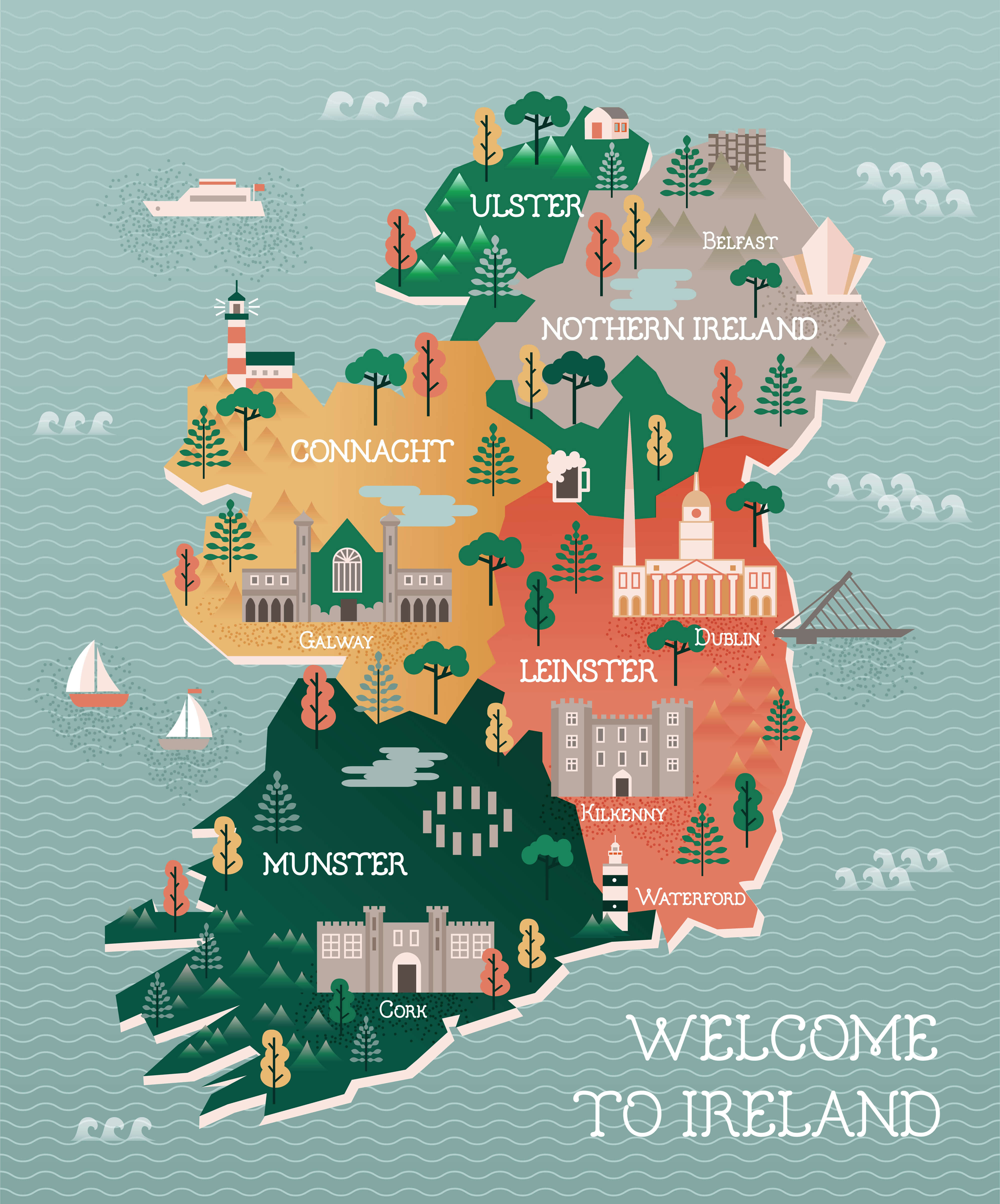 Travel map of Ireland with landmarks and cities.
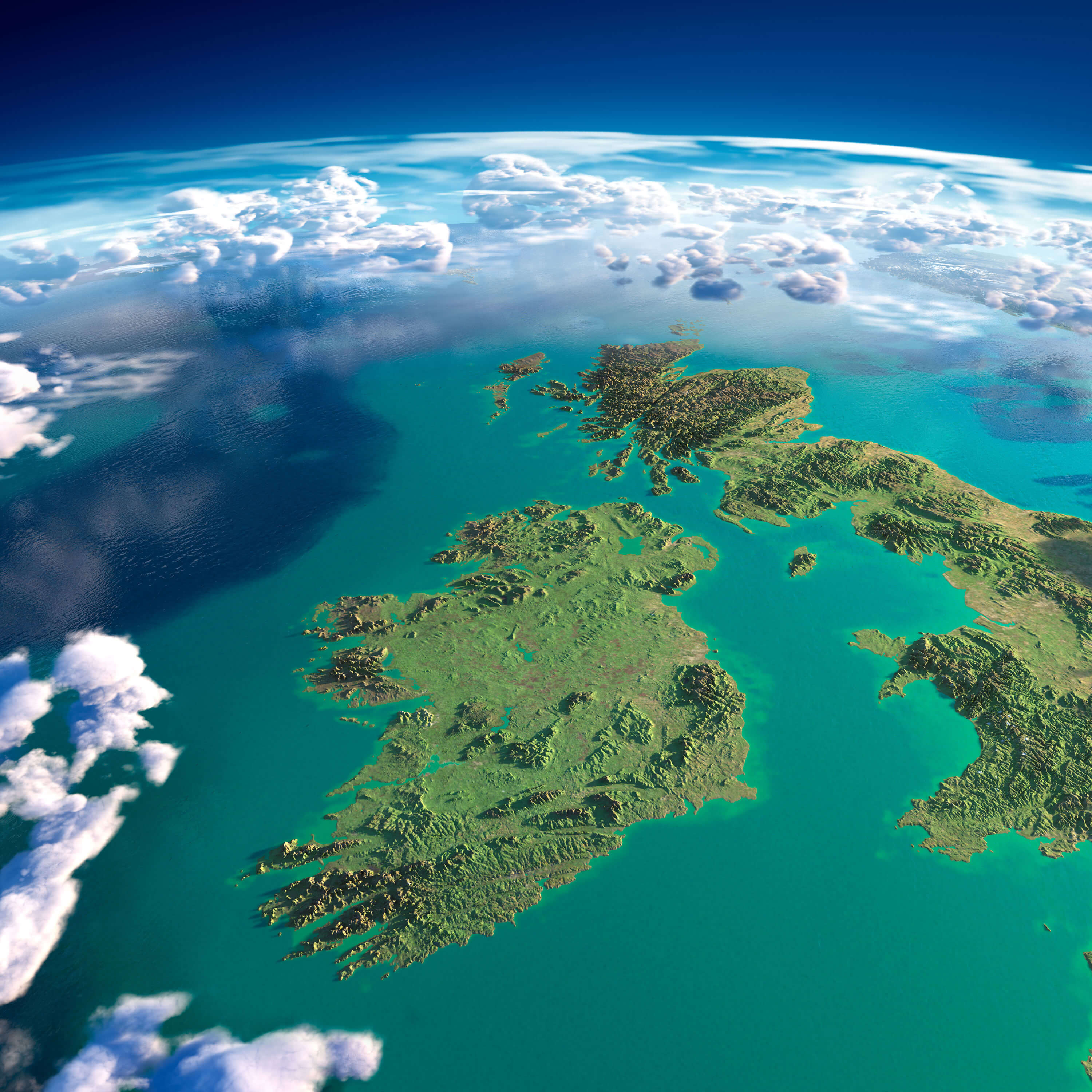
Ireland Satellite Map
 Highly detailed Ireland and UK Map with fragments of the planet Earth with exaggerated relief, translucent ocean and clouds, illuminated by the morning sun.
Political Map of Ireland
 Political Map of Ireland
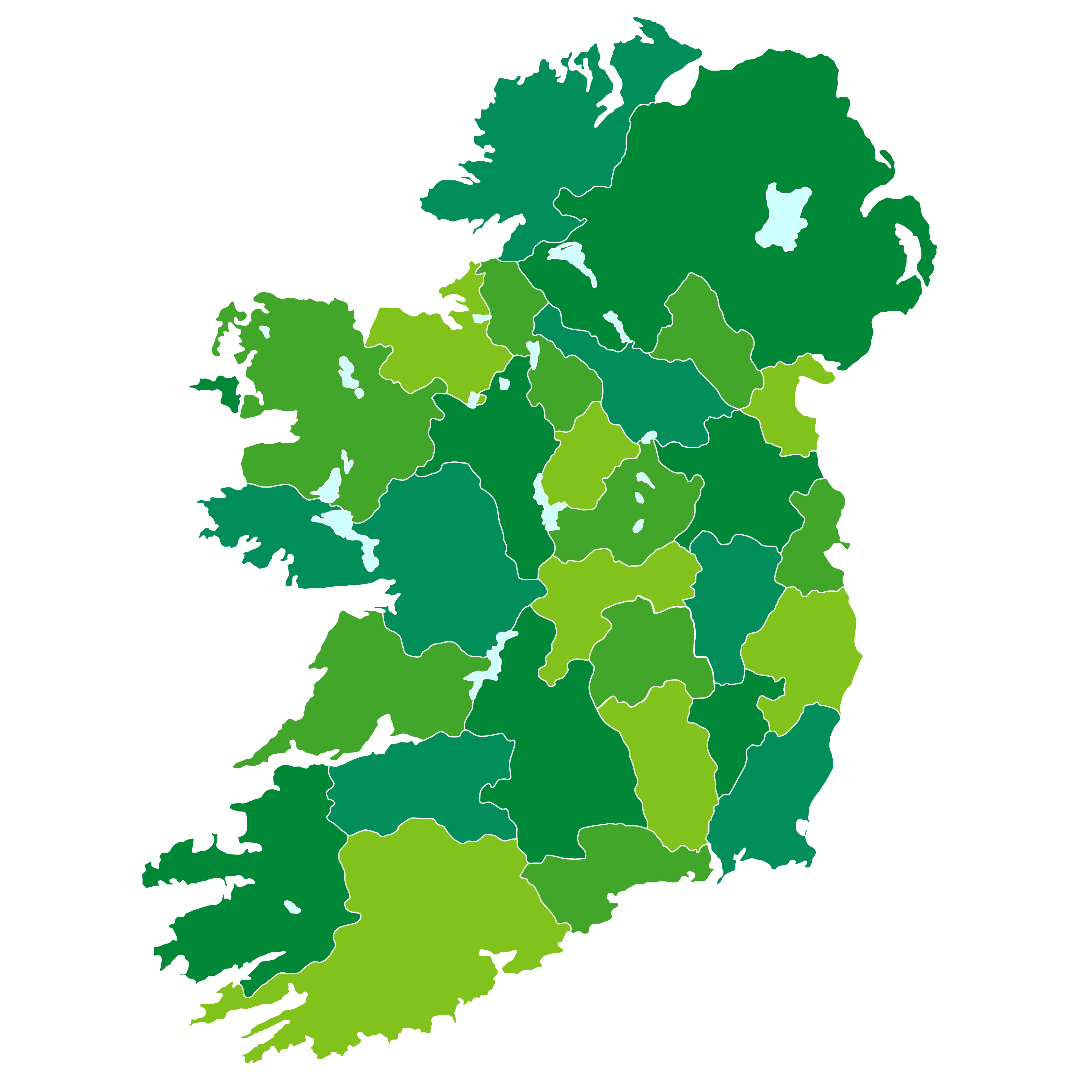
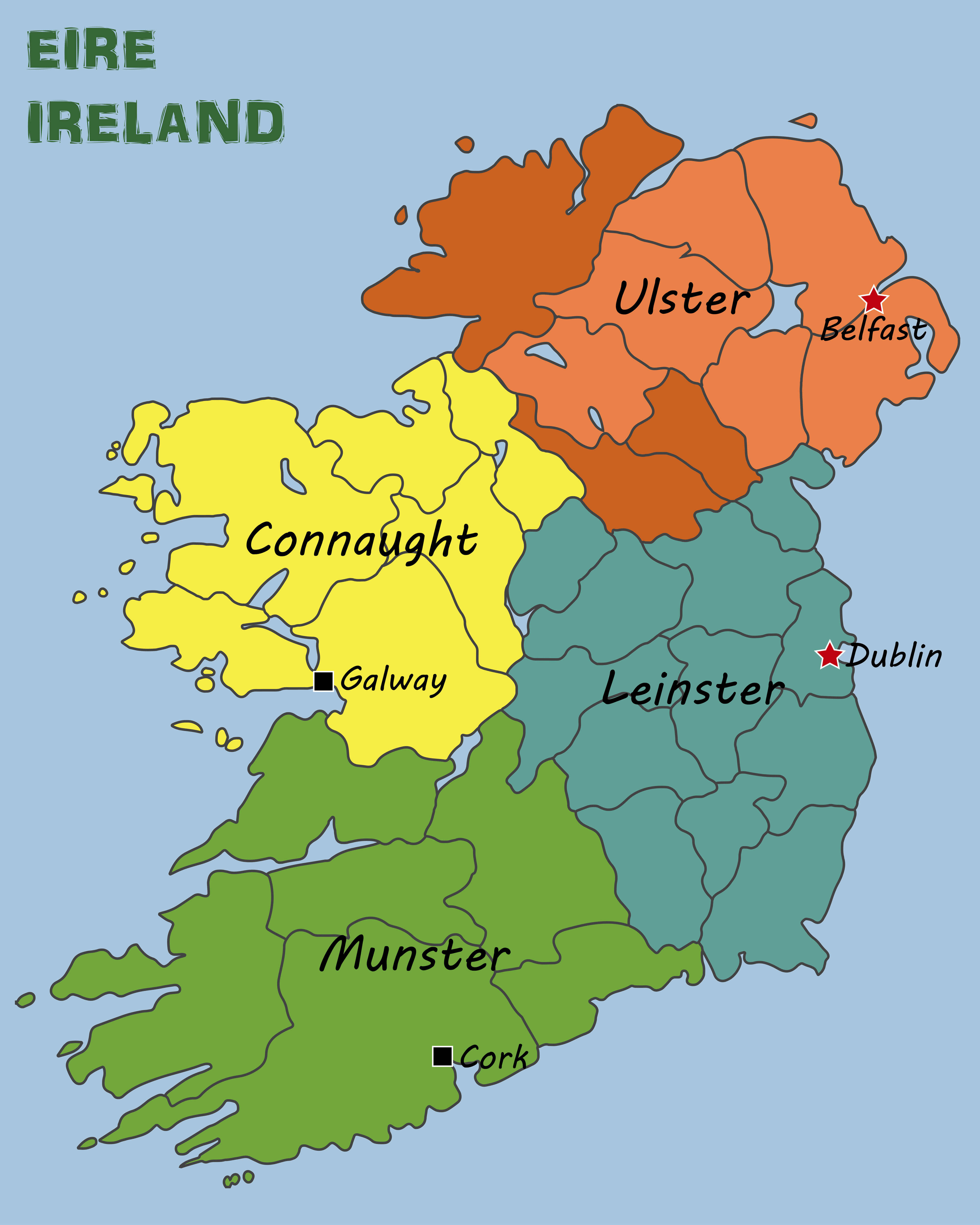
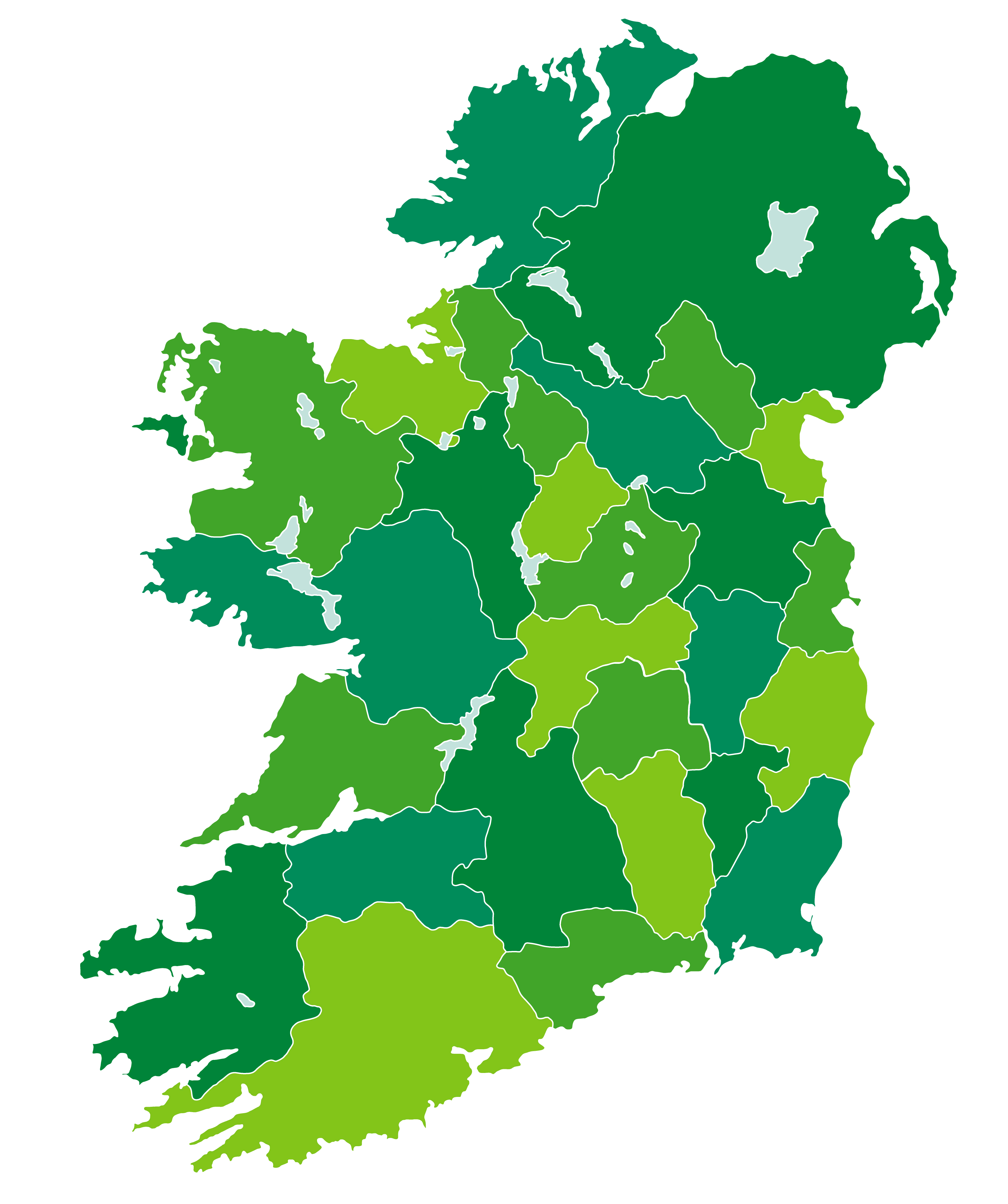
Ireland Regions Map
 Ireland Regions Map
Ireland Road Map
 Ireland Road Map
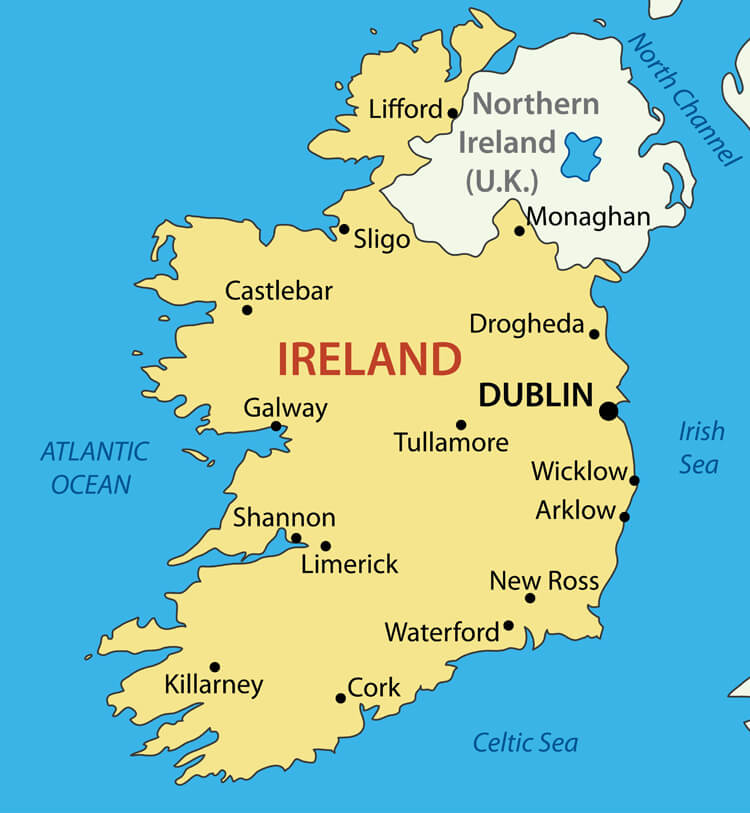
Ireland Main Cities Map
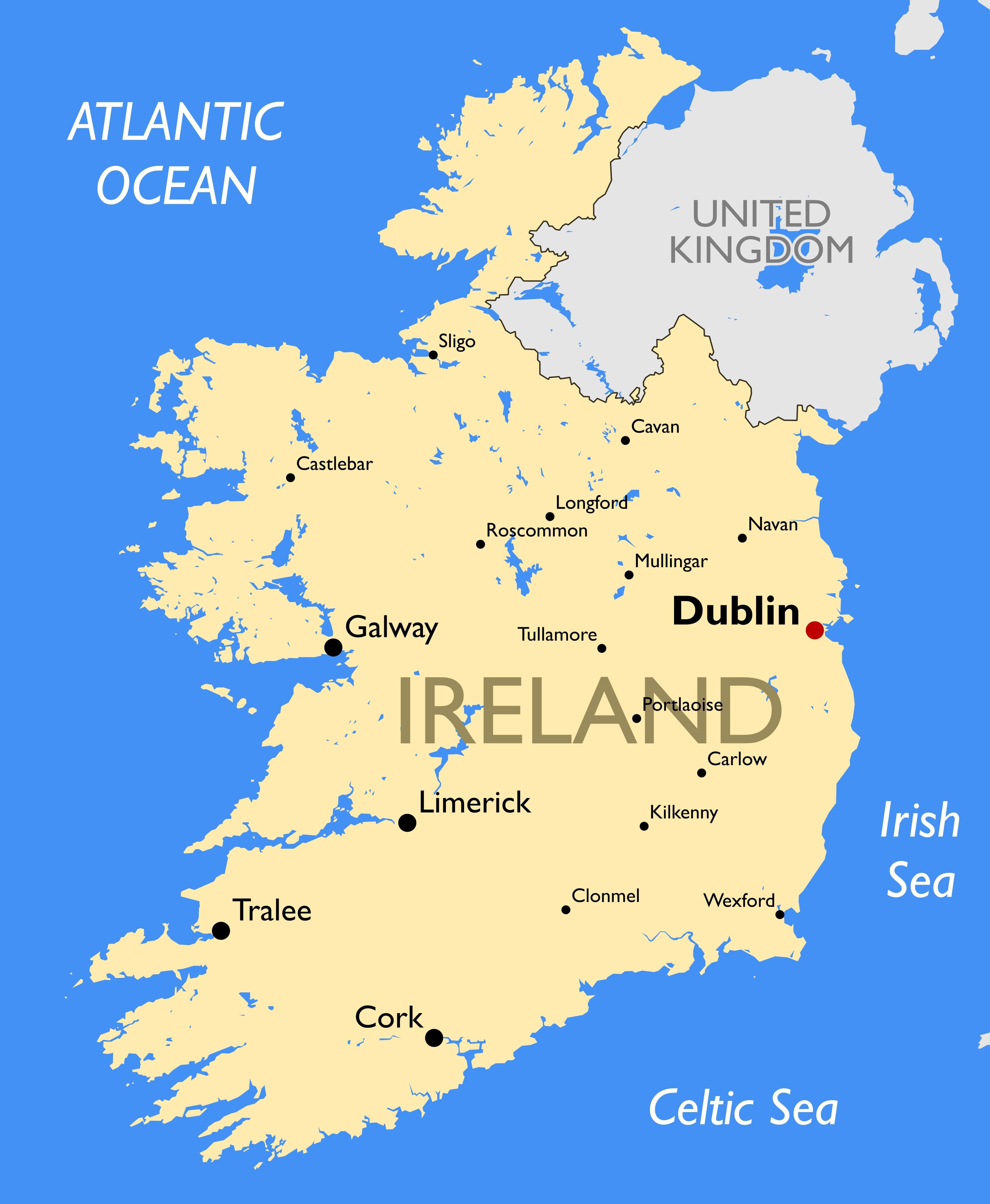
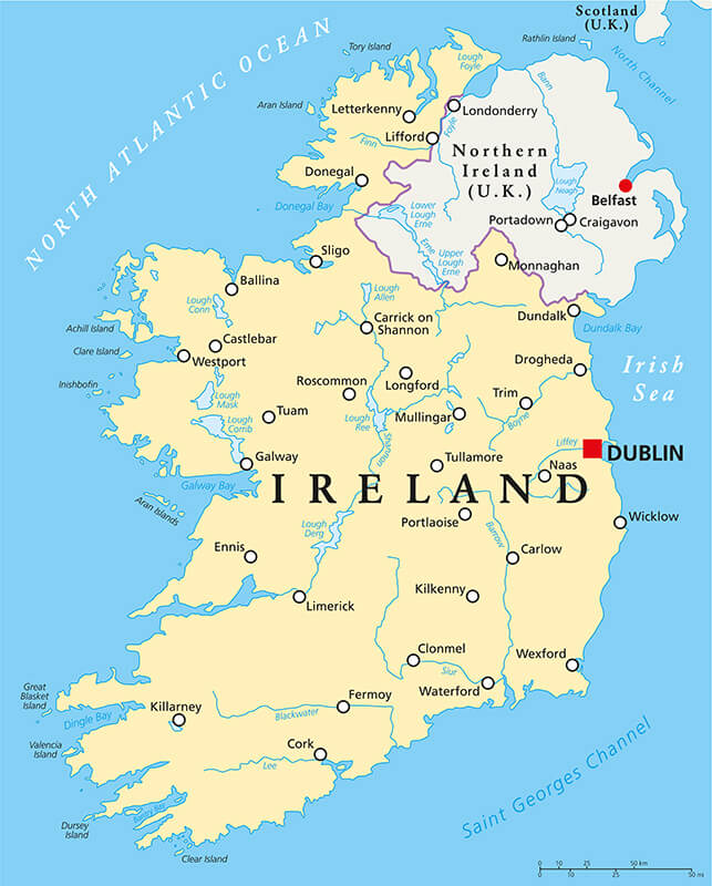 Ireland Political Map with capital Dublin, national borders, most important cities, rivers and lakes in English labeling and scaling.
Ireland Regions Blank Map
 Ireland Regions Blank Map
Republic of Ireland Vector Map
 Republic of Ireland Vector Map
Ireland Map
 Ireland Map
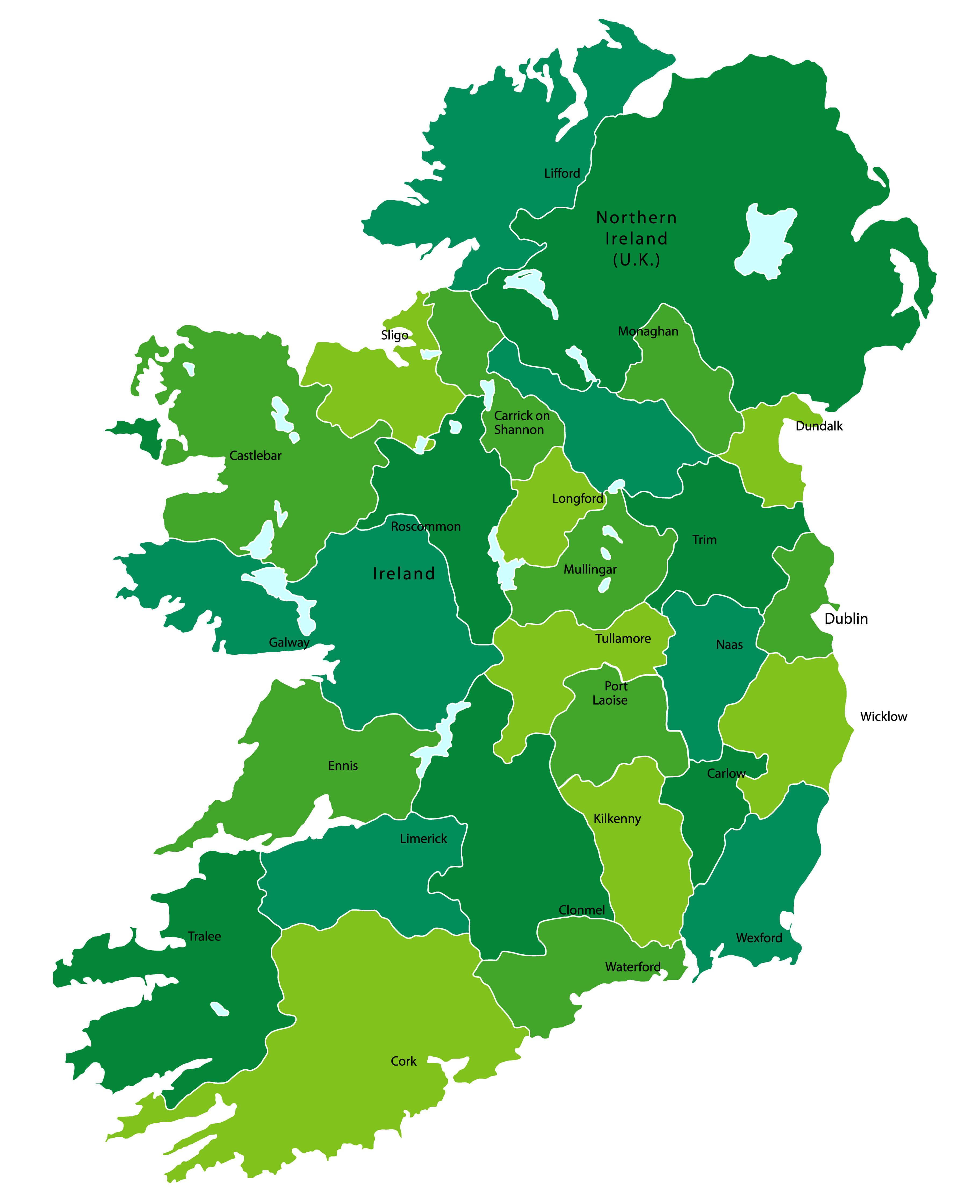
Ireland Administrative Map
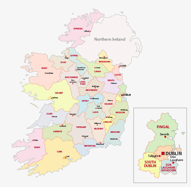 Map of Ireland Administrative divisions on counties level.
Largest Cities' Map of Ireland
Dublin Map Belfast Map Cork Map Limerick Map Derry Map Galway Map Craigavon Map Waterford Map Drogheda Map Dundalk Map Lucan Map Wexford MapCopyright GuideofTheWorld.Net 2006 - 2026. All rights reserved. Privacy Policy | Disclaimer