
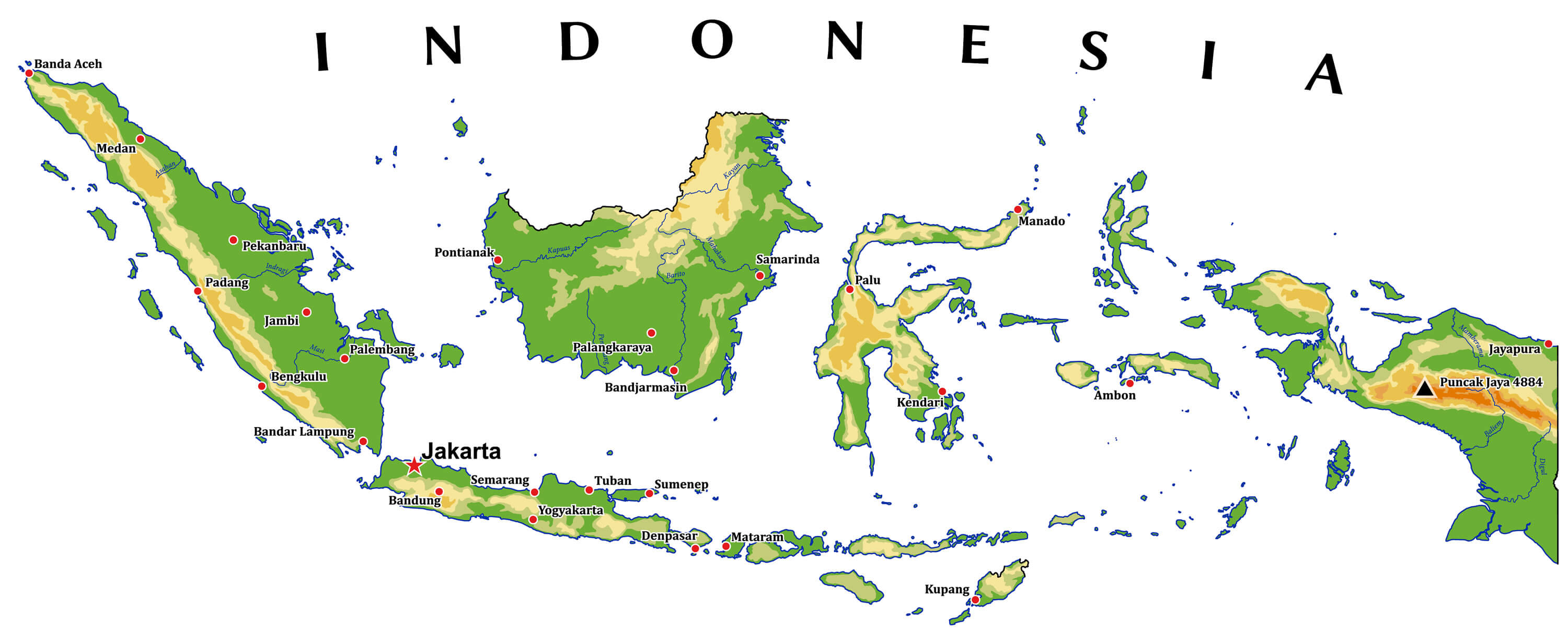
Indonesia Map
Navigate Indonesia map, satellite images of the Indonesia, states, largest cities, political map, capitals and physical maps.
- Capital : Jakarta
- Population : 237,424,363
- GDP : $928.274 billion (17th)
- Per Capita : $3,797 (107th)
- Calling Code : +62
- Jobless Rate : 6.14%
- Time Zone : +7 - +9
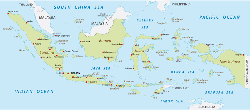
Indonesia Map
 Indonesia map with major cities, national borders.
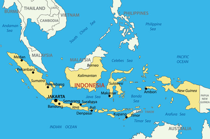
Indonesia Physical Map
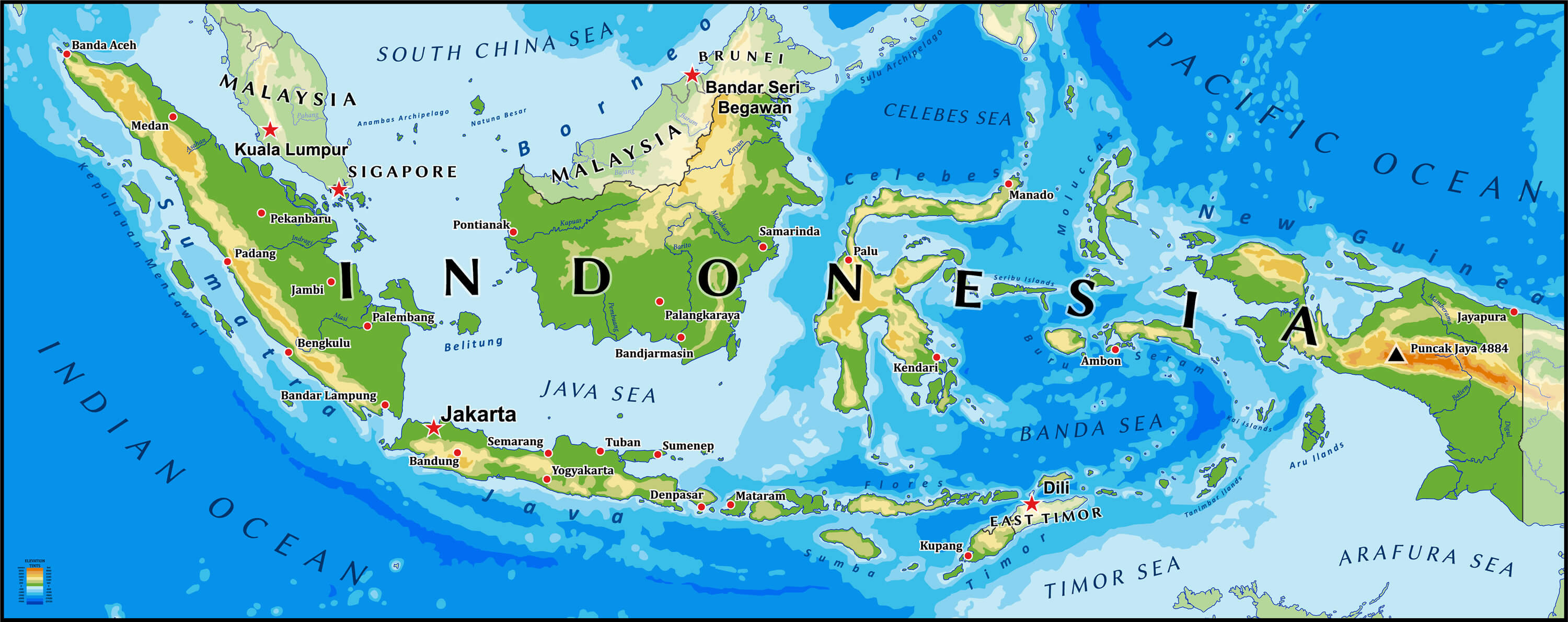 Indonesia physical vector map with main cities and rivers.
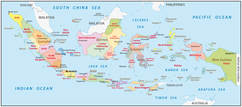
Indonesia Political Map
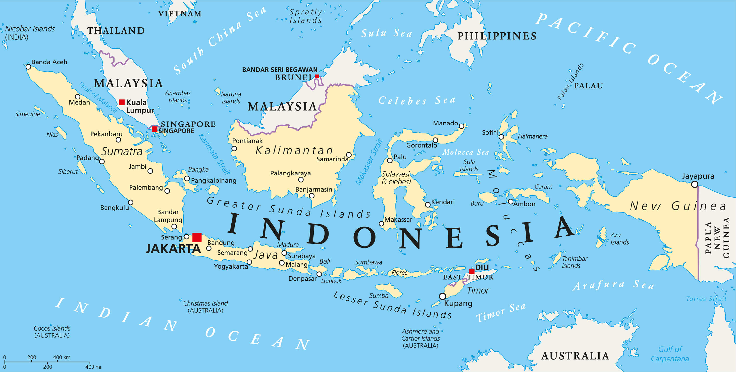 Indonesia political map with capital Jakarta, national borders and important cities. English labeling and scaling. Illustration.
Republic of Indonesia Map
 Republic of Indonesia map with main cities.
Indonesia Physical Vector Map
 Indonesia physical vector map with main cities and rivers.
Indonesia Travel Map
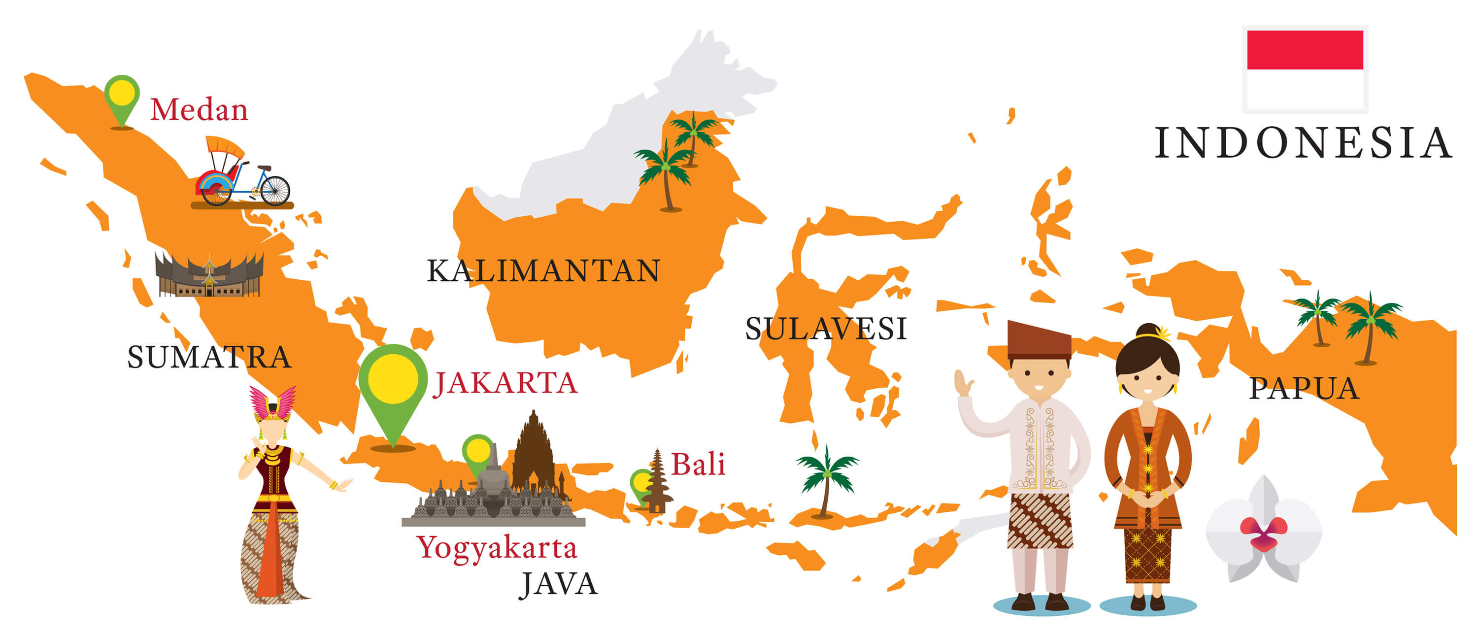 Indonesia Map and Landmarks with People in Traditional Clothing, Culture, Travel and Tourist Attraction.
Indonesia Blank Map
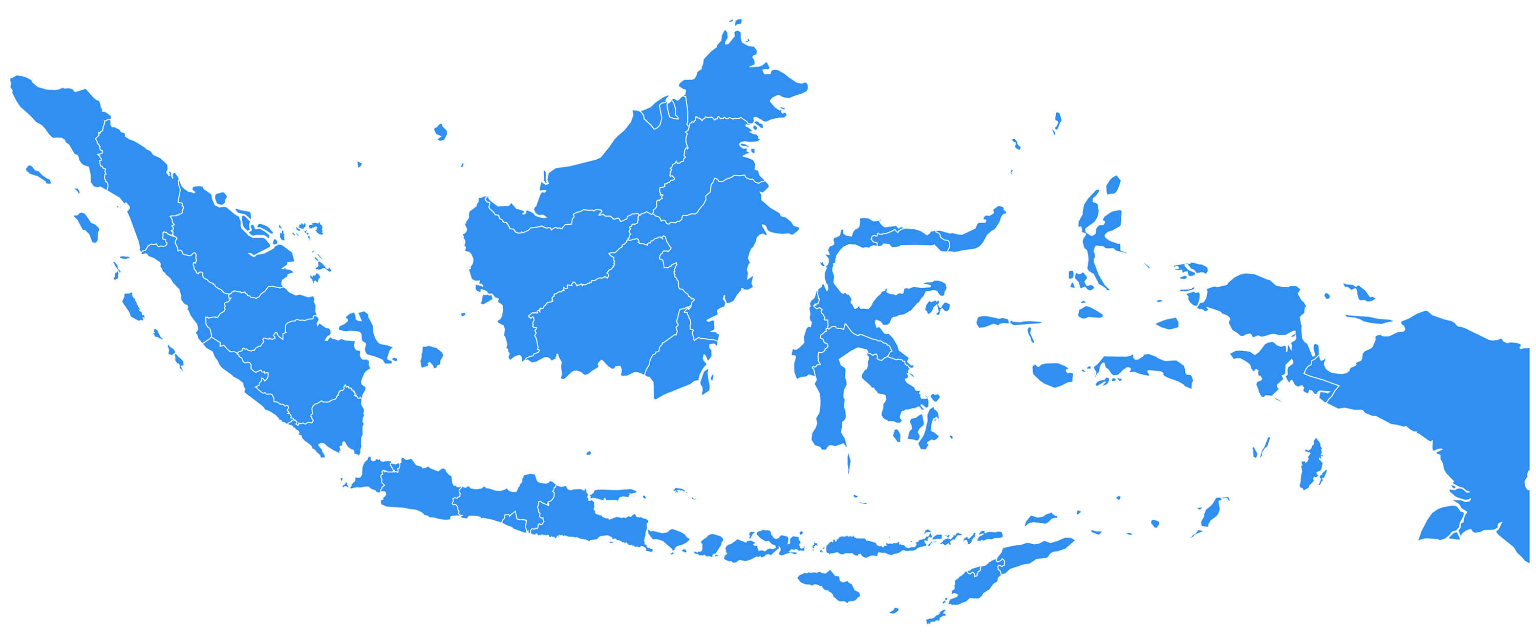 Vector map Indonesia. Isolated vector Illustration. Black on White background.
Indonesia Administrative Map
 Administrative Map with main cities and Malaysia national border.
Republic of Indonesia Vector Map
 Republic of Indonesia - vector map with major cities.
Indonesia Cities Map
 Indonesia Map with main cities.
Indonesia Provinces Map
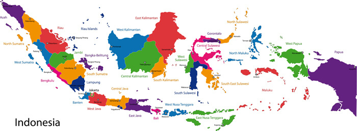 Map of the Republic of Indonesia with the provinces colored in bright colors.
Indonesia, Australia and Oceania from Space
 Australia and Oceania from space. Elements of this image furnished by NASA.
Largest Cities' Map of Indonesia
Bandar Lampung Map Bandung Map Batam Map Bekasi Map Bogor Map Cimahi Map Denpasar Map Depok Map Jakarta Map Makassar Map Malang Map Medan Map Padang Map Palembang Map Pontianak Map Pekanbaru Map Samarinda Map Semarang Map Surabaya Map Surakarta Map Tangerang Map Tasikmalaya Map Yogyakarta MapCopyright GuideofTheWorld.Net 2006 - 2026. All rights reserved. Privacy Policy | Disclaimer