
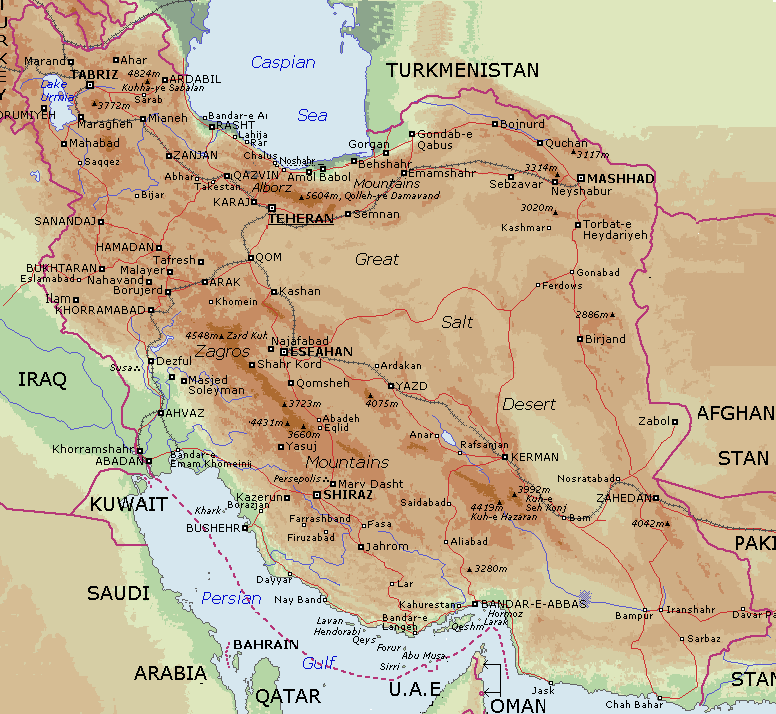
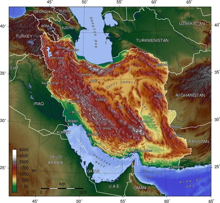
Physical Map of Iran: Mountains, Deserts and Natural Features
Explore a detailed Iran Physical Map that illustrates the country's diverse natural landscape, including mountain ranges, deserts, rivers, lakes, and coastal plains. The map highlights major geographic features such as the Zagros and Alborz Mountains, the Dasht-e Kavir and Dasht-e Lut deserts, and the coastlines along the Caspian Sea and the Persian Gulf. Ideal for geographic study and reference, it provides a clear overview of Iran's terrain and elevation patterns.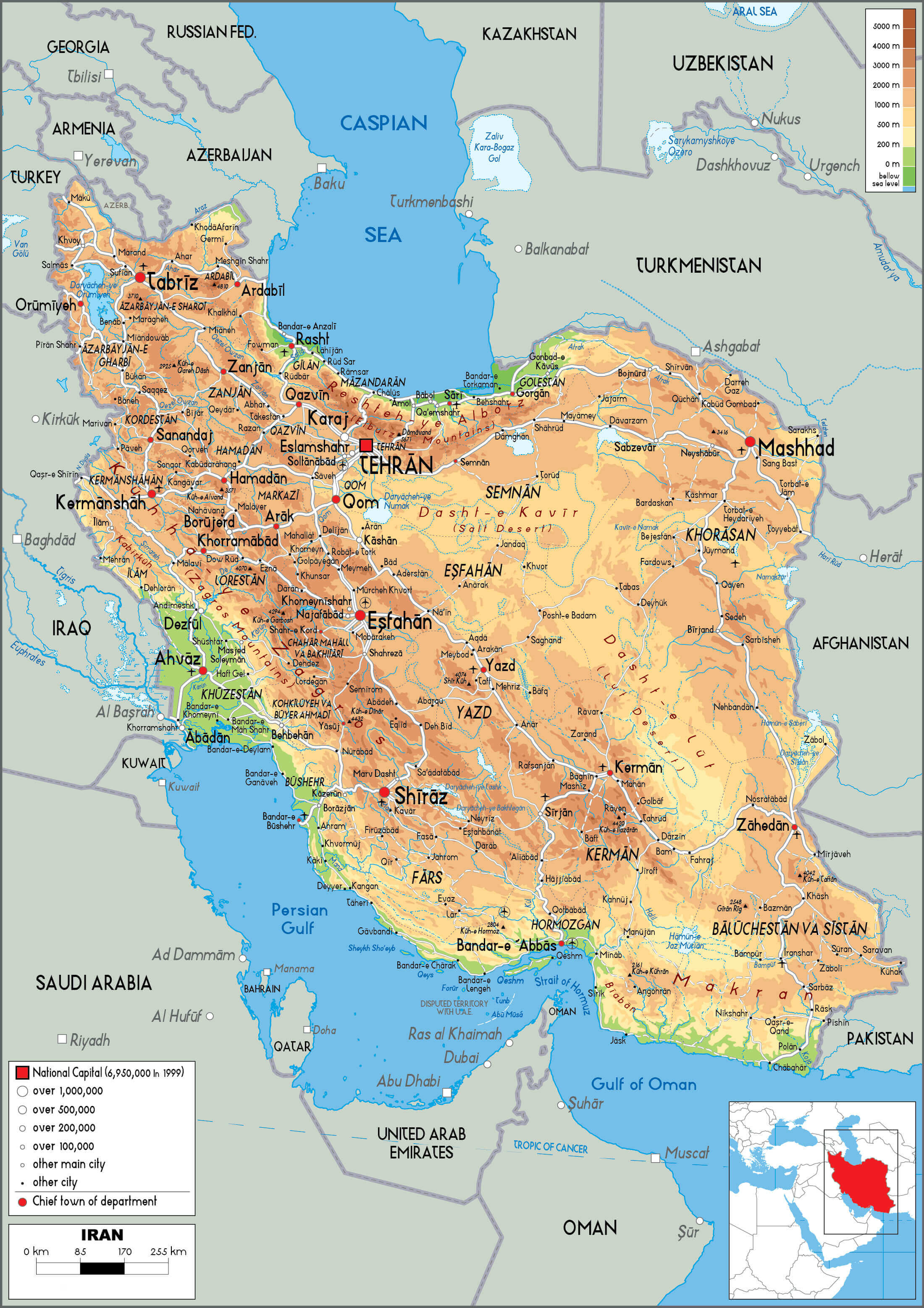
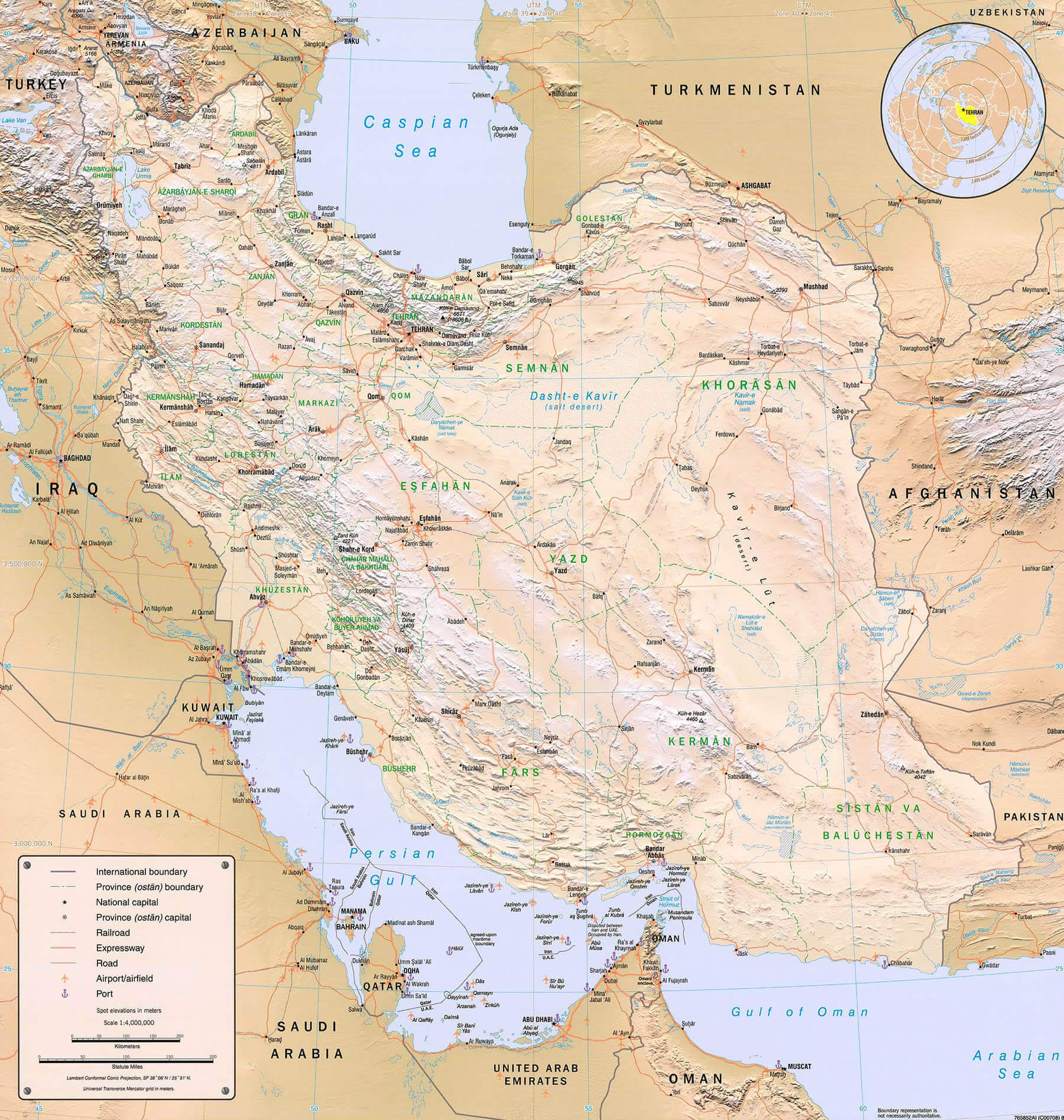
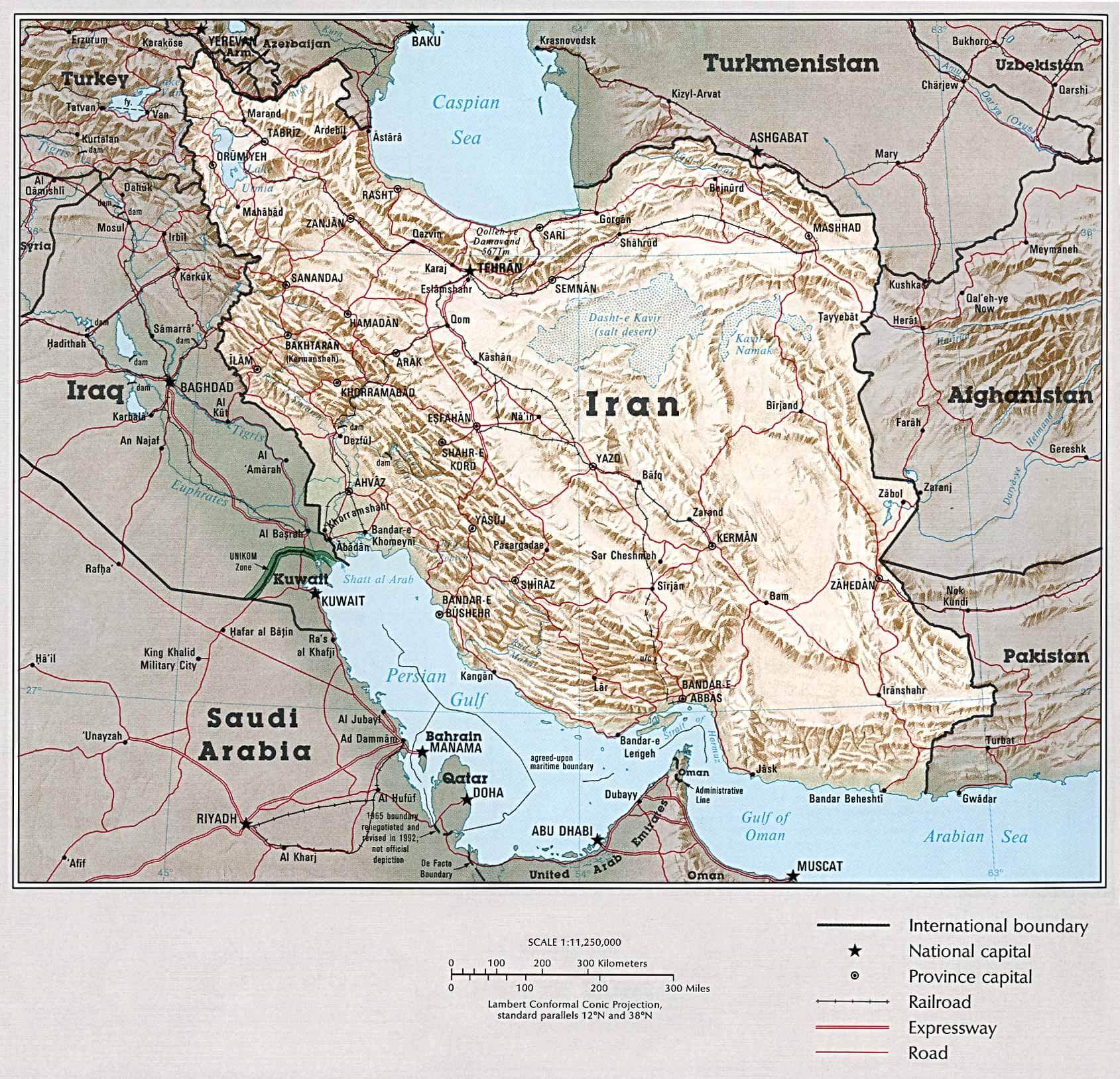
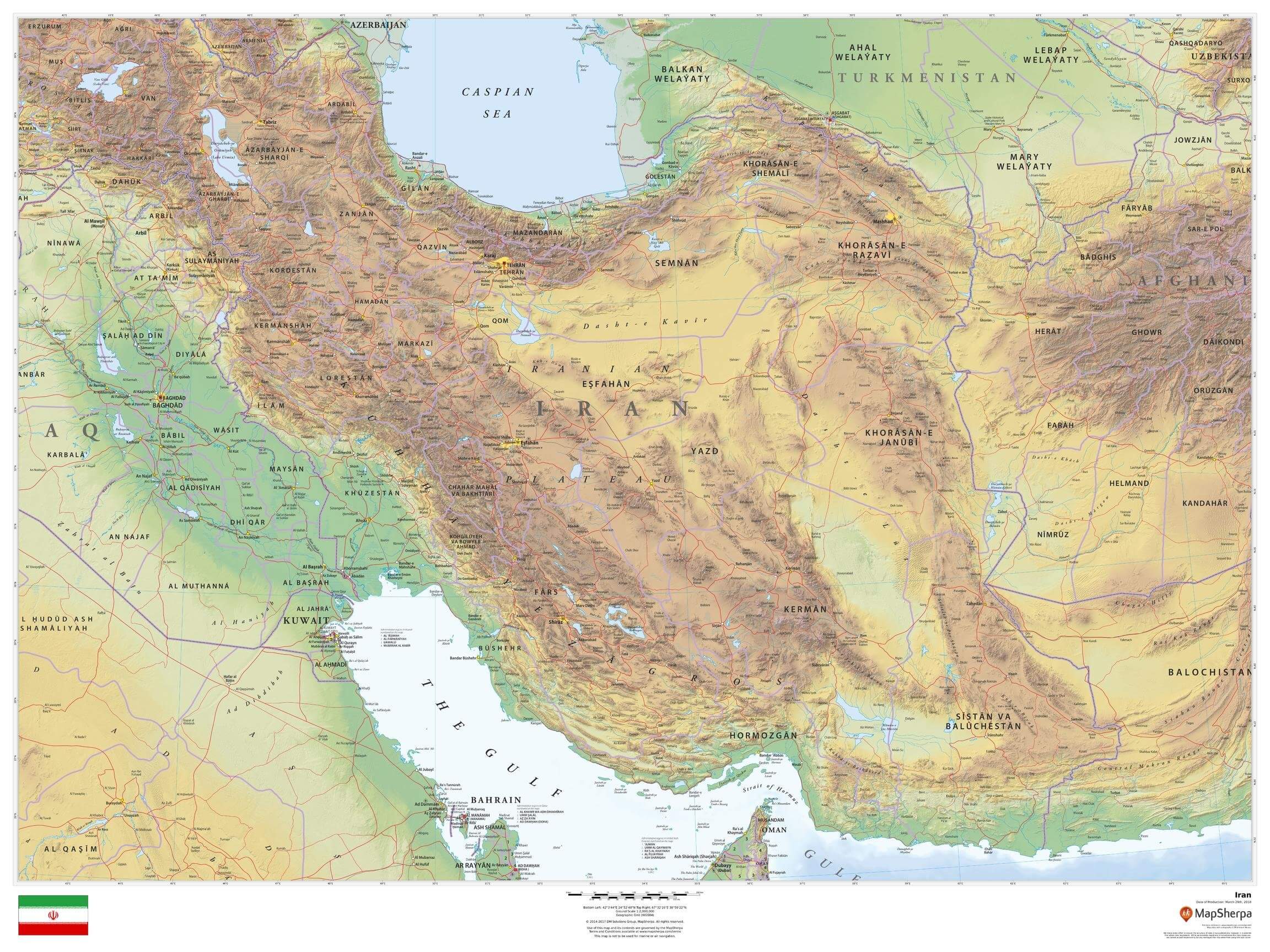
Physical map of Iran with roads
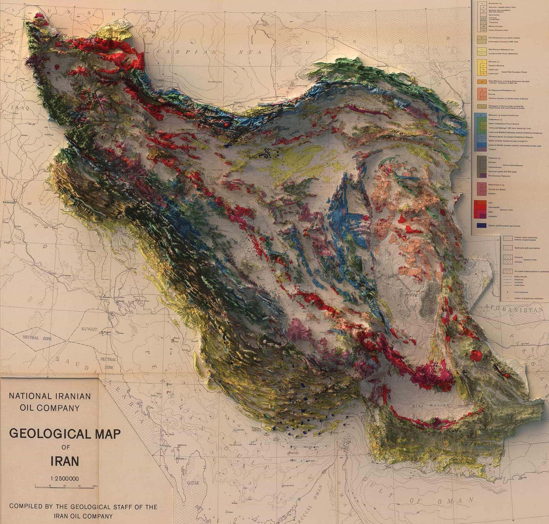
Geological map of Iran
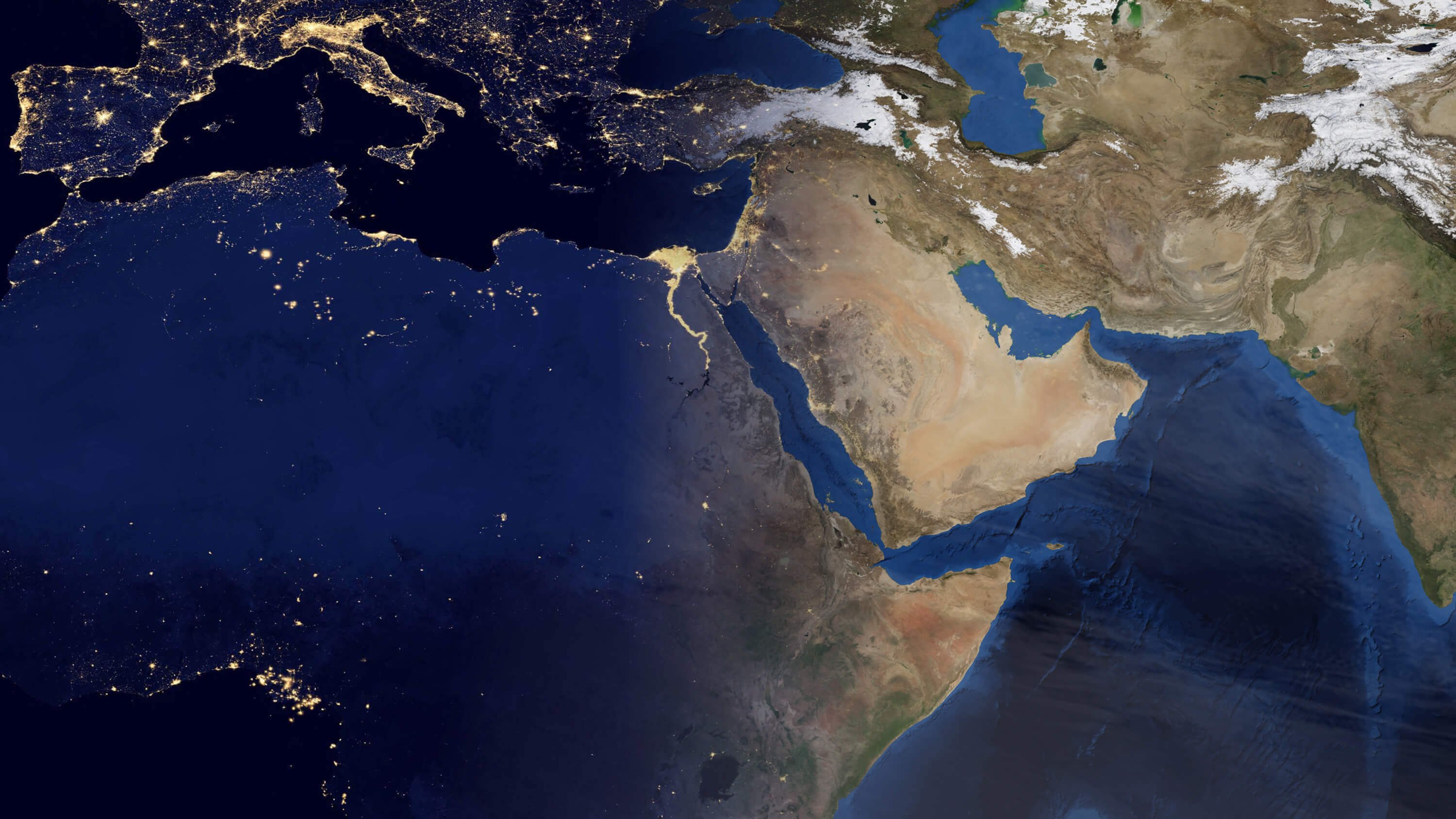
Iran Africa Middle East satellite map
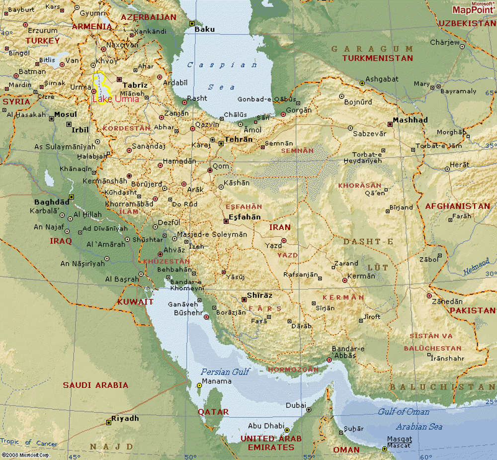
Iran Physical Map with Elevation, Mountains and Major Cities
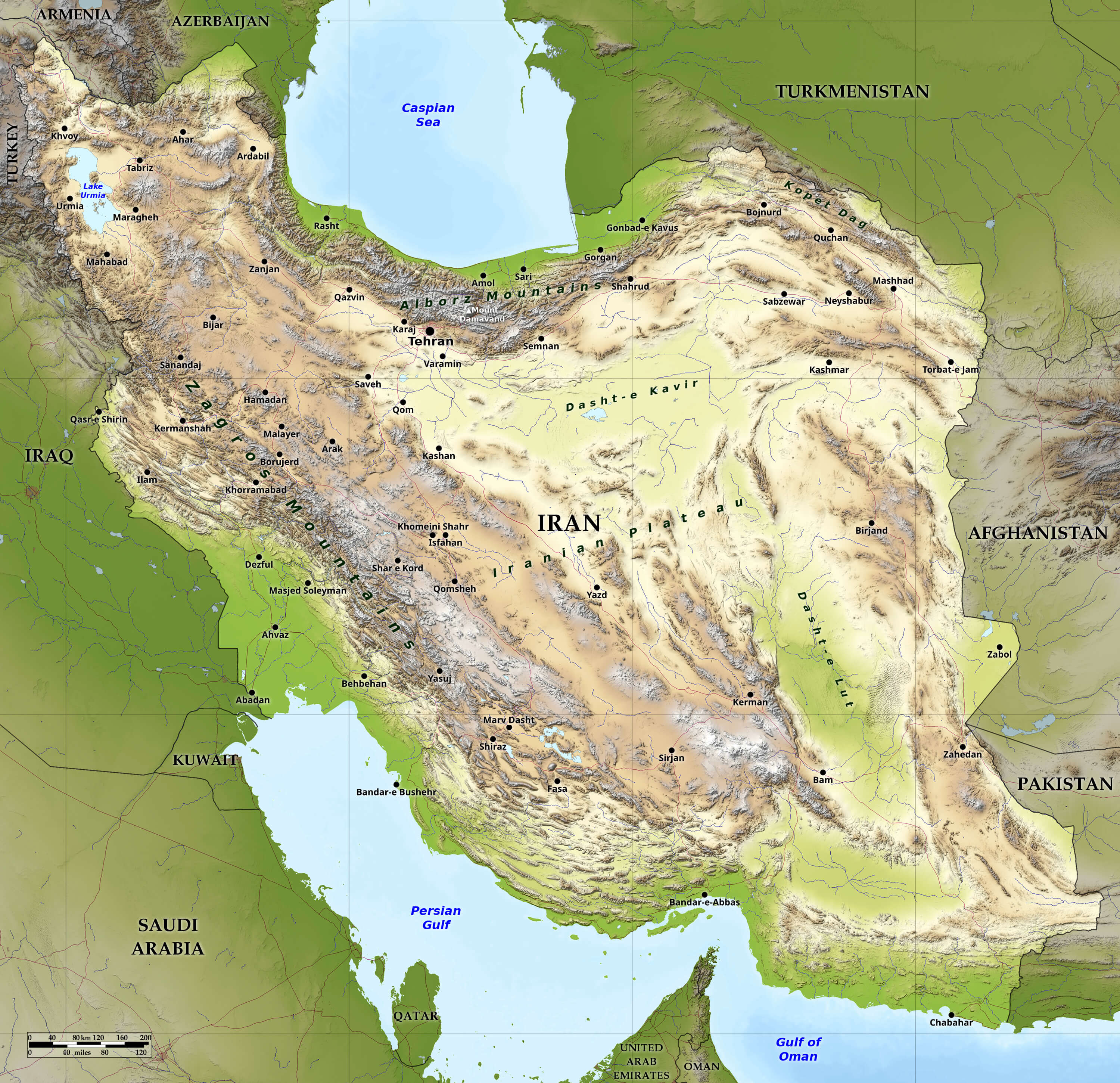
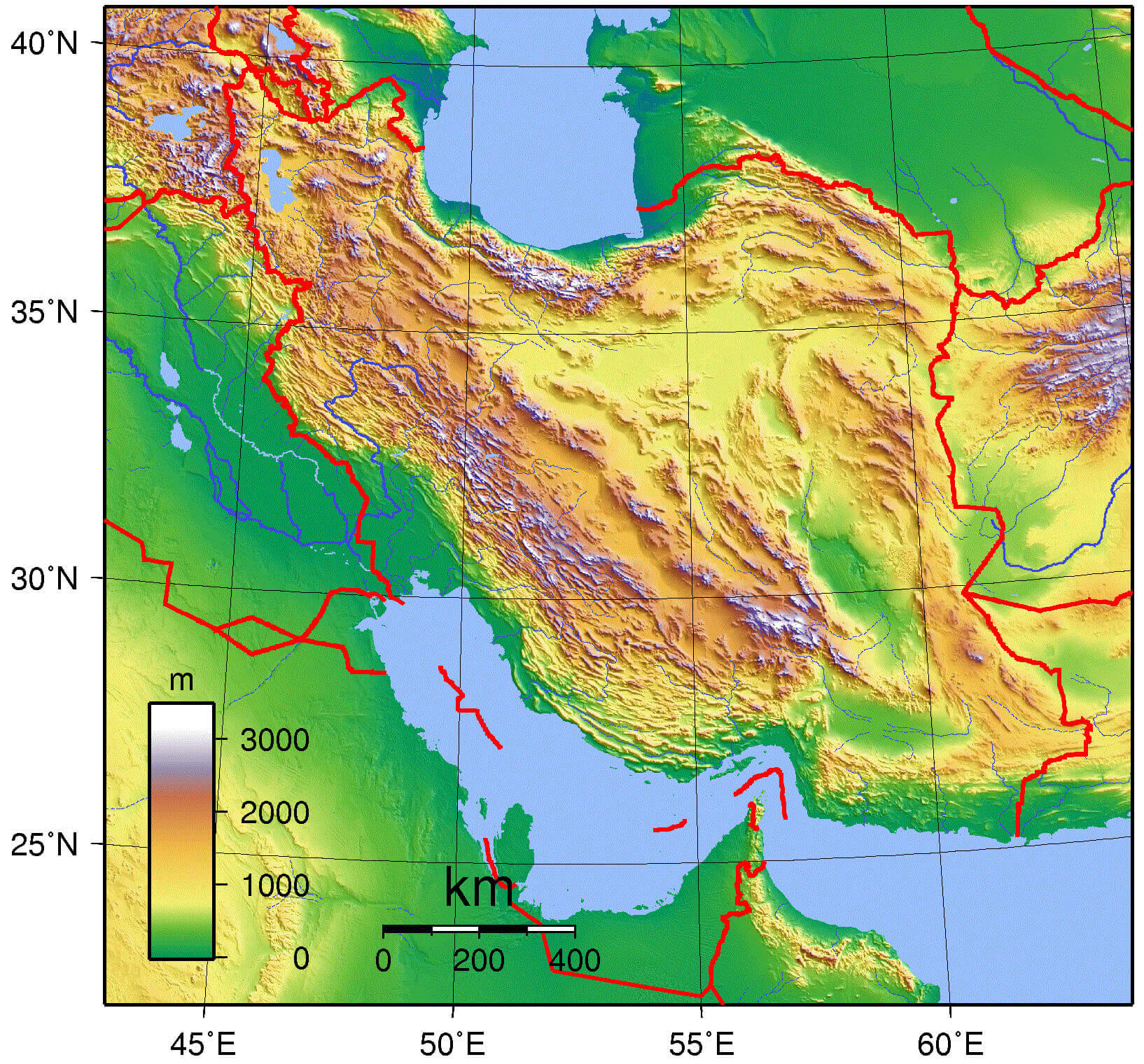
Physical map of Iran with elevation
Iran physical map with major cities
Relief map of Iran
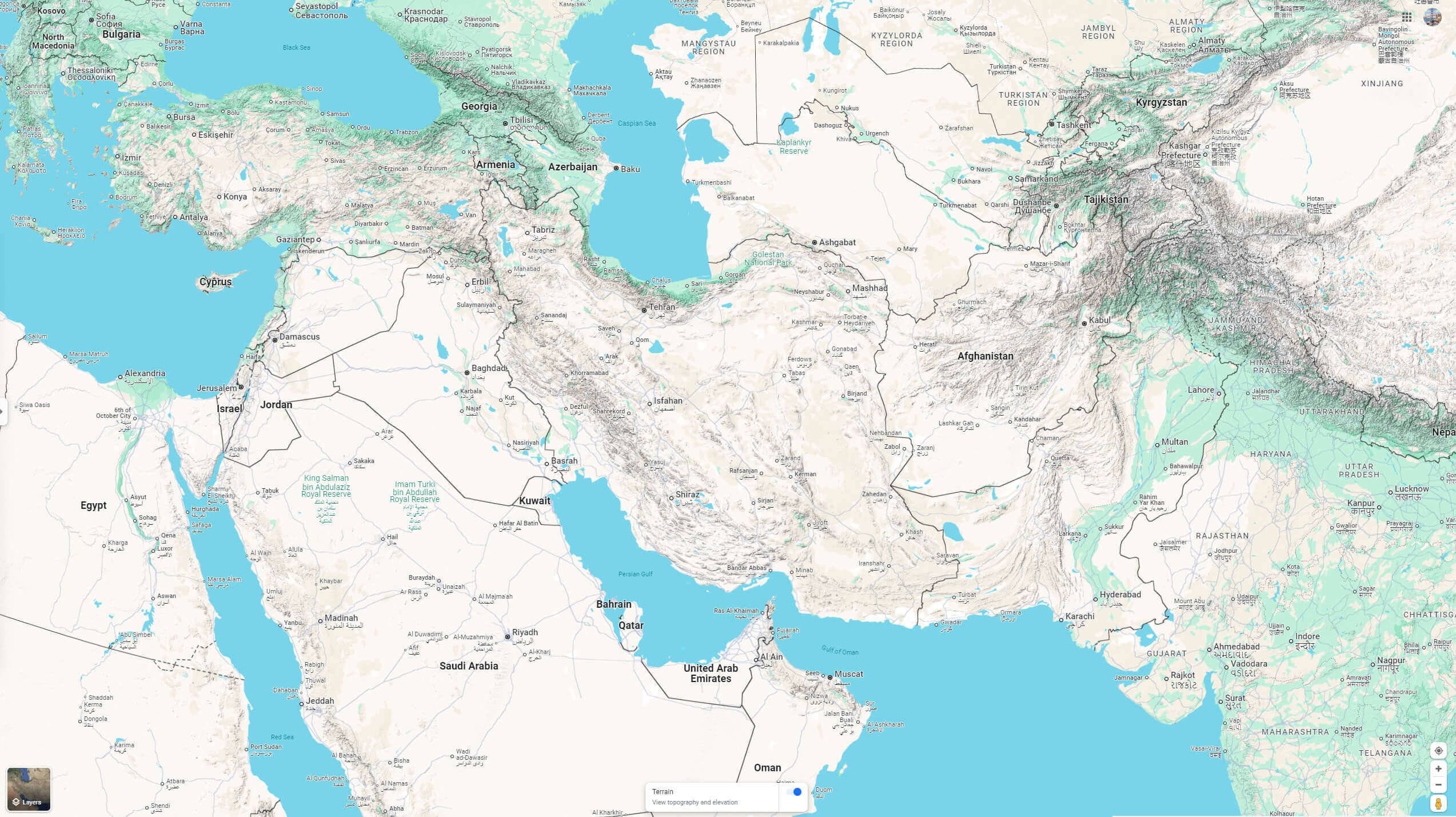
Iran Google terrain map
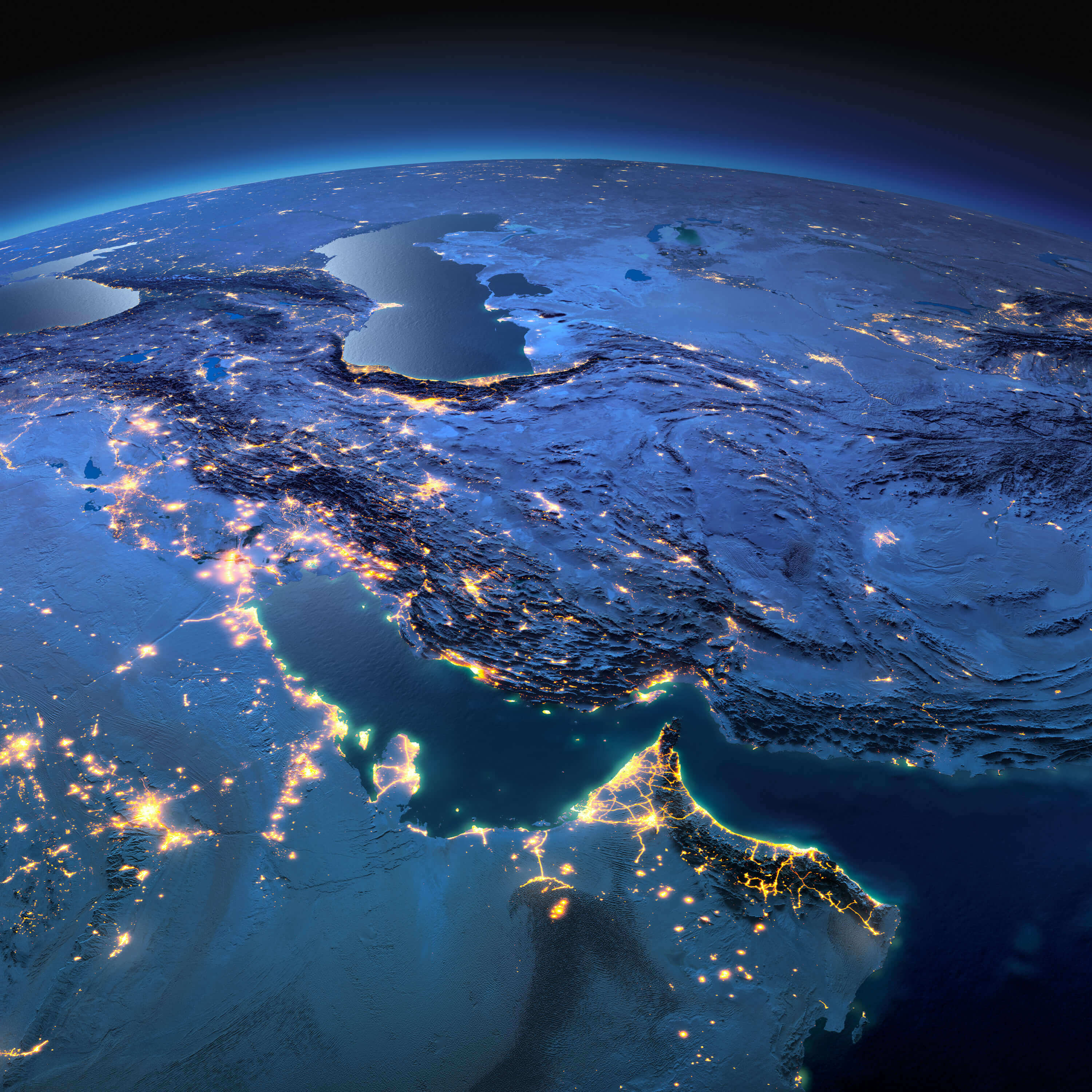
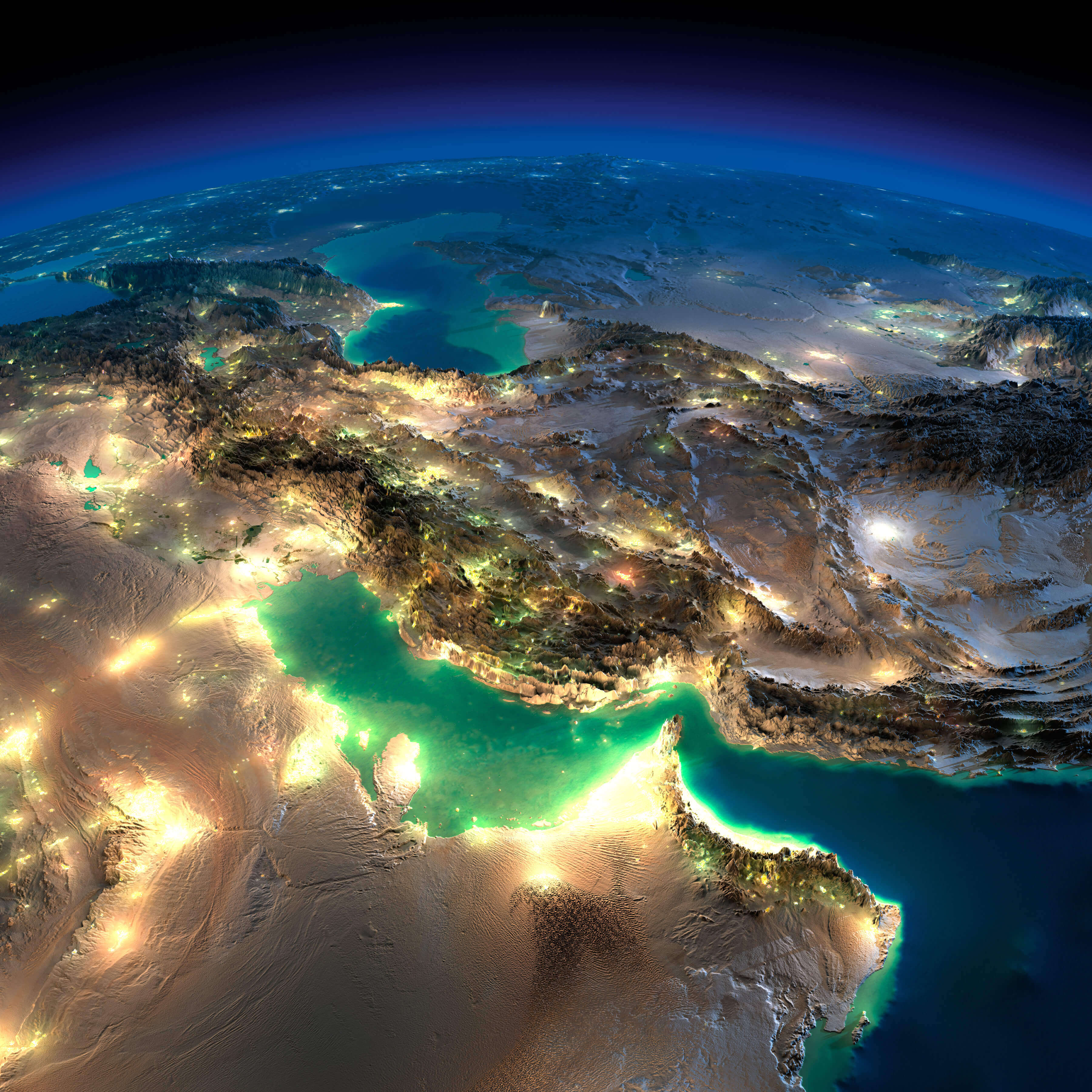
Iran map from space in the night
Iran national boundary physical map
Iran satellite map
Iran topographical map
Physical map of Iran
Topography map of Iran
Feel free to explore these pages as well:
Copyright GuideofTheWorld.Net 2006 - 2026. All rights reserved. Privacy Policy | Disclaimer