
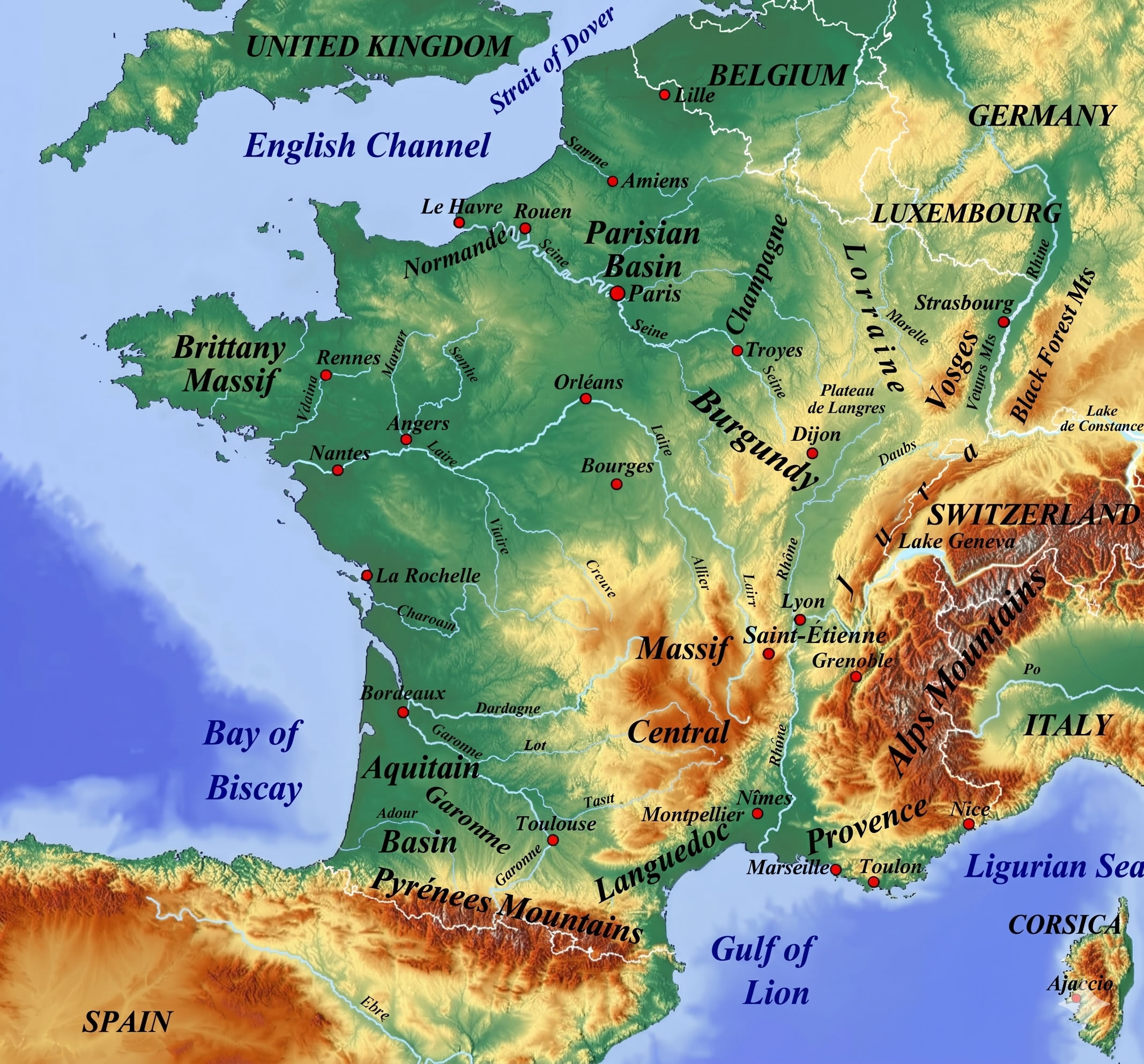
Detailed High-Resolution France Map: Cities, Regions, Rivers & Mountains
Access our highly detailed, high-resolution map of France. Explore major cities, regions, rivers, and mountain ranges in crystal clear detail. Ideal for travel planning, education, or research.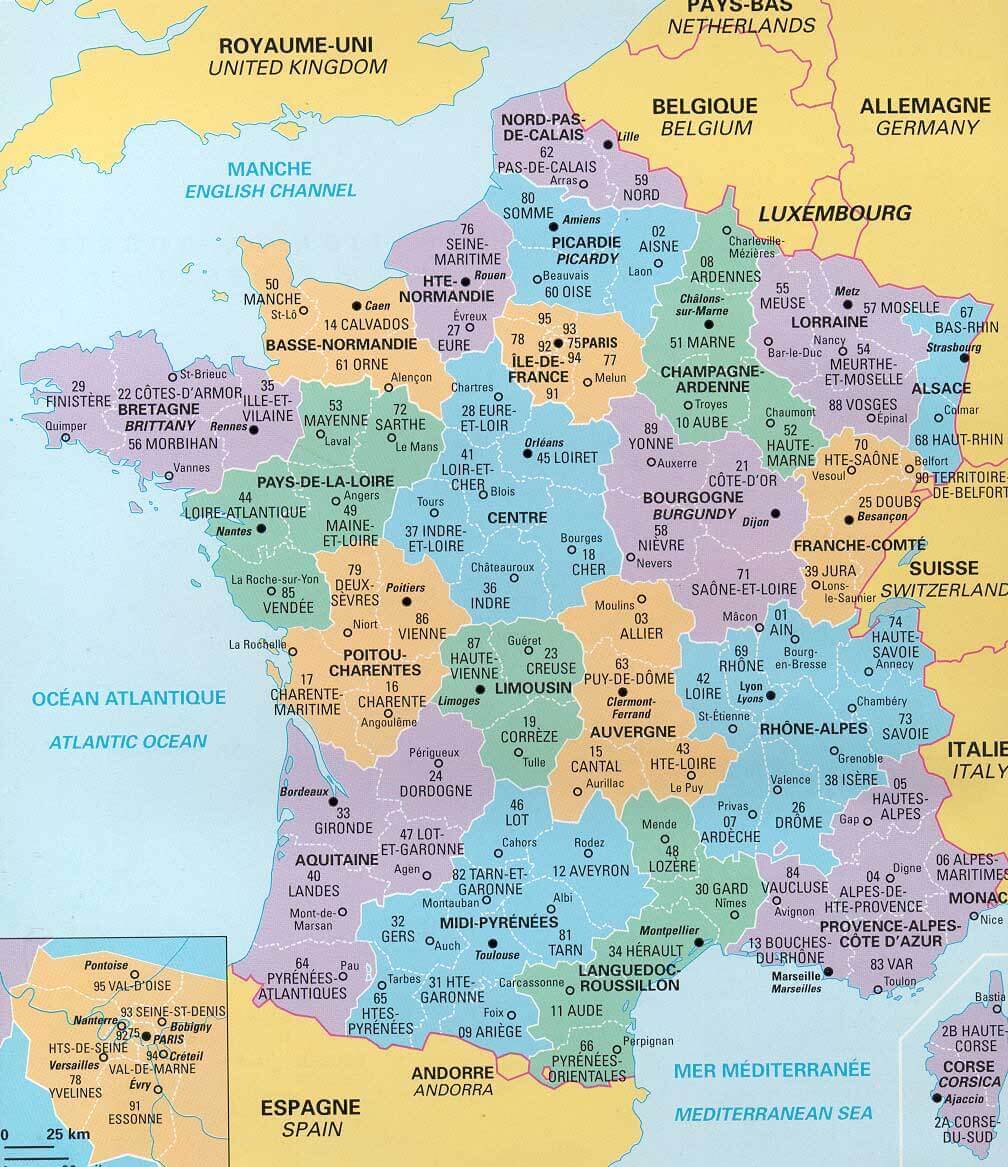
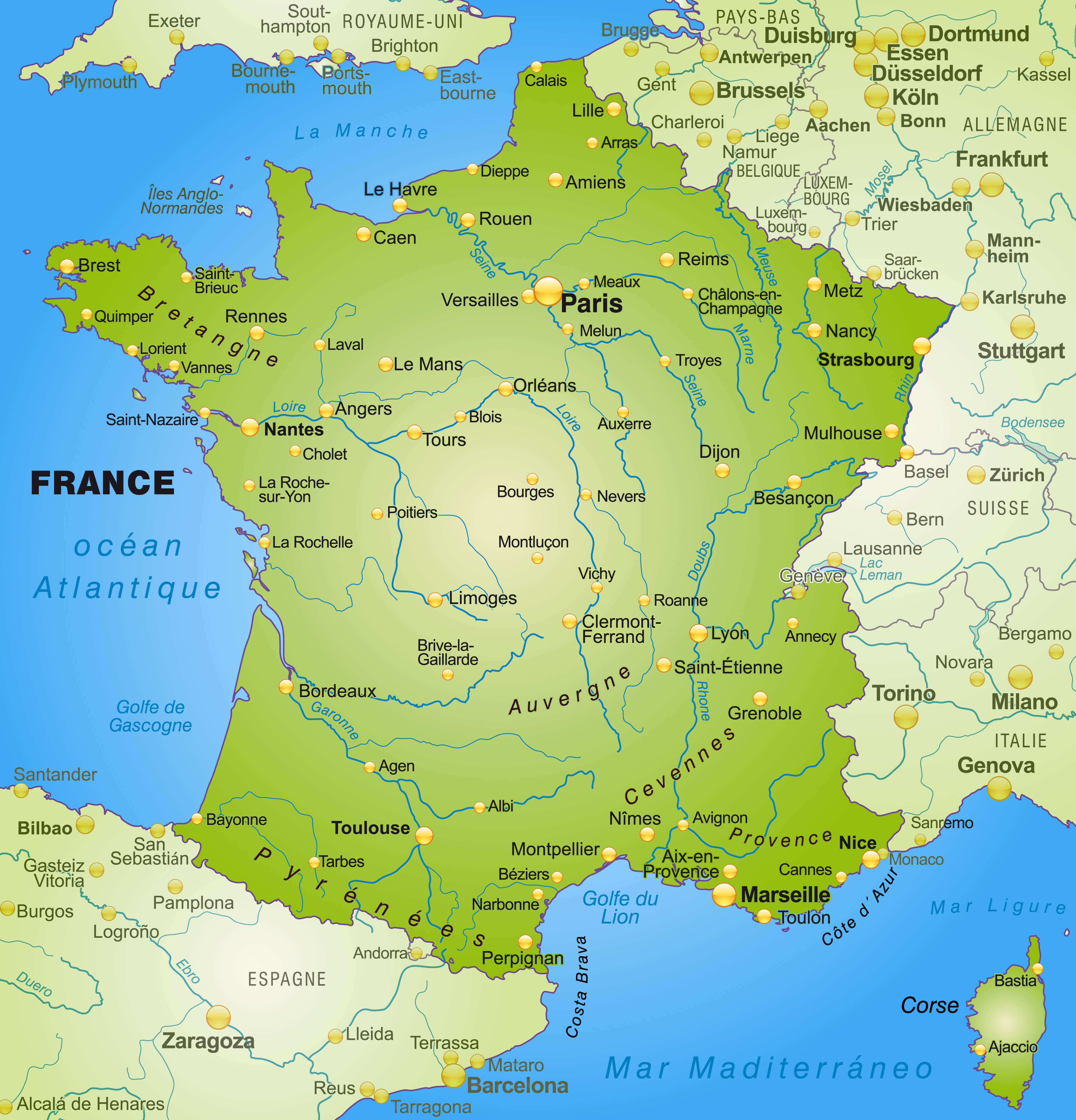
Map of France with rivers
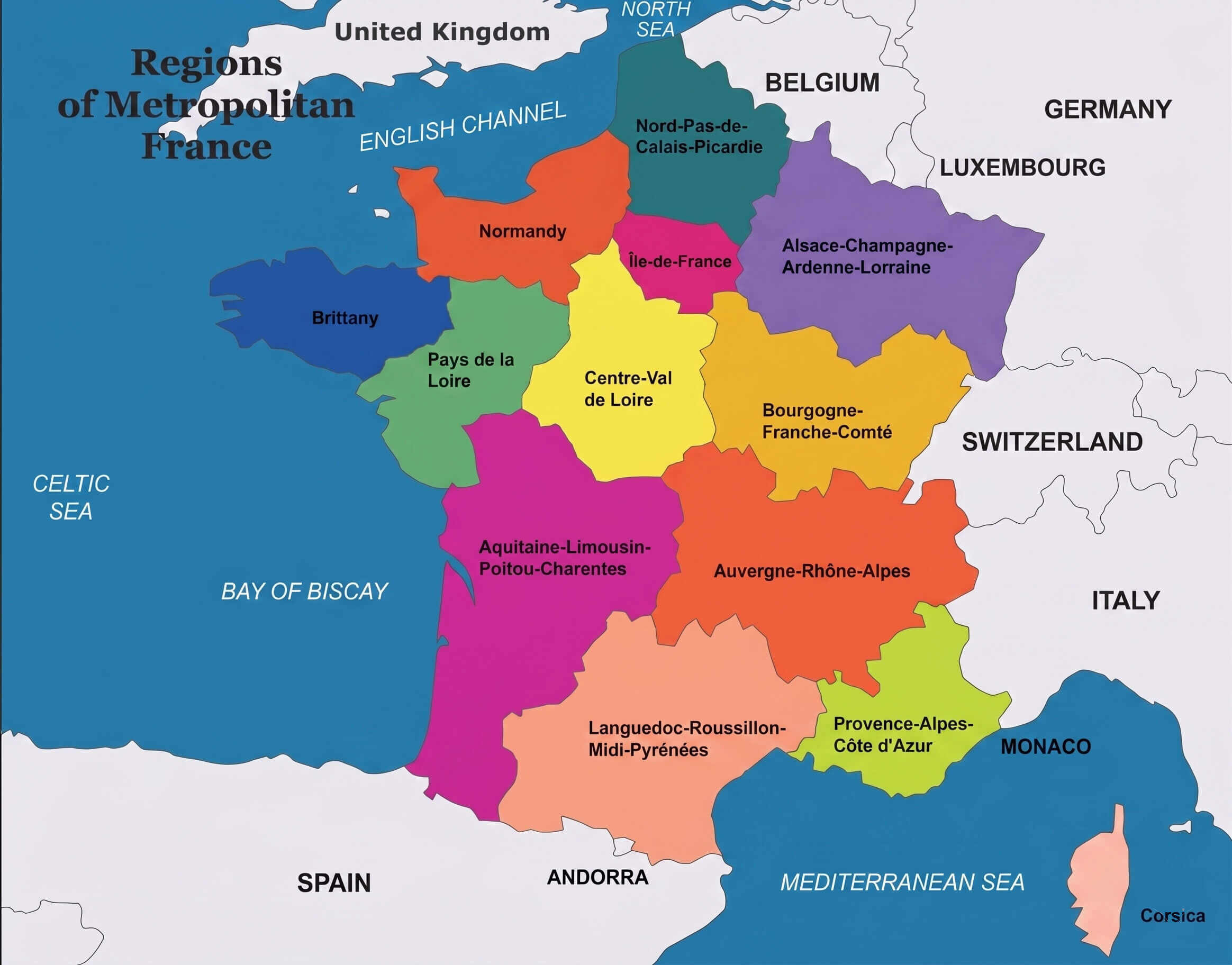
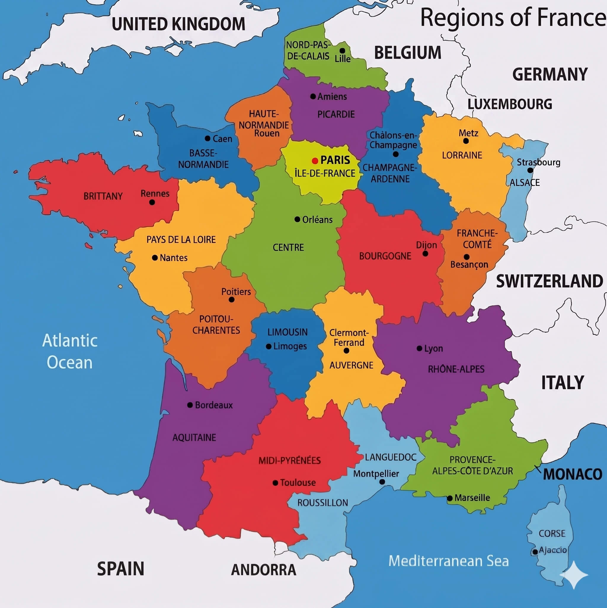
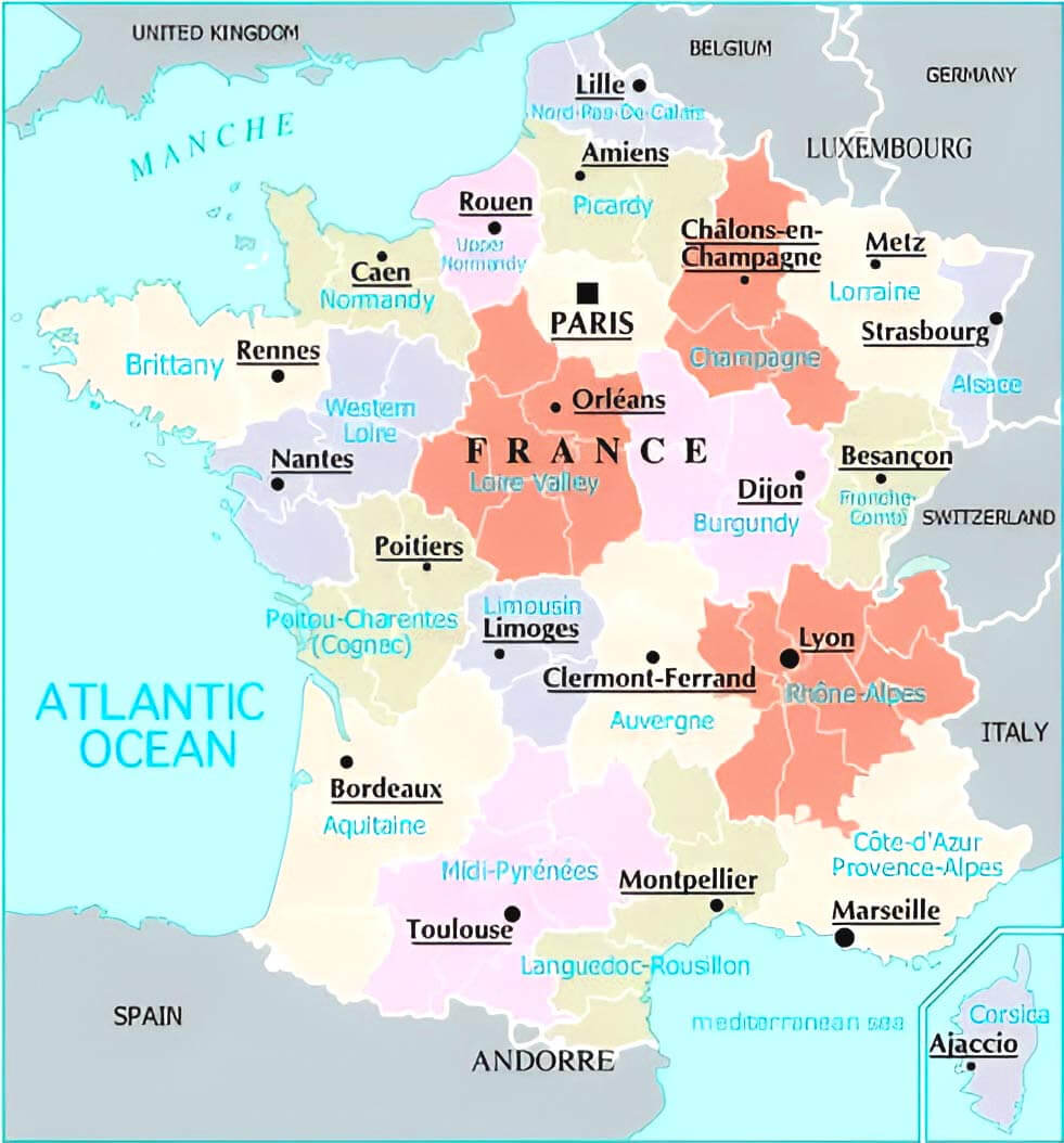
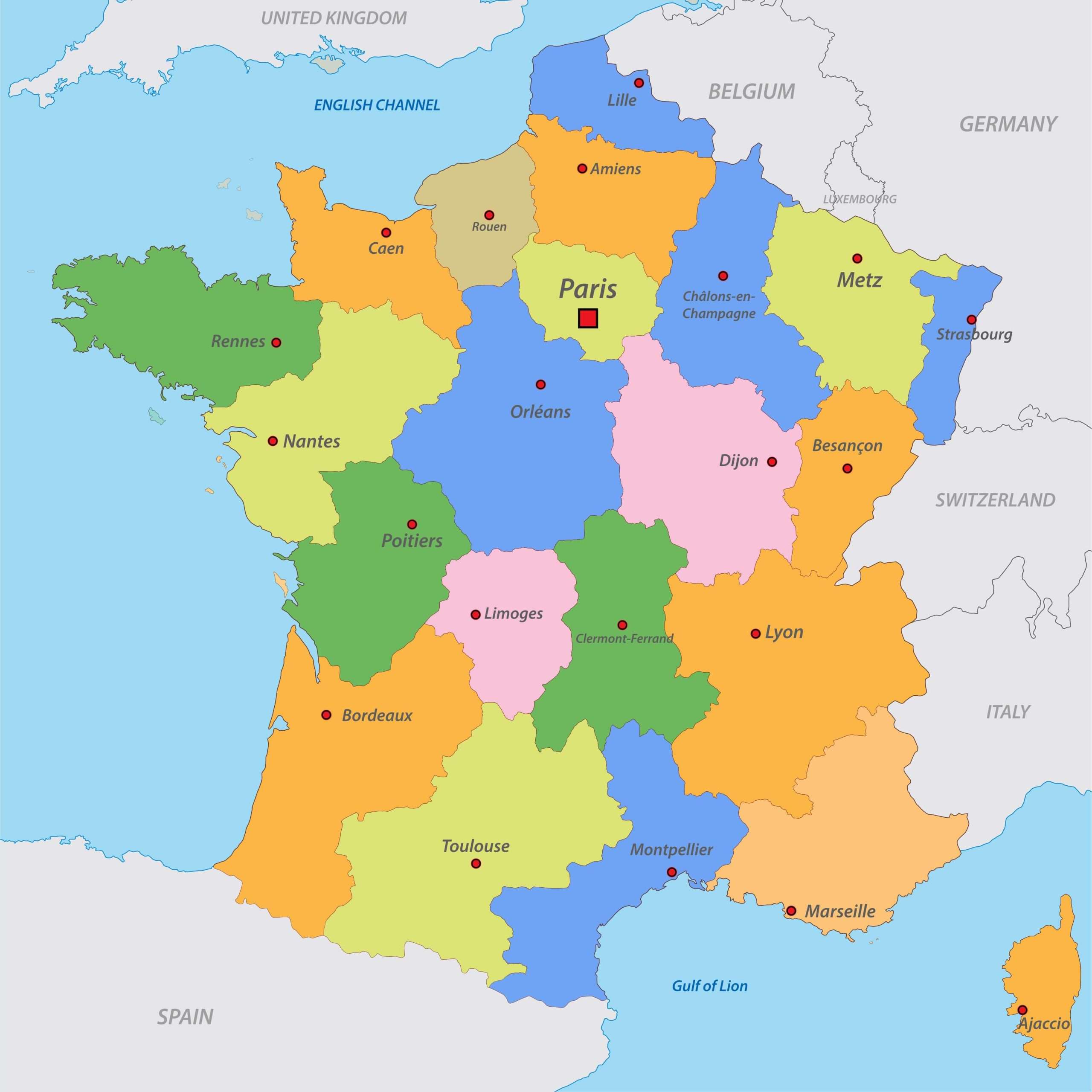
Regions of France Map
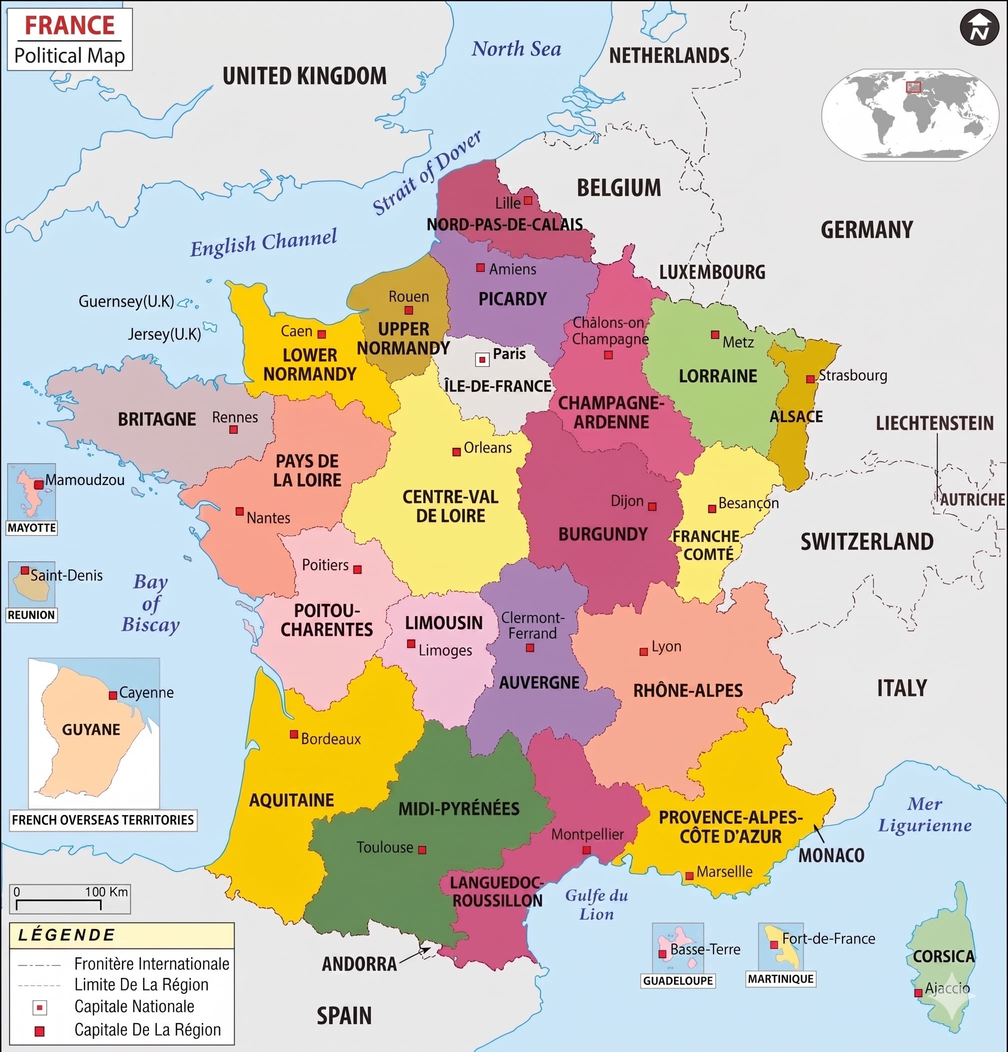
France political map
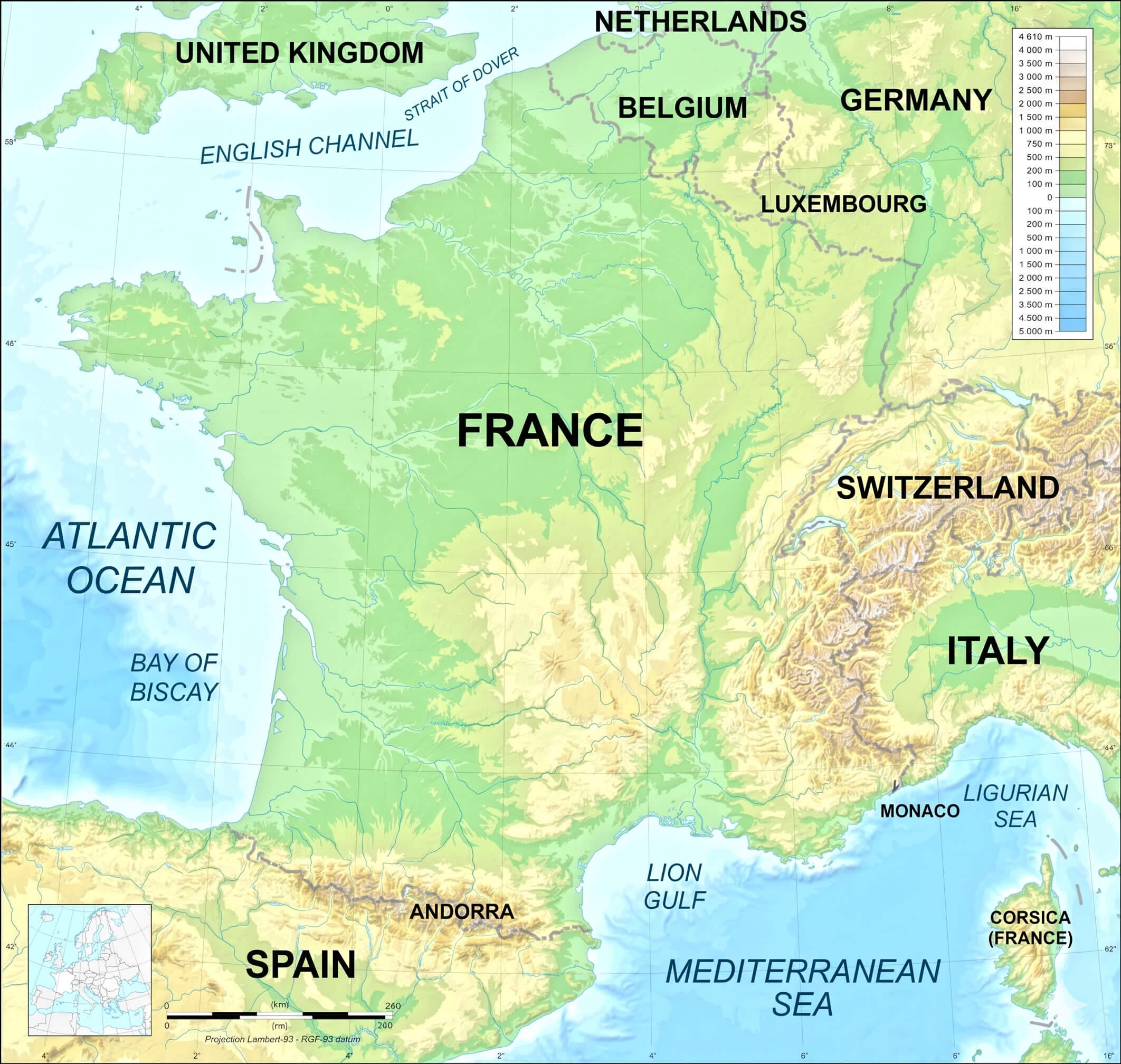
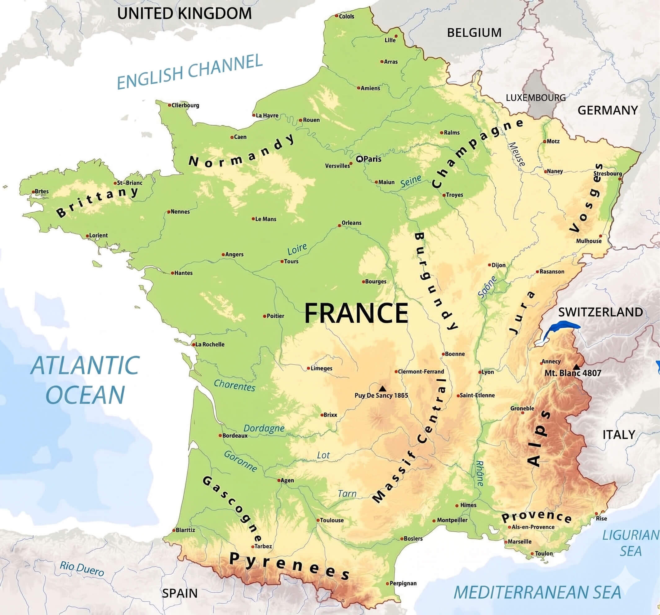
We provide extensive topographic information, labeling key mountain ranges such as the Alps—featuring the towering Mont Blanc—the Pyrenees border with Spain, and the sprawling Massif Central. Trace the full length of key rivers like the Seine, Loire, Garonne, and Rhône, or study the country’s coastal features and surrounding waters, including the Atlantic Ocean, Mediterranean Sea, and English Channel. Perfect for research, travel planning, or satisfying your curiosity about French geography, this is the ultimate detailed geography map available in high definition.
France provinces map
France physical map

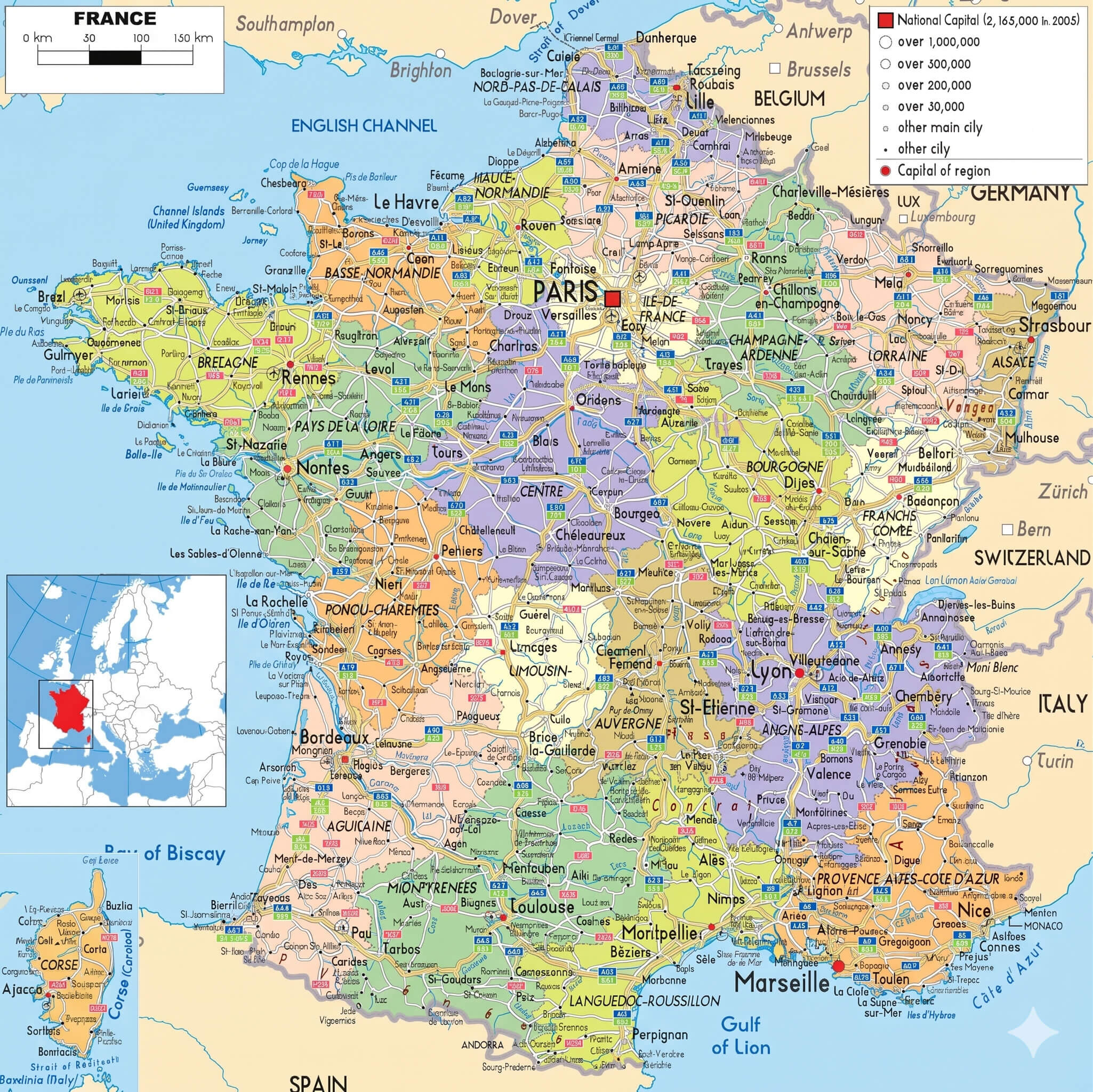
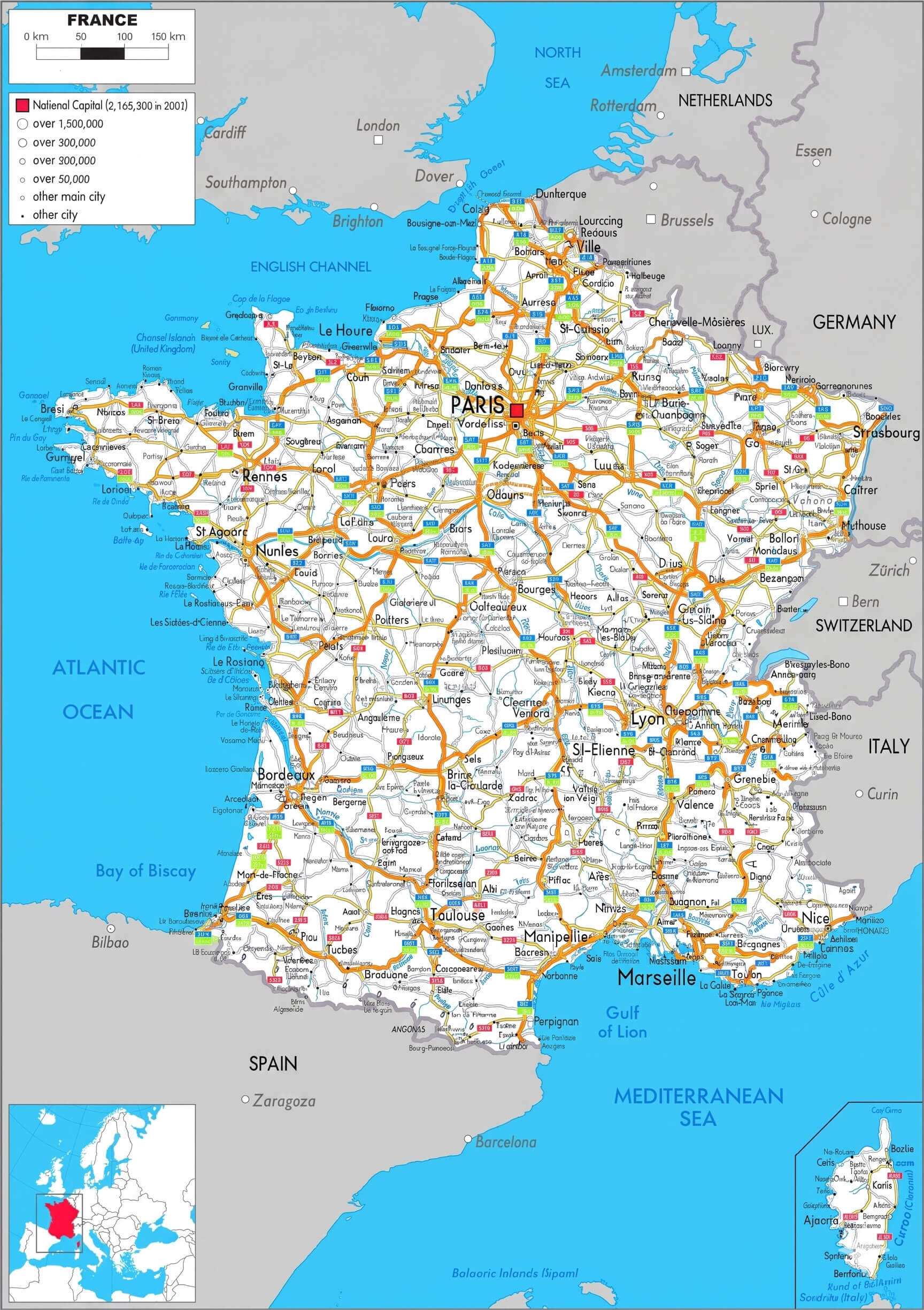
France highways map with cantons
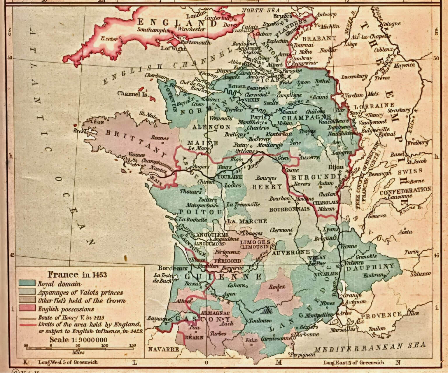
France historical map
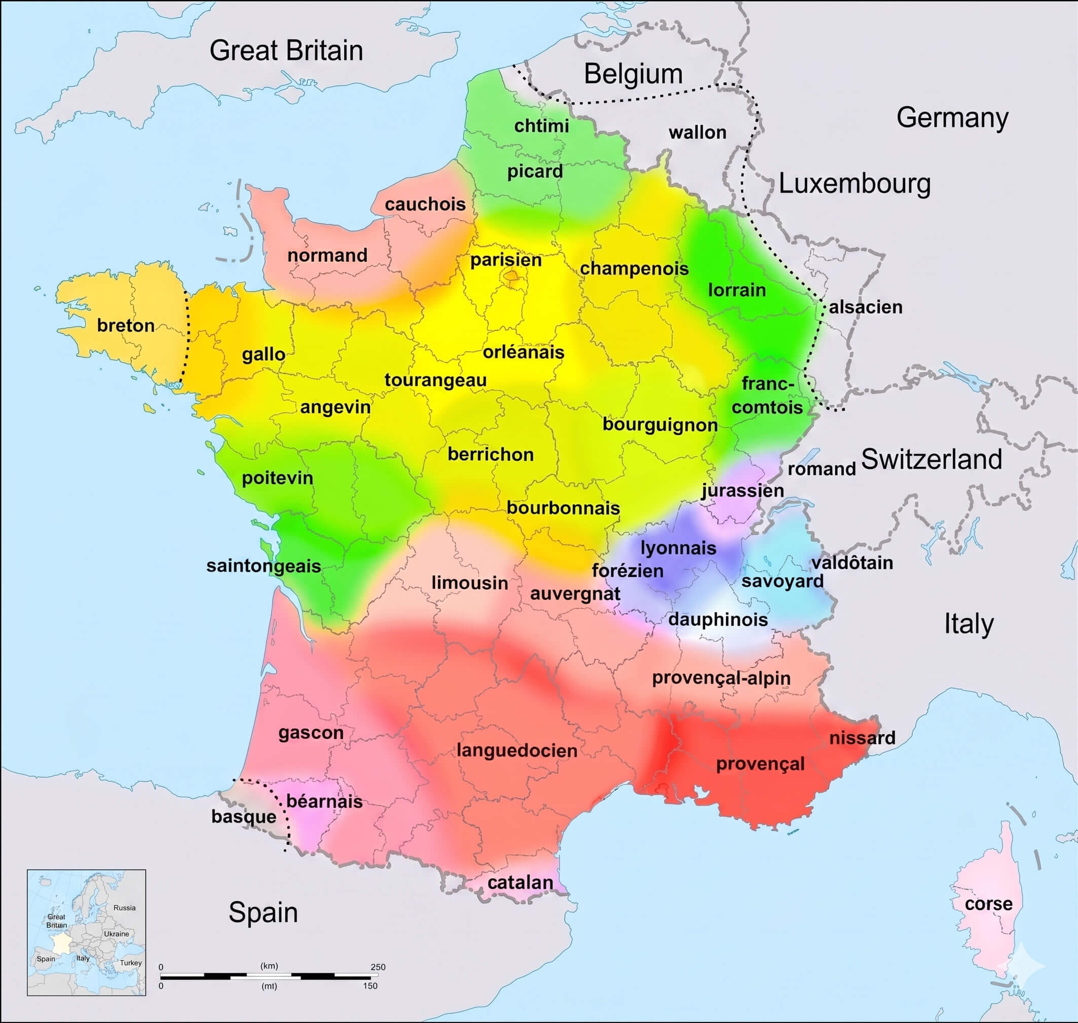
France linguistic map
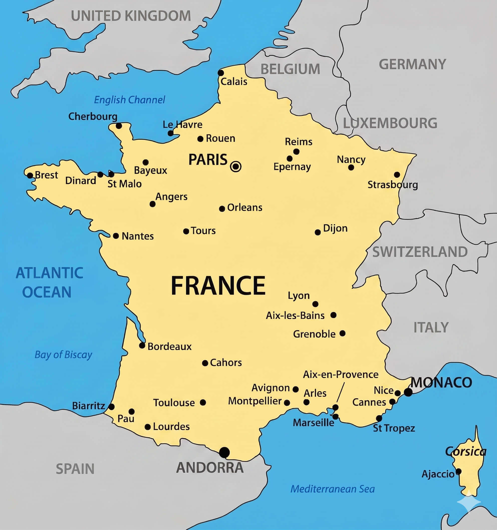
France major cities map
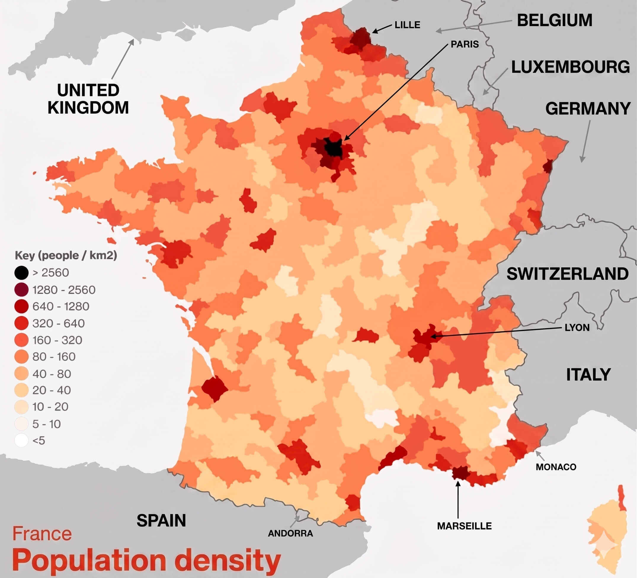
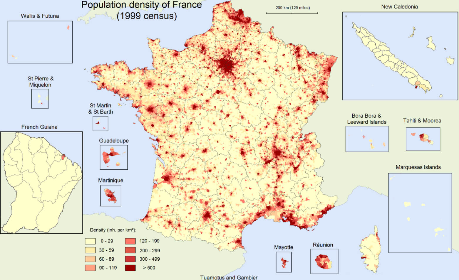
France population density map
France highways map with cities
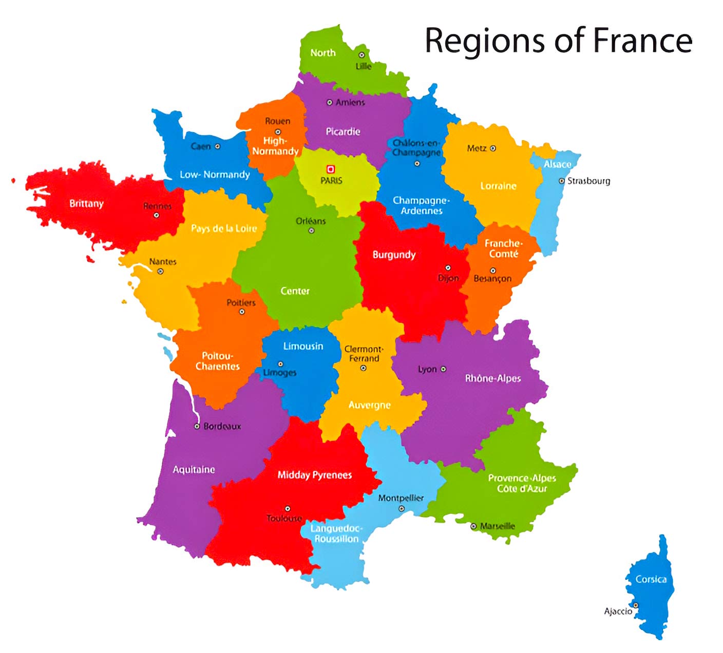
Colorful France map with regions
France satellite map
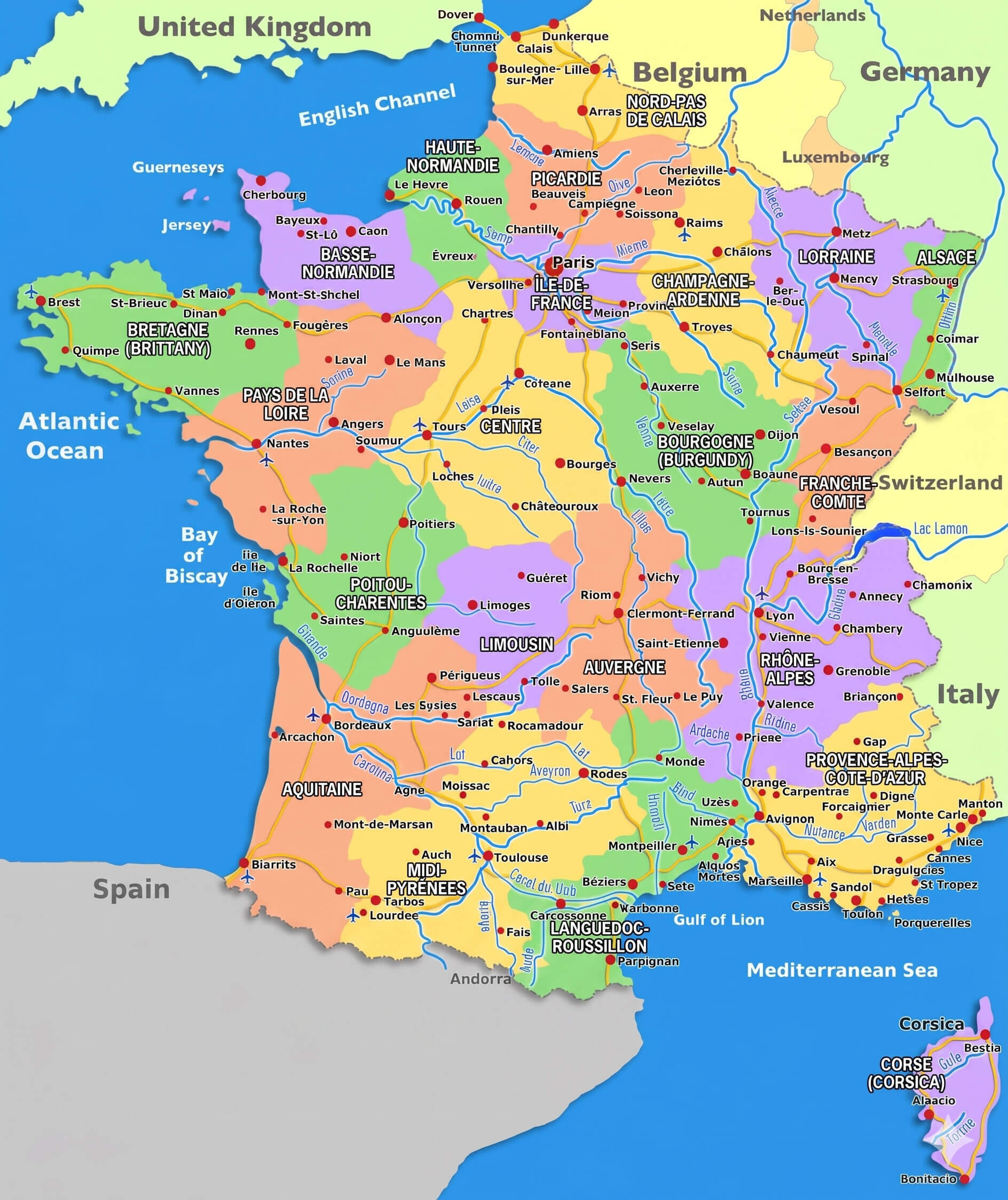
France major cities map with rivers
France administrative map with regions and roads
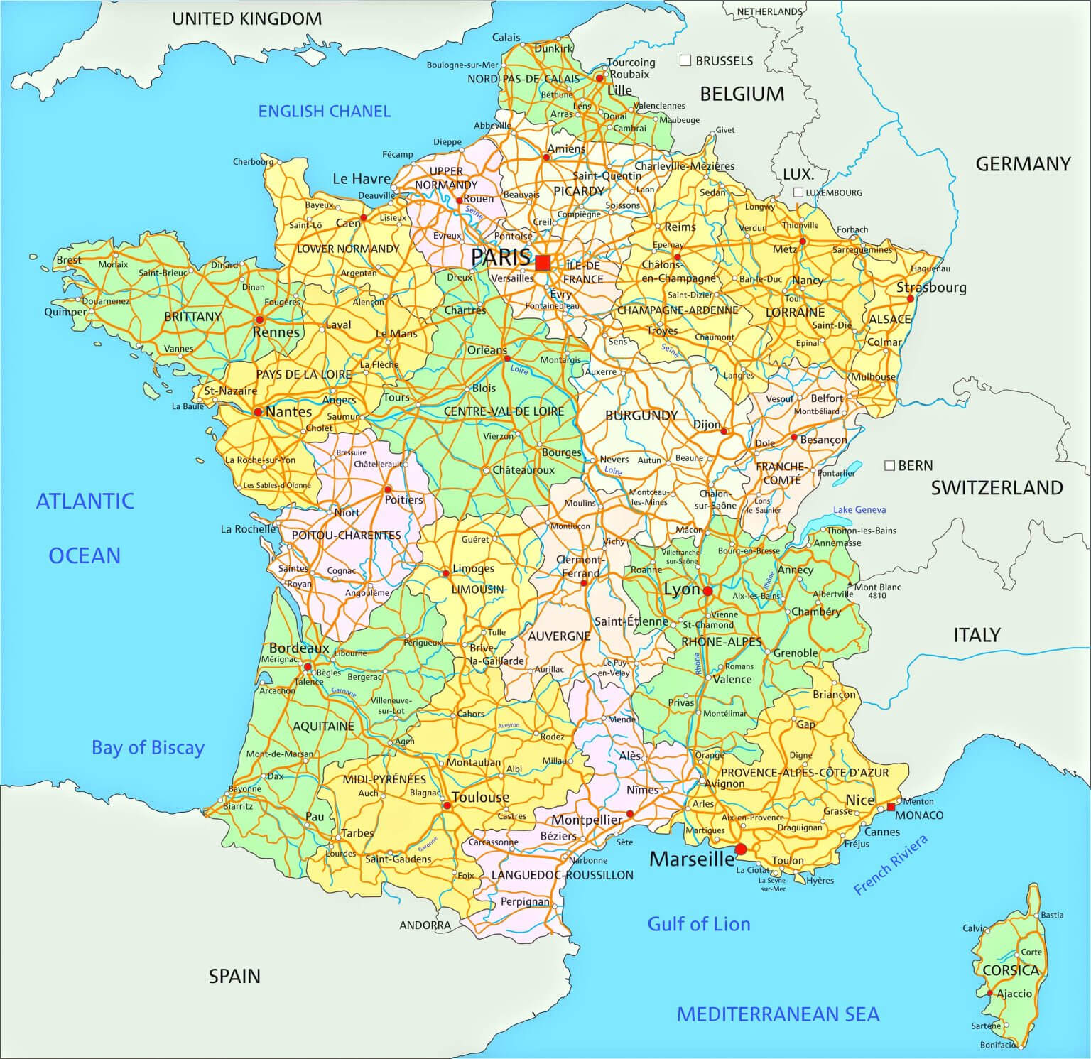
France administrative map
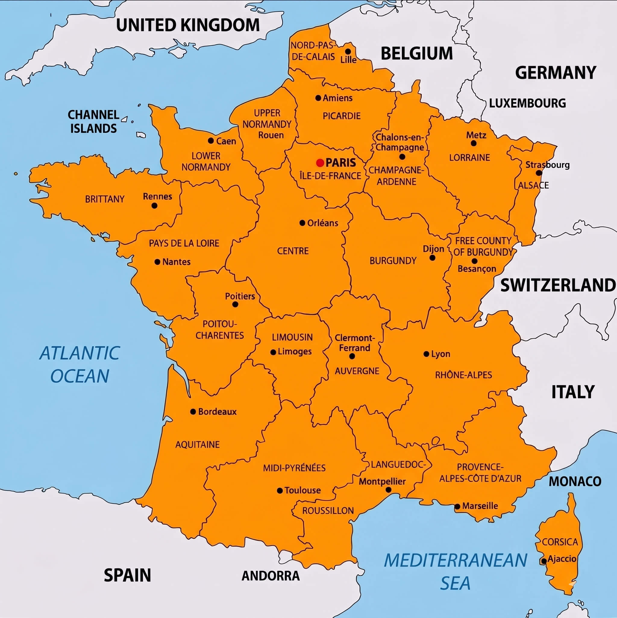
France regions map
France cantons map with major cities
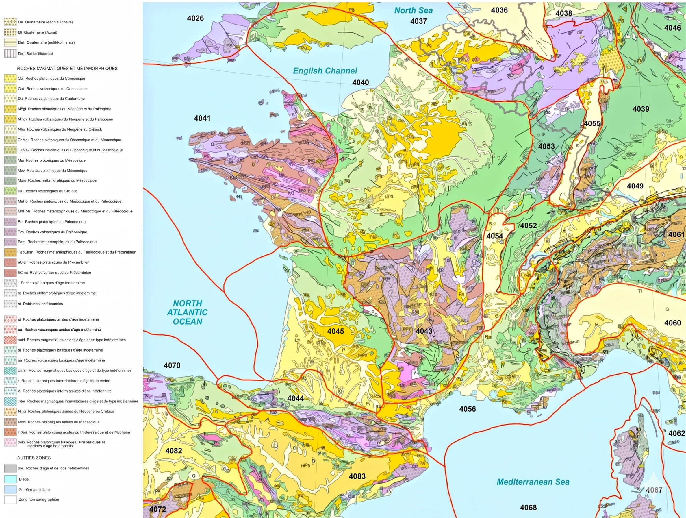
France geologic map
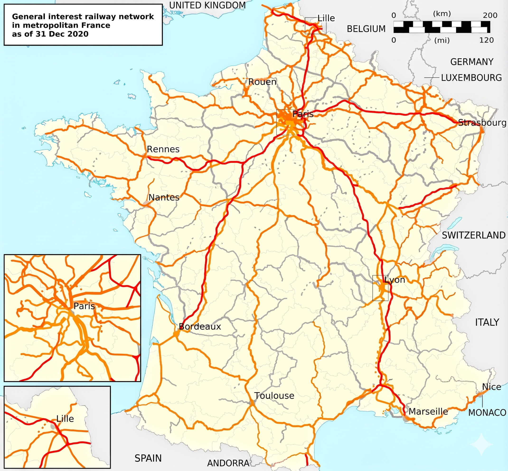
France railway network map
France relief map
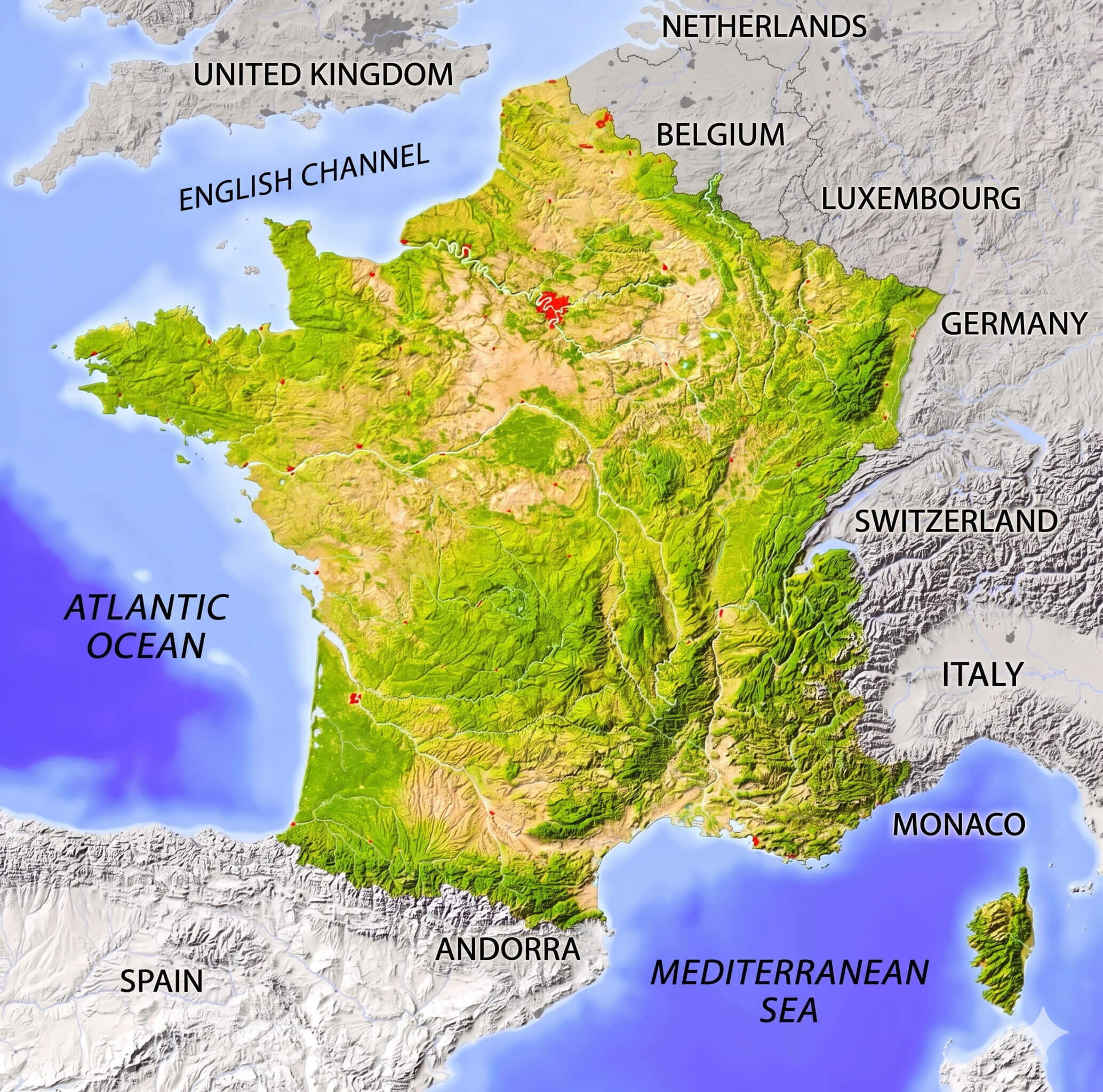
France topographic map mountains rivers
France tourism map
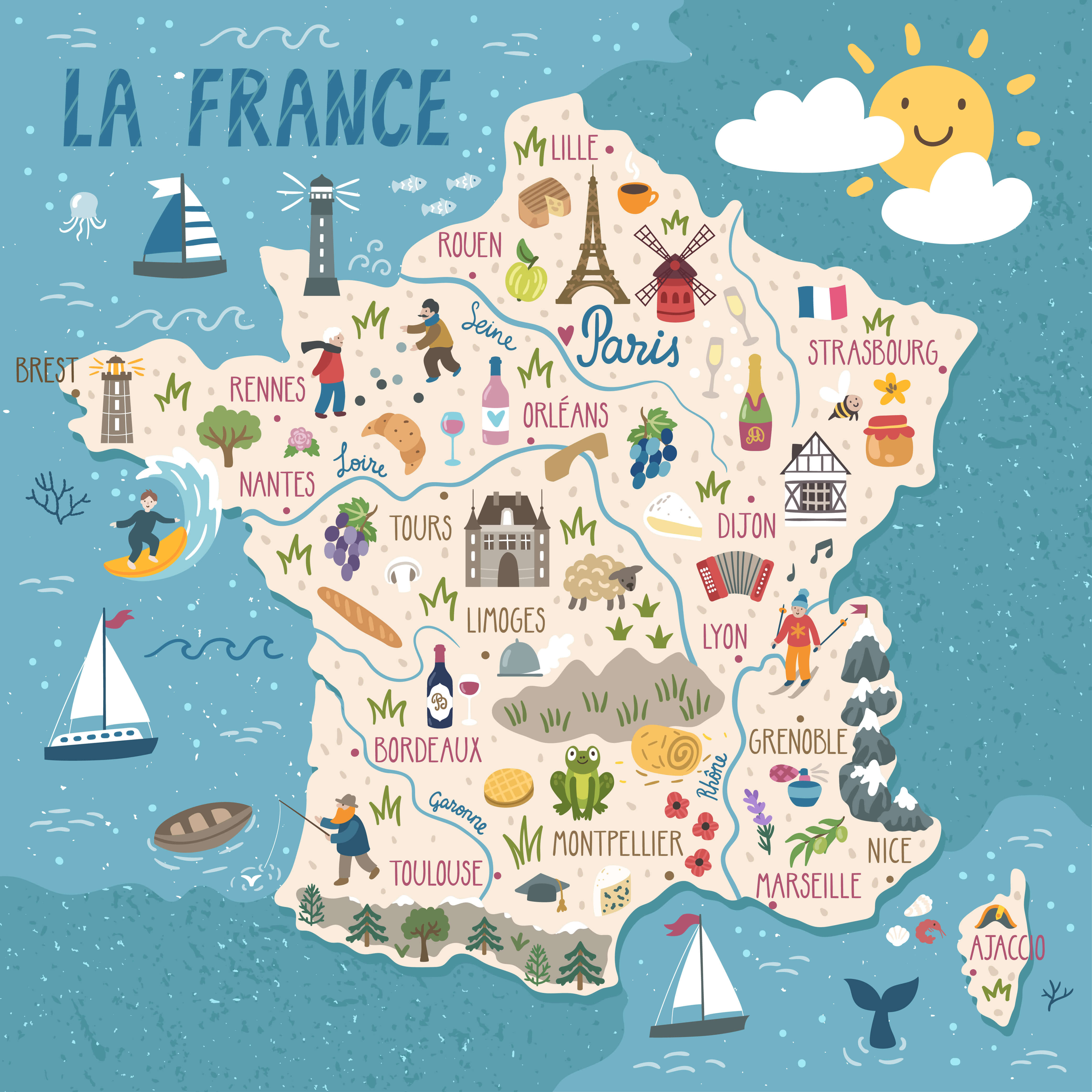
France travel map
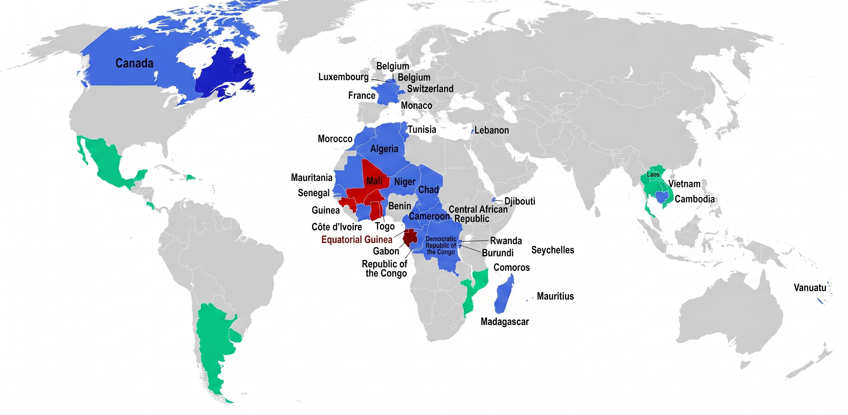
Francophone countries map in the World
Map of France with regions labeled
Physical map of France rivers and mountains
Population density map of France
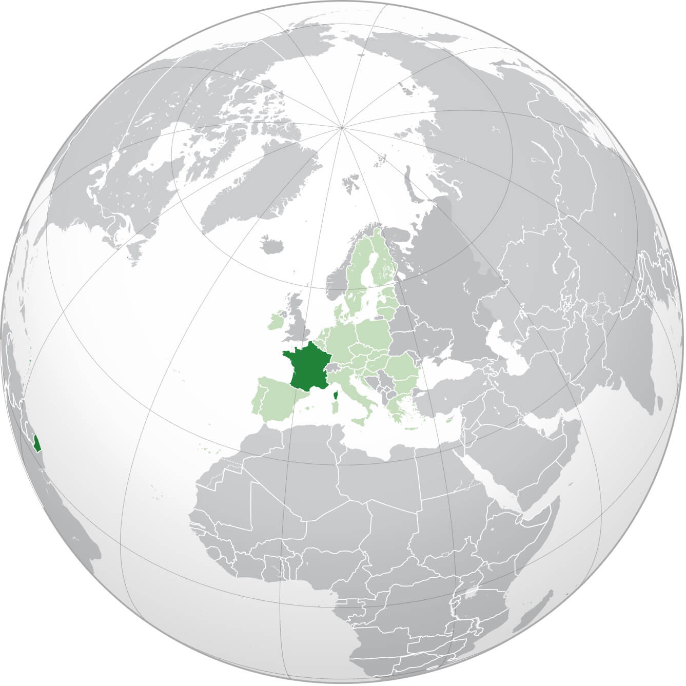
Where is France on the World map
Feel free to explore these pages as well:
Paris Map Lyon Map Marseille Map Lille Map Strasbourg Map Bordeaux Map Nice Map Saint Etienne Map Toulouse Map Montpellier Map Grenoble Map Toulon Map Rouen Map Mulhouse Map Le Havre Map Metz Map Chambery Map Annecy Map Colmar Map Besancon Map Le Mans Map Caen Map Valence Map Avignon Map Nantes Map Angers Map Nancy Map Nimes Map Rennes Map Annemasse Map Cannes Map Brest Map Dijon Map Clermont Ferrand Map Aix en Provence MapCopyright GuideofTheWorld.Net 2006 - 2026. All rights reserved. Privacy Policy | Disclaimer