
Map of Colorado
Navigate Colorado map, satellite images of the ColoradoUnited States, US states, largest cities, political map of Colorado USA, capitals and physical maps.
A Collection of Colorado Maps
Colorado administrative map
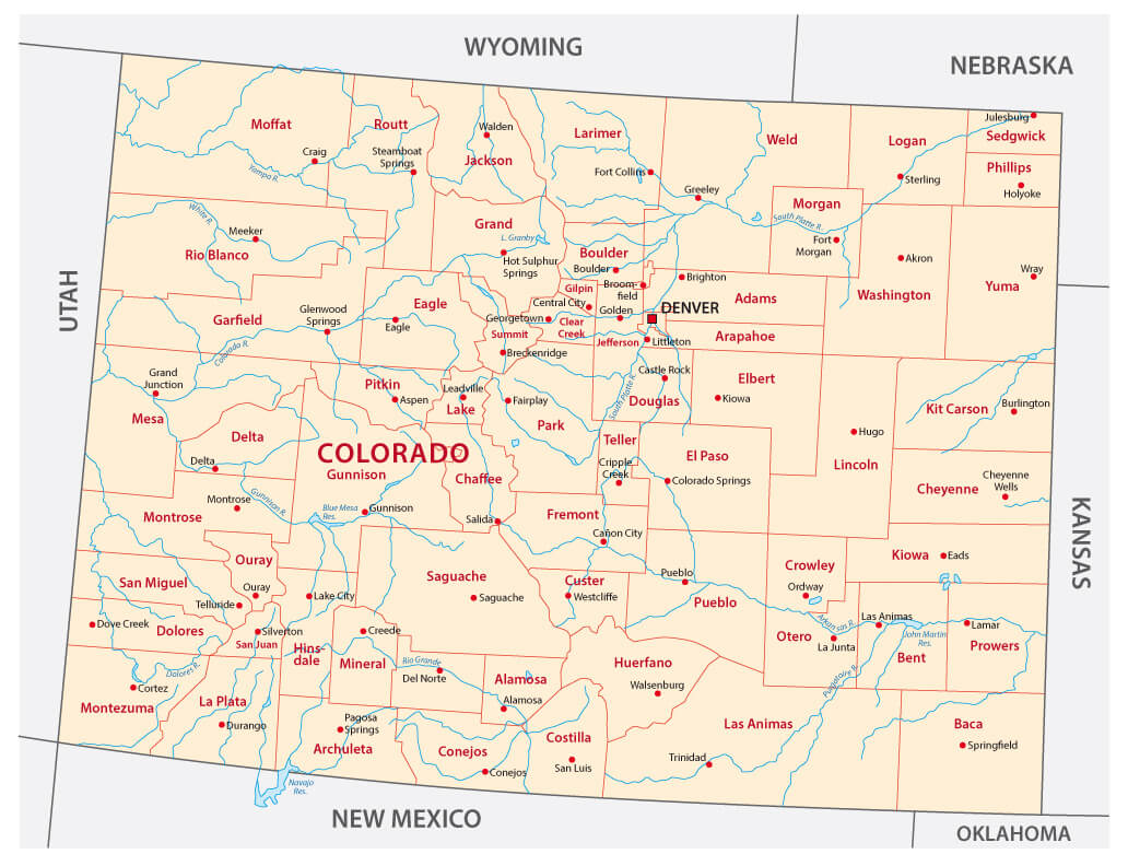 Colorado administrative map with cities, USA.
Colorado Shaded relief map
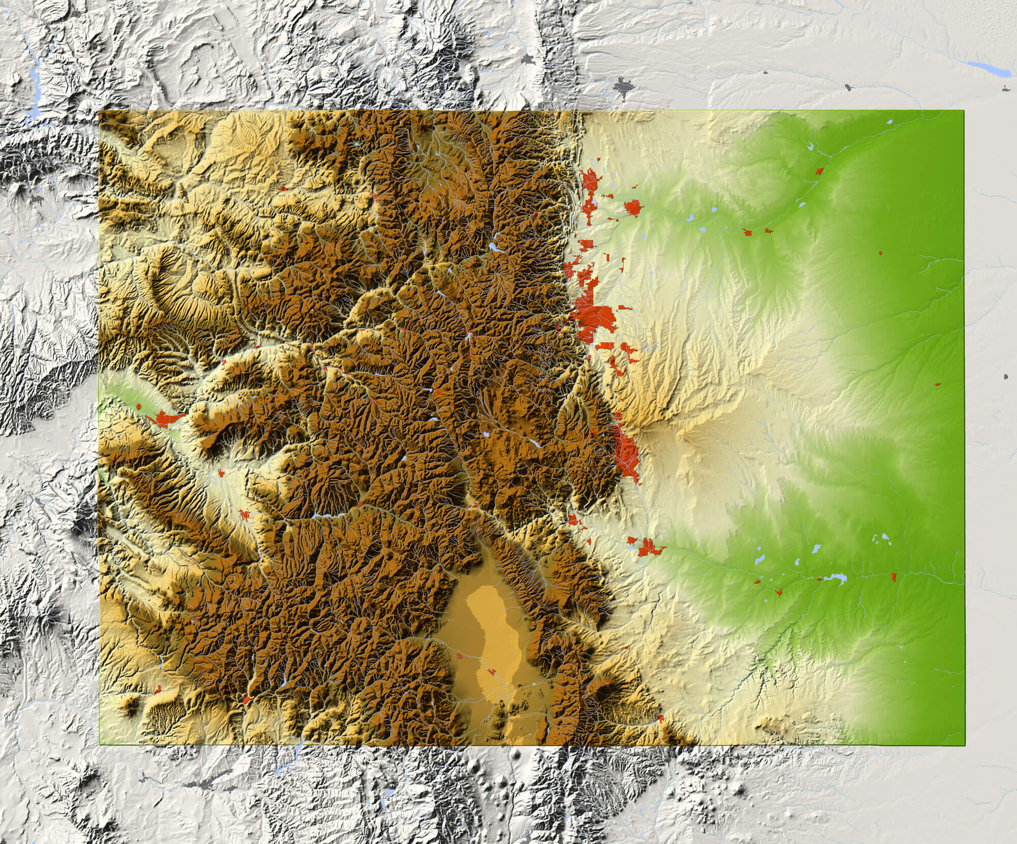 Colorado. Shaded relief map, with major urban areas and rivers, surrounding territory greyed out. Colored according to elevation. Clipping path for the state area included.
Map of America, Colorado
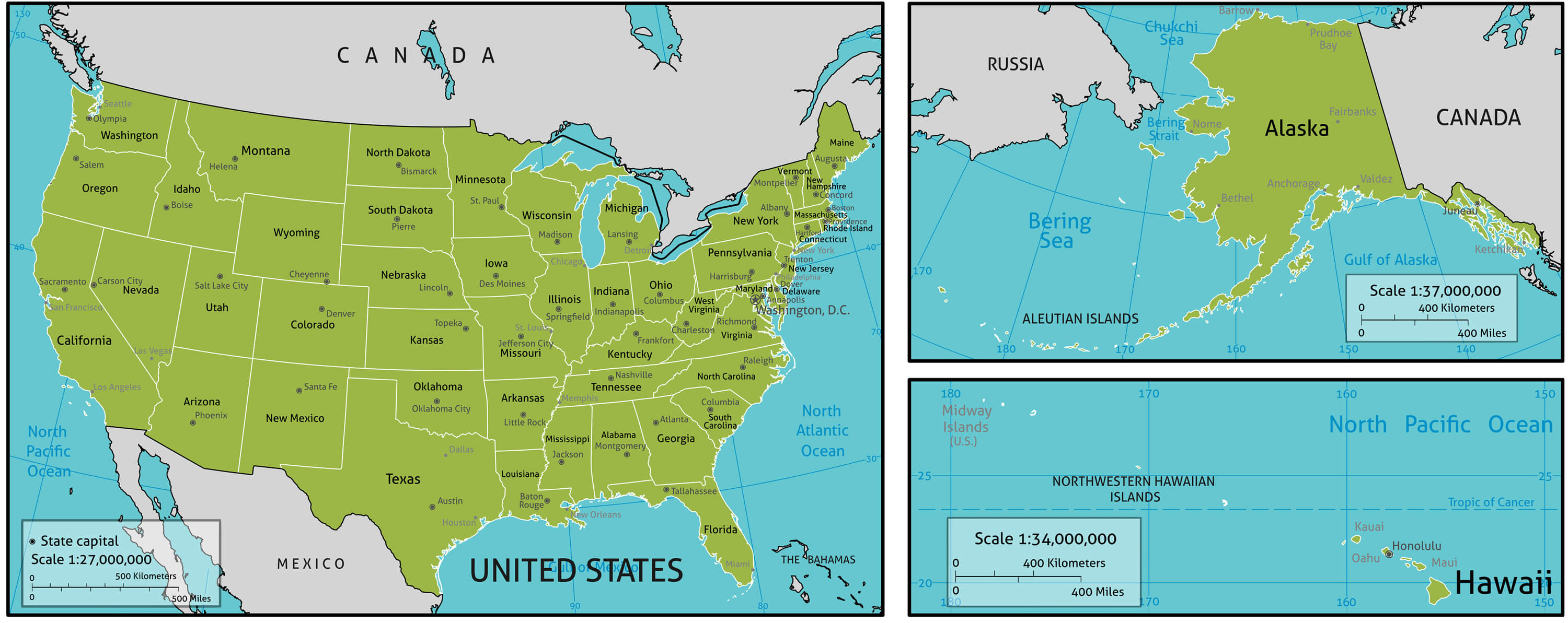 Map of America with state names, capitals and other major citieS. Colors and strokes easily changed. Vector Layers: Keys, state names, capital markers, capital names, longitude latitude lines and more.
Colorado State Map
 Colorado State Map with Community Assistance and Activates Icons Original Illustration.
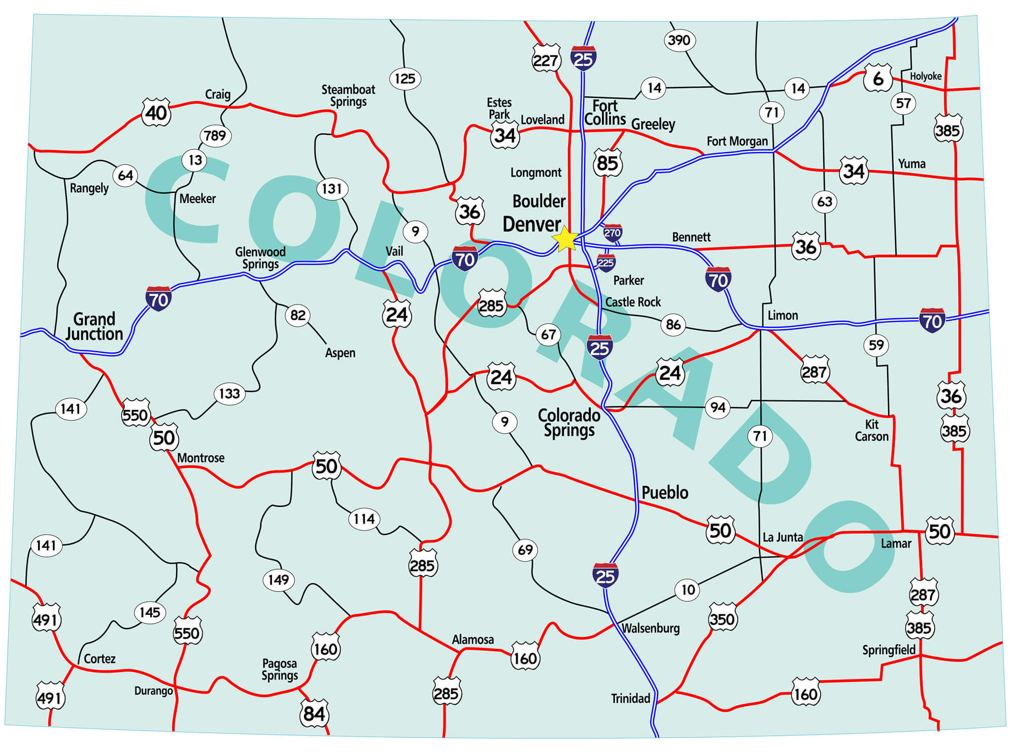
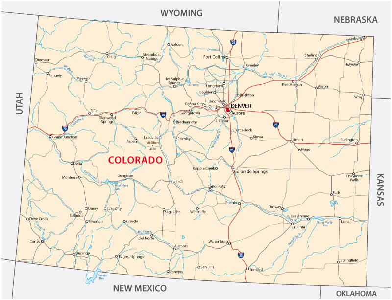
Colorado state road map
 Colorado state road map with Interstates, U.S. Highways and state roads. Raster illustration.
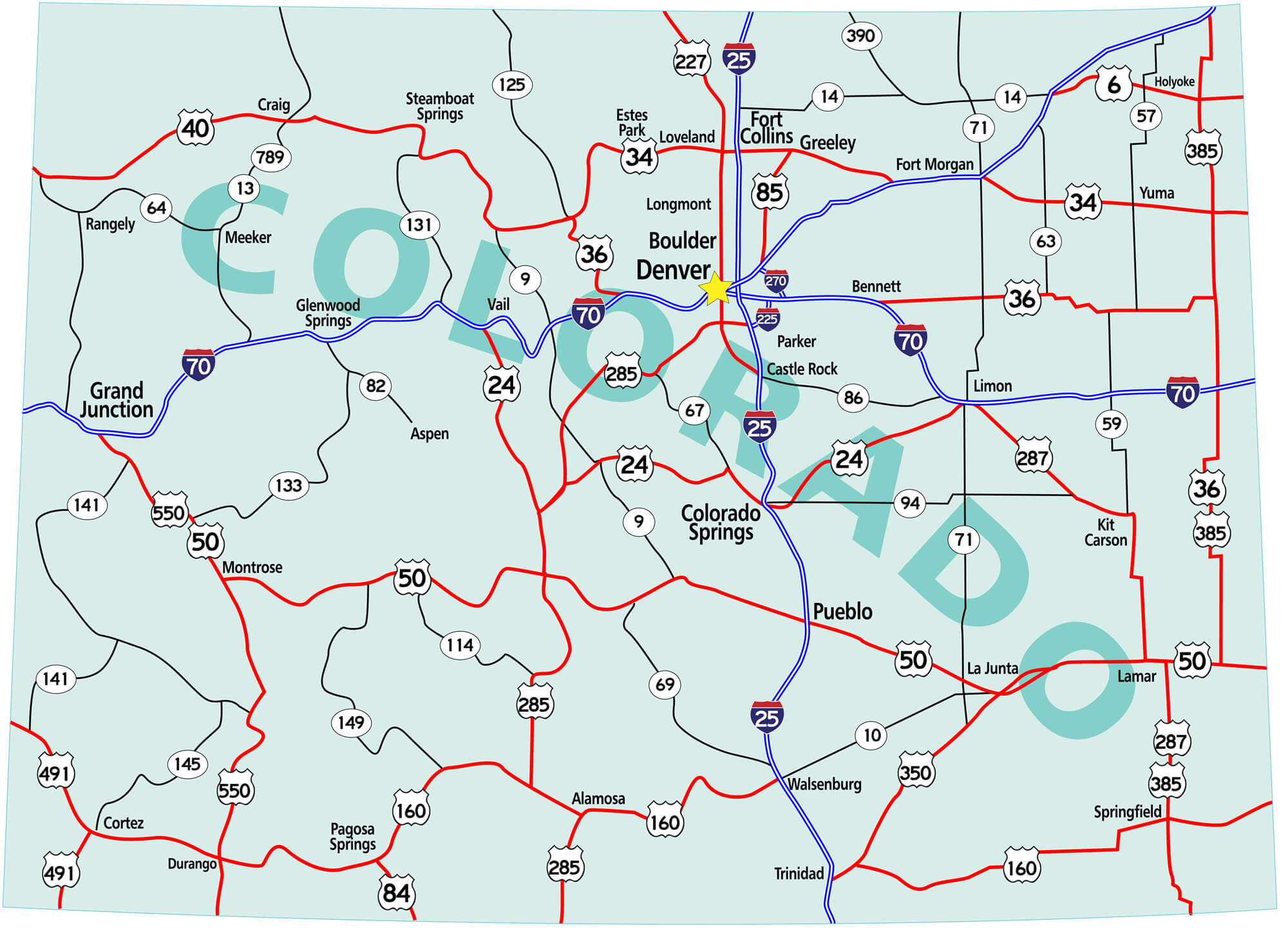
Colorado Road Map
 Colorado state road map with Interstates, U.S. Highways and state roads. Vector illustration.
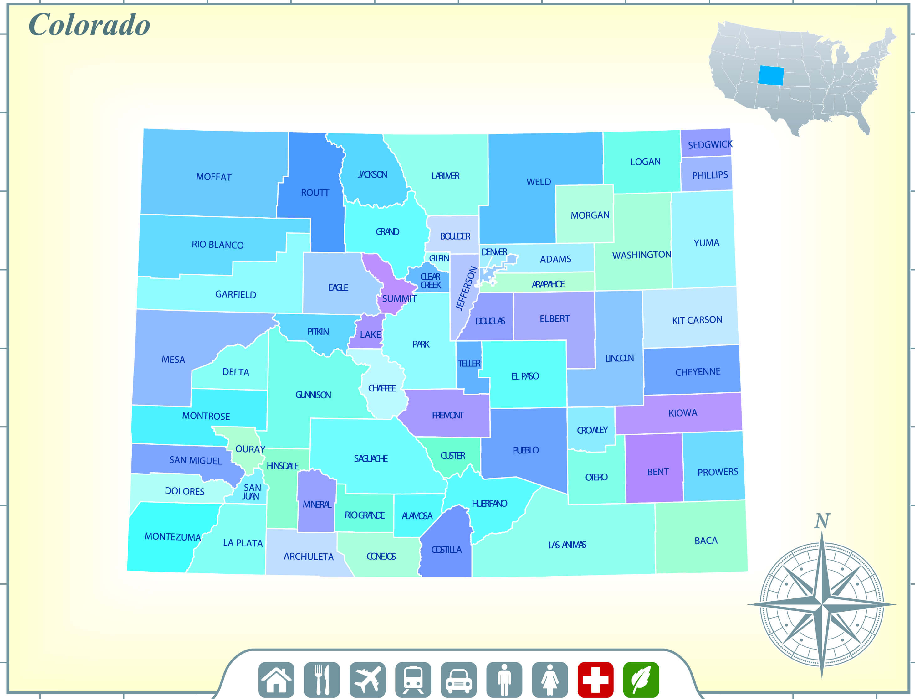
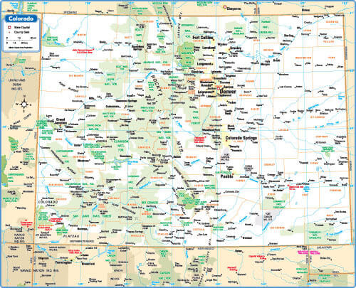
Map of Colorado state
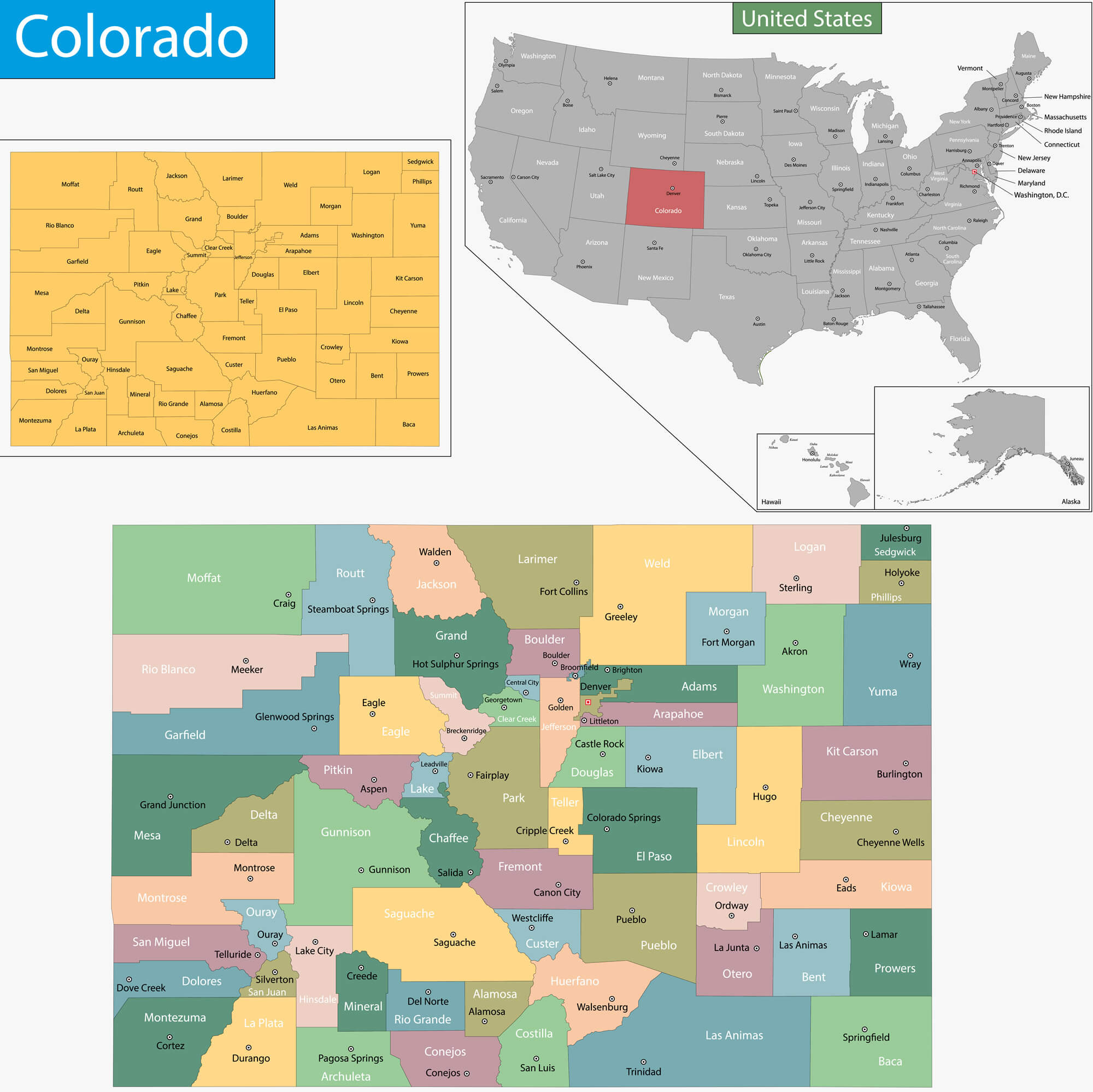 Map of Colorado state designed in illustration with the counties and the county seats.
Map of Colorado
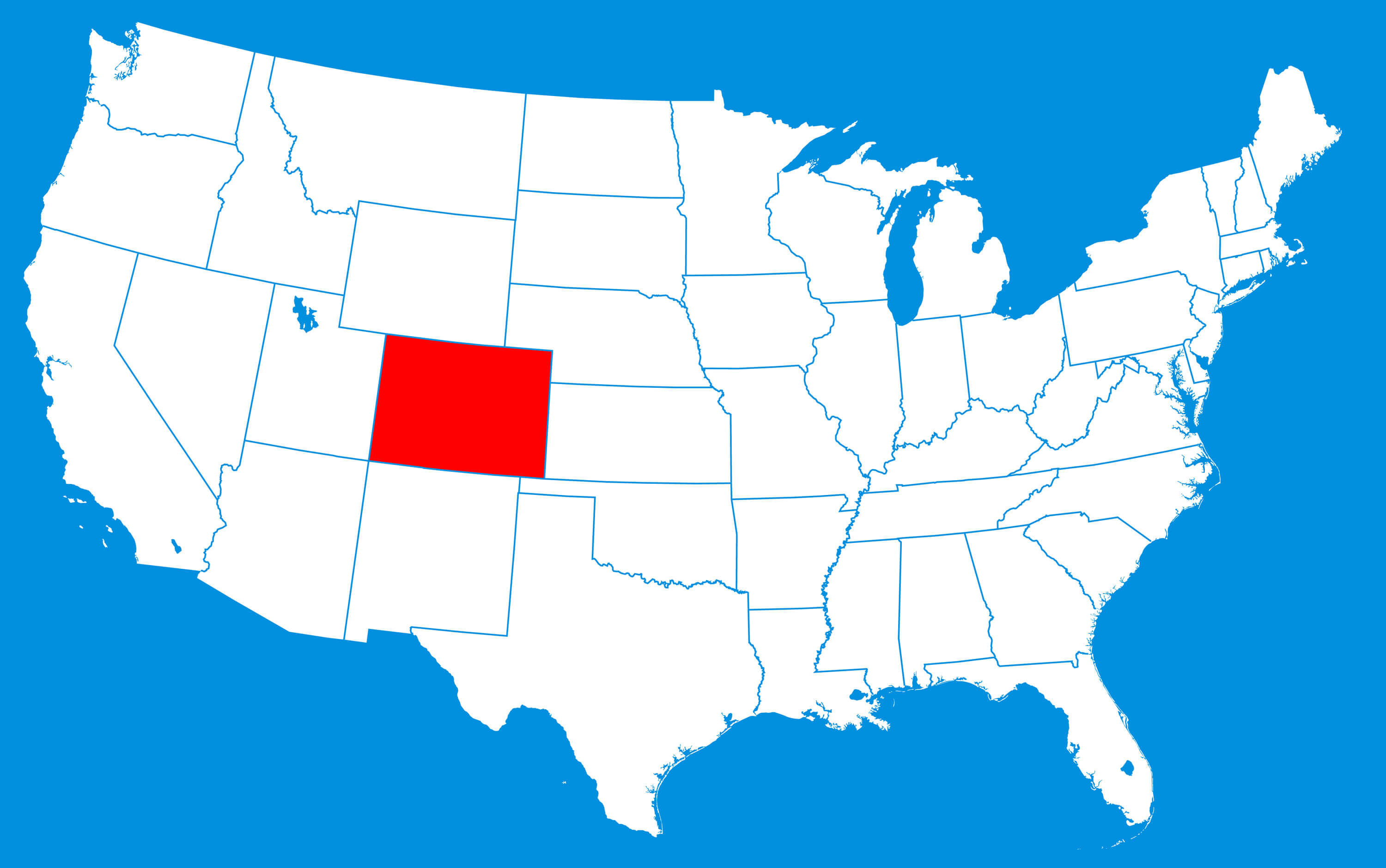 Map of Colorado where is state located in the USA.
Colorado, United States of America Political Map
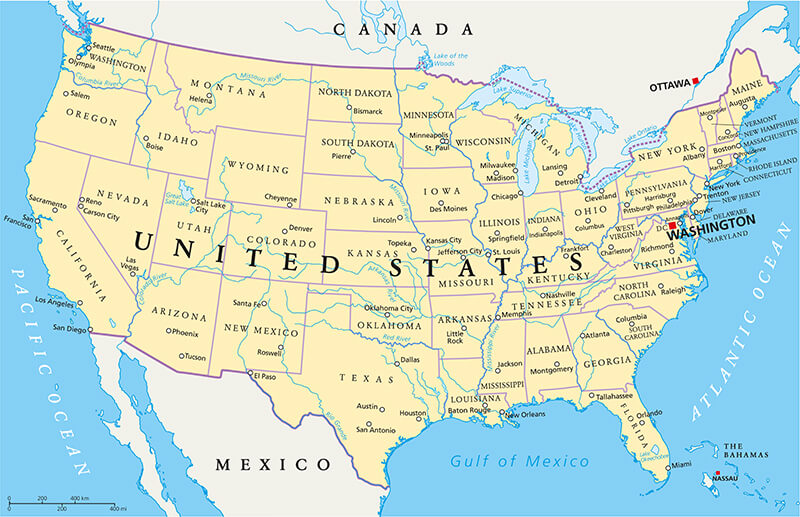 United States of America Political Map with capital Washington, national borders, most important cities, rivers and lakes. With single states, their borders and capitals, except Hawaii and Alaska.
Vector color map of Colorado state, USA
 Vector color map of Colorado state, United States of America.
Road Map of Colorado
 Road Map of Colorado with major cities interstates.
Colorful Map of Colorado and US

Colorado State Map, US
 Colorado State Map with US cities.
Denver Neighborhood Map, Colorado
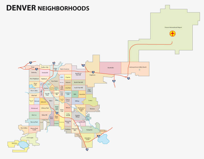 Denver Neighborhood Map, Colorado.
Map of USA, Colorado
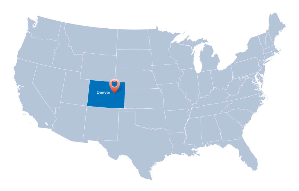 map of USA with the indication of State of Colorado and Denver.
Largest Cities Map of Colorado and Population
- Denver Map - 600,158 - (39.739,-104.985)
- Colorado Springs Map - 416,427 - (38.834,-104.821)
- Aurora Map - 325,078 - (39.729,-104.832)
- Fort Collins Map - 143,986 - (40.585,-105.084)
- Lakewood Map - 142,980 - (39.705,-105.081)
- Thornton Map - 118,772 - (39.868,-104.972)
- Pueblo Map - 106,595 - (38.254,-104.609)
- Arvada Map - 106,433 - (39.803,-105.087)
- Westminster Map - 106,114 - (39.837,-105.037)
- Centennial Map - 100,377 - (39.579,-104.877)
- Boulder Map - 97,385 - (40.014986, -105.270546)
- Highlands Ranch Map - 96,713 - (39.544444, -104.968056)
- Greeley Map - 92,889 - (40.423314, -104.709132)
- Longmont Map - 86,270 - (40.167207, -105.101928)
- Loveland Map - 66,859 - (40.397761, -105.074980)
- Grand Junction Map - 58,566 - (39.063871, -108.550649)
- Broomfield Map - 55,889 - (39.920541, -105.086650)
- Head of Performance Marketing
- Head of SEO
- Linkedin Profile: linkedin.com/in/arifcagrici
Largest Cities Map of Colorado and Population
Denver Map - 600,158 Colorado Springs Map - 416,427 Aurora Map - 325,078 Fort Collins Map - 143,986 Lakewood Map - 142,980 Thornton Map - 118,772 Pueblo Map - 106,595 Arvada Map - 106,433 Westminster Map - 106,114 Centennial Map - 100,377 Boulder Map - 97,385 Highlands Ranch Map - 96,713 Greeley Map - 92,889 Longmont Map - 86,270 Loveland Map - 66,859 Grand Junction Map - 58,566 Broomfield Map - 55,889Copyright GuideofTheWorld.Net 2006 - 2026. All rights reserved. Privacy Policy | Disclaimer