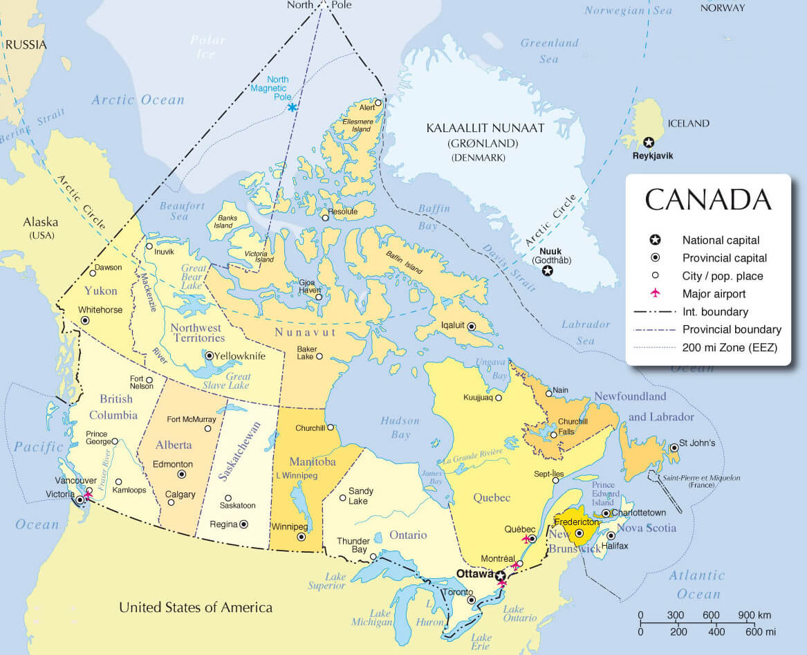
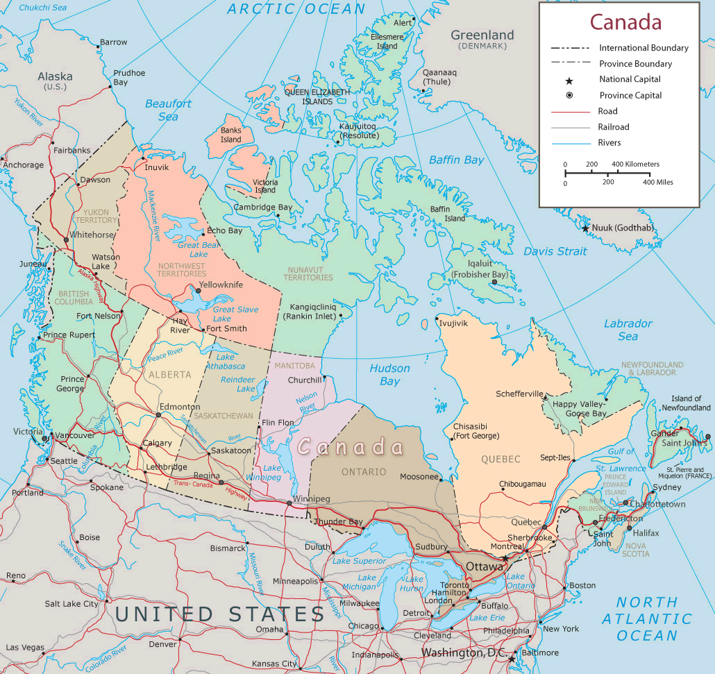
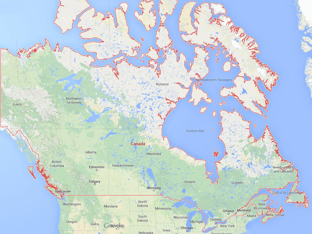
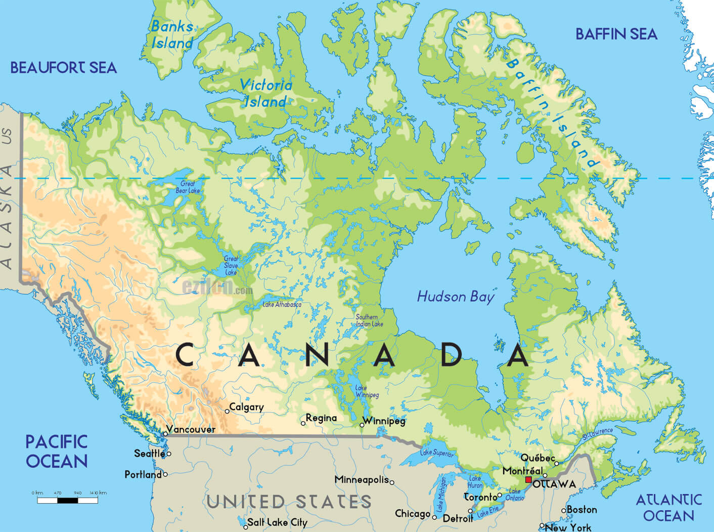
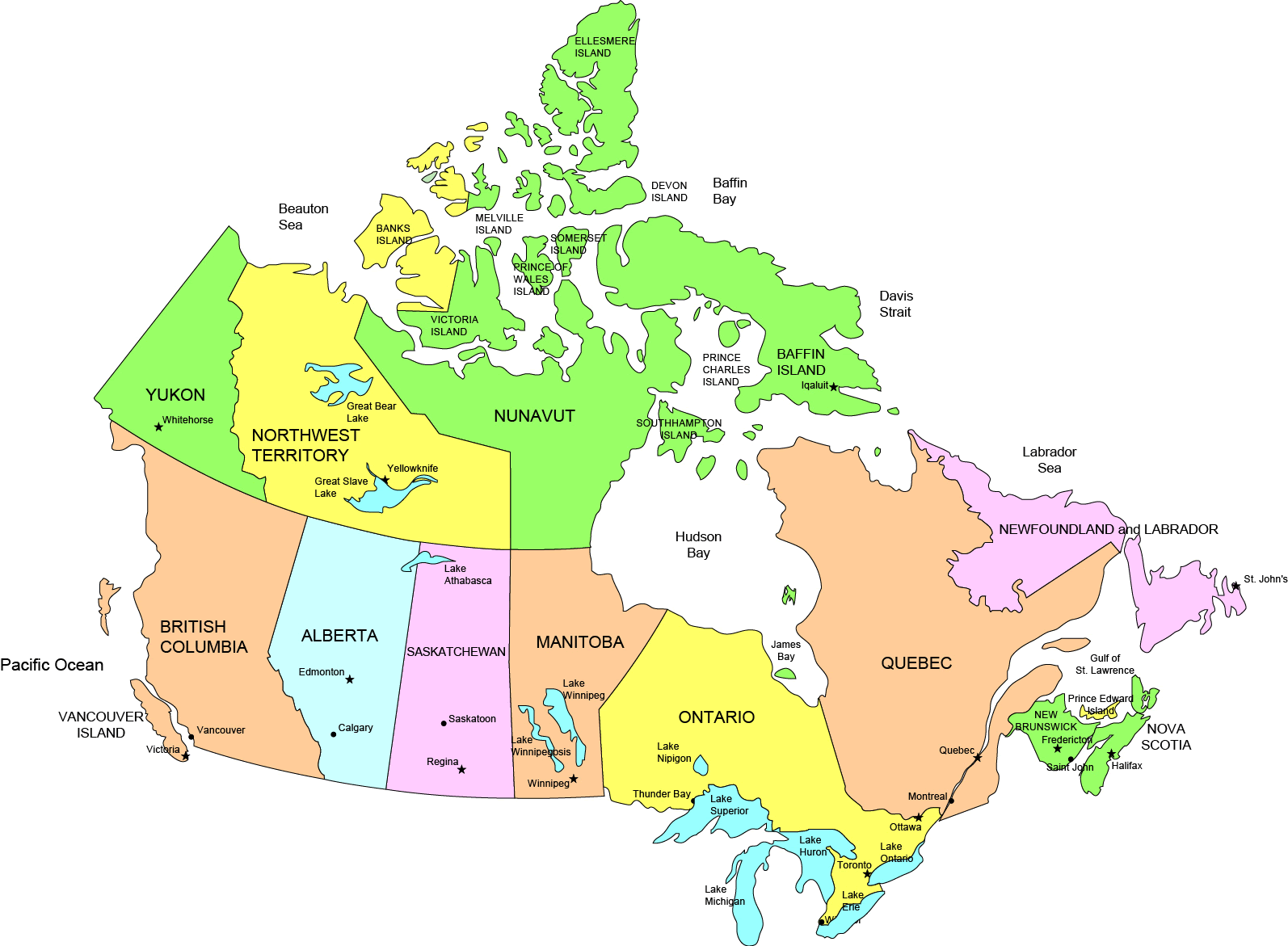
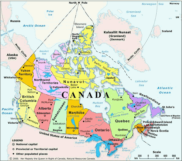
Canada Map
Navigate Canada map, Canada country map, satellite images of Canada, Canada largest cities, towns maps, political map of Canada, driving directions, physical, atlas and traffic maps.
Click for Content Detail »
Find desired maps by entering country, city, town, region or village names regarding under search criteria. On upper left Map of Canada (+) beside zoom in and (-) sign to to zoom out via the links you can visit. Canada Map move the mouse over it via (left click) and clicking the image you can drag. Right upper Map, Satellite, Terrain icons via the map view, satellite, hybrid and terrain map can be switch between images.
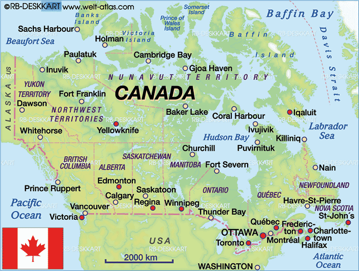
Canada City Maps
» Toronto » Montreal » Vancouver » Ottawa » Calgary » Edmonton » Quebec City » Winnipeg » Hamilton » London » Kitchener » St. Catharines » Halifax » Victoria » Oshawa » Windsor » Saskatoon » Regina » Barrie » St. John's » Abbotsford » Kelowna » Sherbrooke » Trois Rivieres » Guelph » Kingston » Moncton » Sudbury » Chicoutimi Jonquiere » Thunder Bay » Kanata » Saint John » Brantford » Red Deer » Nanaimo » Lethbridge » Saint Jean sur Richelieu » White Rock » Peterborough » Sarnia » Milton » Kamloops » Chateauguay » Sault Ste. Marie » Chilliwack » Drummondville » Saint Jerome » Medicine Hat » Prince George » Belleville » Fredericton » Fort McMurray » Granby » Grande Prairie » North Bay » Beloeil » Cornwall » Saint Hyacinthe » Shawinigan » Brandon » Vernon » Chatham » Bowmanville » Joliette » Charlottetown » Airdrie » Victoriaville » St. Thomas » Courtenay » Georgetown » Salaberry de Valleyfield » Rimouski » Woodstock » Sorel Tracy » Penticton » Prince Albert » Campbell River » Moose Jaw » Cape Breton » Midland » Leamington » Stratford » Orangeville » Timmins » Orillia » Walnut Grove » Spruce Grove » Lloydminster » Alma » Bolton » Saint Georges » Keswick Elmhurst Beach » Stouffville » Okotoks » Duncan » Parksville » Leduc » Val d'Or » Rouyn Noranda » Buckingham » Brockville » Sept Iles » Truro » Owen Sound » Thetford MinesRelated Canada Maps and Canada Satellite Images
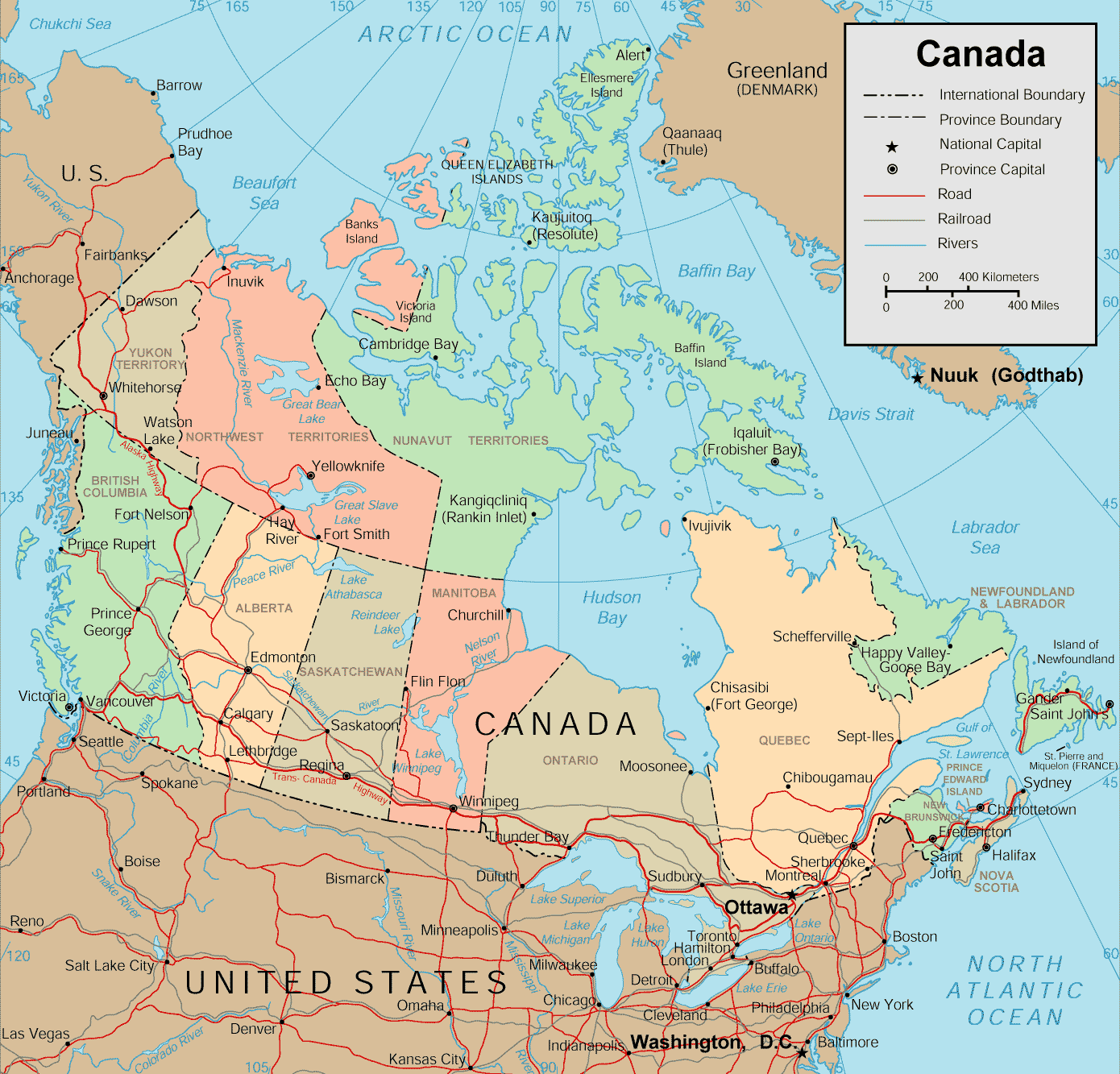
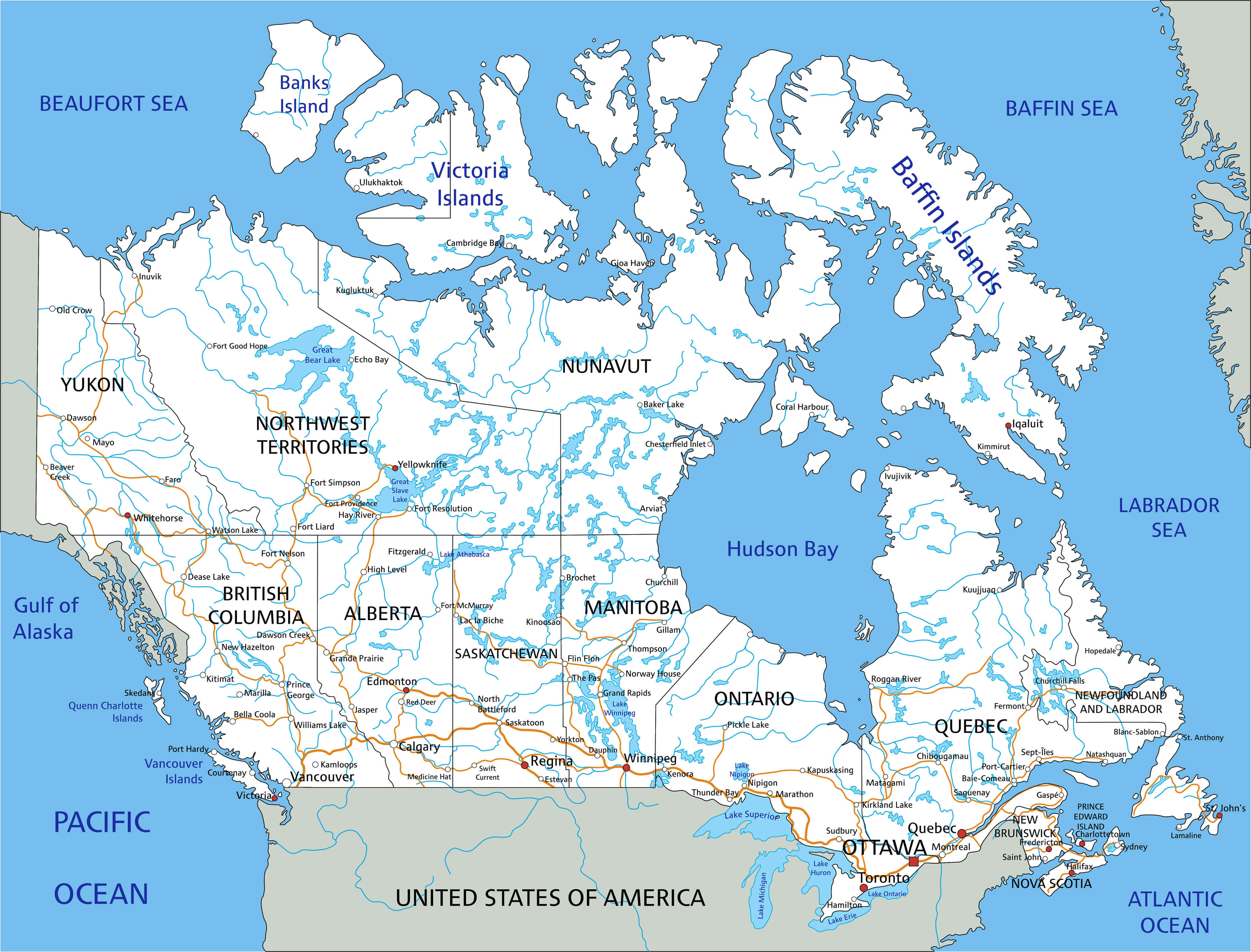
map of canada
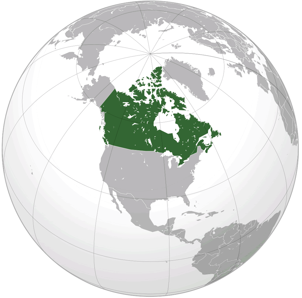
where is canada in the world
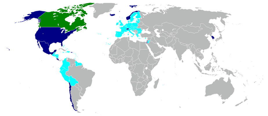
canada world free trade agreements 2009
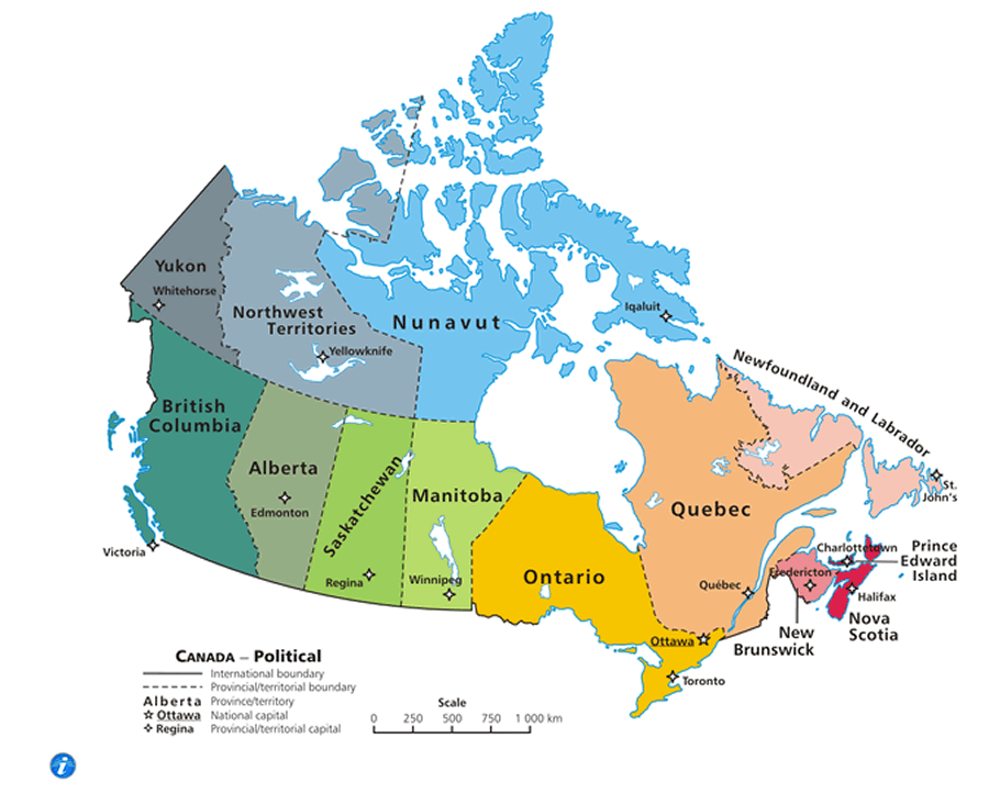
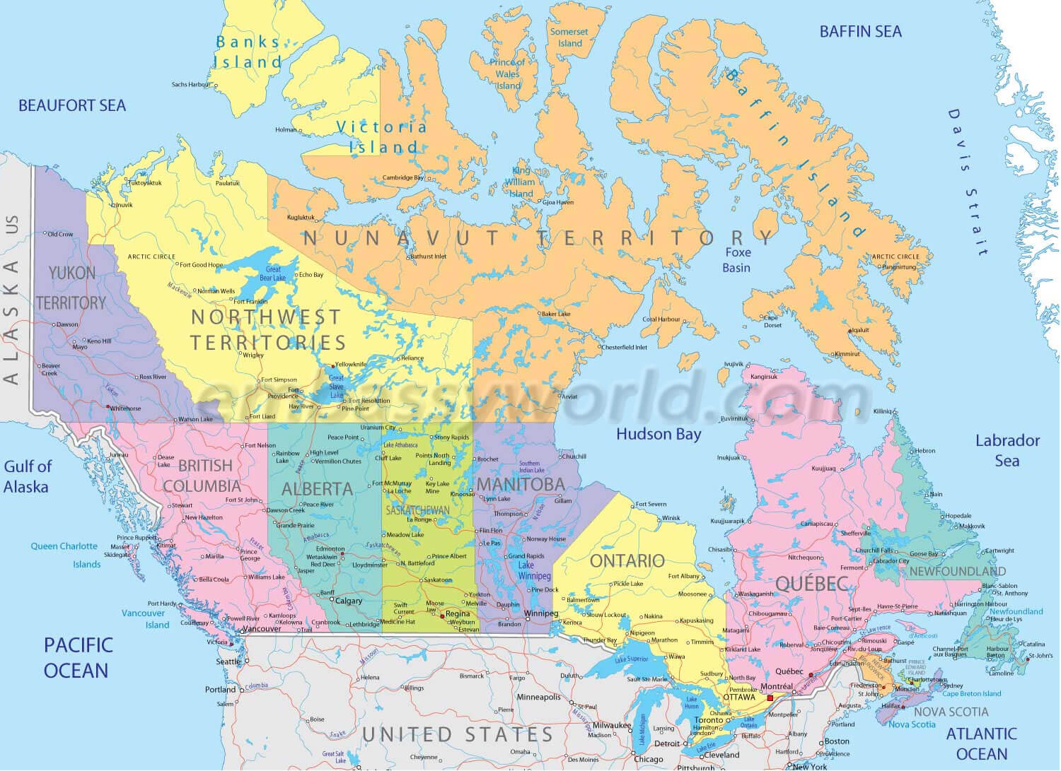
canada territorial boundary map
canada map
canada map
canada map
canada map atlas
canada map cities
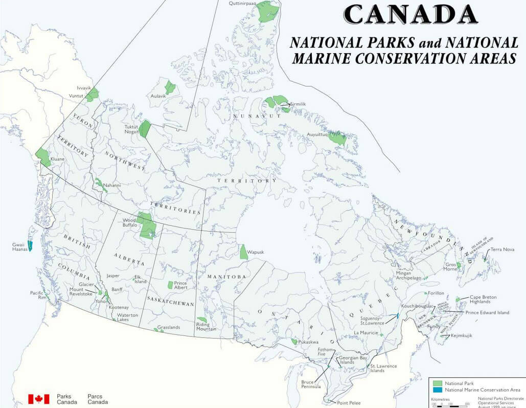
canada map national park
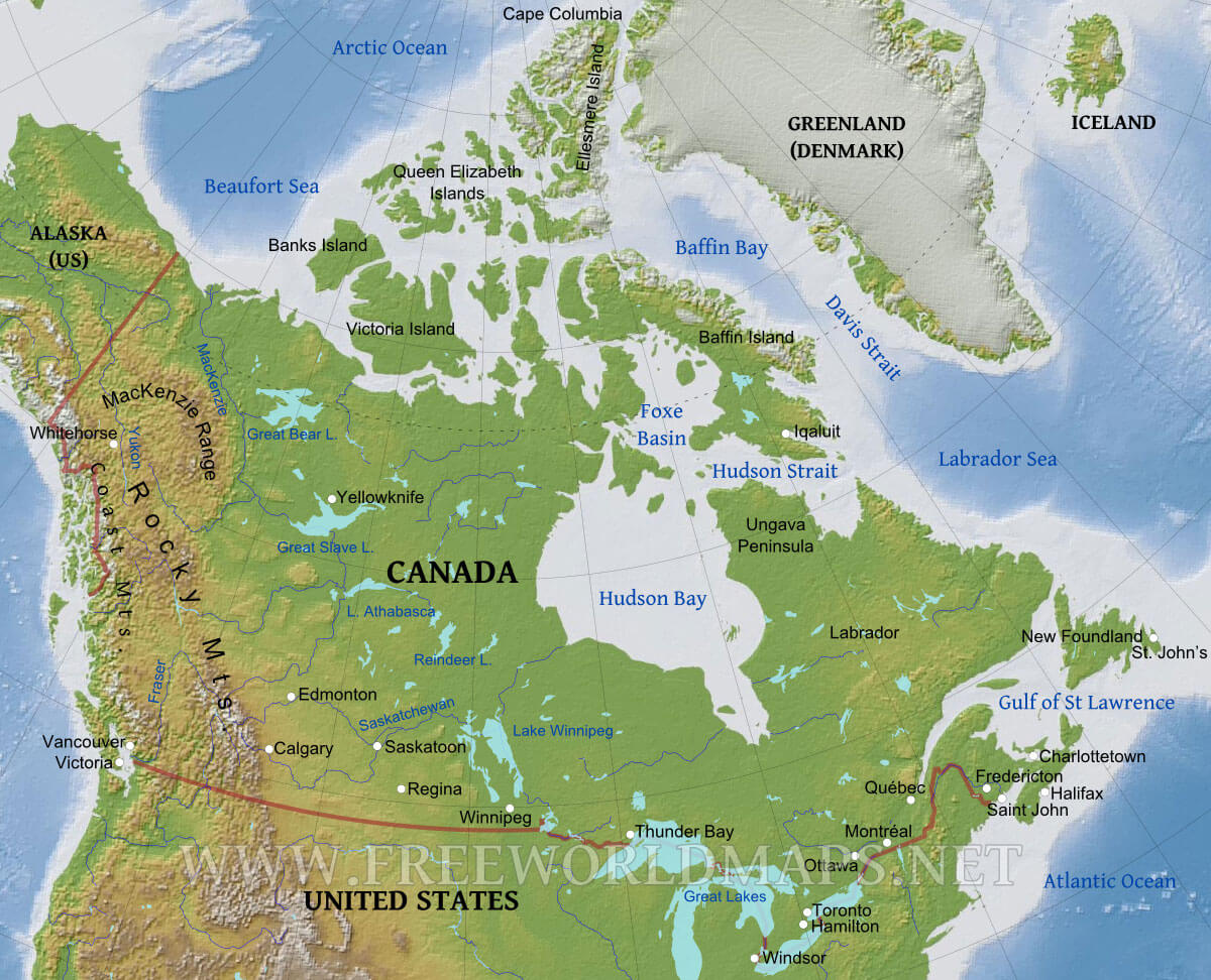
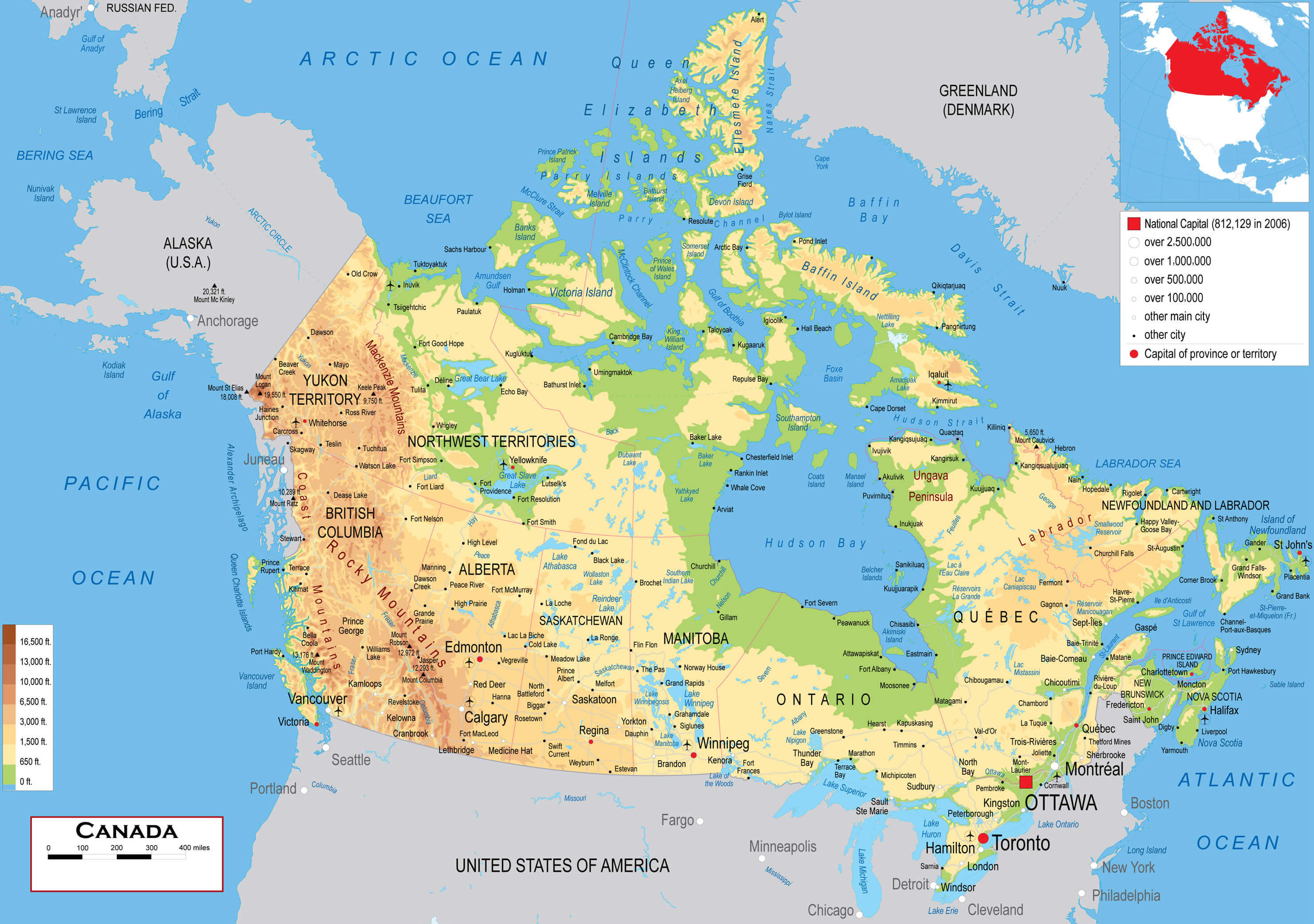
canada map physical
canada map states
map canada
map canada l
map of canada google
map of canada physical
map of canada political
map of canada provinces
satellite canada map
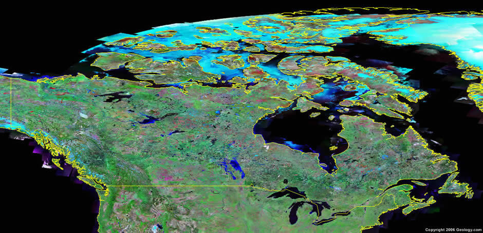
satellite image of canada
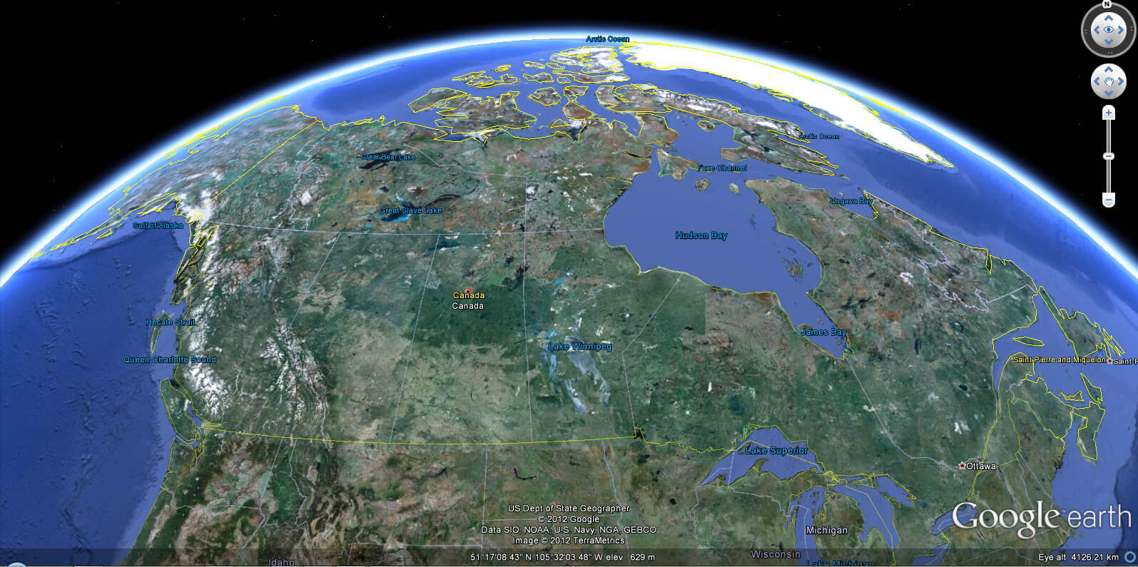
Canada Earth Map
Click for Google Map »
Where on World Map
Click for Direction »
Road Map and Direction
Click for Street View »
Click for comments and questions »
Please feel free share your comments and questions :
Please feel free share your comments and questions :