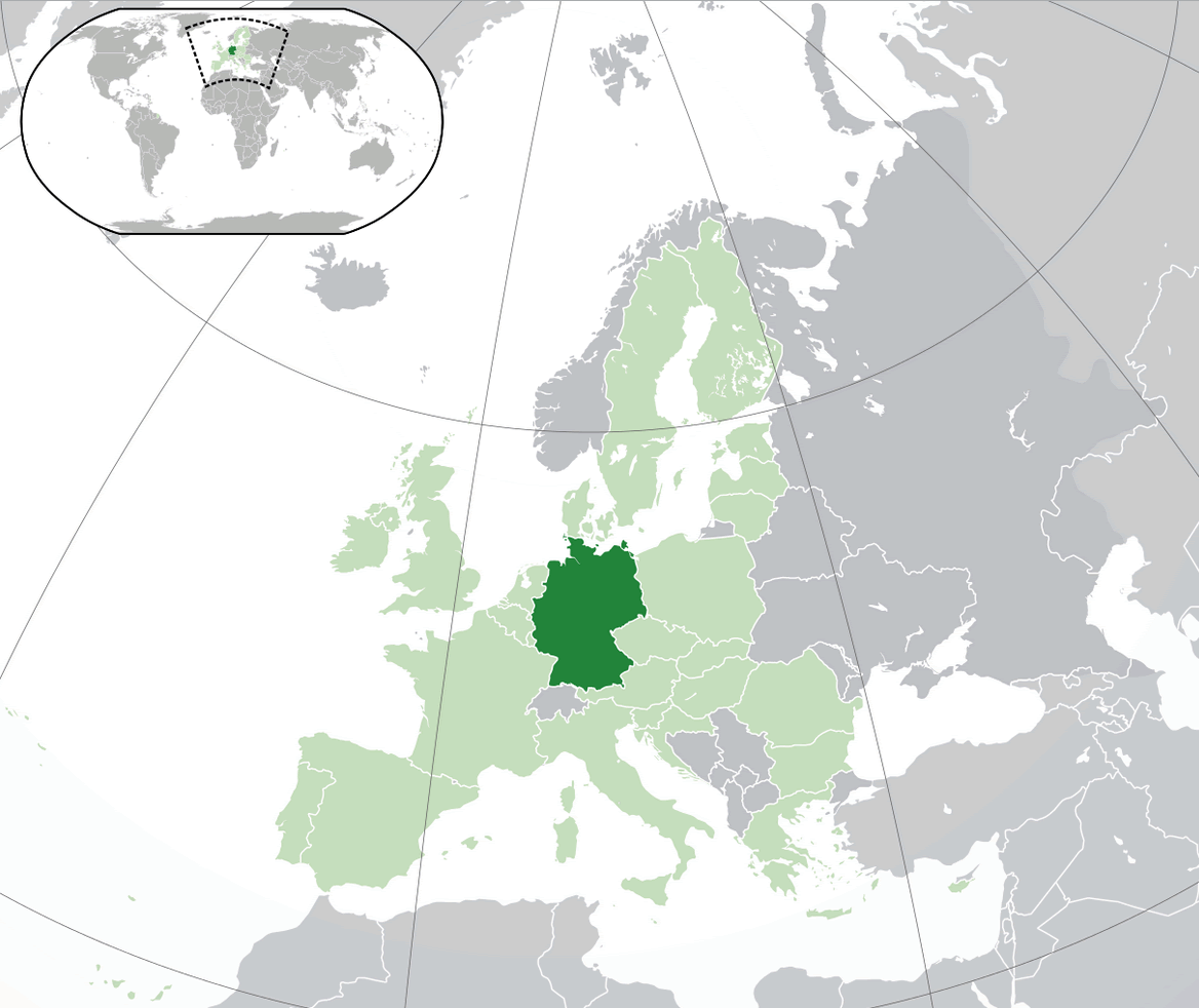
world map » europe map » germany map
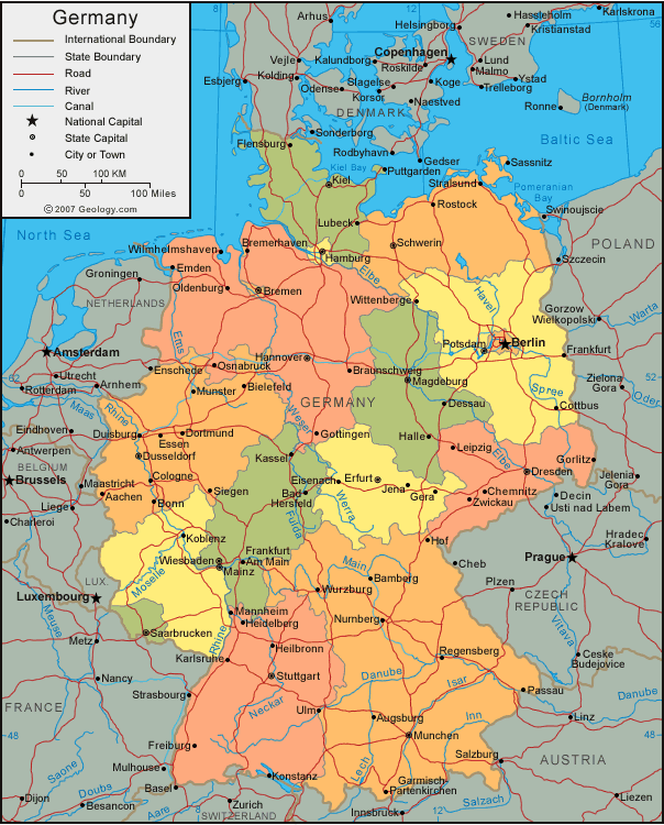
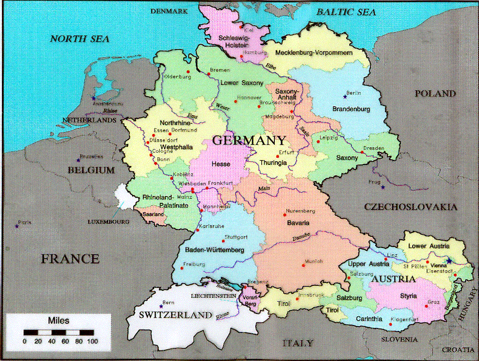
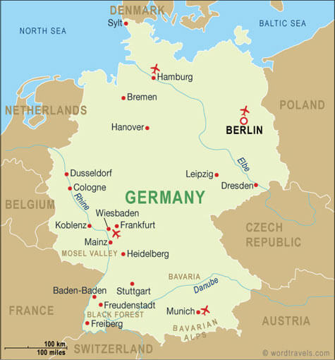
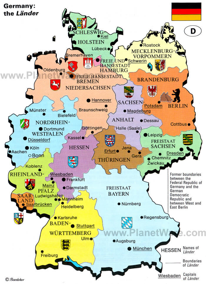
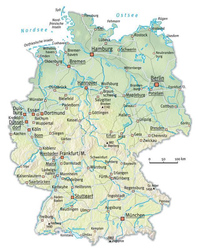
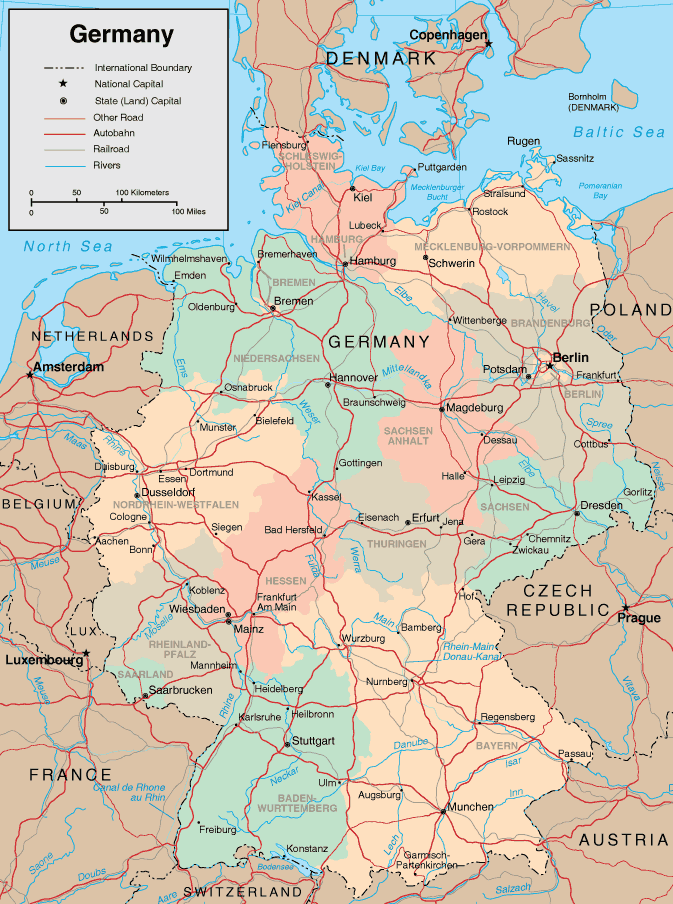
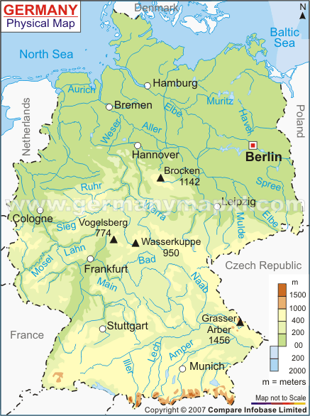
Germany Map
Navigate Germany Map, Germany countries map, satellite images of the Germany, Germany largest cities maps, political map of Germany, driving directions and traffic maps.
Click for Content Detail »
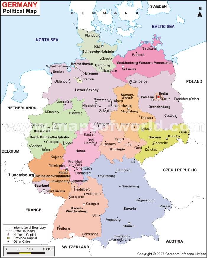
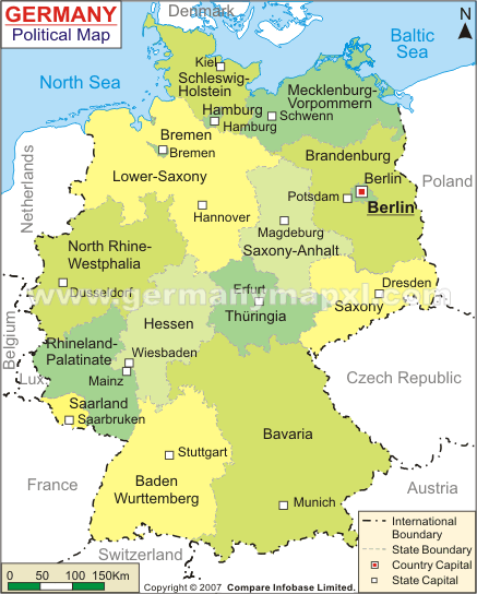
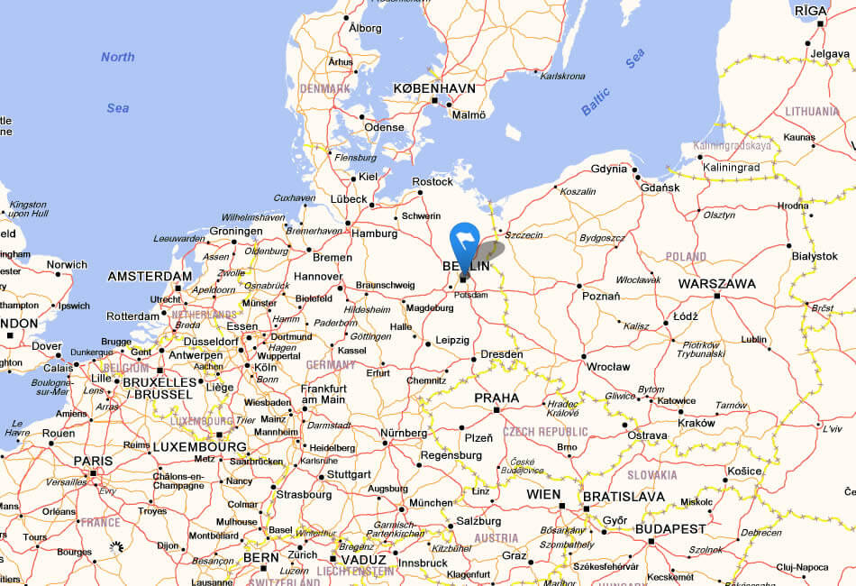
Germany
- Capital : Berlin
- Population : 81,799,600
- GDP : $3.367 trillion (4th)
- Per Capita : $41,168 (19th)
- Calling Code : +49
- Jobless Rate : 6.70%
- Time Zone : +1
For more about Germany >>
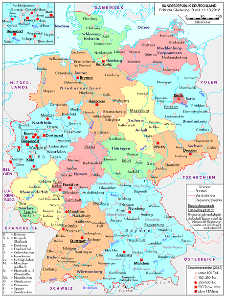
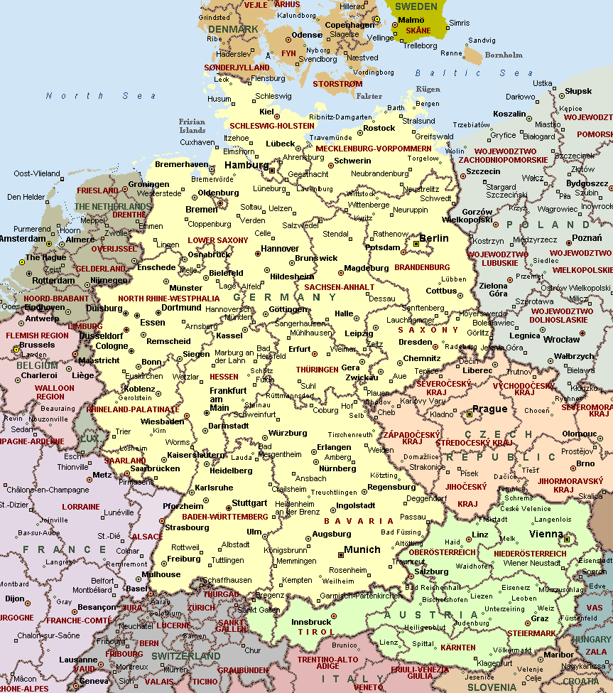
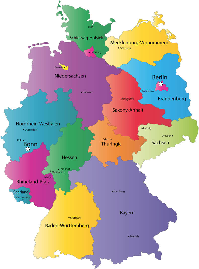
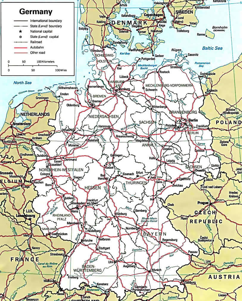
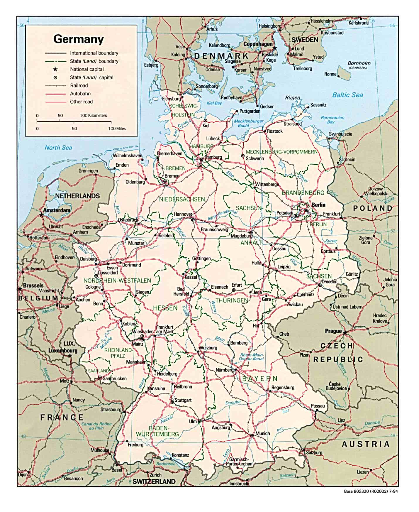
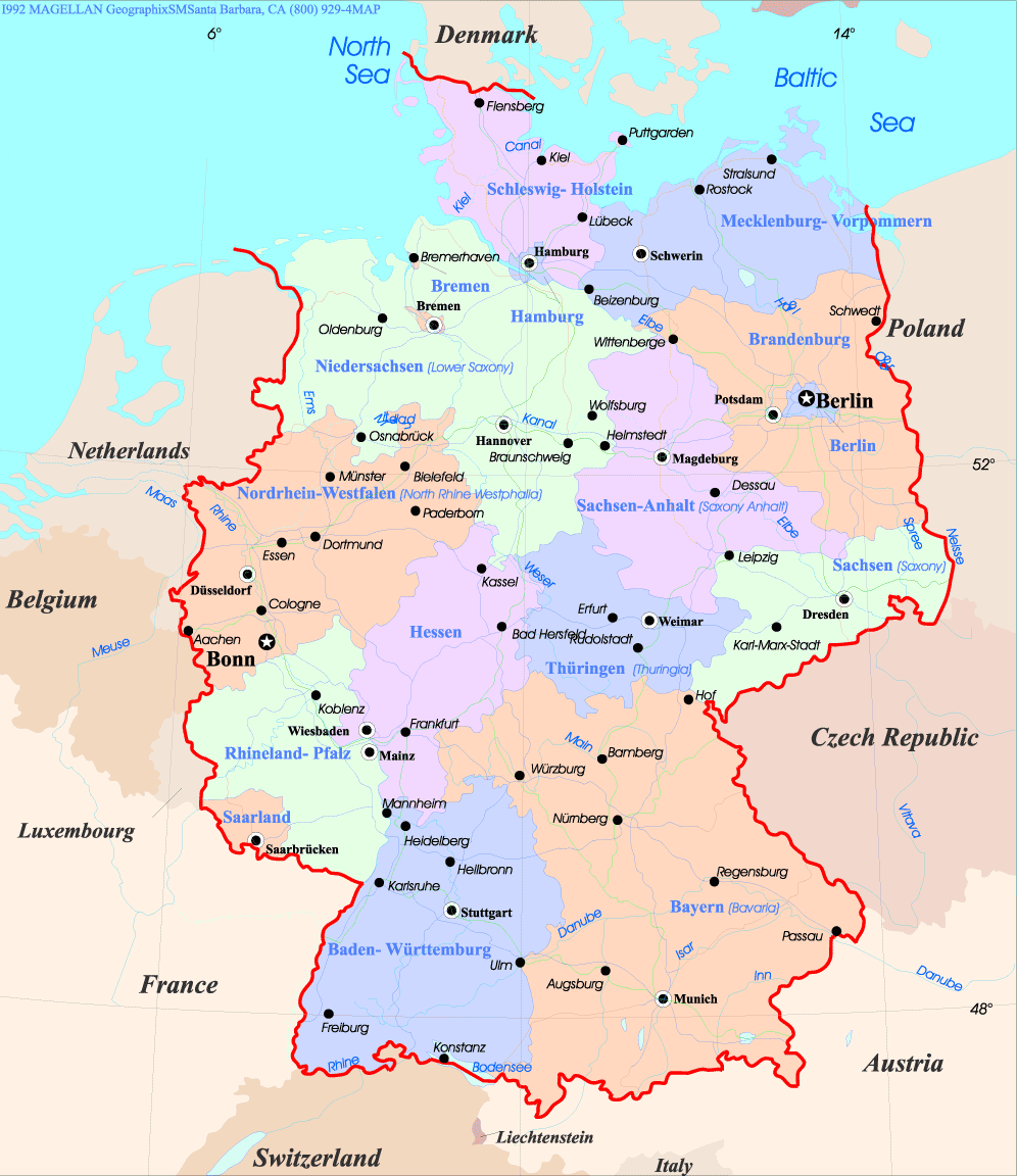
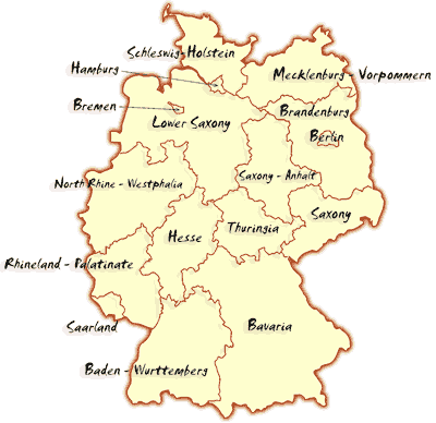
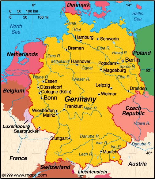
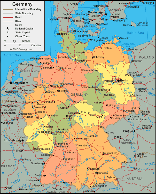
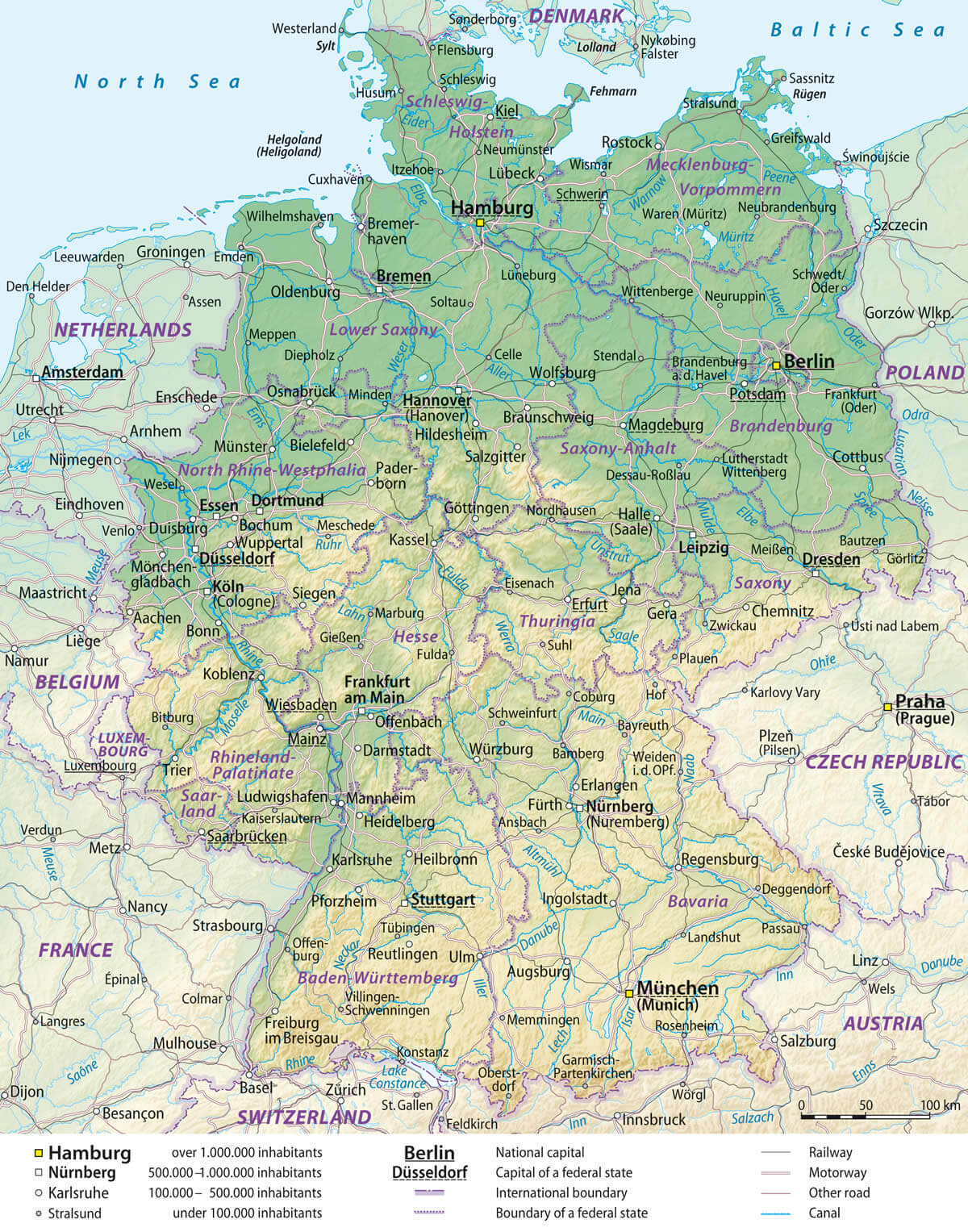
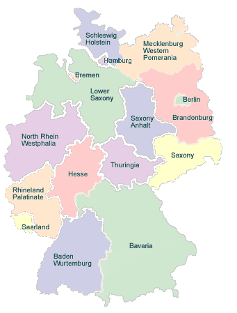
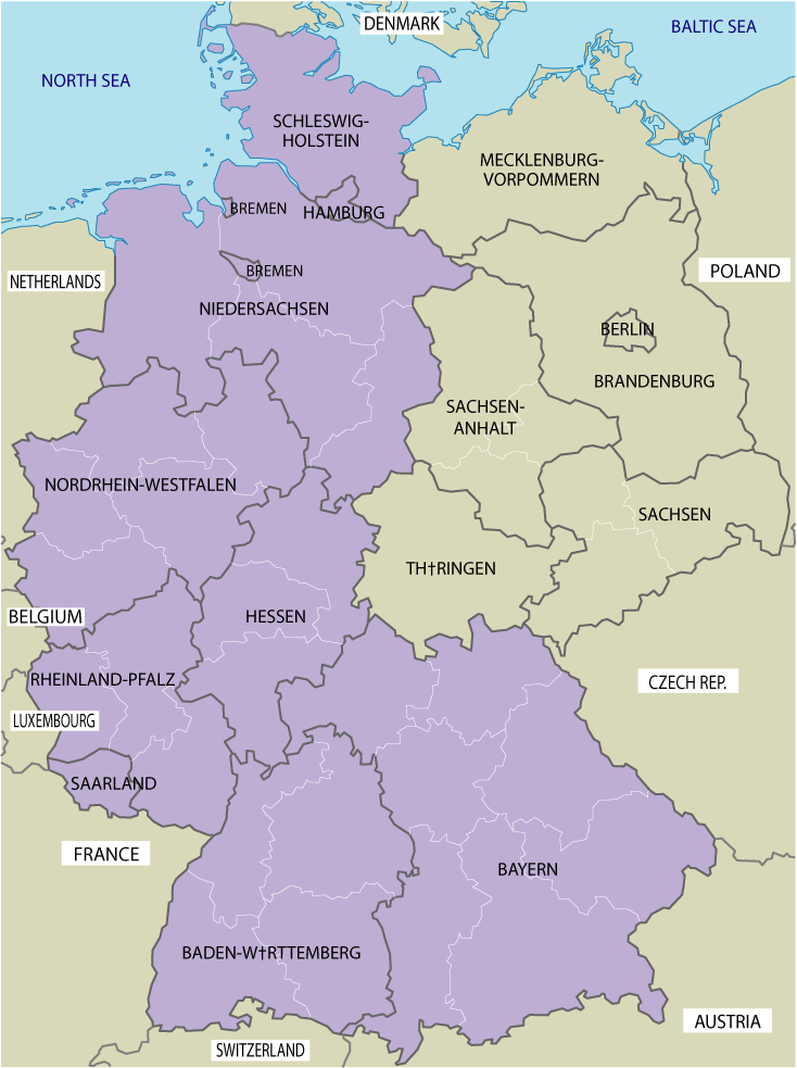
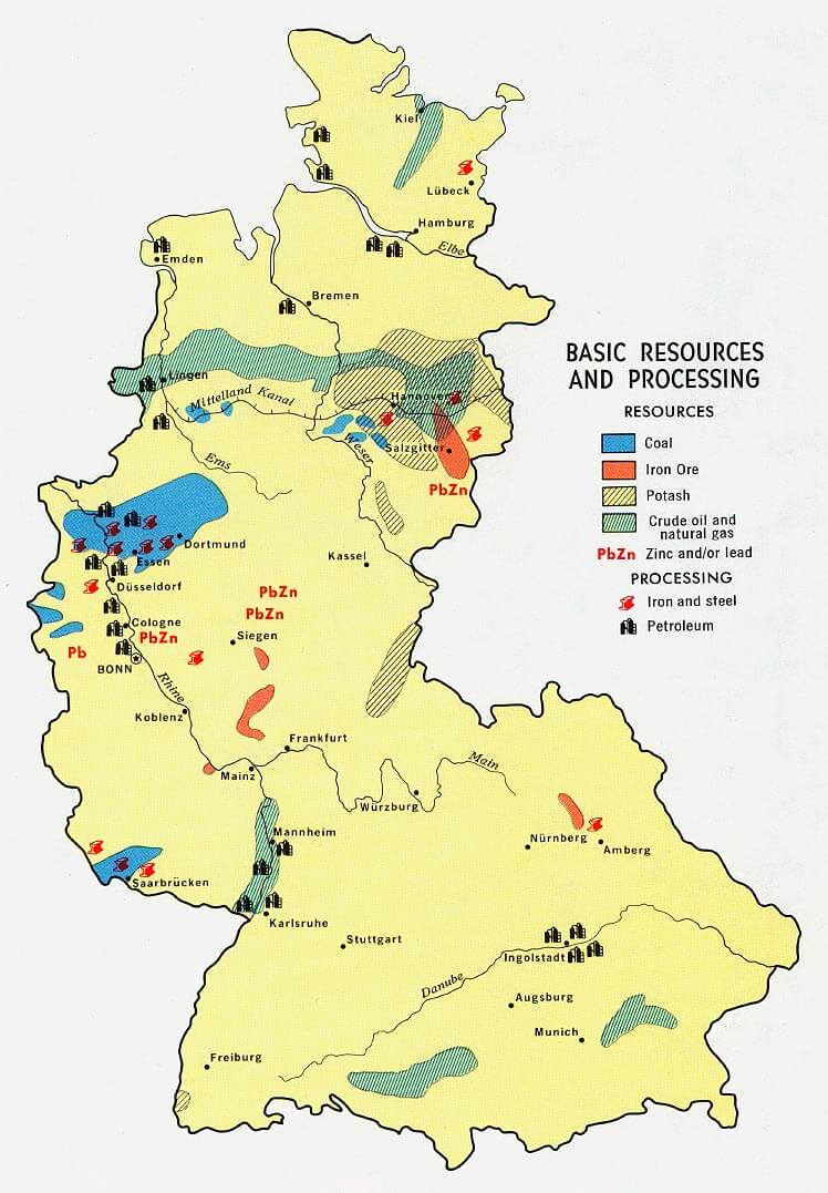
Germany Map & Germany Satellite Images
Largest Cities Map of Germany
» Heidelberg Map - » Heilbronn Map - » Hildesheim Map - » Ingolstadt Map - » Iserlohn Map - » Jena Map - » Kaiserslautern Map - » Karlsruhe Map - » Kassel Map - » Kiel Map - » Koblenz Map - » Krefeld Map - » Leverkusen Map - » Lubeck Map - » Ludwigshafen Map - » Magdeburg Map - » Mainz Map - » Mannheim Map - » Moers Map - » Monchengladbach Map - » Mulheim Map - » Munster Map - » Neuss Map - » Herne Map - » Oberhausen Map - » Offenbach Map - » Oldenburg Map - » Osnabruck Map - » Paderborn Map - » Pforzheim Map - » Potsdam Map - » Recklinghausen Map - » Regensburg Map - » Remscheid Map - » Rostock Map - » Saarbrucken Map - » Salzgitter Map - » Schwerin Map - » Siegen Map - » Solingen Map - » Ulm Map - » Wiesbaden Map - » Witten Map - » Wolfsburg Map - » Wuppertal Map - » Wurzburg Map - » Zwickau Map - » Berlin Map - » Hamburg Map - » Munchen Map - » Koln Map - » Frankfurt Map - » Stuttgart Map - » Dortmund Map - » Essen Map - » Dusseldorf Map - » Bremen Map - » Hannover Map - » Leipzig Map - » Dresden Map - » Nurnberg Map - » Aachen Map - » Augsburg Map - » Bergisch Gladbach Map - » Bielefeld Map - » Bochum Map - » Bonn Map - » Braunschweig Map - » Brandenburg Map - » Bremerhaven Map - » Cottbus Map - » Darmstadt Map - » Dessau Map - » Duisburg Map - » Erfurt Map - » Erlangen Map - » Freiburg Map - » Furth Map - » Gelsenkirchen Map - » Gera Map - » Gottingen Map - » Hagen Map - » Hamm Map - » Hanau Map -A Collection of Germany Maps and Germany Satellite Images
Click for Google Map »
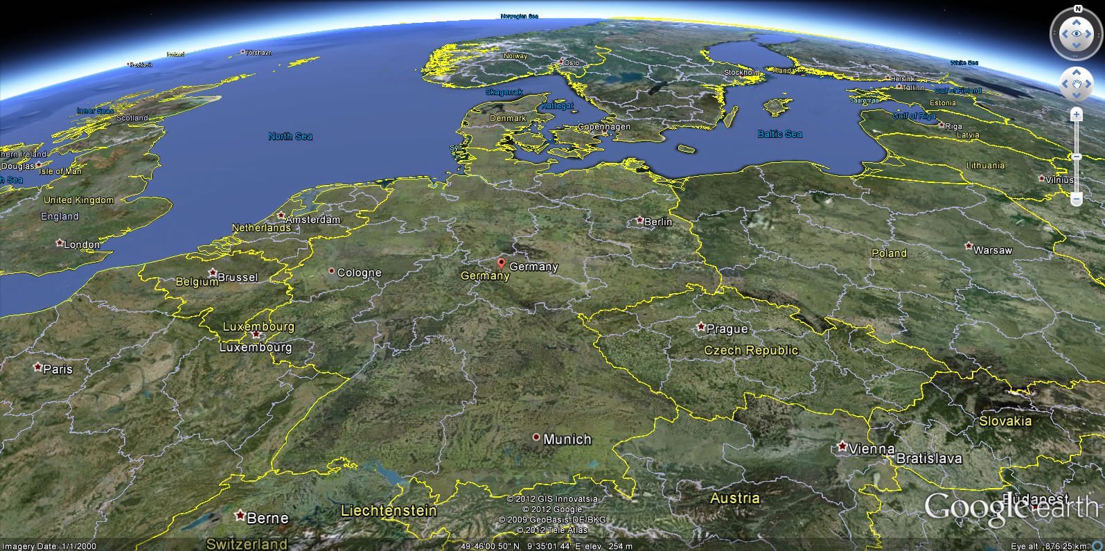
Where germany on World Map